 Old Cumbria Gazetteer
 |
 |
|
| Middle Sadgill, Longsleddale | ||
| Middle Sadgill | ||
| Middle Sadghyll | ||
| locality:- | Sadgill | |
| civil parish:- | Longsleddale (formerly Westmorland) | |
| county:- | Cumbria | |
| locality type:- | buildings | |
| coordinates:- | NY48240574 | |
| 1Km square:- | NY4805 | |
| 10Km square:- | NY40 | |
|
|
||
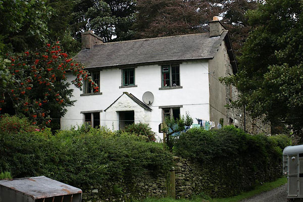 BRI19.jpg (taken 27.8.2009) |
||
|
|
||
| evidence:- | old map:- OS County Series (Wmd 27 6) |
|
| source data:- | Maps, County Series maps of Great Britain, scales 6 and 25
inches to 1 mile, published by the Ordnance Survey, Southampton,
Hampshire, from about 1863 to 1948. OS County Series (Wmd 27 7) 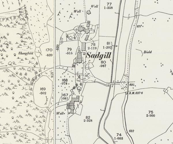 C5E001.jpg "Sadgill" |
|
|
|
||
| evidence:- | census returns:- placename:- Middle Sadgill placename:- Middle Sadghyll placename:- Middle Sad Gill |
|
|
|
||
| evidence:- | old map:- Kendal Corn Rent Act 1836 |
|
| source data:- | Tithe map, Plan of part of the Township of Longsleddale, Westmorland, made regarding
the Kendal Corn Rent Act, ie a tithe award map, scale about 20 inches to 1 mile, Kendal,
Westmorland, 1836.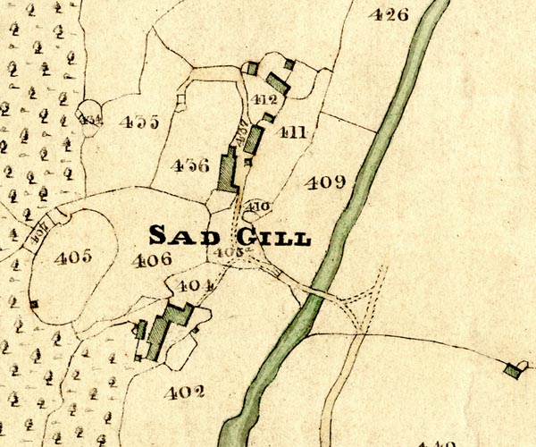 KCR201.jpg courtesy of Mark Cropper Plan of part of the Township of Longsleddale, Westmorland, made regarding the Kendal Corn Rent Act, ie a tithe award map, scale about 20 inches to 1 mile, Kendal, Westmorland, 1836. item:- private collection : 370 Image © see bottom of page |
|
|
|
||
 Kendal Corn Rent Act 1836 Kendal Corn Rent Act 1836 |
||
|
|
||
| evidence:- | old map:- Fields 1875 |
|
| source data:- | 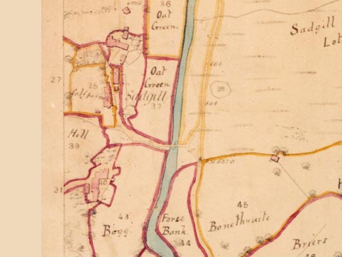 LFld0217.jpg courtesy of Ruth Fishwick |
|
|
|
||
| evidence:- | old map:- OS 1881-82 New Series (outline edition) |
|
| source data:- | Map, engraving, area north of Kendal, Westmorland, New Series
one inch map, outline edition, sheet 39, scale 1 inch to 1 mile,
published by the Ordnance Survey, Southampton, Hampshire,
1881-82.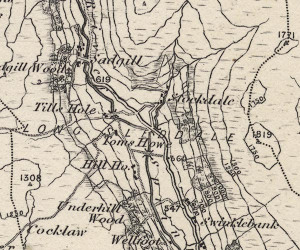 O21NY40X.jpg Not labelled. item:- JandMN : 61 Image © see bottom of page |
|
|
|
||
| evidence:- | old postcard:- |
|
| source data:- | Postcard, sepia toned, photograph of Middle and High Sadgill in the Si-Ko series,
1920s-30s?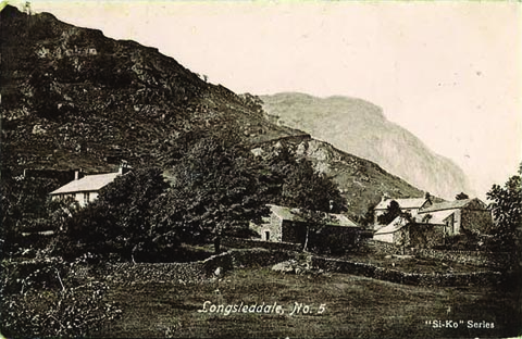 click to enlarge click to enlargePH0044.jpg "Longsleddale, No. 5" "Si-Ko Series" courtesy of Michael Wooldridge item:- private collection : 146 Image © see bottom of page |
|
|
|
||
| census records |
||
|
|
||
| directory entries |
||
|
|
||
| evidence:- | map:- OS Six Inch (1956) |
|
| source data:- | Map series, various editions with the national grid, scale about
6 inches to 1 mile, published by the Ordnance Survey,
Southampton, Hampshire, scale 1 to 10560 from 1950s to 1960s,
then 1 to 10000 from 1960s to 2000s, superseded by print on
demand from digital data.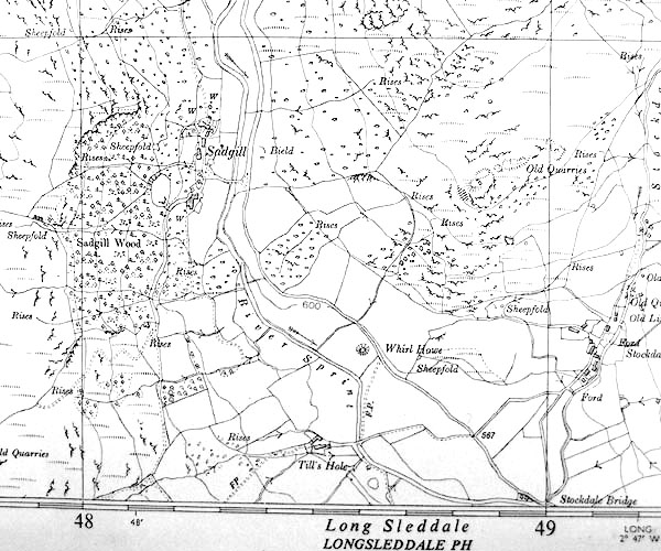 SINY4805.jpg |
|
|
|
||
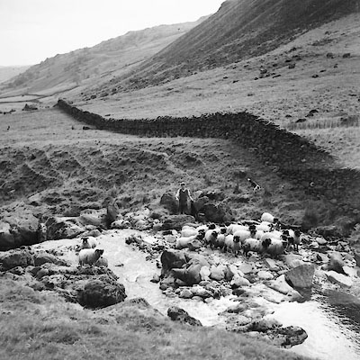 CDP95.jpg Tom, or maybe Billy, Fishwick herding sheep above Sadgill. courtesy of Nial Barnes 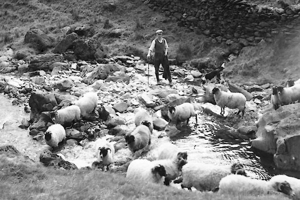 CDP96.jpg Tom, or maybe Billy, Fishwick herding sheep above Sadgill. courtesy of Nial Barnes |
||
|
|
||
| evidence:- | shepherds guide:- Wilson 1913 placename:- Middle Sadgill |
|
| source data:- | Book, New Shepherd's Guide for Cumberland, Westmorland, and
Lancashire, by Thomas Wilson, 1913.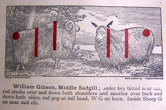 WL1p367c.jpg "William Gibson, Middle Sadgill; under key bitted near ear, red stroke over and down both shoulders and another over back and down both sides, red pop at tail head, W G on horn. Inside sheep G on near mid rib." item:- private collection : 329 Image © see bottom of page |
|
|
|
||
| evidence:- | shepherds guide:- Gate 1879 placename:- Middle Sadgill |
|
| source data:- | Book, New Shepherd's Guide for Cumberland, Westmoreland, and
Lancashire, published by Daniel Gate, Keswick, Cumberland, 1879.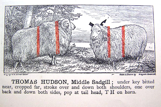 GT1p384c.jpg "THOMAS HUDSON, Middle Sadgill; under key bitted near, cropper far, stroke over and down both shoulders, one over back and down both sides, pop at tail head, TH on horn." item:- Kendal Library : 38 Image © see bottom of page |
|
|
|
||
| evidence:- | shepherds guide:- Lamb 1937 placename:- Middle Sadgill |
|
| source data:- | Book, Lamb's Shepherds' Guide for Cumberland, Westmorland and
Lancashire, by R H Lamb, published by the Herald Printing Co,
Penrith, Cumberland, 1937.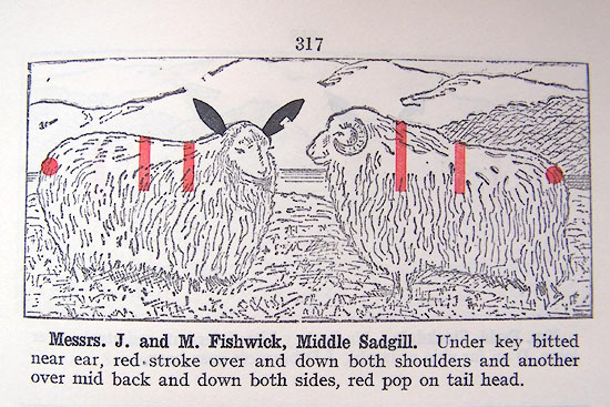 LM1p317a.jpg "Messrs. J.and M. Fishwick, Middle Sadgill. Under key bitted near ear, red stroke over and down both shoulders and another over mid back and down both sides, red pop on tail head." item:- Kendal Library : 40 Image © see bottom of page |
|
|
|
||
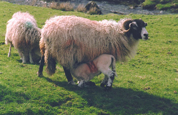 BIQ28.jpg Swaledale sheep and lamb with the Sadghyll mark. Red M on nearside rib. The M stands for Mattinson, earlier owners of the farm, it gets very indistinct as the sheep grows older. (taken 22.4.2004) |
||
|
|
||
| scanning 2009 |
||
|
|
||
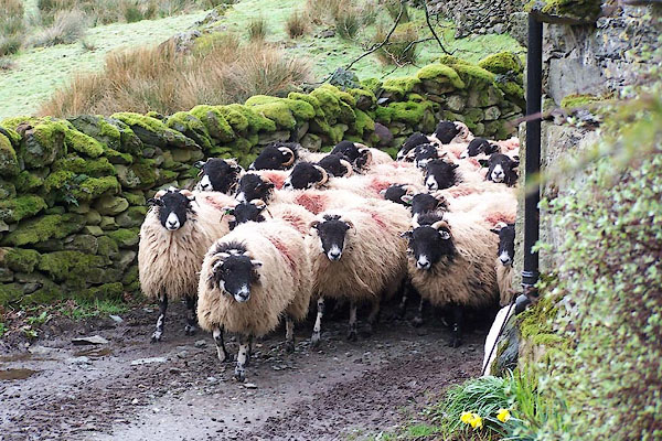
| MN photo:- |
Swaledale ewes, Middle Sadgill flock, Being herded across the front of Low Sadgill,
25 March 2005. |
|
 BJM04.jpg 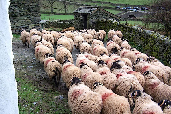 BJM06.jpg |
||
|
|
||
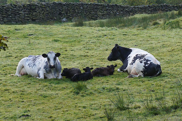 CEA35.jpg Cattle, in Bogg. (taken 9.10.2015) |
||
|
|
||
| fiction:- |
Called High Ghyll in |
|
| Ward, Humphrey, Mrs: 1888: Robert Elsmere |
||
| "... a gray stone house, backed by the sombre red of a great copper beech, and overhung
by crags ..." |
||
| The home of Mary Backhouse who dies after seeing the High Fell ghost. |
||
| "on Harter Fell" |
||
|
|
||
| see:- | [Sadgill, Longsleddale ] | |
|
|
||
 Lakes Guides menu.