 Old Cumbria Gazetteer
 |
 |
|
| Settle Earth, Longsleddale | ||
| Settle Earth | ||
| civil parish:- | Longsleddale (formerly Westmorland) | |
| county:- | Cumbria | |
| locality type:- | locality | |
| locality type:- | scree | |
| coordinates:- | NY47480785 | |
| 1Km square:- | NY4707 | |
| 10Km square:- | NY40 | |
| SummaryText:- | area of slope and screes below Raven Crag (not above as on some maps) | |
|
|
||
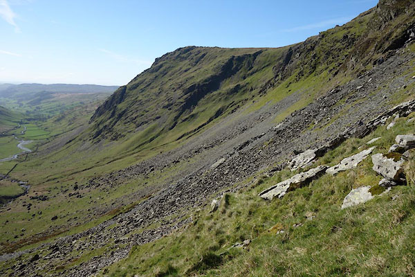 CAK22.jpg (taken 19.4.2014) |
||
|
|
||
| evidence:- | old map:- OS County Series (Wmd 27 2) placename:- Settle Earth |
|
| source data:- | Maps, County Series maps of Great Britain, scales 6 and 25
inches to 1 mile, published by the Ordnance Survey, Southampton,
Hampshire, from about 1863 to 1948. |
|
|
|
||
| evidence:- | map:- OS Six Inch (1956) placename:- Settle Earth |
|
| source data:- | Map series, various editions with the national grid, scale about
6 inches to 1 mile, published by the Ordnance Survey,
Southampton, Hampshire, scale 1 to 10560 from 1950s to 1960s,
then 1 to 10000 from 1960s to 2000s, superseded by print on
demand from digital data.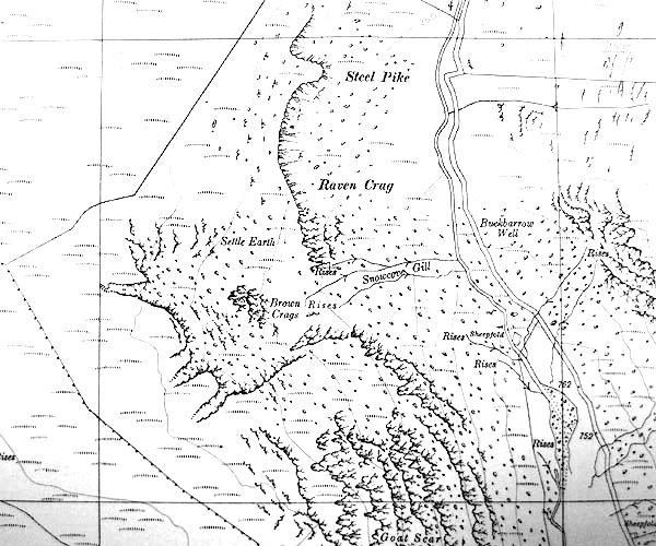 SINY4707.jpg "Settle Earth" |
|
|
|
||
 Lakes Guides menu.