 Old Cumbria Gazetteer
 |
 |
|
| Uldale Fells, Ireby | ||
| Uldale Fells | ||
| civil parish:- | Ireby (formerly Cumberland) | |
| county:- | Cumbria | |
| locality type:- | hill | |
| locality type:- | fell | |
| coordinates:- | NY27533390 (etc) | |
| 1Km square:- | NY2733 | |
| 10Km square:- | NY23 | |
|
|
||
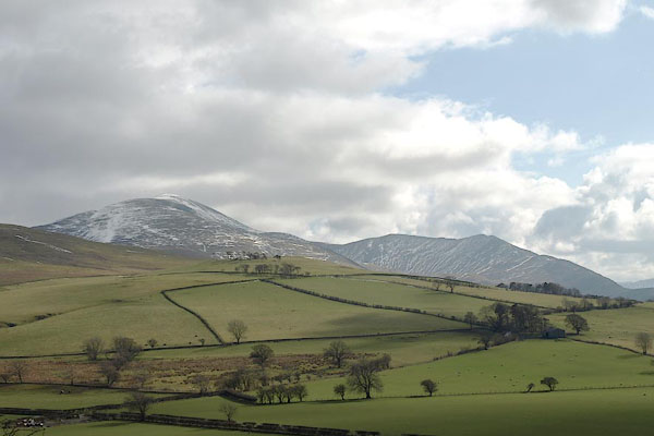 BSL57.jpg From just N of Over Water, looking SE (taken 4.4.2010) 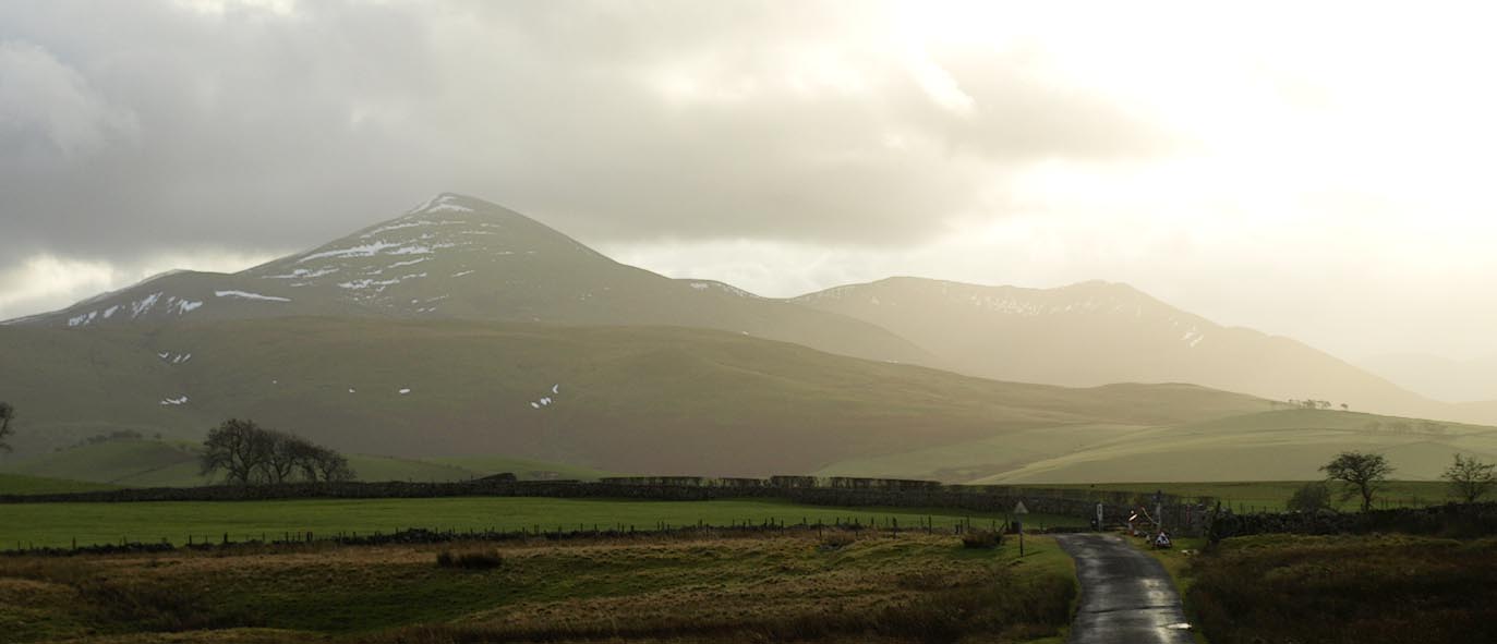 Click to enlarge BPV90.jpg From the NW near Baggra Yeat; Brae Fell, Longlands Fell etc. (taken 17.12.2008) |
||
|
|
||
| evidence:- | old map:- OS County Series (Cmd 47 10) placename:- Uldale Fells |
|
| source data:- | Maps, County Series maps of Great Britain, scales 6 and 25
inches to 1 mile, published by the Ordnance Survey, Southampton,
Hampshire, from about 1863 to 1948. "ULDALE [ ]" |
|
| source data:- | Maps, County Series maps of Great Britain, scales 6 and 25
inches to 1 mile, published by the Ordnance Survey, Southampton,
Hampshire, from about 1863 to 1948. "ULDALE FELLS" |
|
|
|
||
| evidence:- | perhaps old print:- Clarke 1787 placename:- Grisdale Fells |
|
| source data:- | circles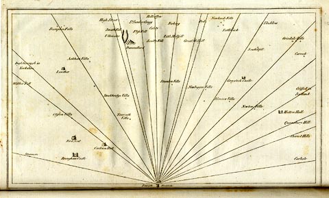 click to enlarge click to enlargeCL18.jpg "Grisdale Fells" item:- Armitt Library : A6615.12 Image © see bottom of page |
|
|
|
||
 Lakes Guides menu.