 Old Cumbria Gazetteer
 |
 |
|
| Wray Crag, Kentmere | ||
| Wray Crag | ||
| civil parish:- | Kentmere (formerly Westmorland) | |
| county:- | Cumbria | |
| locality type:- | rocks | |
| coordinates:- | NY47320531 (etc) | |
| 1Km square:- | NY4705 | |
| 10Km square:- | NY40 | |
|
|
||
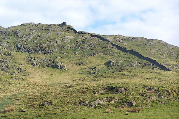 BMF56.jpg (taken 4.6.2006) 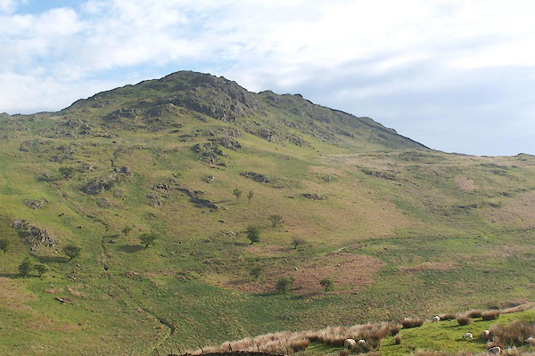 BMF57.jpg (taken 4.6.2006) |
||
|
|
||
| evidence:- | old map:- OS County Series (Wmd 27 6) placename:- Wray Cragg |
|
| source data:- | Maps, County Series maps of Great Britain, scales 6 and 25
inches to 1 mile, published by the Ordnance Survey, Southampton,
Hampshire, from about 1863 to 1948. County Series 25 inch map, Westmorland sheet XXVII 6, surveyed 1858, revised 1897, 2nd edition published by Ordnance Survey, 1898. |
|
|
|
||
| evidence:- | map:- OS Six Inch (1956) placename:- Wray Crag |
|
| source data:- | Map series, various editions with the national grid, scale about
6 inches to 1 mile, published by the Ordnance Survey,
Southampton, Hampshire, scale 1 to 10560 from 1950s to 1960s,
then 1 to 10000 from 1960s to 2000s, superseded by print on
demand from digital data.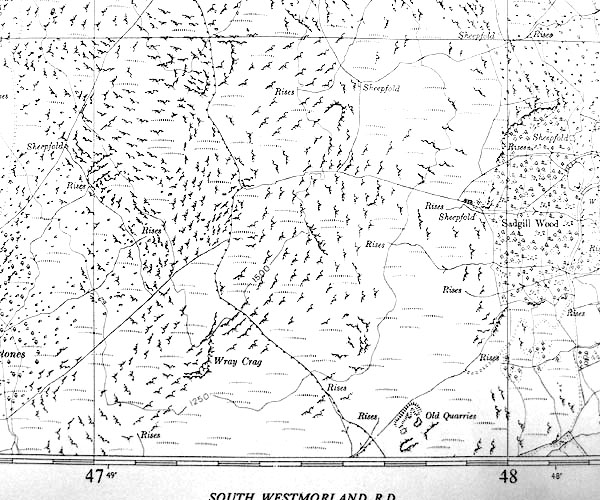 SINY4705.jpg "Wray Crag" |
|
|
|
||
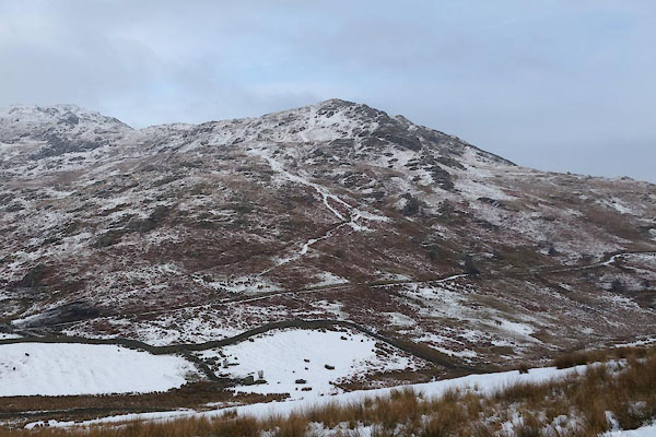 CCG12.jpg (taken 22.1.2015) |
||
|
|
||
 Lakes Guides menu.