 Old Cumbria Gazetteer
 |
 |
|
| Stockdale Bridge, Longsleddale | ||
| Stockdale Bridge | ||
| site name:- | Stockdale Beck | |
| civil parish:- | Longsleddale (formerly Westmorland) | |
| county:- | Cumbria | |
| locality type:- | bridge | |
| coordinates:- | NY48990501 | |
| 1Km square:- | NY4805 | |
| 10Km square:- | NY40 | |
|
|
||
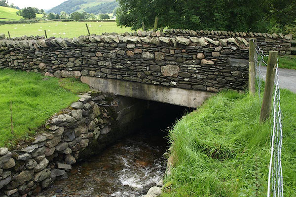 BRI06.jpg (taken 27.8.2009) |
||
|
|
||
| evidence:- | old map:- OS County Series (Wmd 27 7) placename:- Stockdale Bridge |
|
| source data:- | Maps, County Series maps of Great Britain, scales 6 and 25
inches to 1 mile, published by the Ordnance Survey, Southampton,
Hampshire, from about 1863 to 1948.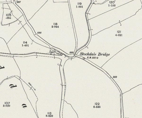 C5E004.jpg "Stockdale Bridge" |
|
|
|
||
| evidence:- | old map:- Hodgson 1828 |
|
| source data:- | Map, hand coloured engraving, 4 sheets mounted together on linen and rolled, Plan
of the County of Westmorland, scale about 1.25 inches to 1 mile, by Thomas Hodgson,
engraved by W R Gardner, Harpur Street, London, published by Thomas Hodgson, Lancaster,
and perhaps by C Smith, 172 Strand, London,1828.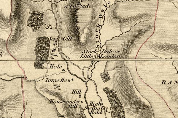 HDG6lsl3.jpg map courtesy of Mark Cropper item:- private collection : 371 Image © see bottom of page |
|
|
|
||
| evidence:- | map:- OS Six Inch (1956) placename:- Stockdale Bridge |
|
| source data:- | Map series, various editions with the national grid, scale about
6 inches to 1 mile, published by the Ordnance Survey,
Southampton, Hampshire, scale 1 to 10560 from 1950s to 1960s,
then 1 to 10000 from 1960s to 2000s, superseded by print on
demand from digital data.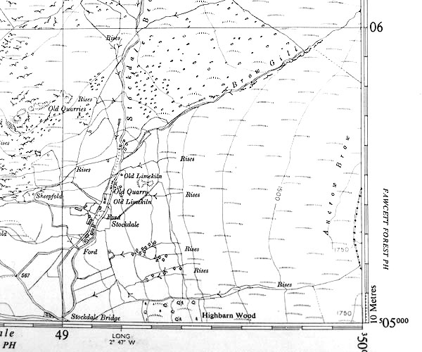 SINY4905.jpg "Stockdale Bridge" |
|
|
|
||
 Lakes Guides menu.