 Old Cumbria Gazetteer
 |
 |
|
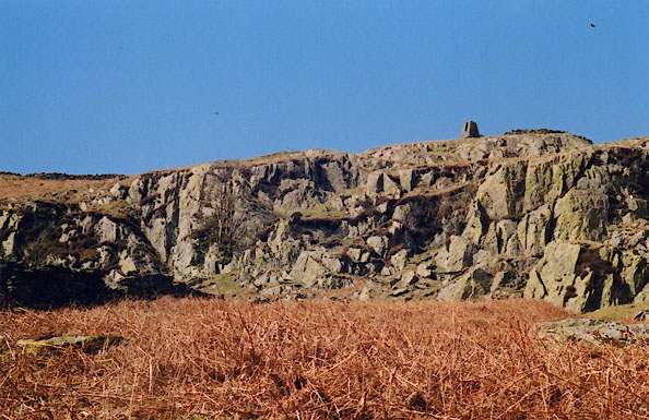
| survey pillar, Longsleddale (3) | ||
| locality:- | Brock Crag | |
| locality:- | Haweswater Aqueduct | |
| civil parish:- | Longsleddale (formerly Westmorland) | |
| county:- | Cumbria | |
| locality type:- | survey pillar | |
| locality type:- | pillar | |
| coordinates:- | NY49050614 | |
| 1Km square:- | NY4906 | |
| 10Km square:- | NY40 | |
|
|
||
 BIP27.jpg |
||
|
|
||
| person:- | local authority : Manchester Corporation |
|
| date:- | ||
| item:- | Haweswater Aqueduct; Longsleddale Tunnel |
|
| Concrete pillar, erected as a survey point for the construction of the Longsleddale
Tunnel carrying the Haweswater Aqueduct. |
||
| Wainwright, A: 1957: Book 2 Far Eastern Fells: Westmorland Gazette (Kendal, Westmorland)::
Grey Crag (4) |
||
|
|
||
 Lakes Guides menu.