 Old Cumbria Gazetteer
 |
 |
|
| Burnside Bridge, Kirklinton Middle | ||
| Burnside Bridge | ||
| site name:- | Hether Burn | |
| civil parish:- | Kirklinton Middle (formerly Cumberland) | |
| county:- | Cumbria | |
| locality type:- | bridge | |
| coordinates:- | NY42516645 | |
| 1Km square:- | NY4266 | |
| 10Km square:- | NY46 | |
|
|
||
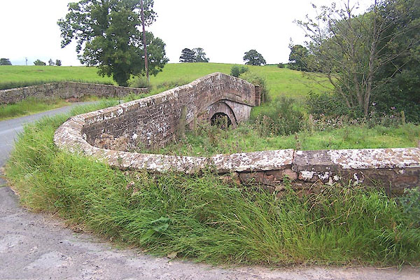 BOB35.jpg (taken 31.8.2007) 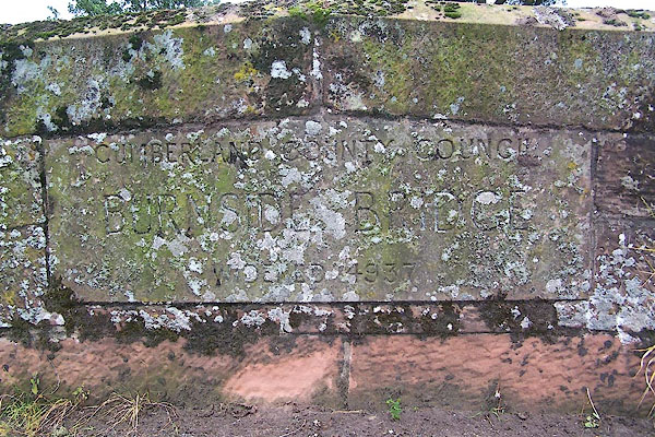 BOB36.jpg Plaque on parapet:- "CUMBERLAND COUNTY COUNCIL / BURNSIDE BRIDGE / WIDENED 4937 (sic)" (taken 31.8.2007) |
||
|
|
||
| evidence:- | old map:- OS County Series (Cmd 10 12) placename:- Hether Bridge |
|
| source data:- | Maps, County Series maps of Great Britain, scales 6 and 25
inches to 1 mile, published by the Ordnance Survey, Southampton,
Hampshire, from about 1863 to 1948. |
|
|
|
||
| evidence:- | old map:- Bell 1892 placename:- Burnside Bridge |
|
| source data:- | Map, colour lithograph, Road Map of Cumberland, by George Joseph
Bell, scale about 2.5 miles to 1 inch, printed by Charles
Thurnam and Sons, Carlisle, Cumberland, 1892. BEL9NY46.jpg "BURNSIDE" bridge symbol Road map of Cumberland showing County Bridges item:- Carlisle Library : Map 38 Image © Carlisle Library |
|
|
|
||
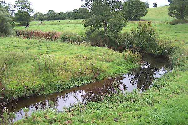 BOB37.jpg View of river. (taken 31.8.2007) |
||
|
|
||
 Lakes Guides menu.