 Old Cumbria Gazetteer
 |
 |
|
| milestone, Egremont | ||
| site name:- | road, Egremont to Whitehaven | |
| civil parish:- | Egremont (formerly Cumberland) | |
| county:- | Cumbria | |
| locality type:- | milestone | |
| coordinates:- | NY00411281 | |
| 1Km square:- | NY0012 | |
| 10Km square:- | NY01 | |
|
|
||
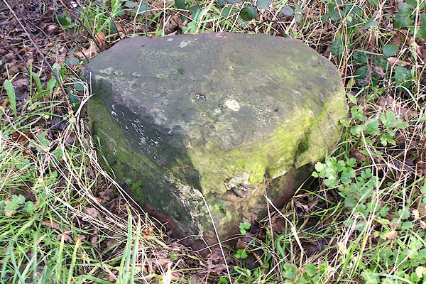 BOJ67.jpg There could have been two cast iron plates. (taken 7.12.2007) |
||
|
|
||
| evidence:- | old map:- OS County Series (Cmd 72) |
|
| source data:- | Maps, County Series maps of Great Britain, scales 6 and 25
inches to 1 mile, published by the Ordnance Survey, Southampton,
Hampshire, from about 1863 to 1948. "M.S. WHITEHAVEN [ ] CALDER BRIDGE [ ]" on old road |
|
|
|
||
| evidence:- | database:- Listed Buildings 2010 |
|
| source data:- | courtesy of English Heritage "MILESTONE TO SOUTH EAST OF BIGRIGG / / A595 / EGREMONT / COPELAND / CUMBRIA / II / 76119 / NY0041212818" |
|
| source data:- | courtesy of English Heritage "Milestone, mid C19. Single sandstone block c2 ft high with chamfered top; square in plan, set diagonally to road. Painted white with rectangular cast-iron plate to south face; border and raised sans-serif lettering picked out in black: TO WHITEHAVEN 4 MILES. Plate missing from north face" |
|
|
|
||
 Lakes Guides menu.