 Old Cumbria Gazetteer
 |
 |
|
| bench mark, NY51760013 | ||
| locality:- | Longsleddale | |
| civil parish:- | Longsleddale (formerly Westmorland) | |
| county:- | Cumbria | |
| locality type:- | bench mark (cut) | |
| coordinates:- | NY51760013 | |
| 1Km square:- | NY5100 | |
| 10Km square:- | NY50 | |
| altitude:- | 520.480 feet | |
| altitude:- | 158.6423m | |
| SummaryText:- | NE face 5.1m N angle building SW side of road, 0.7 m above ground | |
| SummaryText:- | The Winnows | |
|
|
||
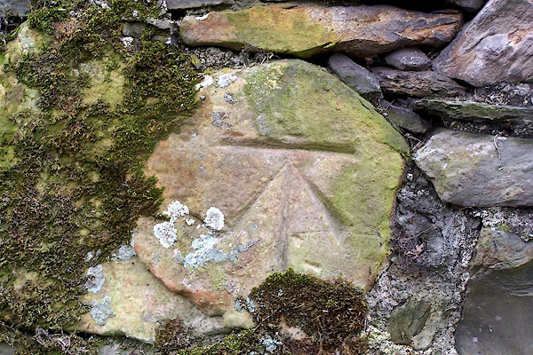 BNJ95.jpg (taken 19.3.2007) 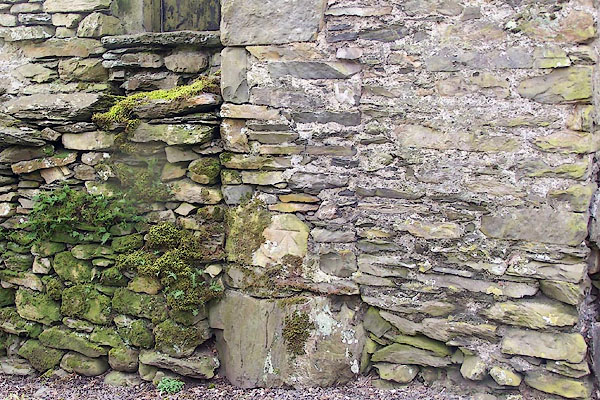 BNJ96.jpg The barn wall. (taken 19.3.2007) |
||
|
|
||
| evidence:- | old map:- OS County Series (Wmd 33 4) |
|
| source data:- | County Series map, Westmorland sheet 33 4, part of Longsleddale, Westmorland, scale
25 inches to 1 mile, published by the Ordnance Survey, Southampton, Hampshire, about
1890s?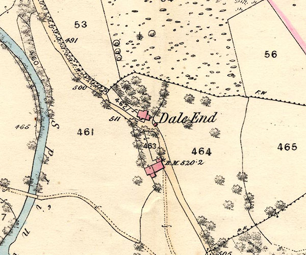 BNJ80.jpg item:- private collection : 55 Image © see bottom of page "B.M. 520.2" |
|
|
|
||
 Lakes Guides menu.