 Old Cumbria Gazetteer
 |
 |
|
||
| Dungeon Ghyll | ||||
| runs into:- |  Great Langdale Beck Great Langdale Beck |
|||
|
|
||||
| locality:- | Great Langdale | |||
| civil parish:- | Lakes (formerly Westmorland) | |||
| county:- | Cumbria | |||
| locality type:- | river | |||
| 1Km square:- | NY2906 (etc) | |||
| 10Km square:- | NY20 | |||
|
|
||||
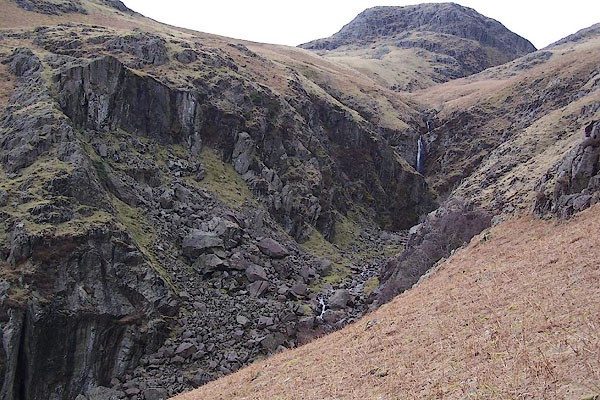 BSJ11.jpg Waterfall at (taken 23.3.2010) |
||||
|
|
||||
| evidence:- | old map:- OS County Series (Wmd 25 2) placename:- Dungeon Gill |
|||
| source data:- | Maps, County Series maps of Great Britain, scales 6 and 25
inches to 1 mile, published by the Ordnance Survey, Southampton,
Hampshire, from about 1863 to 1948. |
|||
|
|
||||
| evidence:- | old text:- Green 1810 |
|||
| source data:- | Set of prints, soft ground etchings, Sixty Studies from Nature,
by William Green, Ambleside, Westmorland, drawn 1808-10,
published 1810. goto source page 105:- "... Dungeon Gill passes through a deep cleft of the mountains, the tops of which cleft so overhang its basis, as nearly to meet; there is, indeed, a large stone stretching from side to side, over which, some have had the temerity to cross this hideous gulph." |
|||
|
|
||||
| places:- |
|
|||
Lakes Guides menu.