 Old Cumbria Gazetteer
 |
 |
|
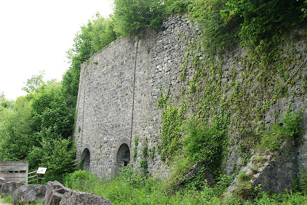
| Sandside Kiln, Sandside | ||
| Sandside Kiln | ||
| locality:- | Sandside | |
| civil parish:- | Beetham (formerly Westmorland) | |
| county:- | Cumbria | |
| locality type:- | limekiln | |
| coordinates:- | SD48028088 | |
| 1Km square:- | SD4880 | |
| 10Km square:- | SD48 | |
|
|
||
 BQS35.jpg (taken 5.6.2009) 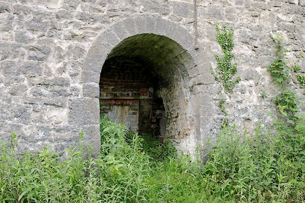 BQS36.jpg (taken 5.6.2009) |
||
|
|
||
| evidence:- | old map:- OS County Series (Wmd 46 3) |
|
| source data:- | Maps, County Series maps of Great Britain, scales 6 and 25
inches to 1 mile, published by the Ordnance Survey, Southampton,
Hampshire, from about 1863 to 1948. "L.K." |
|
|
|
||
 Lakes Guides menu.