 Old Cumbria Gazetteer
 |
 |
|
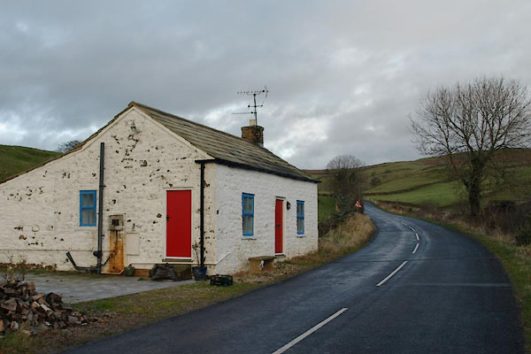
| Milkingstile Cottage, Brough | ||
| Milkingstile Cottage | ||
| Milkingstile Turn Pike | ||
| site name:- | road, Brough to Middleton-in-Teesdale | |
| civil parish:- | Brough (formerly Westmorland) | |
| county:- | Cumbria | |
| locality type:- | toll gate (site) | |
| locality type:- | buildings | |
| locality type:- | toll house (once?) | |
| coordinates:- | NY80521509 | |
| 1Km square:- | NY8015 | |
| 10Km square:- | NY81 | |
| references:- | OS County Series |
|
|
|
||
 BVT22.jpg (taken 2.12.2011) |
||
|
|
||
| evidence:- | old map:- OS County Series (Wmd 16 16) placename:- Milkingstile Turn Pike |
|
| source data:- | Maps, County Series maps of Great Britain, scales 6 and 25
inches to 1 mile, published by the Ordnance Survey, Southampton,
Hampshire, from about 1863 to 1948. "Milkingstile T.P." gate across road and a building |
|
|
|
||
 Lakes Guides menu.