 Old Cumbria Gazetteer
 |
 |
|
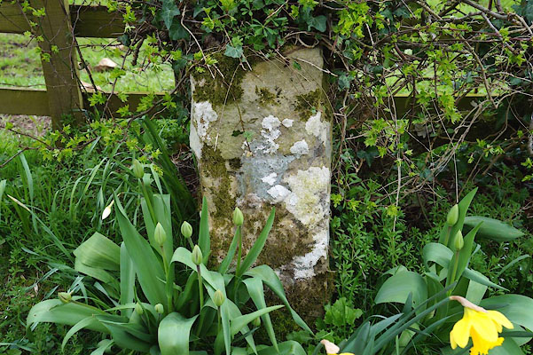
| boundary stone, Brough (3) | ||
| civil parish:- | Brough (formerly Westmorland) | |
| county:- | Cumbria | |
| locality type:- | boundary stone | |
| locality type:- | boundary mark | |
| coordinates:- | NY80281368 | |
| 1Km square:- | NY8013 | |
| 10Km square:- | NY81 | |
| references:- | Listed Buildings 2010 |
|
|
|
||
 CAH84.jpg (taken 11.4.2014) |
||
|
|
||
| evidence:- | database:- Listed Buildings 2010 |
|
| source data:- | courtesy of English Heritage "BOUNDARY STONE TO NORTH- WEST OF DUCK POOL FARM / / / BROUGH / EDEN / CUMBRIA / II / 73312 / NY8028313686" |
|
| source data:- | courtesy of English Heritage "Boundary stone; mid C19. Moved 5/6 ft north to present location in late C20. Single rough-dressed stone c3 ft high, square in plan. East face has 13 carved on dressed section." |
|
|
|
||
 Lakes Guides menu.