 Old Cumbria Gazetteer
 |
 |
|
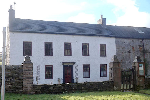
| Ivy House Farm, Garrigill | ||
| Ivy House Farm | ||
| locality:- | Garrigill | |
| civil parish:- | Alston Moor (formerly Cumberland) | |
| county:- | Cumbria | |
| locality type:- | buildings | |
| coordinates:- | NY74474147 | |
| 1Km square:- | NY7441 | |
| 10Km square:- | NY74 | |
| references:- | Listed Buildings 2010 |
|
|
|
||
 CCM13.jpg (taken 20.2.2015) |
||
|
|
||
| evidence:- | probably old map:- OS County Series (Cmd 42 6) placename:- Ivy House |
|
| source data:- | Maps, County Series maps of Great Britain, scales 6 and 25
inches to 1 mile, published by the Ordnance Survey, Southampton,
Hampshire, from about 1863 to 1948. |
|
|
|
||
| evidence:- | database:- Listed Buildings 2010 placename:- Ivy House Farm item:- date stone (1694) |
|
| source data:- | courtesy of English Heritage "IVY HOUSE FARMHOUSE AND ADJOINING BYRE / / / ALSTON MOOR / EDEN / CUMBRIA / II / 73124 / NY7447041477" |
|
|
|
||
| evidence:- | database:- Listed Buildings 2010 |
|
| source data:- | courtesy of English Heritage "FORECOURT WALLS, GATE AND END PIERS TO IVY HOUSE FARMHOUSE / / / ALSTON MOOR / EDEN / CUMBRIA / II / 73125 / NY7448641480" |
|
|
|
||
 Lakes Guides menu.