 Old Cumbria Gazetteer
 |
 |
|
| Longhouses Farm, Kentmere | ||
| Longhouses Farm | ||
| locality:- | Long Houses | |
| civil parish:- | Kentmere (formerly Westmorland) | |
| county:- | Cumbria | |
| locality type:- | buildings | |
| coordinates:- | NY45900305 | |
| 1Km square:- | NY4503 | |
| 10Km square:- | NY40 | |
| references:- | Listed Buildings 2010 |
|
|
|
||
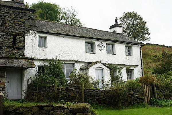 BPS63.jpg (taken 9.10.2008) 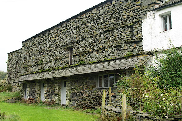 BPS64.jpg Barn beside the house. (taken 9.10.2008) |
||
|
|
||
| evidence:- | old map:- OS County Series (Wmd 27 10) placename:- Long Houses |
|
| source data:- | Maps, County Series maps of Great Britain, scales 6 and 25
inches to 1 mile, published by the Ordnance Survey, Southampton,
Hampshire, from about 1863 to 1948. |
|
|
|
||
| evidence:- | database:- Listed Buildings 2010 placename:- Longhouses Farm |
|
| source data:- | courtesy of English Heritage "LONGHOUSES FARMHOUSE AND ATTACHED SHIPPON / / / KENTMERE / SOUTH LAKELAND / CUMBRIA / II / 76475 / NY4590703057" |
|
|
|
||
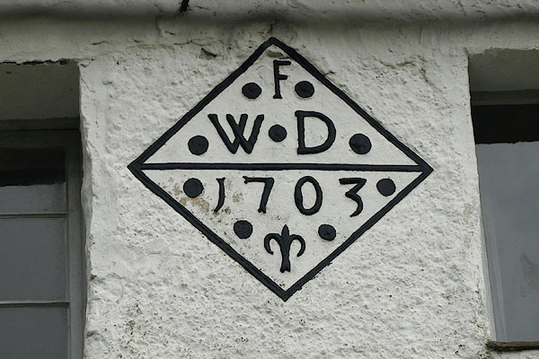 BPS65.jpg Date stone:- "F / W D / 1703" (taken 9.10.2008) |
||
|
|
||
 Lakes Guides menu.