 Old Cumbria Gazetteer
 |
 |
|
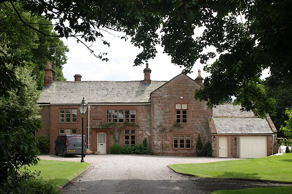
| Rectory, Great Salkeld | ||
| locality:- | Great Salkeld | |
| civil parish:- | Great Salkeld (formerly Cumberland) | |
| county:- | Cumbria | |
| locality type:- | buildings | |
| coordinates:- | NY55153660 | |
| 1Km square:- | NY5536 | |
| 10Km square:- | NY53 | |
| references:- | Listed Buildings 2010 |
|
|
|
||
 BWW58.jpg (taken 20.7.2012) |
||
|
|
||
| evidence:- | old map:- OS County Series (Cmd 50 2) |
|
| source data:- | Maps, County Series maps of Great Britain, scales 6 and 25
inches to 1 mile, published by the Ordnance Survey, Southampton,
Hampshire, from about 1863 to 1948. "Rectory" |
|
|
|
||
| evidence:- | database:- Listed Buildings 2010 placename:- Rectory, The item:- date stone (1674) |
|
| source data:- | courtesy of English Heritage "THE RECTORY / / / GREAT SALKELD / EDEN / CUMBRIA / II[star] / 74247 / NY5515636600" |
|
|
|
||
| notes:- |
tower and hall, altered |
|
| Perriam, D R &Robinson, J: 1998: Medieval Fortified Buildings of Cumbria: CWAAS::
ISBN 1 873124 23 6; plan and illustration |
||
|
|
||
 Lakes Guides menu.