 Old Cumbria Gazetteer
 |
 |
|
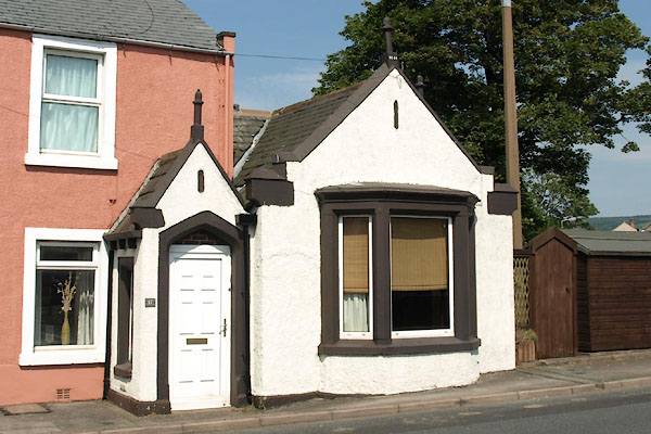
| toll gate, Egremont (2) | ||
| site name:- | road, Egremont to Whitehaven | |
| Street:- | Bridge End | |
| locality:- | Egremont | |
| civil parish:- | Egremont (formerly Cumberland) | |
| county:- | Cumbria | |
| locality type:- | toll house | |
| locality type:- | toll gate (site) | |
| coordinates:- | NY01271034 | |
| 1Km square:- | NY0110 | |
| 10Km square:- | NY01 | |
| references:- | OS County Series |
|
|
|
||
 BUX31.jpg (taken 4.7.2011) |
||
|
|
||
| evidence:- | old map:- OS County Series (Cmd 72 8) |
|
| source data:- | Maps, County Series maps of Great Britain, scales 6 and 25
inches to 1 mile, published by the Ordnance Survey, Southampton,
Hampshire, from about 1863 to 1948. "T.P" |
|
|
|
||
| evidence:- | database:- Listed Buildings 2010 |
|
| source data:- | courtesy of English Heritage "/ 17 / BRIDGE END / EGREMONT / COPELAND / CUMBRIA / II / 76121 / NY0127810328" |
|
|
|
||
 Lakes Guides menu.