 Old Cumbria Gazetteer
 |
 |
|
| Ireby Dale, Ireby | ||
| Ireby Dale | ||
| locality:- | Gill Beck (4) | |
| civil parish:- | Ireby (formerly Cumberland) | |
| county:- | Cumbria | |
| locality type:- | valley | |
| coordinates:- | NY25213888 (etc etc) | |
| 1Km square:- | NY2538 | |
| 10Km square:- | NY23 | |
| references:- | Donald 1774 |
|
|
|
||
| evidence:- | old map:- Donald 1774 (Cmd) placename:- Ireby Dale |
|
| source data:- | Map, hand coloured engraving, 3x2 sheets, The County of Cumberland, scale about 1
inch to 1 mile, by Thomas Donald, engraved and published by Joseph Hodskinson, 29
Arundel Street, Strand, London, 1774.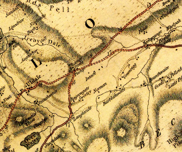 D4NY23NE.jpg "Ireby Dale" valley, hill hachures item:- Carlisle Library : Map 2 Image © Carlisle Library |
|
|
|
||
 Lakes Guides menu.