 Old Cumbria Gazetteer
 |
 |
|
| included in:- |
 Low Sadgill, Longsleddale Low Sadgill, Longsleddale |
|
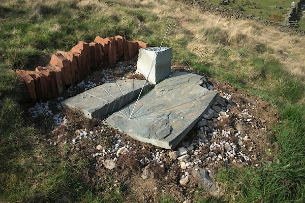
| sundial, Low Sadgill, Longsleddale | ||
| Martin's sundial | ||
| locality:- | Low Sadgill | |
| locality:- | Sadgill | |
| civil parish:- | Longsleddale (formerly Westmorland) | |
| county:- | Cumbria | |
| locality type:- | sundial | |
| coordinates:- | NY48200569 (about) | |
| 1Km square:- | NY4805 | |
| 10Km square:- | NY40 | |
|
|
||
 BWD28.jpg (taken 24.3.2012) 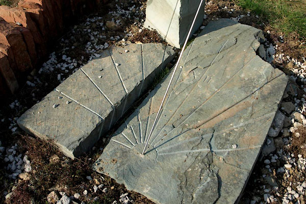 BWD29.jpg (taken 24.3.2012) |
||
| Taken before a tilt in the upright block was corrected! |
||
|
|
||
| notes:- |
The sundial is set for Local Mean Time. |
|
| Low Sadgill is at 54d 26.600m N, 2d 47.892m W, 11.1928 minutes behind GMT - ie about
11minutes 11.6 seconds behind Greenwich. |
||
| Tables of the Equation of Time were consulted in:- |
||
| Waugh, Albert E: 1973: Sundials, their Theory and Construction: Dover Publications
(New York, United States) |
||
| The 'local' clock used to know GMT was a hand held GPS. The noon line was set N-S
using the GPS and sun's shadow adjusted for local position, and the gnomon, with correct
angle for latitude, then fixed in place with its shadow on the line. The other hour
lines were positioned using the sun's shadow at the appropriate time checked by GPS,
adjusted for longitude and Equation of Time. |
||
|
|
||
Lakes Guides menu.