 Old Cumbria Gazetteer
 |
 |
|
| Bampton Grange, Bampton | ||
| Bampton Grange | ||
| civil parish:- | Bampton (formerly Westmorland) | |
| county:- | Cumbria | |
| locality type:- | buildings | |
| coordinates:- | NY52161806 (etc) | |
| 1Km square:- | NY5218 | |
| 10Km square:- | NY51 | |
|
|
||
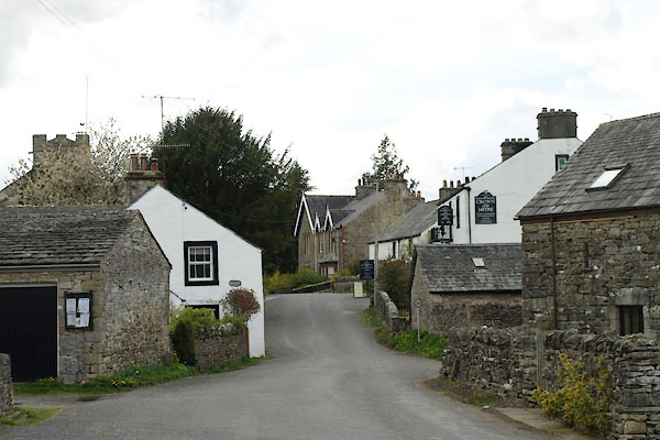
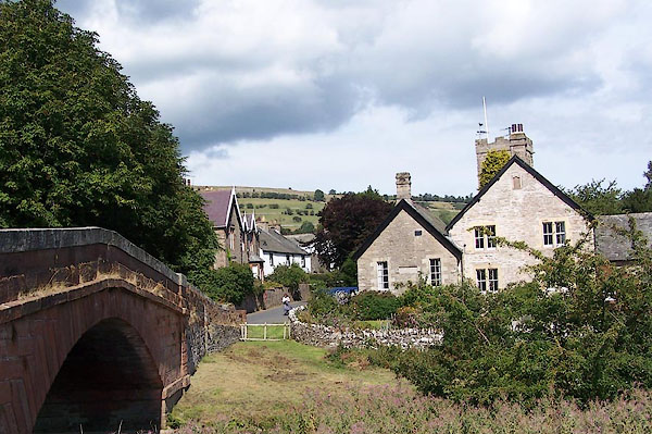 BJT76.jpg (taken 22.8.2005) 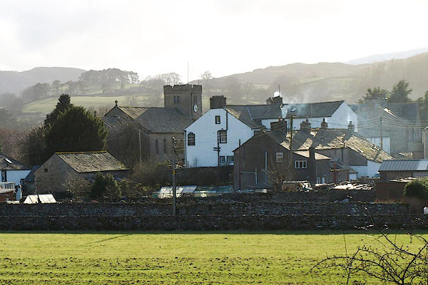 BQF24.jpg (taken 6.3.2009) |
||
|
|
||
| evidence:- | old map:- OS County Series (Wmd 13 8) placename:- Bampton Grange |
|
| source data:- | Maps, County Series maps of Great Britain, scales 6 and 25
inches to 1 mile, published by the Ordnance Survey, Southampton,
Hampshire, from about 1863 to 1948. |
|
|
|
||
| evidence:- | old map:- Saxton 1579 placename:- Banton |
|
| source data:- | Map, hand coloured engraving, Westmorlandiae et Cumberlandiae Comitatus ie Westmorland
and Cumberland, scale about 5 miles to 1 inch, by Christopher Saxton, London, engraved
by Augustinus Ryther, 1576, published 1579-1645.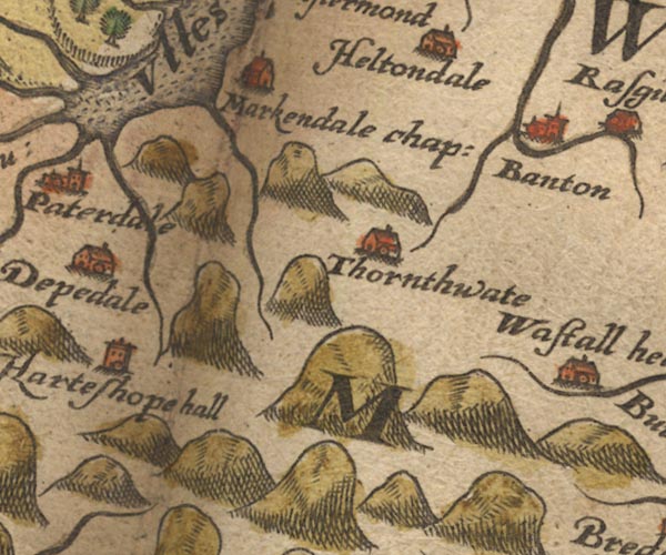 Sax9NY41.jpg Church, symbol for a parish or village, with a parish church. "Banton" item:- private collection : 2 Image © see bottom of page |
|
|
|
||
| evidence:- | probably old map:- Mercator 1595 (edn?) placename:- Banton |
|
| source data:- | Map, hand coloured engraving, Westmorlandia, Lancastria, Cestria
etc, ie Westmorland, Lancashire, Cheshire etc, scale about 10.5
miles to 1 inch, by Gerard Mercator, Duisberg, Germany, 1595,
edition 1613-16. MER5WmdA.jpg "Banton" circle item:- Armitt Library : 2008.14.3 Image © see bottom of page |
|
|
|
||
| evidence:- | old map:- Keer 1605 placename:- Banton |
|
| source data:- | Map, hand coloured engraving, Westmorland and Cumberland, scale
about 16 miles to 1 inch, probably by Pieter van den Keere, or
Peter Keer, about 1605 edition perhaps 1676. click to enlarge click to enlargeKER8.jpg "Banton" dot, circle and tower; village item:- Dove Cottage : 2007.38.110 Image © see bottom of page |
|
|
|
||
| evidence:- | old map:- Speed 1611 (Wmd) placename:- Banton |
|
| source data:- | Map, hand coloured engraving, The Countie Westmorland and
Kendale the Cheif Towne, scale about 2.5 miles to 1 inch, by
John Speed, 1610, published by George Humble, Popes Head Alley,
London, 1611-12.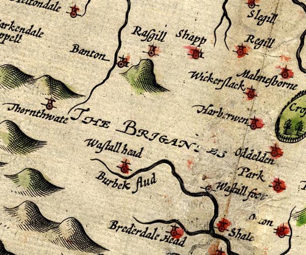 SP14NY51.jpg "Banton" circle, building and tower item:- Armitt Library : 2008.14.5 Image © see bottom of page |
|
|
|
||
| evidence:- | old map:- Jansson 1646 placename:- Banton |
|
| source data:- | Map, hand coloured engraving, Cumbria and Westmoria, ie
Cumberland and Westmorland, scale about 3.5 miles to 1 inch, by
John Jansson, Amsterdam, Netherlands, 1646.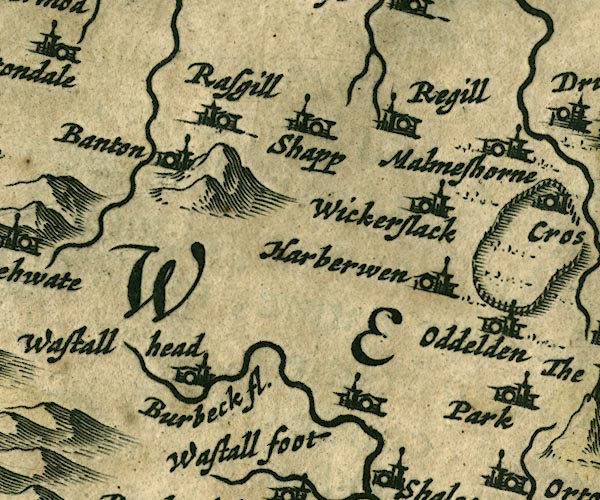 JAN3NY51.jpg "Banton" Buildings and tower. item:- JandMN : 88 Image © see bottom of page |
|
|
|
||
| evidence:- | hearth tax returns:- Hearth Tax 1670 placename:- Grainge |
|
| source data:- | Records, hearth tax returns, exchequer duplicates, Westmorland,
1670. "Grainge" |
|
|
|
||
| evidence:- | probably old map:- Morden 1695 (Wmd) placename:- Bamton Grange |
|
| source data:- | Map, hand coloured engraving, Westmorland, scale about 2.5 miles to 1 inch, by Robert
Morden, published by Abel Swale, the Unicorn, St Paul's Churchyard, Awnsham, and John
Churchill, the Black Swan, Paternoster Row, London, 1695.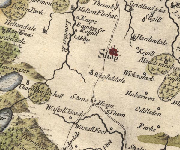 MD10NY51.jpg "Bamton Gr" No symbol. item:- JandMN : 24 Image © see bottom of page |
|
|
|
||
| evidence:- | old map:- Bowen and Kitchin 1760 placename:- Banton |
|
| source data:- | Map, hand coloured engraving, A New Map of the Counties of
Cumberland and Westmoreland Divided into their Respective Wards,
scale about 4 miles to 1 inch, by Emanuel Bowen and Thomas
Kitchin et al, published by T Bowles, Robert Sayer, and John
Bowles, London, 1760.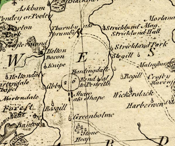 BO18NY41.jpg "Banton / V" circle, building and tower, vicarage, cross potent for a charity school item:- Armitt Library : 2008.14.10 Image © see bottom of page |
|
|
|
||
| evidence:- | old map:- Jefferys 1770 (Wmd) placename:- Grange |
|
| source data:- | Map, 4 sheets, The County of Westmoreland, scale 1 inch to 1
mile, surveyed 1768, and engraved and published by Thomas
Jefferys, London, 1770.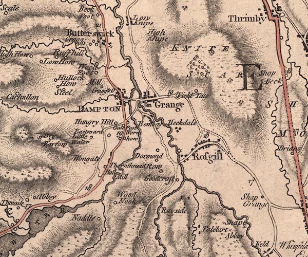 J5NY51NW.jpg "Grange" blocks, labelled in upright lowercase text; settlement; town? item:- National Library of Scotland : EME.s.47 Image © National Library of Scotland |
|
|
|
||
| evidence:- | old map:- Cary 1789 (edn 1805) placename:- Grange |
|
| source data:- | Map, uncoloured engraving, Westmoreland, scale about 2.5 miles
to 1 inch, by John Cary, London, 1789; edition 1805.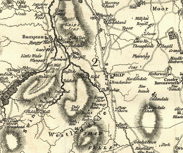 CY24NY51.jpg "Grange" block/s, labelled in italic lowercase; house, or hamlet item:- JandMN : 129 Image © see bottom of page |
|
|
|
||
| evidence:- | old map:- Cooke 1802 placename:- Brompton |
|
| source data:- | Map, The Lakes, Westmorland and Cumberland, scale about 8.5
miles to 1 inch, engravedby Neele and Son, published by
Sherwood, Jones and Co, Paternoster Road, London, 1824. click to enlarge click to enlargeGRA1Lk.jpg "Brompton" blocks, italic lowercase text, village, hamlet, locality item:- Hampshire Museums : FA2000.62.5 Image © see bottom of page |
|
|
|
||
| evidence:- | old map:- Otley 1818 placename:- Bampton |
|
| source data:- | Map, uncoloured engraving, The District of the Lakes,
Cumberland, Westmorland, and Lancashire, scale about 4 miles to
1 inch, by Jonathan Otley, 1818, engraved by J and G Menzies,
Edinburgh, Scotland, published by Jonathan Otley, Keswick,
Cumberland, et al, 1833.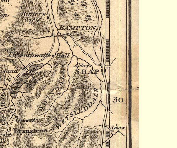 OT02NY51.jpg "BAMPTON" item:- JandMN : 48.1 Image © see bottom of page |
|
|
|
||
| evidence:- | descriptive text:- Otley 1823 (5th edn 1834) |
|
| source data:- | Guide book, A Concise Description of the English Lakes, the
mountains in their vicinity, and the roads by which they may be
visited, with remarks on the mineralogy and geology of the
district, by Jonathan Otley, published by the author, Keswick,
Cumberland now Cumbria, by J Richardson, London, and by Arthur
Foster, Kirkby Lonsdale, Cumbria, 1823; published 1823-49,
latterly as the Descriptive Guide to the English Lakes. goto source goto sourcePage 28:- "..." "There is a public house at Mardale Green, ... and two at Bampton Grange, a distance of two miles from its [Hawes Water's] foot." "..." goto sourcePage 116:- "... return to the Grange for refreshment. At this place there are two public-houses; but not being often visited by strangers, they are not well fitted up for their entertainment. ..." |
|
|
|
||
| evidence:- | probably fiction:- Trollope 1864 placename:- Bampton placename:- Baampton |
|
| source data:- | goto source chapter 57 Showing how the wild beast got himself back from the mountains "We will ... tell how he [George] walked across the mountains, in the rain, to Bampton,a little village at the foot of Haweswater. ..." "... The rain soon came on and found him exposed on the hill-side. He thought little about it, but buttoned his coat, as I have said before, and strode on. It was a storm of rain, so that he was forced to hold his head to one side, as it hit him from the north. But with his hand on his hat, and his head bent against the wind, he went on till he had reached the valley at the foot, and found that the track by which he had been led thither had become a road. ..." "... As he [George] got near the village he overtook a shepherd boy coming down from the hills, and learned his whereabouts from him. 'Baampton,' said the boy, with an accent that was almost Scotch, when he was asked the name of the place. When Vavasor further asked whether a gig was kept there, the boy simply stared at him, not knowing a gig by that name. At last, however, he was made to understand the nature of his companion's want, and expressed his belief that 'John Applethwaite, up at the Craigs yon, had got a mickle cart.' But the Craigs was a farm-house, which now came in view about a mile off, up across valley: and Vavasor, hoping that he might still find a speedier conveyance than John Applethwaite's mickle cart, went on to the public-house in the village. But, in truth, neither there, nor yet from John Applethwaite, to whom at last an application was sent, could he get any vehicle; and between six and seven he started off again, through the rain, to make his weary way on foot to Shap. ..." |
|
|
|
||
 BWH38.jpg (taken 27.4.2012) 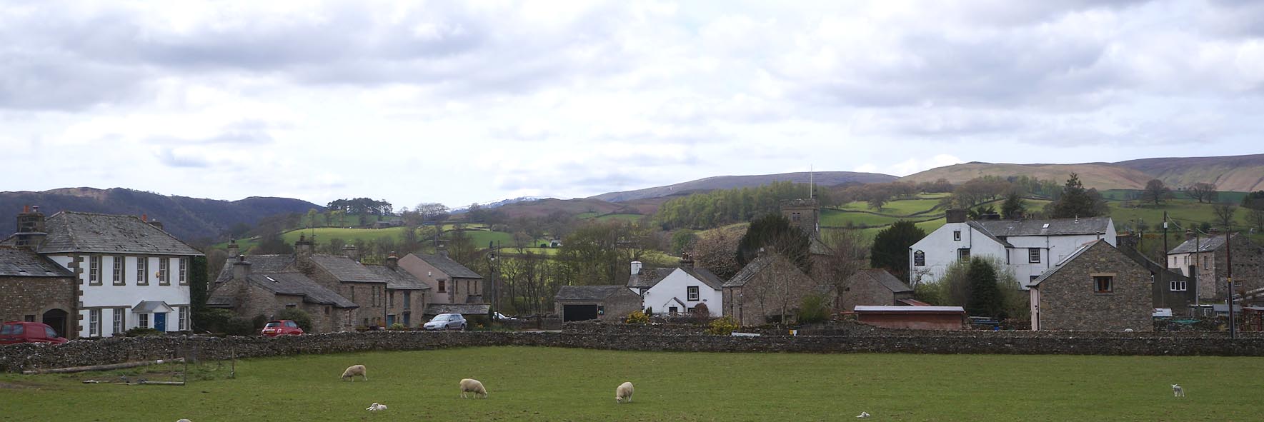 Click to enlarge CCY55.jpg (taken 1.5.2015) 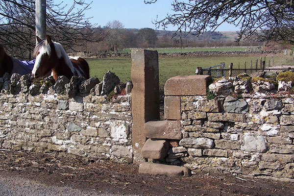 BNK38.jpg A stile, near the bridge. (taken 23.3.2007) |
||
|
|
||
| hearsay:- |
The vicarage, opposite St Patrick's Church, houses the Tinklar Library, with many
texts in Latin. There is a local saying:- |
|
| "They drove the plough in Latin in Bampton." |
||
|
|
||
Lakes Guides menu.