 Old Cumbria Gazetteer
 |
 |
|
| Branstree, Longsleddale | ||
| Branstree | ||
| Brant Street | ||
| civil parish:- | Longsleddale (formerly Westmorland) | |
| civil parish:- | Shap Rural (formerly Westmorland) | |
| county:- | Cumbria | |
| locality type:- | hill | |
| coordinates:- | NY47820993 | |
| 1Km square:- | NY4709 | |
| 10Km square:- | NY40 | |
| altitude:- | 2340 feet (?) | |
| altitude:- | 713m (?) | |
|
|
||
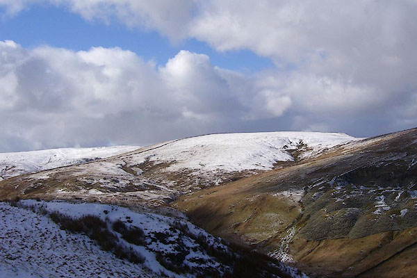 BOT57.jpg (taken 4.3.2008) |
||
|
|
||
| evidence:- | old map:- Jefferys 1770 (Wmd) |
|
| source data:- | Map, 4 sheets, The County of Westmoreland, scale 1 inch to 1
mile, surveyed 1768, and engraved and published by Thomas
Jefferys, London, 1770.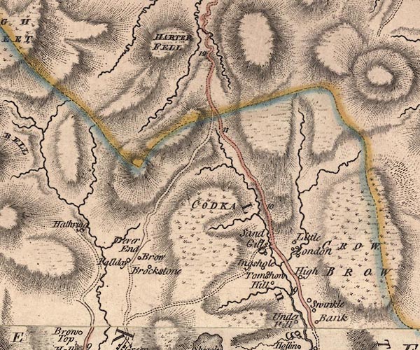 J5NY40NE.jpg hill hachuring; hill or mountain item:- National Library of Scotland : EME.s.47 Image © National Library of Scotland |
|
|
|
||
| evidence:- | old map:- Hodgson 1828 placename:- Branstree |
|
| source data:- | Map, hand coloured engraving, 4 sheets mounted together on linen and rolled, Plan
of the County of Westmorland, scale about 1.25 inches to 1 mile, by Thomas Hodgson,
engraved by W R Gardner, Harpur Street, London, published by Thomas Hodgson, Lancaster,
and perhaps by C Smith, 172 Strand, London,1828.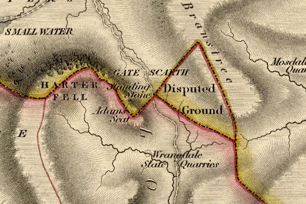 HDG6lsl5.jpg map courtesy of Mark Cropper "Branstree" item:- private collection : 371 Image © see bottom of page The Disputed Ground between parishes on Branstree shown here is now in Longsleddale parish. |
|
|
|
||
| evidence:- | old map:- Garnett 1850s-60s H placename:- Branstree |
|
| source data:- | Map of the English Lakes, in Cumberland, Westmorland and
Lancashire, scale about 3.5 miles to 1 inch, published by John
Garnett, Windermere, Westmorland, 1850s-60s.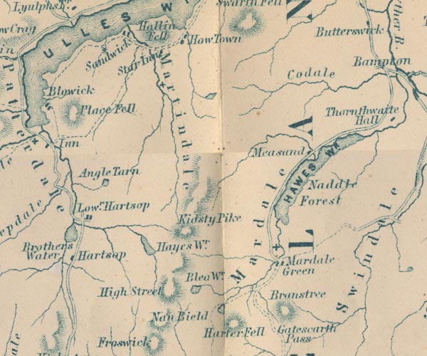 GAR2NY41.jpg "Branstree" hill hachuring item:- JandMN : 82.1 Image © see bottom of page |
|
|
|
||
| evidence:- | old text:- Prior 1865 placename:- Branstreet |
|
| source data:- | Guide book, Ascents and Passes in the Lake District of England,
by Herman Prior, published by John Garnett, Windermere,
Westmorland, and by Simpkin, Marshall and Co, London, 1865. Pages 113-347 have descriptions of mountains, amongst which:- "Brandstreet.- 2,333 feet." "This mountain forms the eastern boundary of the Gatescarth Pass between Longsleddale and Mardale." |
|
|
|
||
| evidence:- | old map:- OS 1881-82 New Series (outline edition) |
|
| source data:- | Maps, parts of Westmorland, Cumberland etc, New Series 1 inch
maps of England, scale 1 inch to 1 mile, published by the
Ordnance Survey, London, 1881-82. "2333" |
|
|
|
||
| evidence:- | outline view:- Black 1856 (23rd edn 1900) placename:- Branstree |
|
| source data:- | Print, lithograph, Outline Views, Haws and Wastwater - Mountains as seen from Burn-Banks
near the Foot of Hawes Water, and Mountains as seen near Nether Wastdale at the First
Bridge on the road to Wast-Water, by J Flintoft, Keswick, Cumberland, engraved by
R Mason, Edinburgh, Lothian, about 1900.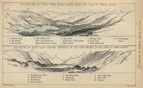 click to enlarge click to enlargeBC08E6.jpg "... 2 Branstree ..." item:- JandMN : 37.21 Image © see bottom of page |
|
|
|
||
| evidence:- | outline view:- Black 1841 (3rd edn 1846) placename:- Branstree |
|
| source data:- | Print, engraving, outline view, Mountains as seen from Burn Banks near the Foot of
Hawes Water, and Mountains as seen near Strands in Wastdale at the First bridge on
the Road to Wast Water, by J Flintoft, Keswick, Cumberland, engraved by R Mason, Edinburgh,
Lothian, about 1846.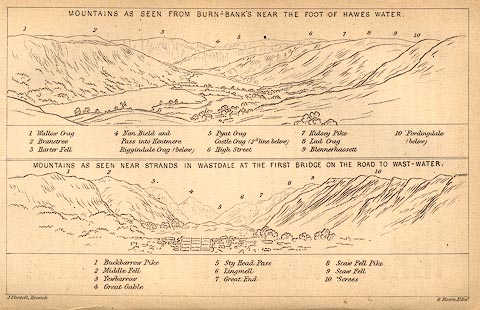 click to enlarge click to enlargeBC02E8.jpg "... 2 Branstree ..." item:- JandMN : 32.12 Image © see bottom of page |
|
|
|
||
| :- |
Possibly this was originally the name of the track from Mardale to Longsleddale, brant
stree = steep path, but now the name of the hillside above the lake. |
|
| EPNS Westmorland 1967 |
||
|
|
||
 Lakes Guides menu.