 Old Cumbria Gazetteer
 |
 |
|
| Cark, Lower Holker | ||
| Cark | ||
| civil parish:- | Lower Holker (formerly Lancashire) | |
| county:- | Cumbria | |
| locality type:- | buildings | |
| coordinates:- | SD363765 | |
| 1Km square:- | SD3676 | |
| 10Km square:- | SD37 | |
|
|
||
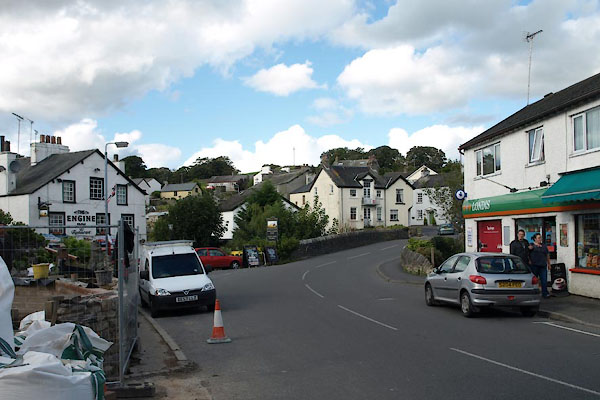 BXK11.jpg (taken 21.9.2012) |
||
|
|
||
| evidence:- | old map:- OS County Series (Lan 17 6) placename:- Cark |
|
| source data:- | Maps, County Series maps of Great Britain, scales 6 and 25
inches to 1 mile, published by the Ordnance Survey, Southampton,
Hampshire, from about 1863 to 1948. |
|
|
|
||
| evidence:- | old map:- Otley 1818 placename:- Cark |
|
| source data:- | Map, uncoloured engraving, The District of the Lakes,
Cumberland, Westmorland, and Lancashire, scale about 4 miles to
1 inch, by Jonathan Otley, 1818, engraved by J and G Menzies,
Edinburgh, Scotland, published by Jonathan Otley, Keswick,
Cumberland, et al, 1833.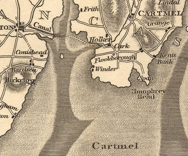 OT02SD37.jpg item:- JandMN : 48.1 Image © see bottom of page |
|
|
|
||
| evidence:- | old map:- Garnett 1850s-60s H placename:- Cark |
|
| source data:- | Map of the English Lakes, in Cumberland, Westmorland and
Lancashire, scale about 3.5 miles to 1 inch, published by John
Garnett, Windermere, Westmorland, 1850s-60s.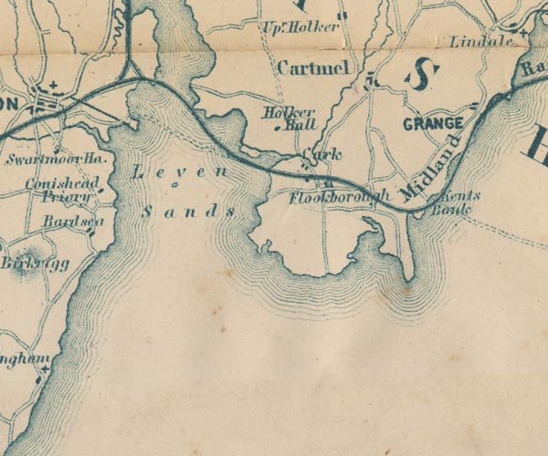 GAR2SD37.jpg "Cark" blocks, settlement item:- JandMN : 82.1 Image © see bottom of page |
|
|
|
||
| evidence:- | old map:- Post Office 1850s-1900s placename:- Carke |
|
| source data:- | Post road maps, General Post Office Circulation Map for England
and Wales, for the General Post Office, London, 1850s-1900s. click to enlarge click to enlargePOF7Cm.jpg "Carke" map date 1909 |
|
|
|
||
| evidence:- | old map:- Post Office 1850s-1900s placename:- Carke |
|
| source data:- | Post road maps, General Post Office Circulation Map for England
and Wales, for the General Post Office, London, 1850s-1900s. click to enlarge click to enlargePF10Cm.jpg "Carke" map date 1892 |
|
|
|
||
| evidence:- | old map:- Post Office 1850s-1900s placename:- Carke |
|
| source data:- | Post road maps, General Post Office Circulation Map for England
and Wales, for the General Post Office, London, 1850s-1900s.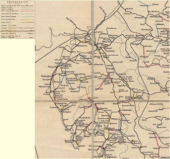 click to enlarge click to enlargePOF2Cm.jpg "Carke" map date 1890 |
|
|
|
||
| evidence:- | old map:- Post Office 1850s-1900s placename:- Carke |
|
| source data:- | Post road maps, General Post Office Circulation Map for England
and Wales, for the General Post Office, London, 1850s-1900s.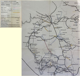 click to enlarge click to enlargePOF8Cm.jpg "Carke" map date 1873 |
|
|
|
||
| :- |
images courtesy of the British Postal Museum and Hampshire CC Museums |
|
|
|
||
| notes:- |
There was a cotton mill built here 1782. Cotton arrived by ship, Cark being a busy
port until it silted up following railway works in the mid 19th century. The mill
was burned down in 1936. High Row and Low Row are mill cottages. There was a Middle
Row, but now mostly demolished. |
|
|
|
||
 Lakes Guides menu.