Old Cumbria Gazetteer
 |
 |
|
||
| Crabtree Beck | ||||
| runs into:- |  Loweswater lake Loweswater lake |
|||
|
|
||||
| civil parish:- | Loweswater (formerly Cumberland) | |||
| county:- | Cumbria | |||
| locality type:- | river | |||
| locality type:- | flood | |||
| 1Km square:- | NY1322 (etc) | |||
| 10Km square:- | NY12 | |||
|
|
||||
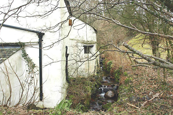 BQD31.jpg Running behind Crabtreebeck house. (taken 17.2.2009) |
||||
|
|
||||
| evidence:- | old map:- OS County Series (Cmd 62 12) placename:- Crabtree Beck |
|||
| source data:- | Maps, County Series maps of Great Britain, scales 6 and 25
inches to 1 mile, published by the Ordnance Survey, Southampton,
Hampshire, from about 1863 to 1948. |
|||
|
|
||||
| evidence:- | old map:- Crosthwaite 1783-94 (But/Cru/Low) |
|||
| source data:- | Map, uncoloured engraving, An Accurate Map of Buttermere,
Crummock and Loweswater Lakes, scale about 3 inches to 1 mile,
by Peter Crosthwaite, Keswick, Cumberland, 1794, version
published 1800.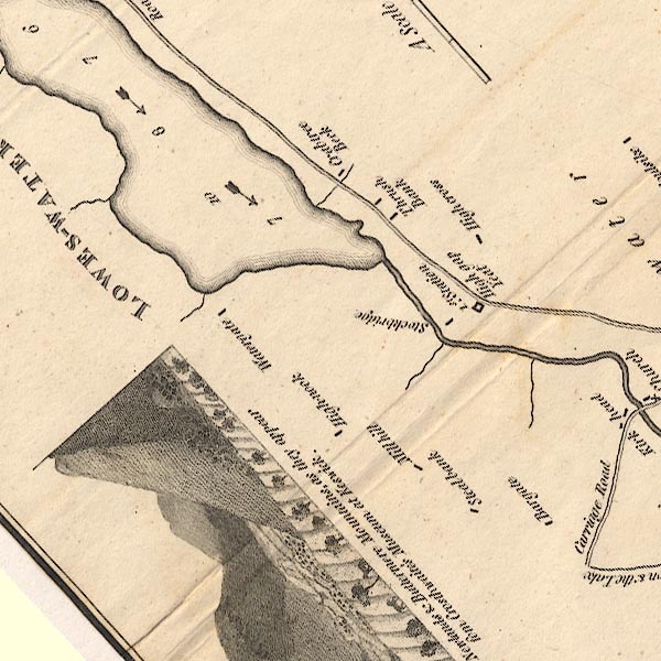 CT8NY12F.jpg item:- Armitt Library : 1959.191.2 Image © see bottom of page |
|||
|
|
||||
| hearsay:- |
There was a dam across the beck to supply water to a lead mine in Kirkhill Wood. Edward
Bogg, in 1902, told of a dam burst:- |
|||
| "Many years ago a small reservoir, or tarn, on the hill above the lake [Loweswater],
burst, and came rolling in one huge wave towards the lake; a farm stood in its path,
and one of the occupants, a girl who was outside the house, saw the dark mass of water
sweeping downwards. Darting into the house, she informed the inmates (the master and
a female) of the occurrence. These two had just reached the outside of the door in
their endeavour to escape, when the wave caught them both, swept them into the lake,
and their bodies were never discovered, while strange to say, the girl, who was first
to discover the inundation, was saved by the water forcibly banging the door in her
face and holding her prisoner, when she was in the act of following the other persons." |
||||
| It is not clear that the right beck and house are identified. |
||||
|
|
||||
| places:- |
|
|||
Lakes Guides menu.