 Old Cumbria Gazetteer
 |
 |
|
||||||||||||||||||||||||
| Crummock Water | ||||||||||||||||||||||||||
| runs into:- |  Cocker, River Cocker, River |
|||||||||||||||||||||||||
|
|
||||||||||||||||||||||||||
| civil parish:- | Buttermere (formerly Cumberland) | |||||||||||||||||||||||||
| county:- | Cumbria | |||||||||||||||||||||||||
| locality type:- | lake | |||||||||||||||||||||||||
| coordinates:- | NY15871867 (etc) | |||||||||||||||||||||||||
| 1Km square:- | NY1518 | |||||||||||||||||||||||||
| 10Km square:- | NY11 | |||||||||||||||||||||||||
|
|
||||||||||||||||||||||||||
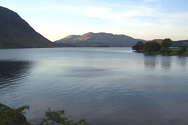 BJY22.jpg Looking north west. (taken 14.10.2005) 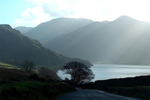 BNE23.jpg From Lanthwaite. (taken 14.2.2007) |
||||||||||||||||||||||||||
|
|
||||||||||||||||||||||||||
| evidence:- | old map:- OS County Series (Cmd 69 2) placename:- Crummock Water |
|||||||||||||||||||||||||
| source data:- | Maps, County Series maps of Great Britain, scales 6 and 25
inches to 1 mile, published by the Ordnance Survey, Southampton,
Hampshire, from about 1863 to 1948. |
|||||||||||||||||||||||||
|
|
||||||||||||||||||||||||||
| evidence:- | old map:- OS County Series (Cmd 69) |
|||||||||||||||||||||||||
| source data:- | Maps, County Series maps of Great Britain, scales 6 and 25
inches to 1 mile, published by the Ordnance Survey, Southampton,
Hampshire, from about 1863 to 1948. "Lowest point of bed of lake 177 feet above O.S. datum" elsewhere:- "Sur. of Water 321" |
|||||||||||||||||||||||||
|
|
||||||||||||||||||||||||||
| evidence:- | old map:- Saxton 1579 placename:- Loweswater |
|||||||||||||||||||||||||
| source data:- | Map, hand coloured engraving, Westmorlandiae et Cumberlandiae Comitatus ie Westmorland
and Cumberland, scale about 5 miles to 1 inch, by Christopher Saxton, London, engraved
by Augustinus Ryther, 1576, published 1579-1645.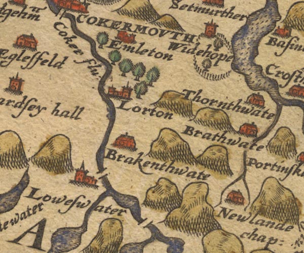 Sax9NY12.jpg "Loweswater" Lake. item:- private collection : 2 Image © see bottom of page |
|||||||||||||||||||||||||
|
|
||||||||||||||||||||||||||
| evidence:- | old map:- Mercator 1595 (edn?) placename:- |
|||||||||||||||||||||||||
| source data:- | Map, hand coloured engraving, Northumbria, Cumberlandia, et
Dunelmensis Episcopatus, ie Northumberland, Cumberland and
Durham etc, scale about 6.5 miles to 1 inch, by Gerard Mercator,
Duisberg, Germany, about 1595. MER8CumE.jpg "" outline, coast shaded, tinted blue; lake item:- JandMN : 169 Image © see bottom of page |
|||||||||||||||||||||||||
|
|
||||||||||||||||||||||||||
| evidence:- | old map:- Speed 1611 (Cmd) |
|||||||||||||||||||||||||
| source data:- | Map, hand coloured engraving, Cumberland and the Ancient Citie
Carlile Described, scale about 4 miles to 1 inch, by John Speed,
1610, published by J Sudbury and George Humble, Popes Head
Alley, London, 1611-12.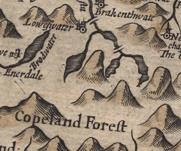 SP11NY11.jpg outline, shaded item:- private collection : 16 Image © see bottom of page |
|||||||||||||||||||||||||
|
|
||||||||||||||||||||||||||
| evidence:- | old map:- Drayton 1612/1622 |
|||||||||||||||||||||||||
| source data:- | Map, hand coloured engraving, Cumberlande and Westmorlande, by
Michael Drayton, probably engraved by William Hole, scale about
4 or 5 miles to 1 inch, published by John Mariott, John
Grismand, and Thomas Dewe, London, 1622.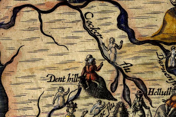 DRY513.jpg Lake. item:- JandMN : 168 Image © see bottom of page |
|||||||||||||||||||||||||
|
|
||||||||||||||||||||||||||
| evidence:- | old map:- Jansson 1646 |
|||||||||||||||||||||||||
| source data:- | Map, hand coloured engraving, Cumbria and Westmoria, ie
Cumberland and Westmorland, scale about 3.5 miles to 1 inch, by
John Jansson, Amsterdam, Netherlands, 1646.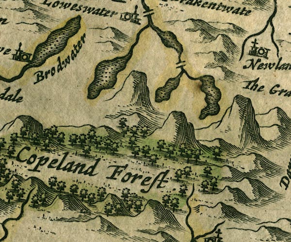 JAN3NY11.jpg Outline with shore shaded, dotted area. item:- JandMN : 88 Image © see bottom of page |
|||||||||||||||||||||||||
|
|
||||||||||||||||||||||||||
| evidence:- | possibly old map:- Badeslade 1742 placename:- |
|||||||||||||||||||||||||
| source data:- | Map, uncoloured engraving, A Map of Cumberland North from
London, scale about 11 miles to 1 inch, with descriptive text,
by Thomas Badeslade, London, engraved and published by William
Henry Toms, Union Court, Holborn, London, 1742. click to enlarge click to enlargeBD10.jpg "" outline with form lines item:- JandMN : 115 Image © see bottom of page |
|||||||||||||||||||||||||
|
|
||||||||||||||||||||||||||
| evidence:- | old map:- Gents Mag 1751 placename:- Cromac Lake |
|||||||||||||||||||||||||
| source data:- | Map, uncoloured engraving, Map of the Black Lead Mines in
Cumberland, and area, scale about 2 miles to 1 inch, by George
Smith, published in the Gentleman's Magazine, 1751. GM1306.jpg "CROMAC LAKE" outline with form lines; lake item:- JandMN : 114 Image © see bottom of page |
|||||||||||||||||||||||||
|
|
||||||||||||||||||||||||||
| evidence:- | old map:- Bowen and Kitchin 1760 |
|||||||||||||||||||||||||
| source data:- | Map, hand coloured engraving, A New Map of the Counties of
Cumberland and Westmoreland Divided into their Respective Wards,
scale about 4 miles to 1 inch, by Emanuel Bowen and Thomas
Kitchin et al, published by T Bowles, Robert Sayer, and John
Bowles, London, 1760. BO18NY11.jpg outline with form lines item:- Armitt Library : 2008.14.10 Image © see bottom of page |
|||||||||||||||||||||||||
|
|
||||||||||||||||||||||||||
| evidence:- | old map:- Donald 1774 (Cmd) placename:- Crummock Water |
|||||||||||||||||||||||||
| source data:- | Map, hand coloured engraving, 3x2 sheets, The County of Cumberland, scale about 1
inch to 1 mile, by Thomas Donald, engraved and published by Joseph Hodskinson, 29
Arundel Street, Strand, London, 1774.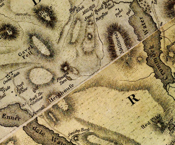 D4NY11NW.jpg 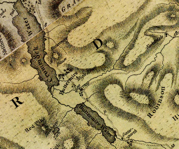 D4NY11NE.jpg "Crummock Water" lake item:- Carlisle Library : Map 2 Images © Carlisle Library |
|||||||||||||||||||||||||
|
|
||||||||||||||||||||||||||
| evidence:- | descriptive text:- West 1778 (11th edn 1821) placename:- Cromack Water item:- fish, Crummock Water; char; red trout; trout; pike; perch |
|||||||||||||||||||||||||
| source data:- | Guide book, A Guide to the Lakes, by Thomas West, published by
William Pennington, Kendal, Cumbria once Westmorland, and in
London, 1778 to 1821. goto source Page 138:- "..." "CROMACK-WATER [1]," "Soon opens after you leave the village [Buttermere], and pass through an oaken grove. A fine expanse of water sweeps away to the right under a rocky promontory, Randon-knot, or Buttermere-hawse. The road then serpentizes round the rock, and under a rugged, pyramidal, craggy mountain. From the crest of this rock, the whole extent of the lake is discovered. ..." "This lake is beautified with three small isles. One of rock lies just before you. The" "[1] This lake abounds with the finest char, and red trout, and contains also some pike and perch." goto sourcePage 139:- "whole eastern shore is diversified with bays, the banks with scattered trees, and a few inclosures, terminated by a hanging wood. ..." "..." "These lakes are of a much greater depth than Derwent-water, and this may be the only reason why they have char, and some others have not. The char, in the summer months, retire to the deeps, probably to avoid the heat. The water here is clear, but not so transparent as the lake of Derwent. The outlet is at the north-east corner, by the river Cocker, over which is a handsome stone bridge, of four arches. This lake is four miles in length, and in some places almost half a mile over." "..." goto sourcePage 190:- "A TABLE OF THE Height of Mountains and Lakes SEEN IN THIS TOUR, ... TAKEN FROM THE LEVEL OF THE SEA. ... by Mr. John Dalton." "Crummock-water ... 91 [yards]" |
|||||||||||||||||||||||||
|
|
||||||||||||||||||||||||||
| evidence:- | old map:- Crosthwaite 1783-94 (But/Cru/Low) placename:- Crummock Lake |
|||||||||||||||||||||||||
| source data:- | Map, uncoloured engraving, An Accurate Map of Buttermere,
Crummock and Loweswater Lakes, scale about 3 inches to 1 mile,
by Peter Crosthwaite, Keswick, Cumberland, 1794, version
published 1800.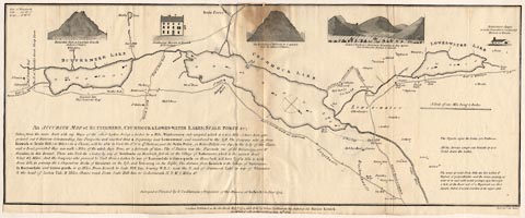 click to enlarge click to enlargeCT08.jpg "CRUMMOCK LAKE" "Lat. of Crummock Lake ... 54. 30. N. Long. ... 3. 26. W." item:- Armitt Library : 1959.191.2 Image © see bottom of page |
|||||||||||||||||||||||||
|
|
||||||||||||||||||||||||||
| evidence:- | old map:- West 1784 map placename:- Crommack Water |
|||||||||||||||||||||||||
| source data:- | Map, hand coloured engraving, A Map of the Lakes in Cumberland,
Westmorland and Lancashire, scale about 3.5 miles to 1 inch,
engraved by Paas, 53 Holborn, London, about 1784.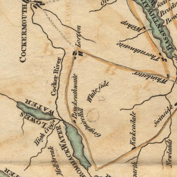 Ws02NY12.jpg 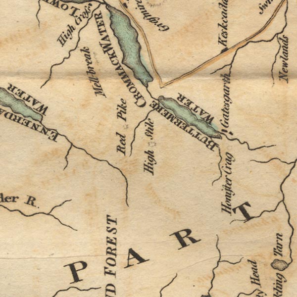 Ws02NY11.jpg "CROMMACK WATER" item:- Armitt Library : A1221.1 Image © see bottom of page |
|||||||||||||||||||||||||
|
|
||||||||||||||||||||||||||
| evidence:- | old map:- Aikin 1790 (Cmd) placename:- |
|||||||||||||||||||||||||
| source data:- | Map, uncoloured engraving, Cumberland, by John Aikin, London,
1790.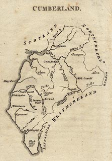 click to enlarge click to enlargeAIK3.jpg "" outline with form lines; lake item:- JandMN : 145 Image © see bottom of page |
|||||||||||||||||||||||||
|
|
||||||||||||||||||||||||||
| evidence:- | old painting:- Green 1790s-1820s item:- clouds |
|||||||||||||||||||||||||
| source data:- | Painting, watercolour, Crummock Water looking towards Rannerdale Knotts, Buttermere,
Cumberland, by William Green, Ambleside, Westmorland, 1800s-10s?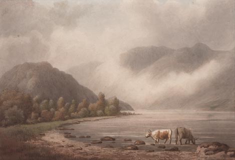 click to enlarge click to enlargePR1753.jpg item:- Dove Cottage : 2010.57.2 Image © see bottom of page |
|||||||||||||||||||||||||
|
|
||||||||||||||||||||||||||
| evidence:- | old map:- Housman 1800 map 3 placename:- Crummock Water |
|||||||||||||||||||||||||
| source data:- | Maps, hand coloured engraving, Lakes in Cumberland, 9 lakes on one sheet, engraved
by James Lowes, published by F Jollie, Carlisle, Cumberland, and C Law, Ave Maria
Lane, London, 1800.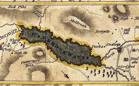 click to enlarge click to enlargeHM01Cru.jpg "CRUMMOCK WATER" item:- Dove Cottage : 2007.38.96 Image © see bottom of page |
|||||||||||||||||||||||||
|
|
||||||||||||||||||||||||||
| evidence:- | old map:- Cooke 1802 placename:- Crommock Water |
|||||||||||||||||||||||||
| source data:- | Map, The Lakes, Westmorland and Cumberland, scale about 8.5
miles to 1 inch, engravedby Neele and Son, published by
Sherwood, Jones and Co, Paternoster Road, London, 1824. click to enlarge click to enlargeGRA1Lk.jpg "Crommock Water" outline with form lines; lake or tarn item:- Hampshire Museums : FA2000.62.5 Image © see bottom of page |
|||||||||||||||||||||||||
|
|
||||||||||||||||||||||||||
| evidence:- | old map:- Cooke 1802 placename:- Crummok Water |
|||||||||||||||||||||||||
| source data:- | Map, Cumberland, scale about 15.5 miles to 1 inch, by George
Cooke, 1802, bound in Gray's New Book of Roads, 1824, published
by Sherwood, Jones and Co, Paternoster Road, London, 1824. click to enlarge click to enlargeGRA1Cd.jpg "Crummok Water" outline with form lines; lake or tarn item:- Hampshire Museums : FA2000.62.2 Image © see bottom of page |
|||||||||||||||||||||||||
|
|
||||||||||||||||||||||||||
| evidence:- | old print:- Green 1804 (plate 22) placename:- Crummock Water |
|||||||||||||||||||||||||
| source data:- | Print, uncoloured aquatint, Crummock Water and Buttermere, Buttermere, Cumberland,
by William Green, Ambleside, Westmorland, 1804.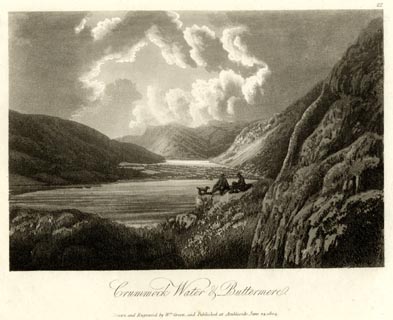 click to enlarge click to enlargeGN1622.jpg Plate 22 from a series. printed at bottom:- "Crummock Water &Buttermere. / Drawn and Engraved by Wm. Green, and Published at Ambleside, June 24, 1804." printed at top right:- "22" item:- Armitt Library : 2014.170 Image © see bottom of page |
|||||||||||||||||||||||||
|
|
||||||||||||||||||||||||||
| evidence:- | old map:- Laurie and Whittle 1806 placename:- Crummock Water |
|||||||||||||||||||||||||
| source data:- | Road map, Completion of the Roads to the Lakes, scale about 10
miles to 1 inch, by Nathaniel Coltman? 1806, published by Robert
H Laurie, 53 Fleet Street, London, 1834. click to enlarge click to enlargeLw18.jpg "Crummock Water" lake item:- private collection : 18.18 Image © see bottom of page |
|||||||||||||||||||||||||
|
|
||||||||||||||||||||||||||
| evidence:- | old map:- Cooper 1808 placename:- Crummock Water |
|||||||||||||||||||||||||
| source data:- | Map, uncoloured engraving, Cumberland, scale about 10.5 miles to
1 inch, drawn and engraved by Cooper, published by R Phillips,
Bridge Street, Blackfriars, London, 1808. click to enlarge click to enlargeCOP3.jpg "Crummock Water" outline, shaded; lake item:- JandMN : 86 Image © see bottom of page |
|||||||||||||||||||||||||
|
|
||||||||||||||||||||||||||
| evidence:- | old map:- Wallis 1810 (Cmd) |
|||||||||||||||||||||||||
| source data:- | Road map, hand coloured engraving, Cumberland, scale about 16
miles to 1 inch, by James Wallis, 77 Berwick Stree, Soho,
London, 1810. click to enlarge click to enlargeWL13.jpg "[ ] Water" outline, shaded; lake item:- Dove Cottage : 2009.81.10 Image © see bottom of page |
|||||||||||||||||||||||||
|
|
||||||||||||||||||||||||||
| evidence:- | old print:- Green 1814 (plate 39) placename:- Crummock Water |
|||||||||||||||||||||||||
| source data:- | Print, uncoloured soft ground etching, Crummock Water and Buttermere, Buttermere,
Cumberland, by William Green, Ambleside, Westmorland, 1814.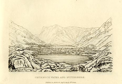 click to enlarge click to enlargeGN0939.jpg Plate 39 in Sixty Small Prints. printed at top right:- "39" printed at bottom:- "CRUMMOCK WATER AND BUTTERMERE. / Published at Ambleside Augst. 1, 1814, by Wm. Green." item:- Armitt Library : A6656.39 Image © see bottom of page |
|||||||||||||||||||||||||
|
|
||||||||||||||||||||||||||
| evidence:- | old print:- Green 1814 (plate 39) placename:- Crummock Water |
|||||||||||||||||||||||||
| source data:- | Print, tinted soft ground etching, Crummock Water and Buttermere, Buttermere, Cumberland,
by William Green, Ambleside, Westmorland, 1814.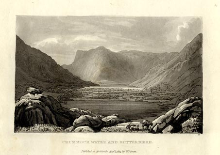 click to enlarge click to enlargeGN1039.jpg Plate 39 in Sixty Small Prints. printed at top right:- "39" printed at bottom:- "CRUMMOCK WATER AND BUTTERMERE. / Published at Ambleside Augst. 1, 1814, by Wm. Green." item:- Armitt Library : A6653.39 Image © see bottom of page |
|||||||||||||||||||||||||
|
|
||||||||||||||||||||||||||
| evidence:- | old print:- Green 1814 (plate 40) placename:- Crummock Water item:- cattle |
|||||||||||||||||||||||||
| source data:- | Print, uncoloured soft ground etching, Crummock Water, Buttermere, Cumberland, by
William Green, Ambleside, Westmorland, 1814.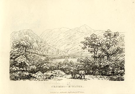 click to enlarge click to enlargeGN0940.jpg Plate 40 in Sixty Small Prints. printed at top right:- "40" printed at bottom:- "CRUMMOCK WATER. / Published at Ambleside Augst. 1, 1814, by Wm. Green." item:- Armitt Library : A6656.40 Image © see bottom of page |
|||||||||||||||||||||||||
|
|
||||||||||||||||||||||||||
| evidence:- | old print:- Green 1814 (plate 40) placename:- Crummock Water item:- cattle |
|||||||||||||||||||||||||
| source data:- | Print, tinted soft ground etching, Crummock Water, Buttermere, Cumberland, by William
Green, Ambleside, Westmorland, 1814.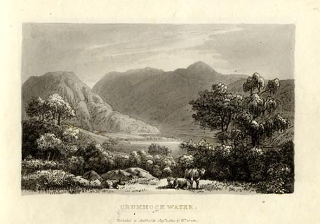 click to enlarge click to enlargeGN1040.jpg Plate 40 in Sixty Small Prints. printed at top right:- "40" printed at bottom:- "CRUMMOCK WATER. / Published at Ambleside Augst. 1, 1814, by Wm. Green." item:- Armitt Library : A6653.40 Image © see bottom of page |
|||||||||||||||||||||||||
|
|
||||||||||||||||||||||||||
| evidence:- | old print:- Green 1815 placename:- Crummock Water item:- clouds |
|||||||||||||||||||||||||
| source data:- | Print, coloured aquatint, Head of Crummock Water, Buttermere, Cumberland, by William
Green, Ambleside, Westmorland, 1815.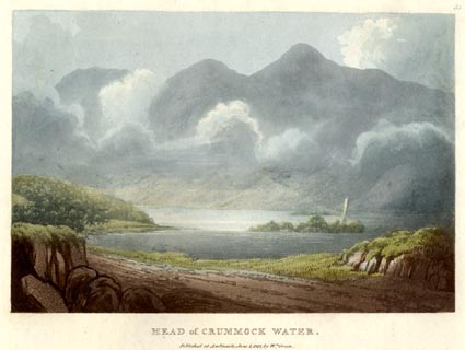 click to enlarge click to enlargeGN0549.jpg Plate 53 in Lake Scenery. printed at upper right:- "53" printed at bottom:- "HEAD of CRUMMOCK WATER. / Published at Ambleside, June 1, 1815, by Wm. Green." item:- Armitt Library : A6646.49 Image © see bottom of page |
|||||||||||||||||||||||||
|
|
||||||||||||||||||||||||||
| evidence:- | old print:- Green 1815 placename:- Crummock Water item:- sheep |
|||||||||||||||||||||||||
| source data:- | Print, coloured aquatint, Crummock Water and Buttermere, Buttermere, Cumberland, by
William Green, Ambleside, Westmorland, 1815.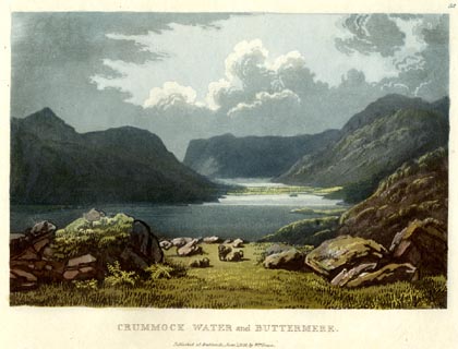 click to enlarge click to enlargeGN0548.jpg Plate 52 in Lake Scenery. printed at upper right:- "52" printed at bottom:- "CRUMMOCK WATER and BUTTERMERE. / Published at Ambleside, June 1, 1815, by Wm. Green." item:- Armitt Library : A6646.48 Image © see bottom of page |
|||||||||||||||||||||||||
|
|
||||||||||||||||||||||||||
| evidence:- | old print with text:- Farington 1816 placename:- Crommoch Water placename:- Crommock Water placename:- Crummock Water |
|||||||||||||||||||||||||
| source data:- | Print, uncoloured engraving and descriptive text, Buttermere and Crommoch Water, Buttermere,
Cumberland, drawn by Joseph Farington, engraved by F R Hay, published by T Cadell
and W Davies, Strand, London, 1815.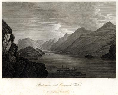 click to enlarge click to enlargeFA0417.jpg printed, bottom left, right, centre "Drawn by J. Farington R.A. / Engraved by F. R. Hay. / Buttermere and Crommoch Water. / London Published Septr. 15, 1815, by T. Cadell &W. Davies, Strand." Descriptive text:- "BUTTERMERE AND CRUMMOCK WATER" "..." "CROMMOCK, or CRUMMOCK WATER, which is seen in the fore-ground of the present view, is separated from Buttermere by a fine level and luxuriant vale. The view from the middle of Crummock Water is singularly grand: the mountains on each side, rise immediately from the water, and consequently appear higher as well as more precipitous than some others in its neighbourhood. Some of these are naked, others wooded to their bases; some are verdant, and some rocky and heathy. This Lake is nearly four miles long, and about half a mile broad." item:- Armitt Library : A6666.17 Image © see bottom of page |
|||||||||||||||||||||||||
|
|
||||||||||||||||||||||||||
| evidence:- | old map:- Otley 1818 placename:- Crummock |
|||||||||||||||||||||||||
| source data:- | Map, uncoloured engraving, The District of the Lakes,
Cumberland, Westmorland, and Lancashire, scale about 4 miles to
1 inch, by Jonathan Otley, 1818, engraved by J and G Menzies,
Edinburgh, Scotland, published by Jonathan Otley, Keswick,
Cumberland, et al, 1833.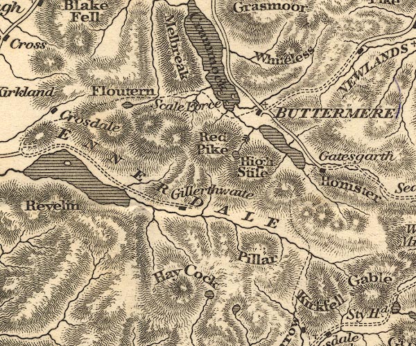 OT02NY11.jpg item:- JandMN : 48.1 Image © see bottom of page |
|||||||||||||||||||||||||
|
|
||||||||||||||||||||||||||
| evidence:- | old map:- Hall 1820 (Cmd) placename:- Crummock Water |
|||||||||||||||||||||||||
| source data:- | Map, hand coloured engraving, Cumberland, scale about 21 miles
to 1 inch, engraved by Sidney Hall, published by S Leigh, 18
Strand, London, 1820-31. click to enlarge click to enlargeHA14.jpg "Crummock [Wr.]" outline, shaded; lake item:- JandMN : 91 Image © see bottom of page |
|||||||||||||||||||||||||
|
|
||||||||||||||||||||||||||
| evidence:- | old print:- Fielding and Walton 1821 (plate 33) placename:- Crumack Water |
|||||||||||||||||||||||||
| source data:- | Print, coloured aquatint, Cromack Water, Buttermere, Cumberland, drawn by Theodore
H A Fielding, published by R Ackermann, 101 Strand, London, 1821.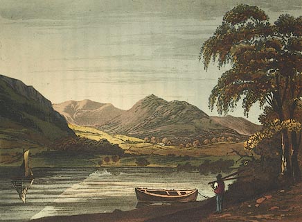 click to enlarge click to enlargeFW0133.jpg Tipped in opposite p.219 in A Picturesque Tour of the English Lakes. item:- Dove Cottage : 1993.R566.33 Image © see bottom of page |
|||||||||||||||||||||||||
|
|
||||||||||||||||||||||||||
| evidence:- | outline view:- Otley 1823 (8th edn 1849) placename:- Crummock Water |
|||||||||||||||||||||||||
| source data:- | Engraving, outline view of mountains, Crummock and Buttermere from the Road near Loweswater
Church, drawn by T Binns, engraved by O Jewitt, opposite p.18 of A Descriptive Guide
of the English Lakes, by Jonathan Otley, 8th edition, 1849.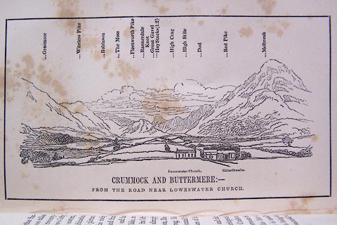 click to enlarge click to enlargeO80E10.jpg item:- Armitt Library : A1180.11 Image © see bottom of page |
|||||||||||||||||||||||||
|
|
||||||||||||||||||||||||||
| evidence:- | descriptive text:- Otley 1823 (5th edn 1834) placename:- Crummock Lake item:- depth, Crummock Water; fishing; trout; char; geology |
|||||||||||||||||||||||||
| source data:- | Guide book, A Concise Description of the English Lakes, the
mountains in their vicinity, and the roads by which they may be
visited, with remarks on the mineralogy and geology of the
district, by Jonathan Otley, published by the author, Keswick,
Cumberland now Cumbria, by J Richardson, London, and by Arthur
Foster, Kirkby Lonsdale, Cumbria, 1823; published 1823-49,
latterly as the Descriptive Guide to the English Lakes. goto source Page 23:- "CRUMMOCK LAKE" "Is nearly three miles in length, three quarters of a mile in breadth, and twenty-two fathoms deep. It is situated between the two lofty mountains, Grasmire or Grasmoor, on the eastern, and Melbreak on the western side; and in combination with the more distant hills, it affords some excellent views. It has three or four small islands, but they are placed too near the shore to add much to its beauty. The best general views of the lake, are from the rocky point on the eastern side, called the Hause; and from the road between Scale Hill and Loweswater: and the views of the mountains, from the bosom of the lake, are excellent." "Both these lakes are well stocked with trout and char, the latter of which are smaller in size, but perhaps not inferior in quality, to those of Windermere or Coniston." "..." goto sourcePage 152:- "The greatest bulk of these mountain rocks have been commonly included under the general appellation of slate; although many of them shew no disposition to the slaty cleavage. They may be classed in three principal divisions." "Of these divisions, the FIRST or lowest in the series, ... extends across Crummock Lake, ..." |
|||||||||||||||||||||||||
|
|
||||||||||||||||||||||||||
| evidence:- | old map:- Perrot 1823 placename:- Cramnock |
|||||||||||||||||||||||||
| source data:- | Map, hand coloured engraving, Cumberland and Westmoreland ie
Westmorland, scale about 38 miles to 1 inch, by Aristide Michel
Perrot, engraved by Migneret, 1823, published by Etienne Ledoux,
9 Rue Guenegaud, Paris, France, 1824-48. click to enlarge click to enlargePER2.jpg "Cramnock" outline with form lines; lake but also marked with a circle item:- Dove Cottage : 2007.38.45 Image © see bottom of page |
|||||||||||||||||||||||||
|
|
||||||||||||||||||||||||||
| evidence:- | descriptive text:- Ford 1839 (3rd edn 1843) placename:- Crummock Lake placename:- Crummock Water item:- depth, Crummock Water |
|||||||||||||||||||||||||
| source data:- | Guide book, A Description of Scenery in the Lake District, by
Rev William Ford, published by Charles Thurnam, Carlisle, by W
Edwards, 12 Ave Maria Lane, Charles Tilt, Fleet Street, William
Smith, 113 Fleet Street, London, by Currie and Bowman,
Newcastle, by Bancks and Co, Manchester, by Oliver and Boyd,
Edinburgh, and by Sinclair, Dumfries, 1839. goto source Page 90:- "..." "CRUMMOCK LAKE" "Is three miles in length, three quarters of a mile in breadth, and twenty-two fathoms in depth. This lake abounds in trout and char, and receives its main supply of water from Buttermere, from which it is parted by low flat meadows, that are little more than half a mile in breadth. Melbreak rises abruptly on the west side; Rannerdale Knott forms a bold promontory projecting from Buttermere Hawse, which advances up to Grasmire and Whiteside, that close it on the east. Its waters flow out by the Cocker under a pretty bridge. It has three small islands, one a rock, the other covered" goto sourcePage 91:- "with wood, but being too near the shore, they add nothing to its beauty." "The best general views are from Buttermere Hawse on the east, and from the road between Scale Hill and Lowes Water. But the mountains of this vale, and those at the head of Newlands, are nowhere so impressive as from the bosom of this lake, some of the loftiest rising from its very margin. The middle part of the lake presents the utmost grandeur." goto sourcePage 169:- "..." "CRUMMOCK WATER is separated from Buttermere by a small tract of flat meadow. The head of the lake is beautiful, the middle part grand, and the foot richly adorned with wood. ..." goto sourcePage 177:- "A TABLE" "OF THE LENGTH, BREADTH, &c. OF THE LAKES," "COLLECTED FROM DIFFERENT AUTHORITIES."
|
|||||||||||||||||||||||||
|
|
||||||||||||||||||||||||||
| evidence:- | old map:- Ford 1839 map placename:- Crummock Water |
|||||||||||||||||||||||||
| source data:- | Map, uncoloured engraving, Map of the Lake District of
Cumberland, Westmoreland and Lancashire, scale about 3.5 miles
to 1 inch, published by Charles Thurnam, Carlisle, and by R
Groombridge, 5 Paternoster Row, London, 3rd edn 1843. FD02NY11.jpg "Crummock Water" Outline with form lines. item:- JandMN : 100.1 Image © see bottom of page |
|||||||||||||||||||||||||
|
|
||||||||||||||||||||||||||
| evidence:- | old drawing:- Aspland 1840s-60s |
|||||||||||||||||||||||||
| source data:- | Drawing, pencil, Crummock Water and Buttermere lake, Buttermere, Cumberland, by Theophilus
Lindsey Aspland, 1849.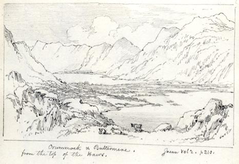 click to enlarge click to enlargeAS0184.jpg "Crummock & Buttermere. / Green Vol 2. p 210. / from the top of the Haws." item:- Armitt Library : 1958.487.83 Image © see bottom of page |
|||||||||||||||||||||||||
|
|
||||||||||||||||||||||||||
| evidence:- | old text:- Miller 1847 placename:- Crummock Lake item:- whirlwind; water spout |
|||||||||||||||||||||||||
| source data:- | Book, Report on the Fall of Rain in the Lake Districts of
Cumberland and Westmoreland in 1846, by John Fletcher Miller,
printed by G Irwin, Lowther Street, Whitehaven, Cumberland, 1847. goto source Page 6:- "..." "The following account of a whirlblast, observed on Crummock Lake in February last, may perhaps be deemed worthy of insertion, by those who take an interest in observing, and tracing the causes of atmospheric phenomena. Owing, probably, to its peculiar, twisted form, whirlwinds are of very common occurrence on this Lake:-" "WHIRLWINDS ON CRUMMOCK LAKE. - On the 4th inst. (February, 1846,) as a friend of mine was proceeding along the margin of Crummock Lake, his attention was attracted by the wind suddenly taking up an immense body of water, by a sweeping rotary motion, until it formed a column 180 feet in height, and apparently five or six yards in diameter at the base; though it must, in reality, have been much more, as the observer was half a mile or more distant from the spot where the phenomenon occurred, which was about 150 yards above the Boat House, and near the centre of the Lake. Its progressive movement, if any, was exceedingly slow, and, after continuing entire for fifteen or twenty seconds, a tremendous gust, in a moment dispersed the entire body of water, sweeping it along towards the entrance of the Cocker, in the form of dense sheet of spray, which, from its whiteness, greatly resembled a rapidly falling snow shower. The sides of the column were dark, as though formed of a solid body of water, but the mass was faintly transparent, and, evidently, hollow in the middle, yet without any ascending central current. The phenomenon was, doubtless, formes by a sudden rotatory motion communicated to the water by a whirlblast, produced by the meeting of strong, opposite, and contrary currents of wind. The pillar" goto sourcePage 7:- "was nearly of the same diameter throughout its height or extent, but was tending slightly towards a point when it was swept away. The water was much more agitated round the base of the pillar, than in other parts of the Lake. The day was fine, but very squally, and at the time of the occurrence, the sky was quite clear overhead; had there been a Rain cloud above, the apex of the column would probably have coalesced with the crown of the nimbus, and a waterspout would have been the result. A few minutes after the disappearance of the column, and when the observer had arrived at the edge of the clump of scraggy oaks, near the foot of Melbreck, another whirlblast occurred. The leaves, and other light substances, were rolled backwards and forwards on the ground, and then, almost instantaneously, were taken up in a conical form, by a spiral or screw-like motion, as high as the top of the mountain (about 2400 feet), and again slowly descended, like flakes of snow." "These phenomena are of frequent occurrence in vallies surrounded by lofty mountains, like those of Cumberland and Westmorland. Pikes of hay are often taken up by them, and scattered to every point of the compass." |
|||||||||||||||||||||||||
|
|
||||||||||||||||||||||||||
| evidence:- | old map:- Wyld 1847 placename:- Crummock Water |
|||||||||||||||||||||||||
| source data:- | Map, uncoloured engraving, Loweswater, Crummock, Buttermere,
Ennerdale and Wastwaters, Cumberland, scale about 3.5 miles to 1
inch, by James Wyld, published by John Johnstone, Paternoster
Row, London, et al, 1847. click to enlarge click to enlargeWLD3M3.jpg printed at bottom:- "LOWESWATER, CRUMMOCK, BUTTERMERE, / ENNERDALE AND WASTWATERS." item:- Armitt Library : A1201.66 Image © see bottom of page |
|||||||||||||||||||||||||
|
|
||||||||||||||||||||||||||
| evidence:- | old map:- Garnett 1850s-60s H placename:- Crummock Water |
|||||||||||||||||||||||||
| source data:- | Map of the English Lakes, in Cumberland, Westmorland and
Lancashire, scale about 3.5 miles to 1 inch, published by John
Garnett, Windermere, Westmorland, 1850s-60s.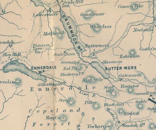 GAR2NY11.jpg "CRUMMOCK WR." outline with shore form lines, lake or tarn item:- JandMN : 82.1 Image © see bottom of page |
|||||||||||||||||||||||||
|
|
||||||||||||||||||||||||||
| evidence:- | old print:- Pyne 1853 placename:- Crummock Water |
|||||||||||||||||||||||||
| source data:- | Print, tinted lithograph, Crummock Water, Cumberland, by James Baker Pyne, engraved
by W Gauci, published by Thomas Agnew and Sons, Manchester, Lancashire, 1853.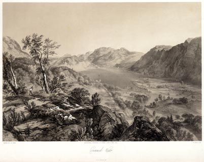 click to enlarge click to enlargePYN220.jpg "PAINTED BY J. B. PYNE. / W. GAUCI LITH. / MANCHESTER, PUBLISHED BY THOMAS AGNEW & SONS, 1853. / Crummock Water / M & N HANHART IMPT." item:- Armitt Library : A6678.21 Image © see bottom of page |
|||||||||||||||||||||||||
|
|
||||||||||||||||||||||||||
| evidence:- | old print:- Pyne 1853 placename:- Crummock Water |
|||||||||||||||||||||||||
| source data:- | Print, coloured lithograph, Crummock Water, Cumberland, by James Baker Pyne, engraved
by W Gauci, published by Thomas Agnew and Sons, Manchester, Lancashire, 1853.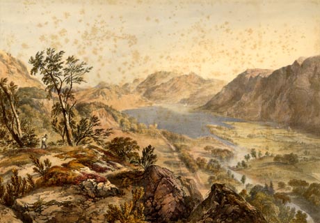 click to enlarge click to enlargePYN420.jpg item:- Armitt Library : A6677.21 Image © see bottom of page |
|||||||||||||||||||||||||
|
|
||||||||||||||||||||||||||
| evidence:- | old text:- Martineau 1855 item:- fish, Crummock Water; char |
|||||||||||||||||||||||||
| source data:- | Guide book, A Complete Guide to the English Lakes, by Harriet
Martineau, published by John Garnett, Windermere, Westmorland,
and by Whittaker and Co, London, 1855; published 1855-76. goto source Page 86:- "... Crummock Water yields char, as well as every other lake fish, in abundance. ..." |
|||||||||||||||||||||||||
|
|
||||||||||||||||||||||||||
| evidence:- | old text:- Martineau 1855 placename:- Crummock item:- depth, Crummock Water |
|||||||||||||||||||||||||
| source data:- | Guide book, A Complete Guide to the English Lakes, by Harriet
Martineau, published by John Garnett, Windermere, Westmorland,
and by Whittaker and Co, London, 1855; published 1855-76. goto source Page 180:- "A TABLE OF THE LENGTH, BREADTH, AND DEPTH OF THE LAKES." "No. : Names of Lakes. : Counties : Length in Miles. : Extreme breadth in Miles : Extreme depth in Feet : Height above the Sea" "12 : Crummock : Cumberland : 3 : ¾: 132 : 240" |
|||||||||||||||||||||||||
|
|
||||||||||||||||||||||||||
| evidence:- | old map:- Jenkinson 1875 map1 placename:- |
|||||||||||||||||||||||||
| source data:- | Map, Buttermere Section, Cumberland, ?colour lithograph, scale
about 1 mile to 1 inch, by Stanford's Geographical
Establishment, published by Edward Stanford, 55 Charing Cross,
London, 1875.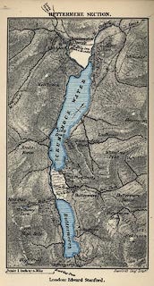 click to enlarge click to enlargeJK08.jpg item:- JandMN : 28.10 Image © see bottom of page |
|||||||||||||||||||||||||
|
|
||||||||||||||||||||||||||
| evidence:- | old photograph:- Bell 1880s-1940s |
|||||||||||||||||||||||||
| source data:- | Photograph, black and white, Crummock Water, Buttermere, Cumberland, by Herbert Bell,
Ambleside, Westmorland, 1890s. click to enlarge click to enlargeHB0462.jpg item:- Armitt Library : ALPS121 Image © see bottom of page |
|||||||||||||||||||||||||
|
|
||||||||||||||||||||||||||
| evidence:- | old photograph:- Bell 1880s-1940s |
|||||||||||||||||||||||||
| source data:- | Photograph, black and white, Crummock Water and Rannerdale, Buttermere, Cumberland,
by Herbert Bell, Ambleside, Westmorland, 1890s.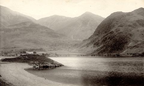 click to enlarge click to enlargeHB0466.jpg item:- Armitt Library : ALPS125 Image © see bottom of page |
|||||||||||||||||||||||||
|
|
||||||||||||||||||||||||||
| evidence:- | old photograph:- Bell 1880s-1940s |
|||||||||||||||||||||||||
| source data:- | Photograph, sepia, Crummock Water from Lowfell, Buttermere, Cumberland, by Herbert
Bell, Ambleside, Westmorland, 1890s.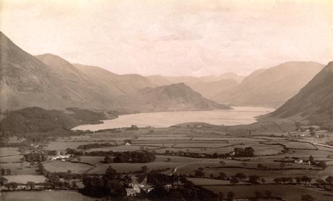 click to enlarge click to enlargeHB0467.jpg item:- Armitt Library : ALPS126 Image © see bottom of page |
|||||||||||||||||||||||||
|
|
||||||||||||||||||||||||||
| evidence:- | old photograph:- Bell 1880s-1940s item:- weir |
|||||||||||||||||||||||||
| source data:- | Photograph, sepia, foot of Crummock Water, Buttermere, Cumberland, by Herbert Bell,
Ambleside, Westmorland, 1890s.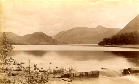 click to enlarge click to enlargeHB0468.jpg item:- Armitt Library : ALPS127 Image © see bottom of page |
|||||||||||||||||||||||||
|
|
||||||||||||||||||||||||||
| evidence:- | old photograph:- Bell 1880s-1940s |
|||||||||||||||||||||||||
| source data:- | Photograph, sepia, head of Crummock Water, Buttermere, Cumberland, by Herbert Bell,
Ambleside, Westmorland, 1890s.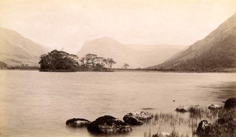 click to enlarge click to enlargeHB0470.jpg item:- Armitt Library : ALPS129 Image © see bottom of page |
|||||||||||||||||||||||||
|
|
||||||||||||||||||||||||||
| evidence:- | old print:- Philip/Wilson 1890s |
|||||||||||||||||||||||||
| source data:- | Print, engraving, Crummock Water, published by George Philip and
Son, London, Philip, Son and Nephew, Liverpool, Lancashire, and
Titus Wilson, Kendal, Westmorland, about 1895.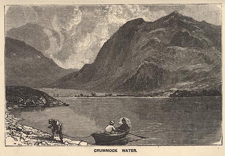 click to enlarge click to enlargePW1E30.jpg "CRUMMOCK WATER." item:- JandMN : 58.31 Image © see bottom of page |
|||||||||||||||||||||||||
|
|
||||||||||||||||||||||||||
| evidence:- | old map:- Mill and Heawood 1895 placename:- Crummock Water |
|||||||||||||||||||||||||
| source data:- | Map, Buttermere, Crummock Water, and Ennerdale Water, scale 2
inches to 1 mile, with soundings by Hugh Robert Mill and Edward
Heawood, by Bartholomew, Edinburgh, Scotland, published by
George Philip and Son, 32 Fleet Street, London, etc, 1895. click to enlarge click to enlargeMIL5.jpg - with soundings and sections item:- Kendal Library : 7.4 Image © see bottom of page |
|||||||||||||||||||||||||
|
|
||||||||||||||||||||||||||
| evidence:- | old map:- Pearson 1900s map (But/Cru/Low) placename:- Crummock Water |
|||||||||||||||||||||||||
| source data:- | Map, lithograph, Buttermere, Crummock Water and Loweswater,
Cumberland, published by C Arthur Pearson, Henrietta Street,
London, 1900s.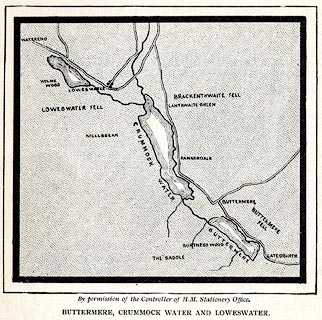 click to enlarge click to enlargePSN1M1.jpg On p.xxv of Pearson's Gossipy Guide to the English Lakes and Neighbouring Districts. printed at bottom:- "By permission of the Controller of H.M. Stationery Office. / BUTTERMERE, CRUMMOCK WATER AND LOWESWATER." item:- Armitt Library : A1188.3 Image © see bottom of page |
|||||||||||||||||||||||||
|
|
||||||||||||||||||||||||||
| evidence:- | old print:- Bradley 1901 placename:- Crummock Lake |
|||||||||||||||||||||||||
| source data:- | Print, uncoloured lithograph, Crummock Lake, Buttermere, Cumberland, by Joseph Pennell,
published by Macmillan and Co, London, 1901.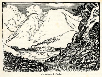 click to enlarge click to enlargeBRL125.jpg On page 121 of Highways and Byways in the Lake District, by A G Bradley. printed at bottom:- "Crummock Lake." item:- JandMN : 464.25 Image © see bottom of page |
|||||||||||||||||||||||||
|
|
||||||||||||||||||||||||||
| evidence:- | old print:- Bradley 1901 placename:- Crummock Lake |
|||||||||||||||||||||||||
| source data:- | Print, uncoloured lithograph, Crummock Lake, Buttermere, Cumberland, by Joseph Pennell,
published by Macmillan and Co, London, 1901. click to enlarge click to enlargeBRL128.jpg On page 133 of Highways and Byways in the Lake District, by A G Bradley. printed at lower left:- "AG" printed at bottom:- "Crummock Lake." item:- JandMN : 464.28 Image © see bottom of page |
|||||||||||||||||||||||||
|
|
||||||||||||||||||||||||||
| evidence:- | old print:- Bradley 1901 placename:- Crummock |
|||||||||||||||||||||||||
| source data:- | Print, uncoloured lithograph, Crummock in Stormy Weather, Buttermere, Cumberland,
by Joseph Pennell, published by Macmillan and Co, London, 1901.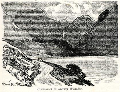 click to enlarge click to enlargeBRL133.jpg On page 155 of Highways and Byways in the Lake District, by A G Bradley. printed at lower left:- "Joseph Pennell" printed at bottom:- "Crummock in Stormy Weather." item:- JandMN : 464.33 Image © see bottom of page |
|||||||||||||||||||||||||
|
|
||||||||||||||||||||||||||
| evidence:- | old print:- Brabant 1902 placename:- Crummock Water |
|||||||||||||||||||||||||
| source data:- | Print, uncoloured lithograph, Crummock Water and Whiteless Pike, Buttermere, Cumberland,
by Edmund H New, published by Methuen and Co, 36 Essex Street, Strand, London, 1902.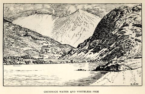 click to enlarge click to enlargeBBT112.jpg Tipped in opposite p.300 of The English Lakes, by F G Brabant. printed at bottom right:- "E. H. N." printed at bottom:- "CRUMMOCK WATER AND WHITELESS PIKE" item:- JandMN : 502.21 Image © see bottom of page |
|||||||||||||||||||||||||
|
|
||||||||||||||||||||||||||
| evidence:- | old print:- Heaton Cooper 1905 (edn 1908) placename:- Crummock Water |
|||||||||||||||||||||||||
| source data:- | Print, colour halftone, Crummock Water, from Scale Hill, Buttermere, Cumberland, from
a watercolour painting by Alfred Heaton Cooper, published by Adam and Charles Black,
London, 2nd edn 1908.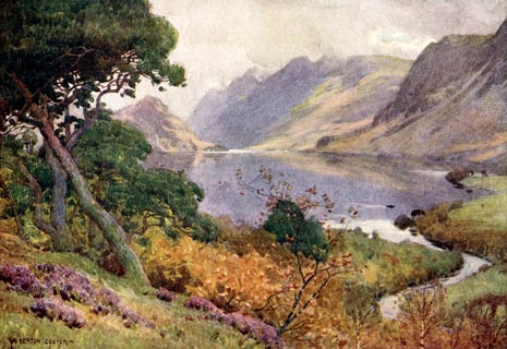 click to enlarge click to enlargeHC0141.jpg Opposite p.116 of The English Lakes, painted by Alfred Heaton Cooper, described by William T Palmer. printed at tissue opposite the print:- "CRUMMOCK WATER, FROM SCALE HILL" printed at signed lower left:- "A HEATON COOPER" item:- JandMN : 468.41 Image © see bottom of page |
|||||||||||||||||||||||||
|
|
||||||||||||||||||||||||||
| evidence:- | old print:- Heaton Cooper 1905 (edn 1908) placename:- Crummock Water |
|||||||||||||||||||||||||
| source data:- | Print, colour halftone, Crummock Water and Buttermere, Buttermere, Cumberland, from
a watercolour painting by Alfred Heaton Cooper, published by Adam and Charles Black,
London, 2nd edn 1908.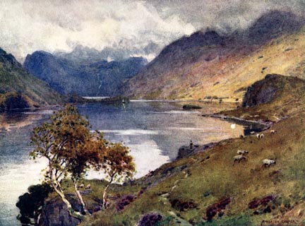 click to enlarge click to enlargeHC0142.jpg Opposite p.120 of The English Lakes, painted by Alfred Heaton Cooper, described by William T Palmer. printed at tissue opposite the print:- "CRUMMOCK WATER AND BUTTERMERE" printed at signed lower right:- "A HEATON COOPER" item:- JandMN : 468.42 Image © see bottom of page |
|||||||||||||||||||||||||
|
|
||||||||||||||||||||||||||
| evidence:- | old map:- Postlethwaite 1877 (3rd edn 1913) placename:- Crummock Lake |
|||||||||||||||||||||||||
| source data:- | Map, uncoloured engraving, Map of the Lake District Mining Field, Westmorland, Cumberland,
Lancashire, scale about 5 miles to 1 inch, by John Postlethwaite, published by W H
Moss and Sons, 13 Lowther Street, Whitehaven, Cumberland, 1877 edn 1913. PST2NY11.jpg "CRUMMOCK LAKE" lake item:- JandMN : 162.2 Image © see bottom of page |
|||||||||||||||||||||||||
|
|
||||||||||||||||||||||||||
| evidence:- | old photograph:- Photochrom 1930s placename:- Crummockwater |
|||||||||||||||||||||||||
| source data:- | Photograph, black and white halftone print, Crummockwater, Buttermere, Cumberland,
published by Photochrom Co, Tunbridge Wells, Kent, 1930s? click to enlarge click to enlargePCH119.jpg printed, "Buttermere and Crummockwater. / ..." item:- JandMN : 1015.19 Image © see bottom of page |
|||||||||||||||||||||||||
|
|
||||||||||||||||||||||||||
| evidence:- | old print:- Barber and Atkinson 1927 placename:- Crummock |
|||||||||||||||||||||||||
| source data:- | Print, halftone photograph, Buttermere and Crummock with Fleetwith Pike in distance,
Cumberland, by Pettit, Keswick, published by James Atkinson, Caxton Printing Works,
Ulverston, Lancashire, 1928.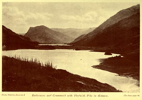 click to enlarge click to enlargeAK0412.jpg Tipped in opposite p.64 of Lakeland Passes, by John B Barber and George Atkinson, 1927, 3rd edn 1928. printed at bottom:- "Photo Pettitts, Keswick.) Buttermere and Crummock with Fleetwith Pike iin distance. (To face plage 64." item:- JandMN : 350.13 Image © see bottom of page |
|||||||||||||||||||||||||
|
|
||||||||||||||||||||||||||
| evidence:- | old print:- Sylvan 1847 placename:- Crummock Water item:- cattle |
|||||||||||||||||||||||||
| source data:- | Print, engraving, Crummock Water, by the hause, Buttermere, Cumberland, published
by John Johnstone, Paternoster Row, London, et al, 1847.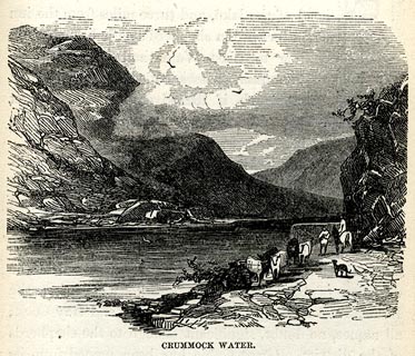 click to enlarge click to enlargeSYL154.jpg On p.209 of Sylvan's Pictorial Guide to the English Lakes. printed at bottom:- "CRUMMOCK WATER." item:- Armitt Library : A1201.54 Image © see bottom of page |
|||||||||||||||||||||||||
|
|
||||||||||||||||||||||||||
| evidence:- | outline view:- Tattersall 1836 (version 1869) placename:- Crummock Lake |
|||||||||||||||||||||||||
| source data:- | Print, hand coloured, Crummock Lake, from the East, Buttermere, Cumberland, drawn
by George Tattersall, 1836, engraved by W F Topham, published by T J Allman, 463 Oxford
Street, London, 1869.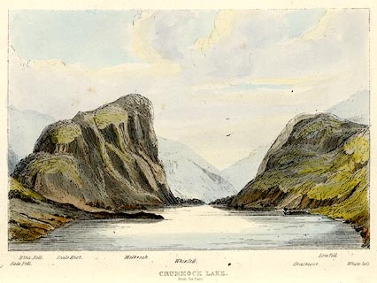 click to enlarge click to enlargeTAT211.jpg Included in The Lakes of England, by W F Topham. printed at bottom:- "CRUMMOCK LAKE, / from the East." printed at bottom:- "Gale Fell. / Blea Fell. / Scale Knot. / Melbreak. / Whinfell. / Grasmoor. / Low Fell. / Whiteless." item:- Armitt Library : A1067.11 Image © see bottom of page |
|||||||||||||||||||||||||
|
|
||||||||||||||||||||||||||
| evidence:- | outline view:- Tattersall 1836 placename:- Crummock Lake |
|||||||||||||||||||||||||
| source data:- | Print, engraving, Crummock Lake, from the East, Buttermere, Cumberland, drawn by George
Tattersall, engraved by W F Topham, published by Sherwood and Co, Paternoster Row,
London, about 1836.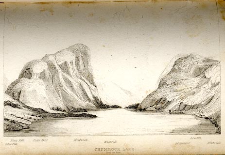 click to enlarge click to enlargeTAT128.jpg The print is captioned with mountain names and acts as an outline view. Tipped in opposite p.74 of The Lakes of England, by George Tattersall. printed at bottom:- "CRUMMOCK LAKE. / from the East." printed at bottom left to right:- "Gale Fell. / Blea Fell. / Scale Knot. / Melbreak. / Whinfell. / Grasmoor. / Lowfell. / Whiteless." item:- Armitt Library : A1204.29 Image © see bottom of page |
|||||||||||||||||||||||||
|
|
||||||||||||||||||||||||||
| evidence:- | old print:- Green 1819 placename:- Crummock Water |
|||||||||||||||||||||||||
| source data:- | Print, aquatint, Crummock Water, Buttermere, Cumberland, by William Green, 1819, published
by R Lough and Co, Chronicle Office, Finkle Street, Kendal, and others, 1820.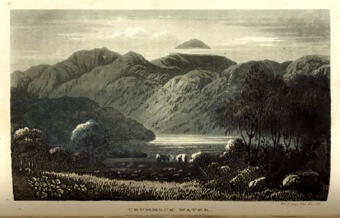 click to enlarge click to enlargeGN0124.jpg Tipped in opposite vol.2 p.209 of The Tourist's New Guide, by William Green. printed at bottom right, centre:- "Vol.2, page 209, line 23. / CRUMMOCK WATER. / Published at Ambleside, Augt. 1. 1819, by Wm. Green." item:- Armitt Library : A1141.25 Image © see bottom of page |
|||||||||||||||||||||||||
|
|
||||||||||||||||||||||||||
| evidence:- | old print:- Green 1819 placename:- Crummock Water |
|||||||||||||||||||||||||
| source data:- | Print, aquatint, Crummock and Buttermere Waters, Buttermere, Cumberland, by William
Green, 1819, published by R Lough and Co, Chronicle Office, Finkle Street, Kendal,
and others, 1820.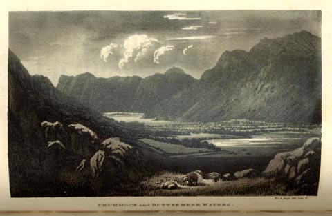 click to enlarge click to enlargeGN0125.jpg Tipped in opposite vol.2 p.211 of The Tourist's New Guide, by William Green. printed at bottom right, centre:- "Vol.2, page 211, line 2. / CRUMMOCK and BUTTERMERE WATERS. / Published at Ambleside, Augt. 1. 1819, by Wm. Green." item:- Armitt Library : A1141.26 Image © see bottom of page |
|||||||||||||||||||||||||
|
|
||||||||||||||||||||||||||
| evidence:- | old print:- placename:- Crummock Water |
|||||||||||||||||||||||||
| source data:- | Print, uncoloured engraving, Crummock Water, Buttermere, and Honister Crag, Cumberland,
published 1900s?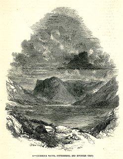 click to enlarge click to enlargePR0271.jpg printed at bottom:- "5.- CRUMMOCK WATER, BUTTERMERE, AND HONISTER CRAG." item:- Dove Cottage : 2008.107.271 Image © see bottom of page |
|||||||||||||||||||||||||
|
|
||||||||||||||||||||||||||
| evidence:- | old print:- Prior 1865 placename:- Crummock Water |
|||||||||||||||||||||||||
| source data:- | Print, uncoloured engraving, Crummock Water from Lanthwaite Wood, Buttermere, Cumberland,
published by John Garnett, Windermere, Westmorland, and by Simpkin, Marshall and Co,
London, 1865.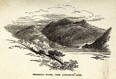 click to enlarge click to enlargePI0109.jpg Included on page 75 of the guide book, Ascents and Passes in the Lake District of England, by Herman Prior. printed at bottom:- "CRUMMOCK-WATER, FROM LANTHWAITE WOOD." item:- JandMN : 235.11 Image © see bottom of page |
|||||||||||||||||||||||||
|
|
||||||||||||||||||||||||||
| evidence:- | old print:- placename:- Crummock Water |
|||||||||||||||||||||||||
| source data:- | Print, uncoloured engraving, Crummock Water, Buttermere, and Honister Crag, Cumberland,
by E Dalziel, published late 19th century?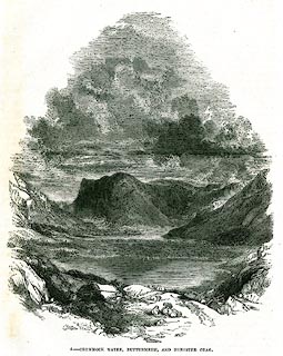 click to enlarge click to enlargePR0338.jpg On a page of The Land We Live In. printed at lower left:- "E. DALZIEL." printed at bottom:- "5.- CRUMMOCK WATER, BUTTERMERE, AND HONISTER CRAG." item:- Dove Cottage : 2008.107.338 Image © see bottom of page |
|||||||||||||||||||||||||
|
|
||||||||||||||||||||||||||
| evidence:- | old print:- Nelson 1859 placename:- Crummock Water item:- picnic |
|||||||||||||||||||||||||
| source data:- | Print, engraving, Crummock Water, drawn by Keeley Halswelle, Edinburgh, published
by T Nelson and Sons, Paternoster Row, London, and Edinburgh and New York, United
States, 1859.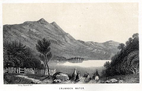 click to enlarge click to enlargeNS0103.jpg A gentleman and a group of ladies are having a picnic on the shore. Tipped in oppposite p.86 of a guide book, The English Lakes. printed at bottom, left, centre:- "Keley Haswell delt. / CRUMMOCK WATER." item:- JandMN : 336.4 Image © see bottom of page |
|||||||||||||||||||||||||
|
|
||||||||||||||||||||||||||
| evidence:- | old print:- Pyne 1853 placename:- Crummock Water |
|||||||||||||||||||||||||
| source data:- | Crummock Water drawn by James Barker Pyne, 1848-1853, lithographed by T Picken, 1859.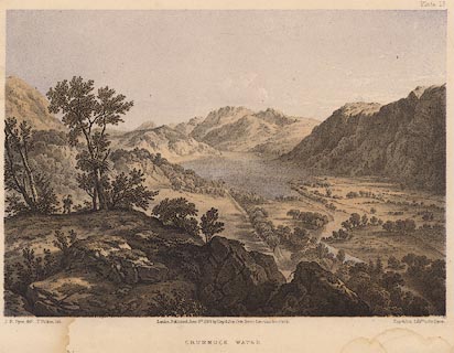 click to enlarge click to enlargePY18.jpg "Crummock Water" item:- JandMN : 97.17 Image © see bottom of page |
|||||||||||||||||||||||||
|
|
||||||||||||||||||||||||||
| evidence:- | old print:- Adams 1852 placename:- Crummock Water |
|||||||||||||||||||||||||
| source data:- | Print, engraving, Crummock Water and Buttermere Lake, by F G Delamotte, published
by W J Adams, 59 Fleet Street, London, 1852.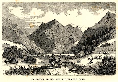 click to enlarge click to enlargeAD03E6.jpg Tipped in opp.p.67 in Adams's Pocket Descriptive Guide to the Lake District. printed at lower centre:- "F DELAMOTTE" printed at bottom:- "CRUMMOCK WATER AND BUTTERMERE LAKE." item:- Armitt Library : A1117.7 Image © see bottom of page |
|||||||||||||||||||||||||
|
|
||||||||||||||||||||||||||
| evidence:- | old print:- Harwood 1842 |
|||||||||||||||||||||||||
| source data:- | Print, uncoloured engraving, Crummock Water and Buttermere, Cumberland, engraved and
published by John and Frederick Harwood, 26 Fenchurch Street, London, 1842.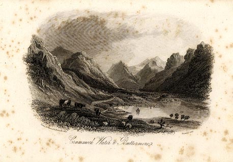 click to enlarge click to enlargeHRW219.jpg printed at bottom left, right, centre:- "London, J &F. Harwood, 26, Fenchurch Street. / August 17, 1842. / Crummock Water and Buttermere." item:- JandMN : 166.19 Image © see bottom of page |
|||||||||||||||||||||||||
|
|
||||||||||||||||||||||||||
| evidence:- | old print:- Rose 1832-35 (vol.1 no.52) placename:- Crummock Water |
|||||||||||||||||||||||||
| source data:- | Print, uncoloured engraving, Crummock Water, Cumberland, drawn by Thomas Allom, engraved
by W le Petit, published by Fisher, Son and Co, London, 1833.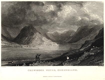 click to enlarge click to enlargePR0020.jpg vol.1 pl.52 in the set of prints, Westmorland, Cumberland, Durham and Northumberland Illustrated. printed at bottom left, right, centre:- "T. Allom. / W. Le Petit. / CRUMMOCK WATER, CUMBERLAND. / FISHER, SON &CO. LONDON, 1833." item:- Dove Cottage : 2008.107.20 Image © see bottom of page |
|||||||||||||||||||||||||
|
|
||||||||||||||||||||||||||
| evidence:- | old print:- placename:- Crummock Lake |
|||||||||||||||||||||||||
| source data:- | Print, uncoloured engraving, Crummock Lake, Cumberland, engraved by J Gellatly, published
by J Menzies, 61 Princes Street, Edinburgh, early 19th century?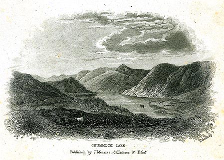 click to enlarge click to enlargePR0267.jpg printed at bottom right, centre:- "J. Gellatly / CRUMMOCK LAKE. / Published by J. Menzies - 61, Princes St. Edinr." item:- Dove Cottage : 2008.107.267 Image © see bottom of page |
|||||||||||||||||||||||||
|
|
||||||||||||||||||||||||||
| evidence:- | old map:- placename:- Cromack Water |
|||||||||||||||||||||||||
| source data:- | Print, coloured aquatint, Cromack Water, Cumberland, published
about 1820?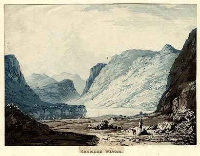 click to enlarge click to enlargePR0435.jpg Print, coloured aquatint, Cromack Water, Cumberland, published about 1820? printed at bottom:- "CROMACK WATER" item:- private collection : 99 Image © see bottom of page |
|||||||||||||||||||||||||
|
|
||||||||||||||||||||||||||
| evidence:- | old print:- Farington 1816 (plate 28) placename:- Crommock Water placename:- Crummock Water |
|||||||||||||||||||||||||
| source data:- | Print, uncoloured engraving, Buttermere and Crommock Water, Buttermere, Cumberland,
drawn by Joseph Farington, engraved by F R Hay, published by T Cadell and W Davies,
Strand, London, 1815.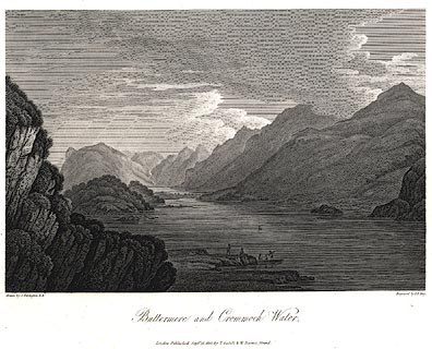 click to enlarge click to enlargePR0448.jpg Plate 28 in The Lakes of Lancashire, Westmorland, and Cumberland. printed at bottom left, right, centre:- "Drawn by J. Farington. / Engraved by F. R. Hay. / Buttermere and Crommock Water. / London, Published Septr. 15, 1815, by T. Cadell &W. Davies, Strand." The accompanying text is by Thomas Hartwell Horne:- "BUTTERMERE AND CROMMOCK WATER." "..." "CROMMOCK, or CRUMMOCK WATER, which is seen in the fore-ground of the present view, is separated from Buttermere by a fine level and luxuriant vale. The view form the middle of Crummock Water is singularly grand: the mountains on each side, rise immediately from the water, and consequently appear higher as well as more precipitous than some others in its neighbourhood. Some of these are naked, other wooded to their bases; some are verdant, and some rocky and heathy. This lake is nearly four miles long, and about half a mile broad." item:- private collection : 112 Image © see bottom of page |
|||||||||||||||||||||||||
|
|
||||||||||||||||||||||||||
| evidence:- | old postcard:- placename:- Crummock Water |
|||||||||||||||||||||||||
| source data:- | Postcard, colour photograph, Crummock Water, Buttermere, Cumberland, published by
Sanderson and Dixon, Ambleside, Westmorland, about 1959.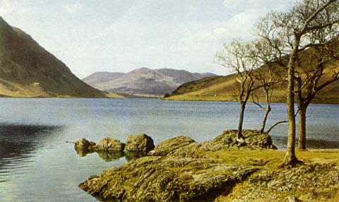 click to enlarge click to enlargePH0111.jpg printed at bottom:- "CRUMMOCK WATER" item:- JandMN : 976.3 Image © see bottom of page |
|||||||||||||||||||||||||
|
|
||||||||||||||||||||||||||
| evidence:- | old postcard:- |
|||||||||||||||||||||||||
| source data:- | Postcard, sepia coloured photograph, Buttermere, Crummock and Loweswater, Cumberland,
published by G P Abraham, Keswick, Cumberland, about 1941.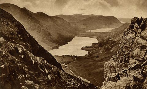 click to enlarge click to enlargePH0095.jpg Perhaps from Dale Head. The message is dated 2.9.1941. printed at bottom:- "BUTTERMERE, CRUMMOCK AND LOWESWATER" printed at rev:- "Photogravure Series by G. P. ABRAHAM, LTD. (copyright) KESWICK" item:- JandMN : 963 Image © see bottom of page |
|||||||||||||||||||||||||
|
|
||||||||||||||||||||||||||
| evidence:- | old drawing:- placename:- Crummock Water item:- cattle |
|||||||||||||||||||||||||
| source data:- | Drawing, Lake Series, Crummock Water from Ling Crag, Buttermere, Cumberland, by Thomas
Bushby, 1884-89.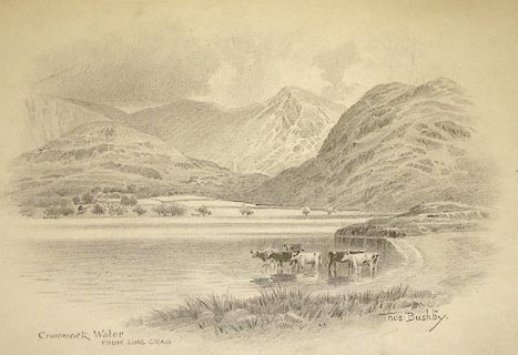 click to enlarge click to enlargePR0997.jpg Cattle stand in the shallows of the lake on the far shore of which stands a farm; beyond rise rocky fells. Designed for Hudson Scott and Sons, box mfrs. inscribed at bottom left:- "Crummock Water FROM LING CRAG" signed &inscribed at bottom right:- "Thos Bushby 'LAKE' SERIES" item:- Tullie House Museum : 1968.11.20 Image © Tullie House Museum |
|||||||||||||||||||||||||
|
|
||||||||||||||||||||||||||
| evidence:- | old drawing:- placename:- Crummock Water |
|||||||||||||||||||||||||
| source data:- | Drawing, Near Crummock Water, Buttermere, Cumberland, by John Harper, 1840.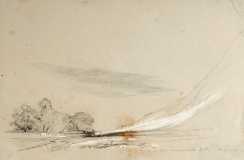 click to enlarge click to enlargePR1379.jpg Valley showing hillside on right and group of trees at base of hills. Executed in pencil with touches of white gouache on buff coloured paper. Preparatory sketch drawn on the spot by the artist. at bottom right:- "near Crummock Water. 13 Sep/40" item:- Tullie House Museum : 2009.89.22 Image © Tullie House Museum |
|||||||||||||||||||||||||
|
|
||||||||||||||||||||||||||
| evidence:- | old drawing:- placename:- Crummock Water |
|||||||||||||||||||||||||
| source data:- | Drawing, Crummock Water, Buttermere, Cumberland, by William Havell, 1800s-10s.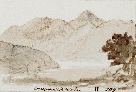 click to enlarge click to enlargePR1401.jpg View of Crummock Water surrounded by hills. One of a set of twenty views of the lake district executed by the artist on one sheet of paper. at bottom:- "Crummock Water II 209" item:- Tullie House Museum : 2009.89.45 Image © Tullie House Museum |
|||||||||||||||||||||||||
|
|
||||||||||||||||||||||||||
| evidence:- | old drawing:- |
|||||||||||||||||||||||||
| source data:- | Drawing, Crummock and Buttermere lakes, Buttermere, Cumberland, by William Havell,
1800s-10s.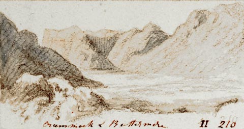 click to enlarge click to enlargePR1405.jpg View of Crummock and Buttermere with large hills in background. One of a set of twenty views of the lake district executed by the artist on one sheet of paper. at bottom:- "Crummock &Buttermere II 218" item:- Tullie House Museum : 2009.89.49 Image © Tullie House Museum |
|||||||||||||||||||||||||
|
|
||||||||||||||||||||||||||
 BXK36.jpg (taken 23.9.2012)  Click to enlarge BXK37.jpg (taken 23.9.2012) 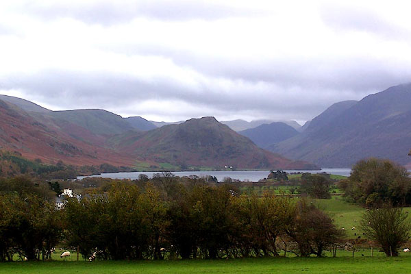 BJZ37.jpg From the north west. (taken 7.11.2005) 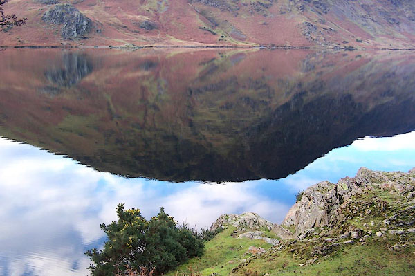 BLM51.jpg WNW from Hause Point. (taken 25.12.2005) 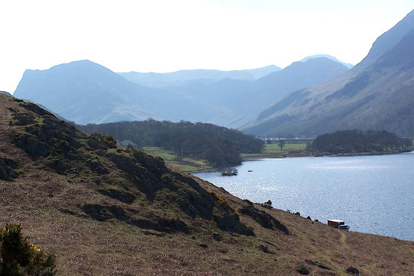 BLY22.jpg From Buttermere Hause. (taken 24.4.2006) 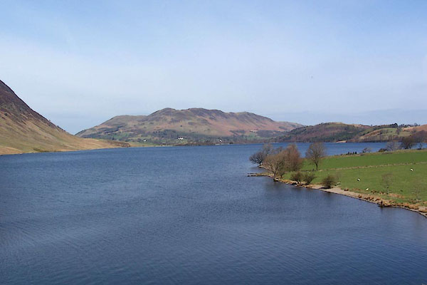 BLY23.jpg From Buttermere Hause. (taken 24.4.2006) 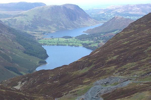 BMR55.jpg From Grey Knotts. (taken 22.9.2006) 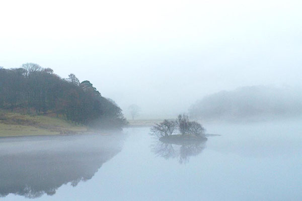 BQD52.jpg Near Wood House. (taken 17.2.2009) 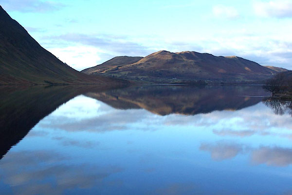 BLM50.jpg Looking north west. (taken 25.12.2005) 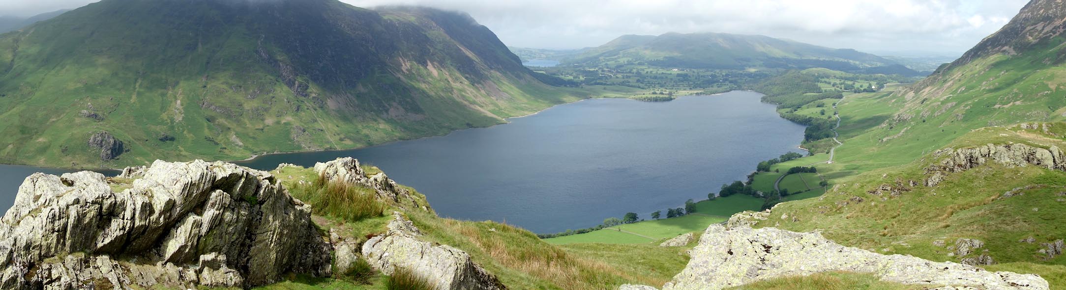 Click to enlarge CAY10.jpg From Rannerdale Knotts. (taken 11.6.2014) |
||||||||||||||||||||||||||
|
|
||||||||||||||||||||||||||
| see:- | viewpoint, Buttermere Peter Crosthwaite 5 viewpoint, Dob Ley Head Thomas West / Peter Crosthwaite 3 viewpoint, Flass Wood Thomas West / Peter Crosthwaite 2 viewpoint, Rannerdale Knotts Thomas West |
|||||||||||||||||||||||||
|
|
||||||||||||||||||||||||||
Lakes Guides menu.