 Old Cumbria Gazetteer
 |
 |
|
| Flookburgh | ||
| civil parish:- | Lower Holker (formerly Lancashire) | |
| county:- | Cumbria | |
| locality type:- | buildings | |
| locality type:- | market town | |
| coordinates:- | SD36637582 (etc) | |
| 1Km square:- | SD3675 | |
| 10Km square:- | SD37 | |
| latitude; longitude:- | 2d 58.2m W; 54d 10.4m N | |
|
|
||
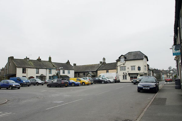 BUE20.jpg (taken 4.3.2011) |
||
|
|
||
| evidence:- | descriptive text:- West 1778 (11th edn 1821) placename:- Flookburg item:- charter; market charter |
|
| source data:- | Guide book, A Guide to the Lakes, by Thomas West, published by
William Pennington, Kendal, Cumbria once Westmorland, and in
London, 1778 to 1821. goto source goto sourcePage 31:- "... Pass through Flookburg [1], once a market-town, by charter granted to the prior of Cartmel, lord paramount, from King Edward I. ..." "[1] Near this place is a noted spaw, called Holy-well, ..." |
|
|
|
||
| evidence:- | old map:- West 1784 map placename:- Flookboro |
|
| source data:- | Map, hand coloured engraving, A Map of the Lakes in Cumberland,
Westmorland and Lancashire, scale about 3.5 miles to 1 inch,
engraved by Paas, 53 Holborn, London, about 1784.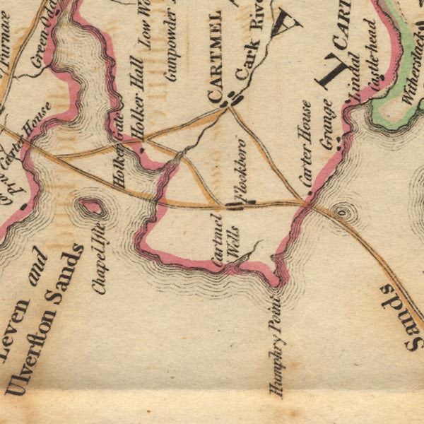 Ws02SD37.jpg item:- Armitt Library : A1221.1 Image © see bottom of page |
|
|
|
||
| evidence:- | old text:- Camden 1789 (Gough Additions) placename:- Flookborough item:- market |
|
| source data:- | Book, Britannia, or A Chorographical Description of the Flourishing Kingdoms of England,
Scotland, and Ireland, by William Camden, 1586, translated from the 1607 Latin edition
by Richard Gough, published London, 1789. goto source Page 142:- "..." "Cartmell ... The town is small and has very irregular streets lying in a vale surrounded by high hills. The market which the priory had at Flookborough adjoining is now removed to Cartmel." |
|
|
|
||
| evidence:- | old map:- Otley 1818 placename:- Flookborough |
|
| source data:- | Map, uncoloured engraving, The District of the Lakes,
Cumberland, Westmorland, and Lancashire, scale about 4 miles to
1 inch, by Jonathan Otley, 1818, engraved by J and G Menzies,
Edinburgh, Scotland, published by Jonathan Otley, Keswick,
Cumberland, et al, 1833.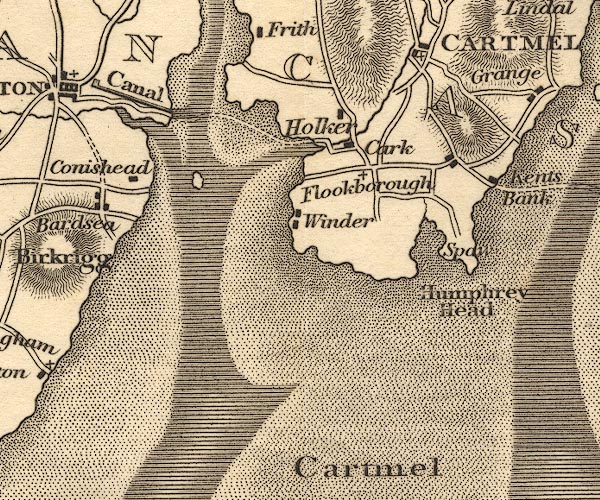 OT02SD37.jpg item:- JandMN : 48.1 Image © see bottom of page |
|
|
|
||
| evidence:- | descriptive text:- Otley 1823 (5th edn 1834) |
|
| source data:- | Guide book, A Concise Description of the English Lakes, the
mountains in their vicinity, and the roads by which they may be
visited, with remarks on the mineralogy and geology of the
district, by Jonathan Otley, published by the author, Keswick,
Cumberland now Cumbria, by J Richardson, London, and by Arthur
Foster, Kirkby Lonsdale, Cumbria, 1823; published 1823-49,
latterly as the Descriptive Guide to the English Lakes. goto source Page 94:- "Flookborough is a village lying between the estuaries of the Kent and Leven: it has two comfortable inns fitted for the reception of persons making use of a medicinal spring near Humphrey Head, two miles distant. ..." |
|
|
|
||
| evidence:- | descriptive text:- Ford 1839 (3rd edn 1843) placename:- Flookborough |
|
| source data:- | Guide book, A Description of Scenery in the Lake District, by
Rev William Ford, published by Charles Thurnam, Carlisle, by W
Edwards, 12 Ave Maria Lane, Charles Tilt, Fleet Street, William
Smith, 113 Fleet Street, London, by Currie and Bowman,
Newcastle, by Bancks and Co, Manchester, by Oliver and Boyd,
Edinburgh, and by Sinclair, Dumfries, 1839. goto source Page 156:- "..." "Flookborough was anciently a market-town, by charter of Edward I." |
|
|
|
||
| evidence:- | old map:- Ford 1839 map placename:- Flookboro |
|
| source data:- | Map, uncoloured engraving, Map of the Lake District of
Cumberland, Westmoreland and Lancashire, scale about 3.5 miles
to 1 inch, published by Charles Thurnam, Carlisle, and by R
Groombridge, 5 Paternoster Row, London, 3rd edn 1843.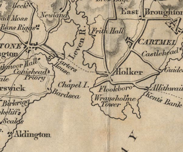 FD02SD37.jpg "Flookboro" item:- JandMN : 100.1 Image © see bottom of page |
|
|
|
||
| evidence:- | old map:- Garnett 1850s-60s H placename:- Flookborough |
|
| source data:- | Map of the English Lakes, in Cumberland, Westmorland and
Lancashire, scale about 3.5 miles to 1 inch, published by John
Garnett, Windermere, Westmorland, 1850s-60s.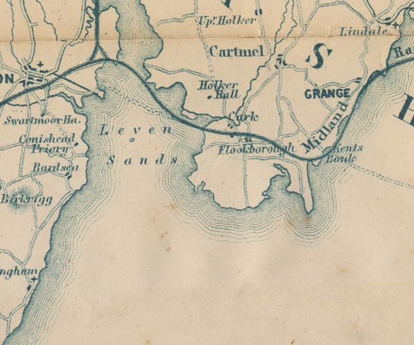 GAR2SD37.jpg "Flookborough" blocks, settlement item:- JandMN : 82.1 Image © see bottom of page |
|
|
|
||
| evidence:- | market notes:- item:- market |
|
| source data:- | www.history.ac.uk/cmh/gaz/gazweb2.htm | |
|
|
||
| evidence:- | old map:- Post Office 1823 placename:- Flookborough |
|
| source data:- | Post road map, The Circulation of Letters, a General Post Office
Circulation Map for England and Wales, General Post Office,
London, 1823.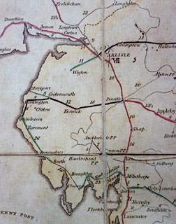 click to enlarge click to enlargePOF5Cm.jpg "Flookboro'" map date 1823 |
|
|
|
||
| :- |
images courtesy of the British Postal Museum and Hampshire CC Museums |
|
|
|
||
| notes:- |
Granted a charter by Edward 1, confirmed by Henry IV, and by Charles II in 1665. Flookburgh
could hold a market and two annual fairs. |
|
| The plague killed so many people in 1669 that they had to be buried in two mass graves
in Ecclestan Meadow on the west side of the village. In 1662 there was a fire which
destroyed 22 houses etc. |
||
| Known for its flukes, caught in the sea not far away. |
||
|
|
||
Lakes Guides menu.