 Old Cumbria Gazetteer
 |
 |
|
||||||||||||||||||||||||
| Grasmere lake | ||||||||||||||||||||||||||
| runs into:- |  Rothay, River Rothay, River |
|||||||||||||||||||||||||
|
|
||||||||||||||||||||||||||
| Grasmere | ||||||||||||||||||||||||||
| civil parish:- | Lakes (formerly Westmorland) | |||||||||||||||||||||||||
| county:- | Cumbria | |||||||||||||||||||||||||
| locality type:- | lake | |||||||||||||||||||||||||
| coordinates:- | NY33900652 | |||||||||||||||||||||||||
| 1Km square:- | NY3306 | |||||||||||||||||||||||||
| 10Km square:- | NY30 | |||||||||||||||||||||||||
|
|
||||||||||||||||||||||||||
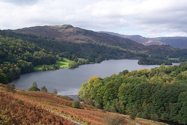
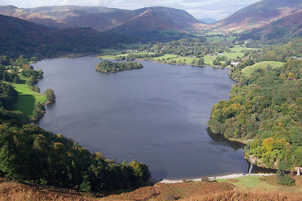 BPS41.jpg From Loughrigg Terrace. (taken 6.10.2008) 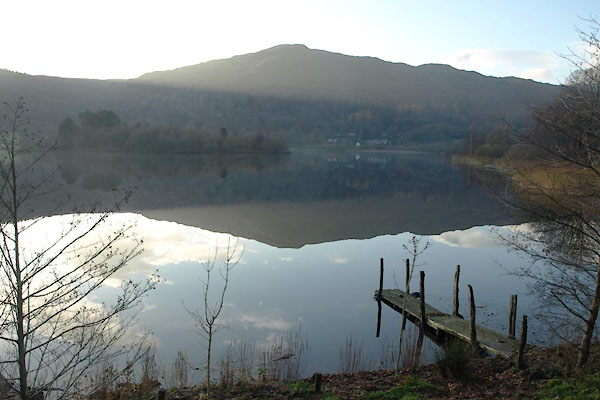 BTU82.jpg From near the Lakeside hotel. (taken 19.11.2010) |
||||||||||||||||||||||||||
|
|
||||||||||||||||||||||||||
| evidence:- | old map:- OS County Series (Wmd 26 1) placename:- Grasmere Lake |
|||||||||||||||||||||||||
| source data:- | Maps, County Series maps of Great Britain, scales 6 and 25
inches to 1 mile, published by the Ordnance Survey, Southampton,
Hampshire, from about 1863 to 1948. |
|||||||||||||||||||||||||
|
|
||||||||||||||||||||||||||
| evidence:- | old map:- Saxton 1579 |
|||||||||||||||||||||||||
| source data:- | Map, hand coloured engraving, Westmorlandiae et Cumberlandiae Comitatus ie Westmorland
and Cumberland, scale about 5 miles to 1 inch, by Christopher Saxton, London, engraved
by Augustinus Ryther, 1576, published 1579-1645. Sax9NY30.jpg Lake. item:- private collection : 2 Image © see bottom of page |
|||||||||||||||||||||||||
|
|
||||||||||||||||||||||||||
| evidence:- | old map:- Mercator 1595 (edn?) placename:- |
|||||||||||||||||||||||||
| source data:- | Map, hand coloured engraving, Westmorlandia, Lancastria, Cestria
etc, ie Westmorland, Lancashire, Cheshire etc, scale about 10.5
miles to 1 inch, by Gerard Mercator, Duisberg, Germany, 1595,
edition 1613-16. MER5WmdA.jpg "" outline, coast shaded, tinted blue; lake, includes Rydal Water item:- Armitt Library : 2008.14.3 Image © see bottom of page |
|||||||||||||||||||||||||
|
|
||||||||||||||||||||||||||
| evidence:- | old map:- Seller 1694 (Wmd) |
|||||||||||||||||||||||||
| source data:- | Map, hand coloured engraving, Westmorland, scale about 8 miles
to 1 inch, by John Seller, 1694. click to enlarge click to enlargeSEL7.jpg outline with shaded shore; lake; joined with Rydal Water item:- Dove Cottage : 2007.38.87 Image © see bottom of page |
|||||||||||||||||||||||||
|
|
||||||||||||||||||||||||||
| evidence:- | old map:- Morden 1695 (Cmd) |
|||||||||||||||||||||||||
| source data:- | Map, uncoloured engraving, Cumberland, scale about 4 miles to 1
inch, by Robert Morden, 1695, published by Abel Swale, the
Unicorn, St Paul's Churchyard, Awnsham, and John Churchill, the
Black Swan, Paternoster Row, London, 1695-1715. MD12NY30.jpg Outline with shore shading, single area for two lakes, between Grasmere and Ambleside, with an island. item:- JandMN : 90 Image © see bottom of page |
|||||||||||||||||||||||||
|
|
||||||||||||||||||||||||||
| evidence:- | old map:- Morden 1695 (Wmd) |
|||||||||||||||||||||||||
| source data:- | Map, hand coloured engraving, Westmorland, scale about 2.5 miles to 1 inch, by Robert
Morden, published by Abel Swale, the Unicorn, St Paul's Churchyard, Awnsham, and John
Churchill, the Black Swan, Paternoster Row, London, 1695. MD10NY30.jpg Outline with shore shading, tinted blue. item:- JandMN : 24 Image © see bottom of page |
|||||||||||||||||||||||||
|
|
||||||||||||||||||||||||||
| evidence:- | perhaps old map:- Badeslade 1742 placename:- |
|||||||||||||||||||||||||
| source data:- | Map, uncoloured engraving, A Map of Westmorland North from
London, scale about 10 miles to 1 inch, with descriptive text,
by Thomas Badeslade, London, engraved and published by William
Henry Toms, Union Court, Holborn, London, 1742. click to enlarge click to enlargeBD12.jpg "" outline with form lines item:- Dove Cottage : 2007.38.62 Image © see bottom of page |
|||||||||||||||||||||||||
|
|
||||||||||||||||||||||||||
| evidence:- | old map:- Simpson 1746 map (Wmd) |
|||||||||||||||||||||||||
| source data:- | Map, uncoloured engraving, Westmorland, scale about 8 miles to 1
inch, printed by R Walker, Fleet Lane, London, 1746. SMP2NYF.jpg Outline with form lines. item:- Dove Cottage : 2007.38.59 Image © see bottom of page |
|||||||||||||||||||||||||
|
|
||||||||||||||||||||||||||
| evidence:- | old map:- Bowen and Kitchin 1760 |
|||||||||||||||||||||||||
| source data:- | Map, hand coloured engraving, A New Map of the Counties of
Cumberland and Westmoreland Divided into their Respective Wards,
scale about 4 miles to 1 inch, by Emanuel Bowen and Thomas
Kitchin et al, published by T Bowles, Robert Sayer, and John
Bowles, London, 1760. BO18NY20.jpg outline with form lines item:- Armitt Library : 2008.14.10 Image © see bottom of page |
|||||||||||||||||||||||||
|
|
||||||||||||||||||||||||||
| evidence:- | old map:- Jefferys 1770 (Wmd) |
|||||||||||||||||||||||||
| source data:- | Map, 4 sheets, The County of Westmoreland, scale 1 inch to 1
mile, surveyed 1768, and engraved and published by Thomas
Jefferys, London, 1770. J5NY30NW.jpg "Tarn" outline with form lines; lake or tarn item:- National Library of Scotland : EME.s.47 Image © National Library of Scotland |
|||||||||||||||||||||||||
|
|
||||||||||||||||||||||||||
| evidence:- | descriptive text:- West 1778 (11th edn 1821) placename:- Grasmere Water |
|||||||||||||||||||||||||
| source data:- | Guide book, A Guide to the Lakes, by Thomas West, published by
William Pennington, Kendal, Cumbria once Westmorland, and in
London, 1778 to 1821. goto source Page 80:- "..." "GRASMERE-WATER," "The river Rothay is their common [with Rydal Water] outlet." "..." goto sourcePage 190:- "A TABLE OF THE Height of Mountains and Lakes SEEN IN THIS TOUR, ... TAKEN FROM THE LEVEL OF THE SEA. ... by Mr. John Dalton." "Grasmere-water ... 60 [yards]" goto sourceAddendum; Mr Gray's Journal, 1769 Page 211:- "... [descending Dunmail Raise] ... opens one of the sweetest landscapes that art ever attempted to imitate. The bosom of the mountains spreading here into a broad bason discovers in the midst Grasmere-water: its margin is hollowed into small bays, with bold eminences; some of rock, some of turf, that half conceal and vary the figure of the little lake they command; from the shore a low promontory pushes itself far into the water, and on it stands a white village, with the parish church rising in the midst of it; hanging inclosures, corn-fields and meadows, green as an emerald, with their trees, and hedges, and cattle, fill up the whole space from the edge of the water; and just opposite to you is a large farm house, at the bottom of a deep smooth lawn, embosomed in old woods, which climb half way up the mountains' sides, and discover above them a broken line of crags that crown the scene. Not a single red tile, no gentleman's flaring house, or garden walls, break in upon the repose of this little unsuspected paradise; but all its peace, rusticity, and happy poverty, in its neatest, most becoming attire." "The road here winds over Grasmere-hill, whose rocks soon conceal the water from your sight; yet it is continued along behind them, and contracting itself to a river, communicates with Rydal-water, ..." goto sourceMr Cumberland's Ode to the Sun, 1776 Page 228:- "... Thee, savage Wyburn, now I hail, / Delicious Grasmere's calm retreat, / And stately Windermere I greet, / ..." |
|||||||||||||||||||||||||
|
|
||||||||||||||||||||||||||
| evidence:- | old map:- West 1784 map placename:- Grasmere Water |
|||||||||||||||||||||||||
| source data:- | Map, hand coloured engraving, A Map of the Lakes in Cumberland,
Westmorland and Lancashire, scale about 3.5 miles to 1 inch,
engraved by Paas, 53 Holborn, London, about 1784. Ws02NY30.jpg "GRASMERE WATER" item:- Armitt Library : A1221.1 Image © see bottom of page |
|||||||||||||||||||||||||
|
|
||||||||||||||||||||||||||
| evidence:- | old text:- goto source placename:- Grassmere Water |
|||||||||||||||||||||||||
| source data:- | goto source Page 120:- "..." "I shall here give an extract from Mr Gray's journal, (because I would wish to be thought impartial in every description.)" ""... Just beyond it [Helm Crag] opens one of the sweetest landscapes that art ever attempted to imit[ate]: the bosom of the mountains spreading here into a broad bason, discovers in the midst Grassmere-Water; its margin is hollowed into small bays, with bold eminences; some of rock, some of turf, that half conceal and vary the figure of the little lake they command: from the shore, a low promontory pushes itself far into the water, and on it stands a white village with the parish church rising in the midst of it; hanging inclosures, corn-fields, and meadows with their trees, hedges, and cattle, fill up the whole space from the edge of the water; ..."" |
|||||||||||||||||||||||||
|
|
||||||||||||||||||||||||||
| evidence:- | old map:- Clarke 1787 map (Ambleside to Keswick) placename:- Grasmere Water |
|||||||||||||||||||||||||
| source data:- | Map, A Map of the Roads Lakes etc between Keswick and Ambleside,
scale about 2.5 ins to 1 mile, by James Clarke, engraved by S J
Neele, 352 Strand, published by James Clarke, Penrith,
Cumberland and in London etc, 1787. CL9NY30I.jpg "Grasmere Water" item:- private collection : 10.9 Image © see bottom of page |
|||||||||||||||||||||||||
|
|
||||||||||||||||||||||||||
| evidence:- | old map:- Cary 1789 (edn 1805) |
|||||||||||||||||||||||||
| source data:- | Map, uncoloured engraving, Westmoreland, scale about 2.5 miles
to 1 inch, by John Cary, London, 1789; edition 1805. CY24NY30.jpg outline with shore form lines; lake or tarn item:- JandMN : 129 Image © see bottom of page |
|||||||||||||||||||||||||
|
|
||||||||||||||||||||||||||
| evidence:- | old print:- Farington 1789 placename:- Grasmere |
|||||||||||||||||||||||||
| source data:- | Print, uncoloured engraving, Grasmere, Westmorland, drawn by Joseph Farington, engraved
by B T Pouncy, published by William Byrne, 79 Titchfield Street, London, 1785.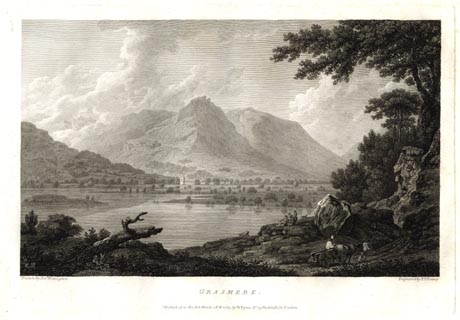 click to enlarge click to enlargeFA0305.jpg printed, bottom left, right, centre "Drawn by Josh. Farington / Engraved by B. T. Pouncy / GRASMERE. / Published as the Act directs, 1 Feb. 1785, by W. Byrne, No 79, Titchfield Str. London." item:- Armitt Library : A6668.5 Image © see bottom of page |
|||||||||||||||||||||||||
|
|
||||||||||||||||||||||||||
| evidence:- | old map:- Aikin 1790 (Wmd) placename:- Gresmere |
|||||||||||||||||||||||||
| source data:- | Map, uncoloured engraving, Westmoreland ie Westmorland, scale
about 8.5 miles to 1 inch, by John Aikin, London, 1790. click to enlarge click to enlargeAIK2.jpg "Gresmere" outline with form lines; lake item:- JandMN : 51 Image © see bottom of page |
|||||||||||||||||||||||||
|
|
||||||||||||||||||||||||||
| evidence:- | old painting:- Green 1790s-1820s (1802) item:- fishing; rowing boat; boat |
|||||||||||||||||||||||||
| source data:- | Painting, watercolour, fishing, Grasmere, Westmorland, by William Green, Ambleside,
Westmorland, 1802.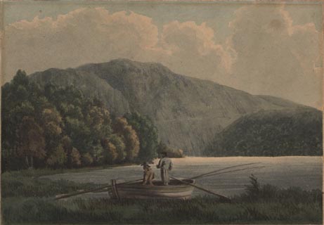 click to enlarge click to enlargePR1734.jpg item:- Dove Cottage : 1991.73.2 Image © see bottom of page |
|||||||||||||||||||||||||
|
|
||||||||||||||||||||||||||
| evidence:- | old painting:- Green 1790s-1820s (1810) item:- sheep |
|||||||||||||||||||||||||
| source data:- | Painting, watercolour, Grasmere from Holme Scar, Westmorland, by William Green, Ambleside,
Westmorland, about 1810.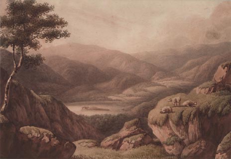 click to enlarge click to enlargePR1756.jpg item:- Dove Cottage : B38 Image © see bottom of page |
|||||||||||||||||||||||||
|
|
||||||||||||||||||||||||||
| evidence:- | old print:- Smith 1795 placename:- Grasmere Lake |
|||||||||||||||||||||||||
| source data:- | Print uncoloured engraving, with some aquatint, Grasmere Lake, Westmorland, drawn
by John 'Warwick' Smith, engraved by F Merigot, published by R Blamire, Strand, London,
1795.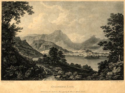 click to enlarge click to enlargePR1852.jpg printed, bottom left, right, centre "Drawn by J. Smith. / Engraved by Merigot. / GRASMERE LAKE. / Published as the Act directs, May, 1795, by Rd. Blamire, Strand, London." item:- Armitt Library : 2011.67 Image © see bottom of page |
|||||||||||||||||||||||||
|
|
||||||||||||||||||||||||||
| evidence:- | old map:- Housman 1800 map 4 placename:- Grasmere Water |
|||||||||||||||||||||||||
| source data:- | Maps, hand coloured engraving, Lakes in Lancashire and Westmorland, 7 lakes on one
sheet, engraved by McIntyre, Edinburgh, published by F Jollie, Carlisle, Cumberland,
and C Law, Ave Maria Lane, London, 1800.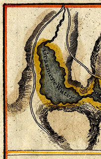 click to enlarge click to enlargeHM02Gra.jpg "Grasmere Water" item:- Dove Cottage : 2007.38.97 Image © see bottom of page |
|||||||||||||||||||||||||
|
|
||||||||||||||||||||||||||
| evidence:- | old map:- Cooke 1802 |
|||||||||||||||||||||||||
| source data:- | Map, The Lakes, Westmorland and Cumberland, scale about 8.5
miles to 1 inch, engravedby Neele and Son, published by
Sherwood, Jones and Co, Paternoster Road, London, 1824. click to enlarge click to enlargeGRA1Lk.jpg outline with form lines; lake or tarn item:- Hampshire Museums : FA2000.62.5 Image © see bottom of page |
|||||||||||||||||||||||||
|
|
||||||||||||||||||||||||||
| evidence:- | old map:- Cooke 1802 |
|||||||||||||||||||||||||
| source data:- | Map, Westmoreland ie Westmorland, scale about 12 miles to 1
inch, by George Cooke, 1802, published by Sherwood, Jones and
Co, Paternoster Road, London, 1824. click to enlarge click to enlargeGRA1Wd.jpg outline with form lines; lake or tarn item:- Hampshire Museums : FA2000.62.4 Image © see bottom of page |
|||||||||||||||||||||||||
|
|
||||||||||||||||||||||||||
| evidence:- | old print:- Green 1804 (plate 9) |
|||||||||||||||||||||||||
| source data:- | Print, uncoloured aquatint, Grasmere Church and Lake, Grasmere, Westmorland, by William
Green, Ambleside, Westmorland, 1804.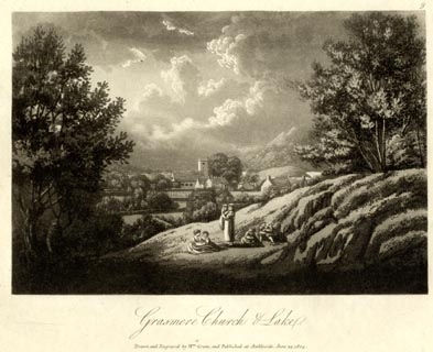 click to enlarge click to enlargeGN1609.jpg Plate 9 from a series. printed at bottom:- "Grasmere Church &Lake. / Drawn and Engraved by Wm. Green, and Published at Ambleside, June 24, 1804." printed at top right:- "9" item:- Armitt Library : 2014.151 Image © see bottom of page |
|||||||||||||||||||||||||
|
|
||||||||||||||||||||||||||
| evidence:- | old text:- Gents Mag |
|||||||||||||||||||||||||
| source data:- | Magazine, The Gentleman's Magazine or Monthly Intelligencer or
Historical Chronicle, published by Edward Cave under the
pseudonym Sylvanus Urban, and by other publishers, London,
monthly from 1731 to 1922. goto source Gentleman's Magazine 1805 p.1010 "... The Lake of Grasmere, basoned in rock, a frontier so terrible, as even to strike the warrior with dismay, might have lain for ages beneath the veil of primaeval obscurity; and it is much to be feared that the facility of access to a scene of such commanding beauty, may prove fatal to its most bewitching attractions. ..." |
|||||||||||||||||||||||||
|
|
||||||||||||||||||||||||||
| evidence:- | old map:- Laurie and Whittle 1806 placename:- Grasmere Water |
|||||||||||||||||||||||||
| source data:- | Road map, Completion of the Roads to the Lakes, scale about 10
miles to 1 inch, by Nathaniel Coltman? 1806, published by Robert
H Laurie, 53 Fleet Street, London, 1834. click to enlarge click to enlargeLw18.jpg "Grasmere Water" lake item:- private collection : 18.18 Image © see bottom of page |
|||||||||||||||||||||||||
|
|
||||||||||||||||||||||||||
| evidence:- | old map:- Cooper 1808 |
|||||||||||||||||||||||||
| source data:- | Map, hand coloured engraving, Westmoreland ie Westmorland, scale
about 9 miles to 1 inch, by H Cooper, 1808, published by R
Phillips, Bridge Street, Blackfriars, London, 1808. click to enlarge click to enlargeCOP4.jpg outline, shaded; lake item:- Dove Cottage : 2007.38.53 Image © see bottom of page |
|||||||||||||||||||||||||
|
|
||||||||||||||||||||||||||
| evidence:- | old print:- Green 1814 (plate 20) placename:- Grasmere |
|||||||||||||||||||||||||
| source data:- | Print, uncoloured soft ground etching, Grasmere from Loughrigg Fell, Grasmere, Westmorland,
by William Green, Ambleside, Westmorland, 1814.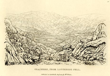 click to enlarge click to enlargeGN0920.jpg Plate 20 in Sixty Small Prints. printed at top right:- "20" printed at bottom:- "GRASMERE FROM LOUGHRIGG FELL. / Published at Ambleside Augst. 1, 1814, by Wm. Green." item:- Armitt Library : A6656.20 Image © see bottom of page |
|||||||||||||||||||||||||
|
|
||||||||||||||||||||||||||
| evidence:- | old print:- Green 1814 (plate 20) placename:- Grasmere |
|||||||||||||||||||||||||
| source data:- | Print, tinted soft ground etching, Grasmere from Loughrigg Fell, Grasmere, Westmorland,
by William Green, Ambleside, Westmorland, 1814.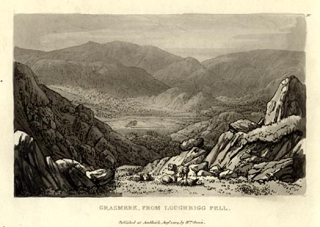 click to enlarge click to enlargeGN1020.jpg Plate 20 in Sixty Small Prints. printed at top right:- "20" printed at bottom:- "GRASMERE FROM LOUGHRIGG FELL. / Published at Ambleside Augst. 1, 1814, by Wm. Green." item:- Armitt Library : A6653.20 Image © see bottom of page |
|||||||||||||||||||||||||
|
|
||||||||||||||||||||||||||
| evidence:- | old print:- Green 1814 (plate 21) placename:- Grasmere item:- cattle |
|||||||||||||||||||||||||
| source data:- | Print, uncoloured soft ground etching, Grasmere from Town End, Grasmere, Westmorland,
by William Green, Ambleside, Westmorland, 1814.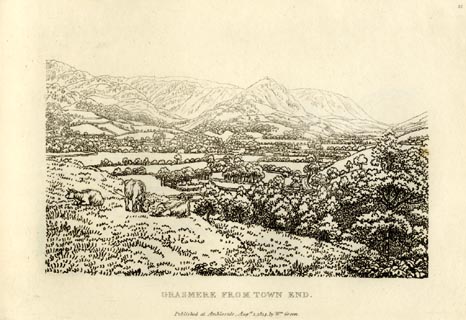 click to enlarge click to enlargeGN0921.jpg Plate 21 in Sixty Small Prints. printed at top right:- "21" printed at bottom:- "GRASMERE FROM TOWN END. / Published at Ambleside Augst. 1, 1814, by Wm. Green." item:- Armitt Library : A6656.21 Image © see bottom of page |
|||||||||||||||||||||||||
|
|
||||||||||||||||||||||||||
| evidence:- | old print:- Green 1814 (plate 21) placename:- Grasmere item:- cattle |
|||||||||||||||||||||||||
| source data:- | Print, tinted soft ground etching, Grasmere from Town End, Grasmere, Westmorland,
by William Green, Ambleside, Westmorland, 1814.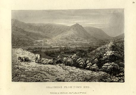 click to enlarge click to enlargeGN1021.jpg Plate 21 in Sixty Small Prints. printed at top right:- "21" printed at bottom:- "GRASMERE FROM TOWN END. / Published at Ambleside Augst. 1, 1814, by Wm. Green." item:- Armitt Library : A6653.21 Image © see bottom of page |
|||||||||||||||||||||||||
|
|
||||||||||||||||||||||||||
| evidence:- | old print:- Green 1815 placename:- Grasmere item:- cattle |
|||||||||||||||||||||||||
| source data:- | Print, coloured aquatint, Grasmere, Westmorland, by William Green, Ambleside, Westmorland,
1815.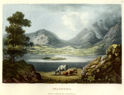 click to enlarge click to enlargeGN0528.jpg Dunmail Raise behind. Plate 30 in Lake Scenery. printed at upper right:- "30" printed at bottom:- "GRASMERE. / Published at Ambleside, June 1, 1815, by Wm. Green." item:- Armitt Library : A6646.28 Image © see bottom of page |
|||||||||||||||||||||||||
|
|
||||||||||||||||||||||||||
| evidence:- | old map:- Otley 1818 |
|||||||||||||||||||||||||
| source data:- | Map, uncoloured engraving, The District of the Lakes,
Cumberland, Westmorland, and Lancashire, scale about 4 miles to
1 inch, by Jonathan Otley, 1818, engraved by J and G Menzies,
Edinburgh, Scotland, published by Jonathan Otley, Keswick,
Cumberland, et al, 1833. OT02NY30.jpg The island is drawn. item:- JandMN : 48.1 Image © see bottom of page |
|||||||||||||||||||||||||
|
|
||||||||||||||||||||||||||
| evidence:- | old print:- Fielding and Walton 1821 (plate 21) |
|||||||||||||||||||||||||
| source data:- | Print, coloured aquatint, Grasmere Church and Helm Crag, Grasmere, Westmorland, drawn
by John Walton, published by R Ackermann, 101 Strand, London, 1821. click to enlarge click to enlargeFW0121.jpg St Oswald's Church. Tipped in opposite p.106 in A Picturesque Tour of the English Lakes. item:- Dove Cottage : 1993.R566.21 Image © see bottom of page |
|||||||||||||||||||||||||
|
|
||||||||||||||||||||||||||
| evidence:- | old print:- Fielding and Walton 1821 (plate 22) placename:- Grasmere |
|||||||||||||||||||||||||
| source data:- | Print, coloured aquatint, Grasmere, Westmorland, drawn by Theodore H A Fielding, published
by R Ackermann, 101 Strand, London, 1821. click to enlarge click to enlargeFW0122.jpg Tipped in opposite p.112 in A Picturesque Tour of the English Lakes. item:- Dove Cottage : 1993.R566.22 Image © see bottom of page |
|||||||||||||||||||||||||
|
|
||||||||||||||||||||||||||
| evidence:- | outline view:- Otley 1823 (8th edn 1849) placename:- Grasmere |
|||||||||||||||||||||||||
| source data:- | Engraving, outline view of mountains, Grasmere from Red Bank Head, drawn by T Binns,
engraved by O Jewitt, opposite p.4 of A Descriptive Guide of the English Lakes, by
Jonathan Otley, 8th edition, 1849.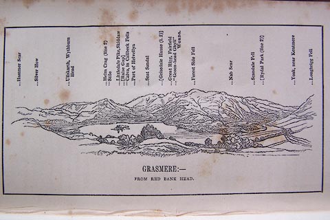 click to enlarge click to enlargeO80E04.jpg item:- Armitt Library : A1180.5 Image © see bottom of page |
|||||||||||||||||||||||||
|
|
||||||||||||||||||||||||||
| evidence:- | descriptive text:- Otley 1823 (5th edn 1834) placename:- Grasmere Water item:- cattle; pike; perch; eel; trout; fishing |
|||||||||||||||||||||||||
| source data:- | Guide book, A Concise Description of the English Lakes, the
mountains in their vicinity, and the roads by which they may be
visited, with remarks on the mineralogy and geology of the
district, by Jonathan Otley, published by the author, Keswick,
Cumberland now Cumbria, by J Richardson, London, and by Arthur
Foster, Kirkby Lonsdale, Cumbria, 1823; published 1823-49,
latterly as the Descriptive Guide to the English Lakes. goto source Page 2:- "..." "Before this country became so much the resort of strangers, the word LAKE was little known to the native inhabitants; but to the ancient termination mere, WATER was usually superadded, as ... Grasmere-Water." "..." goto sourcePage 13:- "GRASMERE LAKE" "Is not large, but well formed; and placed near the confines of a cultivated valley, which, as well as the parish, takes the name of Grasmere. The island, containing about four acres of verdant pasture, forms a striking contrast to the massive wooded islands on some of the neighbouring lakes. It rises boldly from the water, in a fine swelling form; and its smooth green surface, when spotted with grazing cattle, has a beautiful appear-" goto sourcePage 14:- "[appear]ance. Should it, however, be thought wanting in trees, there is scarcely an island in Windermere or Derwent, but what could supply the deficiency. Most of the lakes, in order to be seen to advantage, require the progress to be made from the foot, towards the head of the lake; but Grasmere, being completely encircled by mountains, is an exception to the general rule. The view from Dunmail Raise was much admired by Mr. Gray; others have spoken highly of that from Townend; and Mr. West chose his station on Dearbought hill, on the opposite side. In short, from whatever point the approach of Grasmere is made, the prospect is always pleasing." goto sourcePage 14:- "..." "The fish in Grasmere and Rydal Waters, are pike, perch, (provincially called bass,) and eels, with a few trout." |
|||||||||||||||||||||||||
|
|
||||||||||||||||||||||||||
| evidence:- | old map:- Leigh 1830 map |
|||||||||||||||||||||||||
| source data:- | Map, Grasmere Rydal and Langdale, scale about 1.5 miles to 1
inch, engraved by Josiah Neele, 352 Strand, published by Leigh
and Son, 421 Strand, London, about 1830.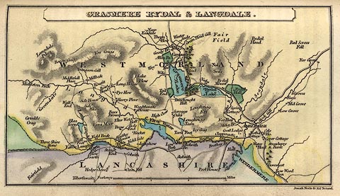 click to enlarge click to enlargeLE04.jpg item:- JandMN : 1.3 Image © see bottom of page |
|||||||||||||||||||||||||
|
|
||||||||||||||||||||||||||
| evidence:- | descriptive text:- Ford 1839 (3rd edn 1843) placename:- Grasmere item:- depth, Grasmere lake |
|||||||||||||||||||||||||
| source data:- | Guide book, A Description of Scenery in the Lake District, by
Rev William Ford, published by Charles Thurnam, Carlisle, by W
Edwards, 12 Ave Maria Lane, Charles Tilt, Fleet Street, William
Smith, 113 Fleet Street, London, by Currie and Bowman,
Newcastle, by Bancks and Co, Manchester, by Oliver and Boyd,
Edinburgh, and by Sinclair, Dumfries, 1839. goto source Page 41:- "..." "GRASMERE." "This water is oval, and lies at the south end of an oval valley. Its dimensions are a mile one way," goto sourcePage 42:- "and half a mile the other. In its centre, a single island of verdant pasture, rising boldly from the water in a fine swelling form. Being completely encircled by mountains, a view of Grasmere from any direction is varied with bold and ennobling mountains, but those are the most awakening which include the Church. ..." goto sourcePage 42:- "..." "The finest views are from the terrace-road under Loughrigg. Here the lake is at your feet, with the church and village scattered amid green enclosures at the base of Butterlip How. On the left are the beetling rocks and woods which ornament the front of Silver How; on the right, Fairfield and Seat Sandale; and in front, Helm Crag, with its rugged top, surnamed the Lion and Lamb; beyond which is seen the road stretching through bare enclosures up to the Raise Gap. ..." goto sourcePage 43:- "... The views on the descent from the Raise Gap, which are in the opposite direction, were much admired and most charmingly described by the poet Gray. There is a most extensive view in the approach from Patterdale, in which this Lake forms the foreground, and Coniston Water and the Duddon Estuary gleam in the distance." goto sourcePage 177:- "A TABLE" "OF THE LENGTH, BREADTH, &c. OF THE LAKES," "COLLECTED FROM DIFFERENT AUTHORITIES."
|
|||||||||||||||||||||||||
|
|
||||||||||||||||||||||||||
| evidence:- | old map:- Ford 1839 map placename:- Grasmere Lake |
|||||||||||||||||||||||||
| source data:- | Map, uncoloured engraving, Map of the Lake District of
Cumberland, Westmoreland and Lancashire, scale about 3.5 miles
to 1 inch, published by Charles Thurnam, Carlisle, and by R
Groombridge, 5 Paternoster Row, London, 3rd edn 1843.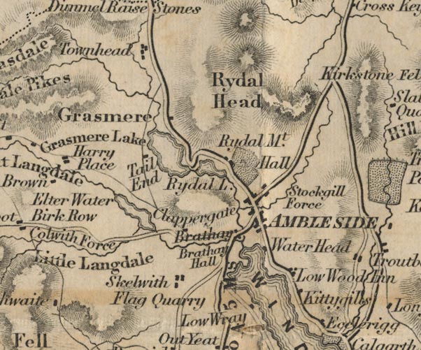 FD02NY30.jpg "Grasmere Lake" Outline with form lines. item:- JandMN : 100.1 Image © see bottom of page |
|||||||||||||||||||||||||
|
|
||||||||||||||||||||||||||
| evidence:- | old drawing:- Aspland 1840s-60s placename:- Grasmere |
|||||||||||||||||||||||||
| source data:- | Drawing, pencil, Grasmere lake, Westmorland, by Theophilus Lindsey Aspland, 1847.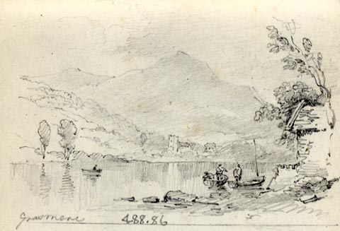 click to enlarge click to enlargeAS0286.jpg "Grasmere" page number "75" item:- Armitt Library : 1958.488.86 Image © see bottom of page |
|||||||||||||||||||||||||
|
|
||||||||||||||||||||||||||
| evidence:- | old drawing:- Aspland 1840s-60s placename:- Grasmere |
|||||||||||||||||||||||||
| source data:- | Drawing, pencil, Grasmere, Westmorland, by Theophilus Lindsey Aspland, 1 August 1857.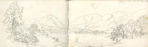 click to enlarge click to enlargeAS0501.jpg "Grasmere from Dale End Aug 1. 1857" page number "1" item:- Armitt Library : 1958.389.1 Image © see bottom of page |
|||||||||||||||||||||||||
|
|
||||||||||||||||||||||||||
| evidence:- | old drawing:- Aspland 1840s-60s |
|||||||||||||||||||||||||
| source data:- | Drawing, pencil, Lion and Lamb, Helm Crag and Grasmere, Westmorland, by Theophilus
Lindsey Aspland, 1857.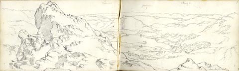 click to enlarge click to enlargeAS0509.jpg "see page 48" page number "7" item:- Armitt Library : 1958.389.9 Image © see bottom of page |
|||||||||||||||||||||||||
|
|
||||||||||||||||||||||||||
| evidence:- | old drawing:- Aspland 1840s-60s |
|||||||||||||||||||||||||
| source data:- | Drawing, pencil, Grasmere village and lake, Westmorland, by Theophilus Lindsey Aspland,
1857.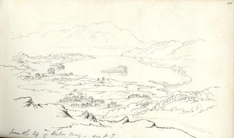 click to enlarge click to enlargeAS0564.jpg "from the top of Helm Crag. / see p.7" page number "48" item:- Armitt Library : 1958.389.64 Image © see bottom of page |
|||||||||||||||||||||||||
|
|
||||||||||||||||||||||||||
| evidence:- | old drawing:- Aspland 1840s-60s |
|||||||||||||||||||||||||
| source data:- | Drawing, pencil, Grasmere lake, from near the Prince of Wales Hotel, Grasmere, Westmorland,
by Theophilus Lindsey Aspland, 1853.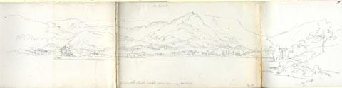 click to enlarge click to enlargeAS0387.jpg "see page 3" "from the high road near Browns Hotel" page number "70" item:- Armitt Library : 1958.390.87 Image © see bottom of page |
|||||||||||||||||||||||||
|
|
||||||||||||||||||||||||||
| evidence:- | old drawing:- Aspland 1840s-60s placename:- Grasmere |
|||||||||||||||||||||||||
| source data:- | Drawing, pencil, Grasmere lake, Westmorland, by Theophilus Lindsey Aspland, 1849.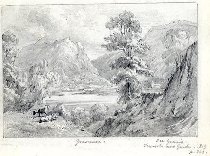 click to enlarge click to enlargeAS0143.jpg "Grasmere. / See Green's Tourists New Guide. 1819 / p.262." item:- Armitt Library : 1958.487.43 Image © see bottom of page |
|||||||||||||||||||||||||
|
|
||||||||||||||||||||||||||
| evidence:- | old map:- Wyld 1847 placename:- Grasmere Water |
|||||||||||||||||||||||||
| source data:- | Map, uncoloured engraving, Windermere, Rydal, Grasmere,
Esthwaite and Coniston Waters, scale about 3.5 miles to 1 inch,
by James Wyld, published by John Johnstone, Paternoster Row,
London, et al, 1847.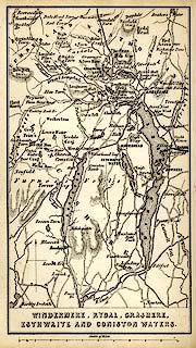 click to enlarge click to enlargeWLD3M1.jpg printed at bottom:- "WINDERMERE, RYDAL, GRASMERE, / ESTHWAITE AND CONISTON WATERS." item:- Armitt Library : A1201.64 Image © see bottom of page |
|||||||||||||||||||||||||
|
|
||||||||||||||||||||||||||
| evidence:- | old print:- Garnett 1850s-60s F placename:- Grasmere |
|||||||||||||||||||||||||
| source data:- | Print, uncoloured lithograph, Grasmere, from Loughrigg Terrace, Westmorland, drawn
by G W Pettit, engraved by William Banks, Edinburgh, published by John Garnett, Post
Office, Windermere, Westmorland, 1850s-60s?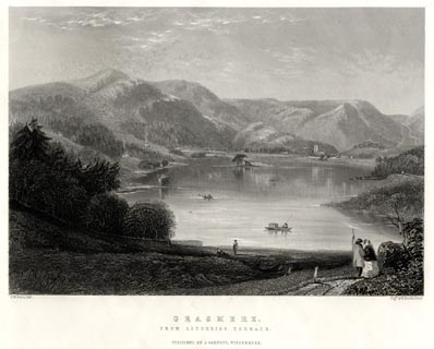 click to enlarge click to enlargeGA1303.jpg printed, bottom left, right, centre "G. W. Pettit, Delt. / Engd. by W. Banks, Edinr. / GRASMERE. / FROM LOUGHRIGG TERRACE. / PUBLISHED BY J. GARNETT, WINDERMERE." item:- Armitt Library : ALMA335.3 Image © see bottom of page |
|||||||||||||||||||||||||
|
|
||||||||||||||||||||||||||
| evidence:- | old map:- Garnett 1850s-60s H placename:- Grasmere Lake |
|||||||||||||||||||||||||
| source data:- | Map of the English Lakes, in Cumberland, Westmorland and
Lancashire, scale about 3.5 miles to 1 inch, published by John
Garnett, Windermere, Westmorland, 1850s-60s. GAR2NY30.jpg "GRASMERE LAKE" outline with shore form lines, lake or tarn item:- JandMN : 82.1 Image © see bottom of page |
|||||||||||||||||||||||||
|
|
||||||||||||||||||||||||||
| evidence:- | old print:- Pyne 1853 placename:- Grasmere lake |
|||||||||||||||||||||||||
| source data:- | Print, tinted lithograph, Grasmere, from Loughrigg Fell, Westmorland, by James Baker
Pyne, engraved by W Gauci, published by Thomas Agnew and Sons, Manchester, Lancashire,
1853.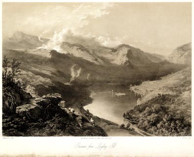 click to enlarge click to enlargePYN217.jpg "PAINTED BY J. B. PYNE. / W. GAUCI LITH. / MANCHESTER, PUBLISHED BY THOMAS AGNEW & SONS, 1853. / Grasmere, from Loughrigg Fell. / M & N HANHART IMPT." item:- Armitt Library : A6678.18 Image © see bottom of page |
|||||||||||||||||||||||||
|
|
||||||||||||||||||||||||||
| evidence:- | old print:- Pyne 1853 placename:- Grasmere |
|||||||||||||||||||||||||
| source data:- | Print, coloured lithograph, Grasmere, from Loughrigg Fell, Westmorland, by James Baker
Pyne, engraved by W Gauci, published by Thomas Agnew and Sons, Manchester, Lancashire,
1853. click to enlarge click to enlargePYN417.jpg item:- Armitt Library : A6677.18 Image © see bottom of page |
|||||||||||||||||||||||||
|
|
||||||||||||||||||||||||||
| evidence:- | outline view, old text:- Martineau 1855 |
|||||||||||||||||||||||||
| source data:- | Plate, opposite p.49 in A Complete Guide to the English Lakes, by Harriet Martineau. goto source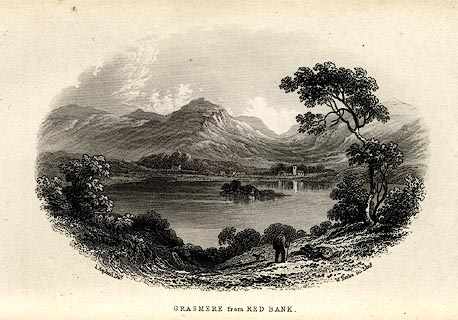 click to enlarge click to enlargeMNU107.jpg Print, engraving, Grasmere from Red Bank, drawn by L Aspland, engraved by W Banks, Edinburgh, published by John Garnett, Windermere, Westmorland, and by Whittaker and Co, London, 1855. "L Aspland Delt. / W Banks Sc Edinr. / GRASMERE from RED BANK." item:- Armitt Library : A1159.7 Image © see bottom of page |
|||||||||||||||||||||||||
|
|
||||||||||||||||||||||||||
| evidence:- | old text:- Martineau 1855 item:- depth, Grasmere lake |
|||||||||||||||||||||||||
| source data:- | Guide book, A Complete Guide to the English Lakes, by Harriet
Martineau, published by John Garnett, Windermere, Westmorland,
and by Whittaker and Co, London, 1855; published 1855-76. goto source Page 180:- "A TABLE OF THE LENGTH, BREADTH, AND DEPTH OF THE LAKES." "No. : Names of Lakes. : Counties : Length in Miles. : Extreme breadth in Miles : Extreme depth in Feet : Height above the Sea" "3 : Grasmere : Westmorland : 1¾ : [⅓] : 180 : 180" |
|||||||||||||||||||||||||
|
|
||||||||||||||||||||||||||
| evidence:- | old print:- Payn 1867 placename:- Grass Mere |
|||||||||||||||||||||||||
| source data:- | Print, uncoloured engraving, Grass Mere, Westmorland, by T L Aspland, published by
J Garnett, Windermere, Westmorland, 1867.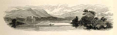 click to enlarge click to enlargePN0318.jpg On p.35 of The Lakes in Sunshine, text by James Payn. item:- Fell and Rock Climbing Club : 184.18 Image © see bottom of page |
|||||||||||||||||||||||||
|
|
||||||||||||||||||||||||||
| evidence:- | old photograph:- Payn 1867 placename:- Grasmere |
|||||||||||||||||||||||||
| source data:- | Photograph, sepia, Grassmere, from Dale End, Westmorland, by Garnett and Sproat, published
by J Garnett, Windermere, Westmorland, 1867.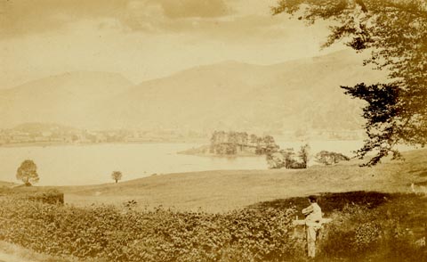 click to enlarge click to enlargePN0345.jpg Tipped in opposite p.83 of The Lakes in Sunshine, text by James Payn. printed at bottom:- "GRASSMERE, FROM DALE END." item:- Fell and Rock Climbing Club : 184.45 Image © see bottom of page |
|||||||||||||||||||||||||
|
|
||||||||||||||||||||||||||
| evidence:- | old map:- Jenkinson 1875 map1 placename:- |
|||||||||||||||||||||||||
| source data:- | Map, Windermere Section, Westmorland and Lancashire, ?colour
lithograph, scale about 1 mile to 1 inch, by Stanford's
Geographical Establishment, published by Edward Stanford, 55
Charing Cross, London, 1875.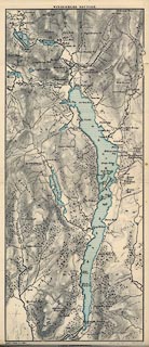 click to enlarge click to enlargeJK04.jpg item:- JandMN : 28.3 Image © see bottom of page |
|||||||||||||||||||||||||
|
|
||||||||||||||||||||||||||
| evidence:- | old print:- Walton 1876 placename:- Grasmere |
|||||||||||||||||||||||||
| source data:- | Print, colour lithograph, Grasmere, Westmorland, from a painting by Elijah Walton,
published by W M Thompson, 20 Cockspur Street, Pall Mall, and Burlington Gallery,
Piccadilly, London, 1876. click to enlarge click to enlargeWLT311.jpg Plate 11 in English Lake Scenery, with a description by T G Bonney. item:- JandMN : 469.11 Image © see bottom of page |
|||||||||||||||||||||||||
|
|
||||||||||||||||||||||||||
| evidence:- | old print:- Nelson 1853 (edn 1880s) placename:- Grasmere |
|||||||||||||||||||||||||
| source data:- | Print, chromolithograph, Grasmere, Westmorland, published by Thomas Nelson and Sons,
London, 1880s? click to enlarge click to enlargeNS0326.jpg At the end of Views of the English Lakes, and Tourists Guide to the English Lakes. printed at bottom:- "GRASMERE" item:- JandMN : 474.27 Image © see bottom of page |
|||||||||||||||||||||||||
|
|
||||||||||||||||||||||||||
| evidence:- | old photograph:- Bell 1880s-1940s |
|||||||||||||||||||||||||
| source data:- | Photograph, black and white, Grasmere, Westmorland, by Herbert Bell, photographer,
Ambleside, Westmorland, 1890s? click to enlarge click to enlargeHB0949.jpg internegative at lower left:- "H. Bell" item:- Armitt Library : 1958.4251 Image © see bottom of page |
|||||||||||||||||||||||||
|
|
||||||||||||||||||||||||||
| evidence:- | old photograph:- Bell 1880s-1940s |
|||||||||||||||||||||||||
| source data:- | Photograph, sepia, Grasmere lake looking towards Dunmail Raise, Grasmere, Westmorland,
by Herbert Bell, photographer, Ambleside, Westmorland, 1890s. click to enlarge click to enlargeHB0913.jpg internegative at lower left:- "H. Bell" item:- Armitt Library : ALPS588 Image © see bottom of page |
|||||||||||||||||||||||||
|
|
||||||||||||||||||||||||||
| evidence:- | old photograph:- Bell 1880s-1940s |
|||||||||||||||||||||||||
| source data:- | Photograph, sepia, Grasmere village and lake from Hunting Stile, Grasmere, Westmorland,
by Herbert Bell, photographer, Ambleside, Westmorland, 1890s.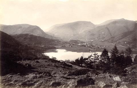 click to enlarge click to enlargeHB0869.jpg internegative at lower left:- "H. Bell" item:- Armitt Library : ALPS540 Image © see bottom of page |
|||||||||||||||||||||||||
|
|
||||||||||||||||||||||||||
| evidence:- | old photograph:- Bell 1880s-1940s |
|||||||||||||||||||||||||
| source data:- | Photograph, black and white, Grasmere lake, Westmorland, by Herbert Bell, photographer,
Ambleside, Westmorland, 1890s. click to enlarge click to enlargeHB0564.jpg stamped on reverse:- "HERBERT BELL / Photographer / AMBLESIDE" item:- Armitt Library : ALPS224 Image © see bottom of page |
|||||||||||||||||||||||||
|
|
||||||||||||||||||||||||||
| evidence:- | old photograph:- Bell 1880s-1940s |
|||||||||||||||||||||||||
| source data:- | Photograph, sepia, Grasmere, from the old road, Westmorland, by Herbert Bell, photographer,
Ambleside, Westmorland, 1890s. click to enlarge click to enlargeHB0563.jpg internegative at lower left:- "H. Bell" item:- Armitt Library : ALPS223 Image © see bottom of page |
|||||||||||||||||||||||||
|
|
||||||||||||||||||||||||||
| evidence:- | old photograph:- Bell 1880s-1940s |
|||||||||||||||||||||||||
| source data:- | Photograph, black and white, Grasmere lake, from Red Bank, Westmorland, by Herbert
Bell, photographer, Ambleside, Westmorland, 1890s. click to enlarge click to enlargeHB0562.jpg stamped on reverse:- "HERBERT BELL / Photographer / AMBLESIDE" item:- Armitt Library : ALPS222 Image © see bottom of page |
|||||||||||||||||||||||||
|
|
||||||||||||||||||||||||||
| evidence:- | old photograph:- Bell 1880s-1940s |
|||||||||||||||||||||||||
| source data:- | Photograph, black and white, Grasmere lake, from Loughrigg Terrace, Westmorland, by
Herbert Bell, photographer, Ambleside, Westmorland, 1890s. click to enlarge click to enlargeHB0561.jpg item:- Armitt Library : ALPS221 Image © see bottom of page |
|||||||||||||||||||||||||
|
|
||||||||||||||||||||||||||
| evidence:- | old photograph:- Bell 1880s-1940s |
|||||||||||||||||||||||||
| source data:- | Photograph, black and white, Grasmere lake, from Huntingstile, Westmorland, by Herbert
Bell, photographer, Ambleside, Westmorland, 1890s.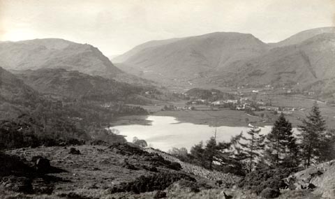 click to enlarge click to enlargeHB0560.jpg stamped on reverse:- "HERBERT BELL / Photographer / AMBLESIDE" item:- Armitt Library : ALPS220 Image © see bottom of page |
|||||||||||||||||||||||||
|
|
||||||||||||||||||||||||||
| evidence:- | old photograph:- Bell 1880s-1940s |
|||||||||||||||||||||||||
| source data:- | Photograph, b/w, Grasmere lake, Dunmail Raise, etc, Grasmere, Westmorland, by Herbert
Bell, Ambleside, Westmorland, 1890s?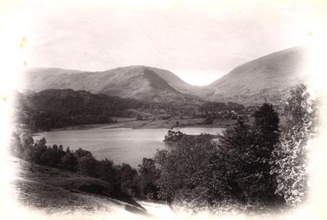 click to enlarge click to enlargeHB0281.jpg item:- Armitt Library : ALPS638 Image © see bottom of page |
|||||||||||||||||||||||||
|
|
||||||||||||||||||||||||||
| evidence:- | old photograph:- Bell 1880s-1940s |
|||||||||||||||||||||||||
| source data:- | Photograph, b/w, Grasmere lake, Westmorland, by Herbert Bell, Ambleside, Westmorland,
1890s?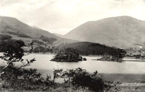 click to enlarge click to enlargeHB0283.jpg item:- Armitt Library : ALPS640 Image © see bottom of page |
|||||||||||||||||||||||||
|
|
||||||||||||||||||||||||||
| evidence:- | old photograph:- Bell 1880s-1940s item:- cattle; landing stage; rowing boat |
|||||||||||||||||||||||||
| source data:- | Photograph, b/w, Grasmere lake, Grasmere, Westmorland, by Herbert Bell, Ambleside,
Westmorland, 1890s?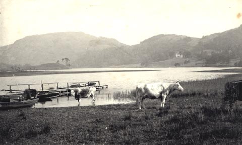 click to enlarge click to enlargeHB0316.jpg item:- Armitt Library : ALPS675 Image © see bottom of page |
|||||||||||||||||||||||||
|
|
||||||||||||||||||||||||||
| evidence:- | old photograph:- Bell 1880s-1940s item:- cattle; boat house |
|||||||||||||||||||||||||
| source data:- | Photograph, b/w, Grasmere lake, Grasmere, Westmorland, by Herbert Bell, Ambleside,
Westmorland, 1890s?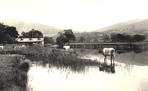 click to enlarge click to enlargeHB0317.jpg item:- Armitt Library : ALPS676 Image © see bottom of page |
|||||||||||||||||||||||||
|
|
||||||||||||||||||||||||||
| evidence:- | old print:- Bemrose 1881 placename:- Grasmere |
|||||||||||||||||||||||||
| source data:- | Print, uncoloured, Grasmere from Town End, Westmorland, published by Bemrose and Sons,
23 Old Bailey, London and Derby, by A B Moss, Carlisle, Cumberland, and by T Wilson,
Kendal, Westmorland, about 1881.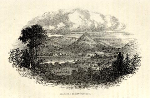 click to enlarge click to enlargeBEM116.jpg Tipped in opposite p.57 of a Handy Guide to the English Lakes and Shap Spa. printed at bottom:- "GRASMERE FROM TOWN END." item:- JandMN : 455.18 Image © see bottom of page |
|||||||||||||||||||||||||
|
|
||||||||||||||||||||||||||
| evidence:- | old map:- Pearson 1900s map (Win/Ryd/Gra) placename:- Grasmere |
|||||||||||||||||||||||||
| source data:- | Map, lithograph, From Windermere to Rydal Water and Grasmere,
Westmorland, published by C Arthur Pearson, Henrietta Street,
London, 1900s.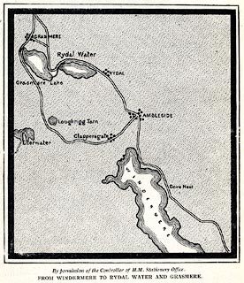 click to enlarge click to enlargePSN1M2.jpg On p.xxviii of Pearson's Gossipy Guide to the English Lakes and Neighbouring Districts. printed at bottom:- "By permission of the Controller of H.M. Stationery Office. / FROM WINDERMERE TO RYDAL WATER AND GRASMERE." item:- Armitt Library : A1188.4 Image © see bottom of page |
|||||||||||||||||||||||||
|
|
||||||||||||||||||||||||||
| evidence:- | old print:- Bradley 1901 placename:- Grasmere |
|||||||||||||||||||||||||
| source data:- | Print, uncoloured lithograph, Grasmere Looking towards Dunmail Raise, Westmorland,
by Joseph Pennell, published by Macmillan and Co, London, 1901.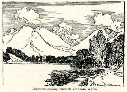 click to enlarge click to enlargeBRL159.jpg On page 231 of Highways and Byways in the Lake District, by A G Bradley. printed at bottom:- "Grasmere Looking towards Dunmail Raise." item:- JandMN : 464.59 Image © see bottom of page |
|||||||||||||||||||||||||
|
|
||||||||||||||||||||||||||
| evidence:- | old print:- Brabant 1902 placename:- Grasmere |
|||||||||||||||||||||||||
| source data:- | Print, uncoloured lithograph, Grasmere from Red Bank, Westmorland, by Edmund H New,
published by Methuen and Co, 36 Essex Street, Strand, London, 1902.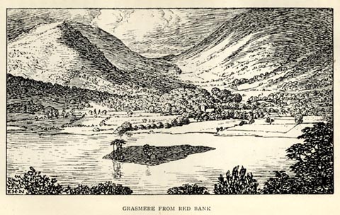 click to enlarge click to enlargeBBT106.jpg Tipped in opposite p.142 of The English Lakes, by F G Brabant. printed at bottom left:- "E. H. N" printed at bottom:- "GRASMERE FROM RED BANK" item:- JandMN : 502.11 Image © see bottom of page |
|||||||||||||||||||||||||
|
|
||||||||||||||||||||||||||
| evidence:- | old map:- Green 1902 placename:- Grasmere |
|||||||||||||||||||||||||
| source data:- | Map, hand coloured? lithograph, Bathymetrical Survey of Grasmere
Lake, scale about 25 ins to 1 mile, by T A Green, Grasmere,
Westmorland, 1902. "BATHYMETRIC SURVEY OF GRASMERE LAKE" 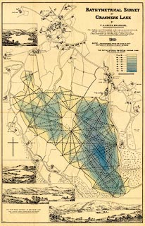 click to enlarge click to enlargeM084.jpg item:- Armitt Library : 1959.195 Image © see bottom of page |
|||||||||||||||||||||||||
|
|
||||||||||||||||||||||||||
| evidence:- | old map:- Green 1902 placename:- Grasmere |
|||||||||||||||||||||||||
| source data:- | Map, hand coloured? lithograph, Bathymetrical Survey of Grasmere
Lake, scale about 25 ins to 1 mile, by T A Green, Grasmere,
Westmorland, 1902.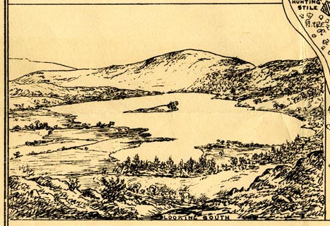 click to enlarge click to enlargeM084Vgn1.jpg "LOOKING SOUTH" item:- Armitt Library : 1959.195 Image © see bottom of page |
|||||||||||||||||||||||||
|
|
||||||||||||||||||||||||||
| evidence:- | old map:- Green 1902 placename:- Grasmere |
|||||||||||||||||||||||||
| source data:- | Map, hand coloured? lithograph, Bathymetrical Survey of Grasmere
Lake, scale about 25 ins to 1 mile, by T A Green, Grasmere,
Westmorland, 1902.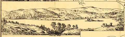 click to enlarge click to enlargeM084Vgn2.jpg "LOOKING WEST" item:- Armitt Library : 1959.195 Image © see bottom of page |
|||||||||||||||||||||||||
|
|
||||||||||||||||||||||||||
| evidence:- | old map:- Green 1902 placename:- Grasmere |
|||||||||||||||||||||||||
| source data:- | Map, hand coloured? lithograph, Bathymetrical Survey of Grasmere
Lake, scale about 25 ins to 1 mile, by T A Green, Grasmere,
Westmorland, 1902. click to enlarge click to enlargeM084Vgn3.jpg "LOOKING EAST" item:- Armitt Library : 1959.195 Image © see bottom of page |
|||||||||||||||||||||||||
|
|
||||||||||||||||||||||||||
| evidence:- | old map:- Green 1902 placename:- Grasmere |
|||||||||||||||||||||||||
| source data:- | Map, hand coloured? lithograph, Bathymetrical Survey of Grasmere
Lake, scale about 25 ins to 1 mile, by T A Green, Grasmere,
Westmorland, 1902.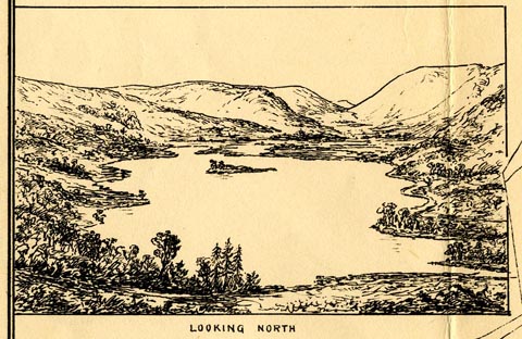 click to enlarge click to enlargeM084Vgn4.jpg "LOOKING NORTH" item:- Armitt Library : 1959.195 Image © see bottom of page |
|||||||||||||||||||||||||
|
|
||||||||||||||||||||||||||
| evidence:- | old print:- Heaton Cooper 1905 (edn 1908) placename:- Grasmere |
|||||||||||||||||||||||||
| source data:- | Print, colour halftone, A Glimpse of Grasmere, evening sun, Westmorland, from a watercolour
painting by Alfred Heaton Cooper, published by Adam and Charles Black, London, 2nd
edn 1908.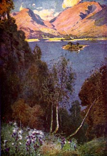 click to enlarge click to enlargeHC0109.jpg Opposite p.30 of The English Lakes, painted by Alfred Heaton Cooper, described by William T Palmer. printed at tissue opposite the print:- "A GLIMPSE OF GRASMERE / Evening sun" printed at signed lower right:- "[A HEATON COOPER]" item:- JandMN : 468.9 Image © see bottom of page |
|||||||||||||||||||||||||
|
|
||||||||||||||||||||||||||
| evidence:- | text:- Mason 1907 (edn 1930) |
|||||||||||||||||||||||||
| source data:- | Text book, The Ambleside Geography Books bk.III, The Counties of
England, by Charlotte M Mason, published by Kegan Paul, Trench,
Trubner and Co, Broadway House, 68-74 Carter Lane, and the
Parents' Educational Union Office, 26 Victoria Street, London,
edn 1930. MSN1P020.txt Page 20:- "..." "... on by Grasmere, which lies at the foot of Silver How. It is another lovely mere, larger than Rydal, set in a soft green vale, hemmed in by rugged mountains. ..." |
|||||||||||||||||||||||||
|
|
||||||||||||||||||||||||||
| evidence:- | old map:- Postlethwaite 1877 (3rd edn 1913) placename:- Grasmere |
|||||||||||||||||||||||||
| source data:- | Map, uncoloured engraving, Map of the Lake District Mining Field, Westmorland, Cumberland,
Lancashire, scale about 5 miles to 1 inch, by John Postlethwaite, published by W H
Moss and Sons, 13 Lowther Street, Whitehaven, Cumberland, 1877 edn 1913.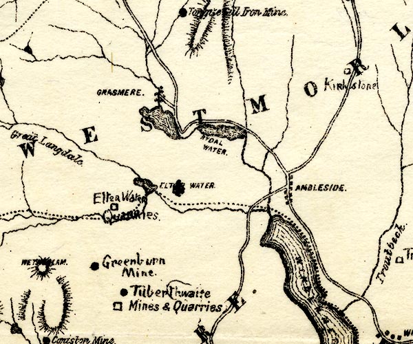 PST2NY30.jpg "GRASMERE" lake item:- JandMN : 162.2 Image © see bottom of page |
|||||||||||||||||||||||||
|
|
||||||||||||||||||||||||||
| evidence:- | old print:- Reynolds 1915 placename:- Grasmere |
|||||||||||||||||||||||||
| source data:- | Print, colour halftone, Grasmere, Evening Sun, Westmorland, from a painting by Alfred
Heaton Cooper, published by Adam and Charles Black, London, 1915. click to enlarge click to enlargeREY603.jpg "A HEATON COOPER" "GRASMERE - EVENING SUN" item:- JandMN : 1071.3 Image © see bottom of page |
|||||||||||||||||||||||||
|
|
||||||||||||||||||||||||||
| evidence:- | old text:- Burrow 1920s placename:- |
|||||||||||||||||||||||||
| source data:- | Road book, strip maps with parts in Westmorland, Cumberland etc,
irregular scales about 1.5 miles to 1 inch, by E J Burrow and
Co, Cheltenham, Gloucestershire, 1920s. "... [the road] almost immediately touching Grasmere Lake with wonderful views across to the mountains beyond. At the northern end of the lake is Grasmere village, ..." |
|||||||||||||||||||||||||
|
|
||||||||||||||||||||||||||
| evidence:- | old photograph:- Photochrom 1930s placename:- Grasmere |
|||||||||||||||||||||||||
| source data:- | Photograph, black and white halftone print, Grasmere, from Red Bank, Westmorland,
published by Photochrom Co, Tunbridge Wells, Kent, 1930s? click to enlarge click to enlargePCH113.jpg printed, "Grasmere, from Red Bank. / ..." item:- JandMN : 1015.13 Image © see bottom of page |
|||||||||||||||||||||||||
|
|
||||||||||||||||||||||||||
| evidence:- | old print:- Pearson 1900s placename:- Grasmere |
|||||||||||||||||||||||||
| source data:- | Print, halftone photograph, Grasmere, from near Red Bank, Westmorland, published by
C Arthur Pearson, Henrietta Street, London, 1900s.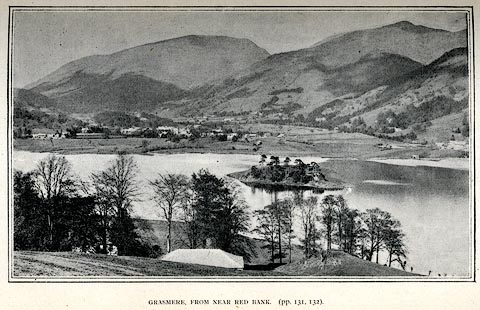 click to enlarge click to enlargePS1E49.jpg On p.133 of Pearson's Gossipy Guide to the English Lakes and Neighbouring Districts. printed at bottom:- "GRASMERE, FROM NEAR RED BANK. (pp.131, 132)." item:- Armitt Library : A1188.56 Image © see bottom of page |
|||||||||||||||||||||||||
|
|
||||||||||||||||||||||||||
| evidence:- | old print:- Pearson 1900s placename:- Grasmere |
|||||||||||||||||||||||||
| source data:- | Print, halftone photograph, Grasmere, from the Prince of Wales Hotel, Westmorland,
published by C Arthur Pearson, Henrietta Street, London, 1900s.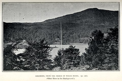 click to enlarge click to enlargePS1E25.jpg On p.57 of Pearson's Gossipy Guide to the English Lakes and Neighbouring Districts. printed at bottom:- "GRASMERE, FROM THE PRINCE OF WALES HOTEL (p.136). / (Silver How in the Background.)" item:- Armitt Library : A1188.32 Image © see bottom of page |
|||||||||||||||||||||||||
|
|
||||||||||||||||||||||||||
| evidence:- | old print:- Pearson 1900s placename:- Grasmere lake item:- boat; rowing boat |
|||||||||||||||||||||||||
| source data:- | Print, halftone photograph, Boats on Grasmere, Westmorland, published by C Arthur
Pearson, Henrietta Street, London, 1900s.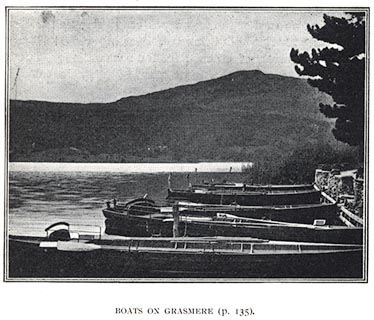 click to enlarge click to enlargePS1E14.jpg On p.27 of Pearson's Gossipy Guide to the English Lakes and Neighbouring Districts. printed at bottom:- "BOATS ON GRASMERE. (p.135)." item:- Armitt Library : A1188.21 Image © see bottom of page |
|||||||||||||||||||||||||
|
|
||||||||||||||||||||||||||
| evidence:- | old advertisement:- Jenkinson 1875 B |
|||||||||||||||||||||||||
| source data:- | Advertisement for Edward Brown, Prince of Wales Lake Hotel, Grasmere, Westmorland,
published by Edward Stanford, 55 Charing Cross, London, 1875 edn 1884?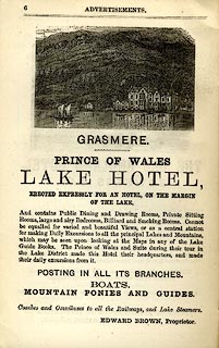 click to enlarge click to enlargeJK1202.jpg Adverts p.6 at the back of Jenkinson's Smaller Practical Guide to Carlisle, Gilsland, Roman Wall and Neighbourhood. item:- Armitt Library : A1717.3 Image © see bottom of page |
|||||||||||||||||||||||||
|
|
||||||||||||||||||||||||||
| evidence:- | old print:- Payn 1860s-70s placename:- Grasmere |
|||||||||||||||||||||||||
| source data:- | Print, colour printed, Grasmere, from the Wishing Gate, Westmorland, published by
John Garnett, Windermere, Westmorland, and by Simpkin, Marshall and Co, London, 1860s-70s?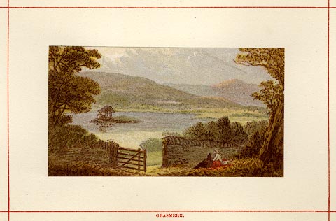 click to enlarge click to enlargePN0108.jpg Tipped in opposite p.37 of England's Lakeland, a Tour Therein, by James Payn. printed at bottom:- "GRASMERE." item:- Armitt Library : A1183.8 Image © see bottom of page |
|||||||||||||||||||||||||
|
|
||||||||||||||||||||||||||
| evidence:- | old print:- Sylvan 1847 placename:- Grasmere Lake |
|||||||||||||||||||||||||
| source data:- | Print, engraving, Grasmere Lake, Westmorland, published by John Johnstone, Paternoster
Row, London, et al, 1847.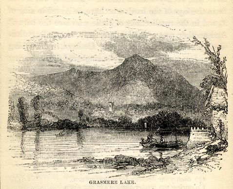 click to enlarge click to enlargeSYL117.jpg On p.54 of Sylvan's Pictorial Guide to the English Lakes. printed at bottom:- "GRASMERE LAKE." item:- Armitt Library : A1201.17 Image © see bottom of page |
|||||||||||||||||||||||||
|
|
||||||||||||||||||||||||||
| evidence:- | outline view:- Tattersall 1836 (version 1869) placename:- Grasmere |
|||||||||||||||||||||||||
| source data:- | Print, hand coloured, Grasmere, from Loughrigg Fell, Westmorland, drawn by George
Tattersall, 1836, engraved by W F Topham, published by T J Allman, 463 Oxford Street,
London, 1869.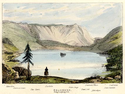 click to enlarge click to enlargeTAT205.jpg Included in The Lakes of England, by W F Topham. printed at bottom:- "GRASMERE, / from Loughrigg Fell." printed at bottom:- "Silver How. / Hammar Scarr. / The Carrs. / Easdale. / Helm Crag. / Steel Fell. / Dunmail Hause. / Helvellyn. / Seat Sandal. / Fairfield." item:- Armitt Library : A1067.5 Image © see bottom of page |
|||||||||||||||||||||||||
|
|
||||||||||||||||||||||||||
| evidence:- | outline view:- Tattersall 1836 placename:- Grasmere |
|||||||||||||||||||||||||
| source data:- | Print, engraving, Grasmere, Westmorland, drawn by George Tattersall, engraved by W
F Topham, published by Sherwood and Co, Paternoster Row, London, about 1836. click to enlarge click to enlargeTAT110.jpg The print is captioned with mountain names and acts as an outline view. Tipped in opposite p.43 of The Lakes of England, by George Tattersall. printed at bottom:- "GRASMERE." printed at bottom left to right:- "Silver How. / Hammar Scarr. / The Carrs. / Easdale. / Helm Crag. / Steel Fell. / Dunmail Raise. / Helvellyn. / Seat Sandal. / Fairfield." item:- Armitt Library : A1204.11 Image © see bottom of page |
|||||||||||||||||||||||||
|
|
||||||||||||||||||||||||||
| evidence:- | old print:- Green 1819 placename:- Grasmere |
|||||||||||||||||||||||||
| source data:- | Print, aquatint, Grasmere, Westmorland, by William Green, 1819, published by R Lough
and Co, Chronicle Office, Finkle Street, Kendal, and others, 1820. click to enlarge click to enlargeGN0105.jpg Tipped in opposite vol.1 p.263 of The Tourist's New Guide, by William Green. printed at bottom right, centre:- "Vol.I, page 263, line 24. / GRASMERE. / Published at Ambleside, Augt. 1. 1819., by Wm. Green." item:- Armitt Library : A1141.6 Image © see bottom of page |
|||||||||||||||||||||||||
|
|
||||||||||||||||||||||||||
| evidence:- | old print:- Robertson 1911 placename:- Grasmere Lake |
|||||||||||||||||||||||||
| source data:- | Print, lithograph? Grasmere Lake, from a watercolour by Arthur Tucker, published by
Chatto and Windus, London, 1911. click to enlarge click to enlargeRSN135.jpg Tipped in opposite p.218 of Wordsworthshire by Eric Robertson. printed at bottom:- "GRASMERE" signed at painting lower left:- "Arthur Tucker" item:- JandMN : 197.37 Image © see bottom of page |
|||||||||||||||||||||||||
|
|
||||||||||||||||||||||||||
| evidence:- | old print:- placename:- Grasmere |
|||||||||||||||||||||||||
| source data:- | Print, chromolithograph, Grasmere, Westmorland, published by T Nelson and Sons, London,
1900s? click to enlarge click to enlargePR0162.jpg From a set of prints, The Scenery of the English Lakes printed at lower right:- "T. NELSON &SONS" printed at bottom left:- "GRASMERE" item:- Dove Cottage : 2008.107.162 Image © see bottom of page |
|||||||||||||||||||||||||
|
|
||||||||||||||||||||||||||
| evidence:- | old print:- Bogg 1898 |
|||||||||||||||||||||||||
| source data:- | Print, engraving, Grasmere lake, from Red Bank, Grasmere, Lakes, Westmorland, by Gilbert
Foster, published by Edmund Bogg, 3 Woodhouse Lane, and James Miles, Guildford Street,
Leeds, Yorkshire, 1898.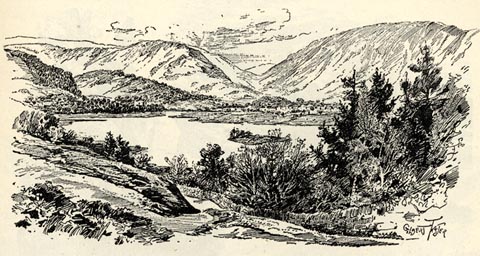 click to enlarge click to enlargeBGG165.jpg Included on p.181 of Lakeland and Ribblesdale, by Edmund Bogg. item:- JandMN : 231.65 Image © see bottom of page |
|||||||||||||||||||||||||
|
|
||||||||||||||||||||||||||
| evidence:- | old print:- placename:- Grasmere |
|||||||||||||||||||||||||
| source data:- | Print, uncoloured engraving, Grasmere, Westmorland, published late 19th century?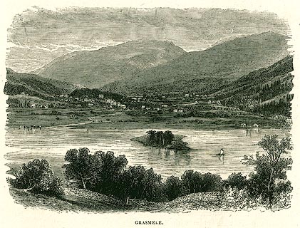 click to enlarge click to enlargePR0333.jpg On page 155 of The English Lakes. printed at bottom:- "GRASMERE." item:- Dove Cottage : 2008.107.333 Image © see bottom of page |
|||||||||||||||||||||||||
|
|
||||||||||||||||||||||||||
| evidence:- | old print:- Religious Tract Society 1860s placename:- Grasmere |
|||||||||||||||||||||||||
| source data:- | Print, engraving, Grasmere, published by the Religious Tract Society, London, 1860s?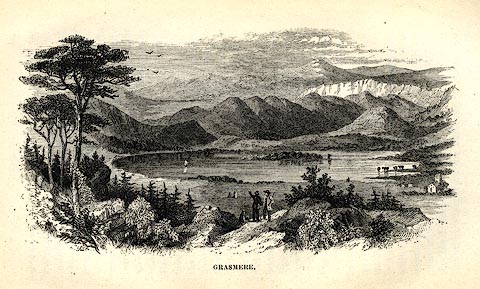 click to enlarge click to enlargeRL01E2.jpg Tipped in opp.p.34 in How To See the English Lakes. printed at bottom:- "GRASMERE." item:- Armitt Library : A1150.3 Image © see bottom of page |
|||||||||||||||||||||||||
|
|
||||||||||||||||||||||||||
| evidence:- | old print:- placename:- Grasmere |
|||||||||||||||||||||||||
| source data:- | Print, uncoloured engraving, Grasmere, from Dunmail Raise, Westmorland, drawn by Dastin?
published late 19th century?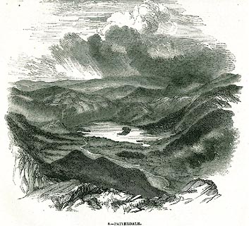 click to enlarge click to enlargePR0346.jpg On a page of The Land We Live In. printed at lower left:- "[ D]ASTIN" printed at bottom:- "9.- GRASMERE, FROM DUNMAIL RAISE. DERWENT WATER AND CONISTON IN THE DISTANCE." item:- Dove Cottage : 2008.107.346 Image © see bottom of page |
|||||||||||||||||||||||||
|
|
||||||||||||||||||||||||||
| evidence:- | outline view:- Nelson 1859 placename:- Grasmere |
|||||||||||||||||||||||||
| source data:- | Print, engraving, Grasmere from Loughrigg Terrace, drawn by Keeley Halswelle, Edinburgh,
published by T Nelson and Sons, Paternoster Row, London, and Edinburgh and New York,
United States, 1859.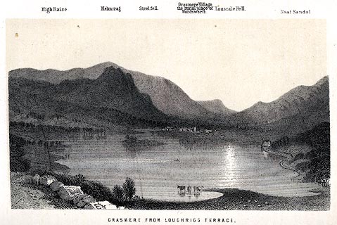 click to enlarge click to enlargeNS0105.jpg Mountains are labelled along the top of the picture, making this an outline view. Tipped in oppposite p.198 of a guide book, The English Lakes. printed at bottom:- "GRASMERE FROM LOUGHRIGG TERRACE." item:- JandMN : 336.6 Image © see bottom of page |
|||||||||||||||||||||||||
|
|
||||||||||||||||||||||||||
| evidence:- | old print:- Pyne 1853 placename:- Grasmere |
|||||||||||||||||||||||||
| source data:- | Grasmere from Loughrigg Fell drawn by James Barker Pyne, 1848-1853, lithographed by
T Picken, 1859.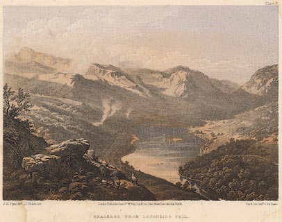 click to enlarge click to enlargePY08.jpg "Grasmere from Loughrigg Fell" item:- JandMN : 97.9 Image © see bottom of page |
|||||||||||||||||||||||||
|
|
||||||||||||||||||||||||||
| evidence:- | old print:- Garnett 1850s-60s F |
|||||||||||||||||||||||||
| source data:- | Print, uncoloured engraving, Grasmere from Red Bank, Westmorland, drawn by L Aspland,
engraved by William Banks, Edinburgh, published by John Garnett, Windermere, Westmorland,
1850s-60s?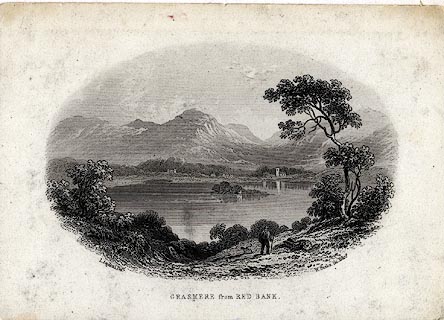 click to enlarge click to enlargeGAR718.jpg Found with Views of the English Lakes. printed at bottom:- "L. Aspland Delt. / GRASMERE from RED BANK. / W. Banks Sc. Edinr." item:- JandMN : 165.18 Image © see bottom of page |
|||||||||||||||||||||||||
|
|
||||||||||||||||||||||||||
| evidence:- | old map:- Hudson 1842 (4th edn 1853) |
|||||||||||||||||||||||||
| source data:- | Map, uncoloured engraving, Eight Miles round Grasmere, engraved
by W Banks, Edinburgh, published by John Hudson, Kendal,
Westmorland, 1853.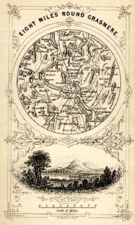 click to enlarge click to enlargeHUD1M1.jpg Map, uncoloured engraving, Eight Miles round Grasmere, engraved by W Banks, Edinburgh, published by John Hudson, Kendal, Westmorland, 1853. Circular map, with a vignette view of Grasmere lake and Helm Crag below. Tipped in opp p.58 in A Complete Guide to the Lakes, edited John Hudson. printed at top:- "EIGHT MILES ROUND GRASMERE." printed at bottom:- "W. Banks, sc. Edinr." item:- JandMN : 327.4 Image © see bottom of page |
|||||||||||||||||||||||||
|
|
||||||||||||||||||||||||||
| evidence:- | old print:- Harwood 1842 |
|||||||||||||||||||||||||
| source data:- | Print, uncoloured engraving, Grasmere, Westmorland, engraved and published by John
Harwood, 26 Fenchurch Street, London, 1845. click to enlarge click to enlargeHRW206.jpg printed at bottom left, right, centre:- "London, J. Harwood, 26, Fenchurch Street. / No.599. Aug. 6, 1845. / Grasmere." item:- JandMN : 166.6 Image © see bottom of page |
|||||||||||||||||||||||||
|
|
||||||||||||||||||||||||||
| evidence:- | old print:- placename:- Grasmere |
|||||||||||||||||||||||||
| source data:- | Print, uncoloured engraving, Grassmere from the Raise Gap, Westmorland, drawn by W
Westall, published by Edward Moxon, Dover Street, London, 1840.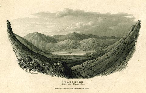 click to enlarge click to enlargePR0158.jpg printed at bottom left, centre:- "W. Westall, ARA. delt. / GRASSMERE, / from the Raise Gap. / London. Edwd. Moxon, Dover Street, 1840." item:- Dove Cottage : 2008.107.158 Image © see bottom of page |
|||||||||||||||||||||||||
|
|
||||||||||||||||||||||||||
| evidence:- | old print:- Rose 1832-35 (vol.3 no.42) placename:- Grasmere |
|||||||||||||||||||||||||
| source data:- | Print, uncoloured engraving, Rydal Water and Grassmere, from Rydal Park, Westmorland,
by George Pickering, engraved by W J Cooke, published by Fisher, Son and Co, London,
1835.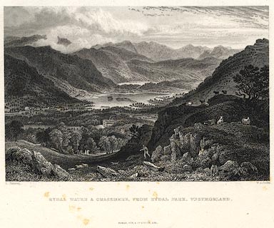 click to enlarge click to enlargePR0423.jpg Originally vol.3 no.42 in Westmorland, Cumberland, Durham and Northumberland Illustrated. printed at bottom left, right, centre:- "G. Pickering. / W. J. Cooke. / RYDAL WATER & GRASSMERE, FROM RYDAL PARK, WESTMORLAND. / FISHER, SON &Co. LONDON, 1835." item:- Dove Cottage : 2008.107.416 Image © see bottom of page |
|||||||||||||||||||||||||
|
|
||||||||||||||||||||||||||
| evidence:- | old print:- Rose 1832-35 (vol.3 no.13) placename:- Grasmere |
|||||||||||||||||||||||||
| source data:- | Print, uncoloured engraving, Grassmere from Loughrigg Fell, Westmorland, by George
Pickering, engraved by le Petit, 1835, published by Peter Jackson, London, 1830s.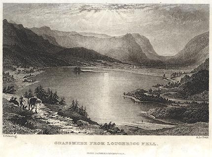 click to enlarge click to enlargePR0363.jpg Opposite p.47 in Westmorland, its Lakes and Mountains Illustrated. printed at bottom, left, right, centre:- "G. Pickering. / A. Le Petit. / GRASSMERE FROM LOUGHRIGG FELL. / PETER JACKSON, LONDON &PARIS." item:- Dove Cottage : 2008.107.363 Image © see bottom of page |
|||||||||||||||||||||||||
|
|
||||||||||||||||||||||||||
| evidence:- | old print:- Rose 1832-35 |
|||||||||||||||||||||||||
| source data:- | Print, engraving, Grasmere from Butler Crags, Westmorland, by Thomas Allom, engraved
by S Lacey, 1833.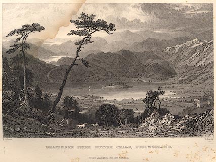 click to enlarge click to enlargeR205.jpg item:- JandMN : 66.53 Image © see bottom of page |
|||||||||||||||||||||||||
|
|
||||||||||||||||||||||||||
| evidence:- | old print:- Rose 1832-35 |
|||||||||||||||||||||||||
| source data:- | Print, engraving, Grasmere Lake and Village, by George
Pickering, engraved by C Mottram,1833. click to enlarge click to enlargeR156.jpg item:- JandMN : 66.12 Image © see bottom of page |
|||||||||||||||||||||||||
|
|
||||||||||||||||||||||||||
| evidence:- | old print with text:- Farington 1789 (plate 5) |
|||||||||||||||||||||||||
| source data:- | Print, engraving, Grasmere, Lakes, Cumbria, painted by Joseph Farington, engraved
by B T Pouncy, published by W Byrne, 69 Titchfield Street, London, 1785.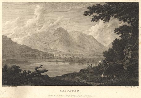 click to enlarge click to enlargeBMZ04.jpg Grasmere lake, Grasmere and St Oswald's Church, and Helm Crag etc, in the background. Plate 5 from Views of the Lakes, &c, in Cumberland and Westmorland, published 1789; with descriptive text:-. "GRASMERE" "LIES about four Miles from Ambleside, near the Road to Keswick. The Vale in which it is situated is about four Miles in Circumference. In the centre of this View, beyond the Lake, stands the Church and Village of Grasmere, above which rises Helme-Crag, of a pyramidal Form, and particularly distinguished by the broken Outline of its Summit. On the Right of this Mountain are Steel-Fell and Seat-Sandle; between them passes the Road leading to Keswick, the highest Point of which, as seen in this View, marks the Situation of Dunmail-Raise, a Heap of Stones, which perpetuate the Name and Fall of the last King of Cumberland, defeated there by the Saxon Monarch, Edmund, about the Year 944. Grasmere contains one Island, and is not of great Extent, but, with its Vale, possesses peculiar Beauty. Enriched with Cultivation, the Vale exhibits a variegated Scene of peaceful Industry, while the lofty Mountains which surround it throw a gentle Shade over the Bosom of this secluded Retreat, which adds to the Air of Stillness and Retirement." item:- Dove Cottage : Lowther.4 Image © see bottom of page |
|||||||||||||||||||||||||
|
|
||||||||||||||||||||||||||
| evidence:- | old print:- placename:- Grasmere Water |
|||||||||||||||||||||||||
| source data:- | Print, uncoloured engraving, Grassmere Water, Westmerland, drawn by S Fenton, engraved
by C Williams, published late 18th century.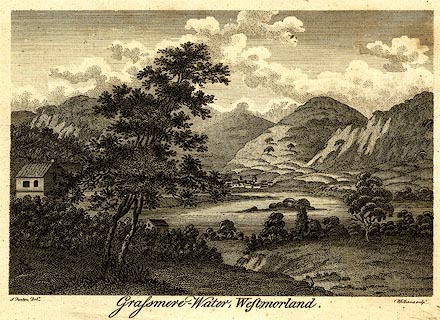 click to enlarge click to enlargePR0281.jpg printed at bottom left, right, centre:- "[S] Fenton Delt. / C. Williams sculpt. / Grassmere-Water, Westmerland." item:- Dove Cottage : 2008.107.281 Image © see bottom of page |
|||||||||||||||||||||||||
|
|
||||||||||||||||||||||||||
| evidence:- | old postcard:- placename:- Grasmere Lake |
|||||||||||||||||||||||||
| source data:- | Postcard, colour photograph, Grasmere lake, Westmorland, published by Sanderson and
Dixon, Ambleside, Westmorland, about 1959.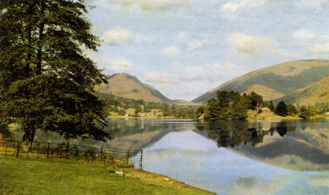 click to enlarge click to enlargePH0113.jpg printed at bottom:- "GRASMERE LAKE SHOWING THE LION AND LAMB" The Lion and Lamb are not distinct. item:- JandMN : 976.5 Image © see bottom of page |
|||||||||||||||||||||||||
|
|
||||||||||||||||||||||||||
| evidence:- | old print:- Gresham Publishing 1900s placename:- Grasmere |
|||||||||||||||||||||||||
| source data:- | Print, colour halftone, Grasmere from Loughrigg, Westmorland, by Ernest W Haslehurst,
published by The Gresham Publishing Co, 66 Chandos Street, London, 1900s?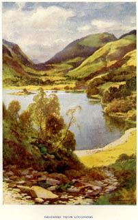 click to enlarge click to enlargePR1562.jpg Tipped in opposite p.16 of The English Lakes section of a volume of Our Beautiful Homeland. printed at bottom:- "GRASMERE FROM LOUGHRIGG" printed at lower right:- "[E. W. HASLEHURST]" item:- JandMN : 381.4 Image © see bottom of page |
|||||||||||||||||||||||||
|
|
||||||||||||||||||||||||||
| evidence:- | old print:- Goodwin 1887 (edn 1890) |
|||||||||||||||||||||||||
| source data:- | Print, etching? The Island, Grasmere, Westmorland, by Harry Goodwin, published by
Swan Sonnenschein and Co, Paternoster Square, London, 1890.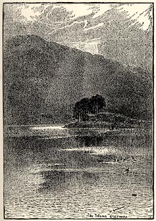 click to enlarge click to enlargePR1588.jpg Tipped in opposite p.82 of Through the Wordsworth Country, by William Knight. printed at lower right of centre:- "H Goodwin / The Island Grasmere" item:- JandMN : 382.18 Image © see bottom of page |
|||||||||||||||||||||||||
|
|
||||||||||||||||||||||||||
| evidence:- | old print:- Goodwin 1887 (edn 1890) placename:- Grasmere |
|||||||||||||||||||||||||
| source data:- | Print, etching? Grasmere, Westmorland, by Harry Goodwin, published by Swan Sonnenschein
and Co, Paternoster Square, London, 1890.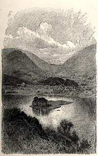 click to enlarge click to enlargePR1583.jpg Tipped in opposite p.52 of Through the Wordsworth Country, by William Knight. printed at lower centre:- "Grasmere" item:- JandMN : 382.13 Image © see bottom of page |
|||||||||||||||||||||||||
|
|
||||||||||||||||||||||||||
| evidence:- | old painting:- |
|||||||||||||||||||||||||
| source data:- | Painting, watercolour, Grasmere Lake, Westmorland, by Edward Arden, 1881-99.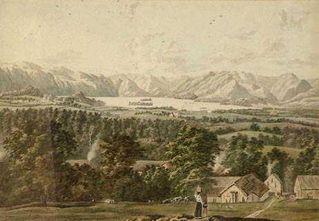 click to enlarge click to enlargePR0930.jpg Distant view of Grasmere from an elevated perspective. A narrow path leads from foreground downhill towards a farm; a woman and child, their backs to the viewer, walk hand in hand towards it. To left of composition lies an ares of woodland amidst the rolling landscape of fields, smoke rising from the buildings which stand amongst the trees. The lake lies in the centre of the composition; beyond it rise barren fells. item:- Tullie House Museum : 1938.93 Image © Tullie House Museum |
|||||||||||||||||||||||||
|
|
||||||||||||||||||||||||||
| evidence:- | old print:- Green 1809 placename:- Grasmere |
|||||||||||||||||||||||||
| source data:- | Print, soft ground etching, Grasmere, Westmorland, by William Green, published by
William Green, Ambleside, Westmorland, and Longman, Hurst, Rees and Orme, Paternoster
Row, London, 1809.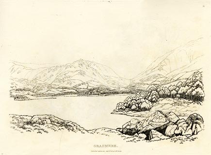 click to enlarge click to enlargeGN0351.jpg Plate 51 in Seventy Eight Studies from Nature. printed in introductory pages to set of prints:- "Number 51. This view of the lake and vale of Grasmere is from the side of Loughrigg Fell, below the road to Langdale Chapel from Ambleside. There is only one island on this lake, but from it there is a fine panorama of the circumjacent country; Helme Crag, a mountain of good figure from some parts of the valley, is seen above the church; beyond which is Steel Fell. Seat Sandal rises high; and at the intersection of the sweeping lines of Steel Fell and Seat Sandal is Dunmail Raise, a considerable heap of stones, dividing Westmoreland and Cumberland; the zigzag line below the raise is part of the road between Keswick and Ambleside." printed at bottom:- "GRASMERE. / Published Ambleside, Augst. 1st. 1809, by W. Green." item:- Armitt Library : A6637.51 Image © see bottom of page |
|||||||||||||||||||||||||
|
|
||||||||||||||||||||||||||
 BPS42.jpg From Loughrigg Terrace. (taken 6.10.2008) 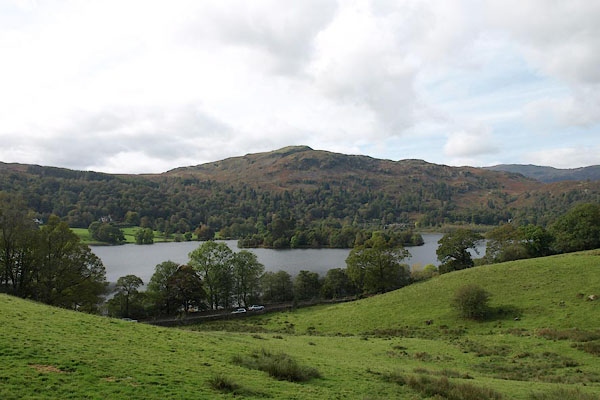 BRR55.jpg From about the Wishing Gate. (taken 7.10.2009) |
||||||||||||||||||||||||||
|
|
||||||||||||||||||||||||||
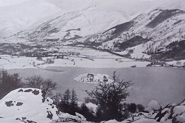 BMW46.jpg Grasmere in winter. |
||||||||||||||||||||||||||
|
|
||||||||||||||||||||||||||
| see:- | viewpoint, Loughrigg Fell Thomas West viewpoint, White Moss Common Thomas West |
|||||||||||||||||||||||||
|
|
||||||||||||||||||||||||||
Lakes Guides menu.