 Old Cumbria Gazetteer
 |
 |
|
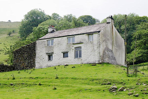
| Hill Cottage, Longsleddale | ||
| Hill Cottage | ||
| civil parish:- | Longsleddale (formerly Westmorland) | |
| county:- | Cumbria | |
| locality type:- | buildings | |
| coordinates:- | NY48850461 | |
| 1Km square:- | NY4804 | |
| 10Km square:- | NY40 | |
|
|
||
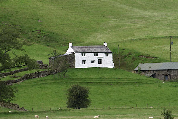 BRI04.jpg (taken 27.8.2009) 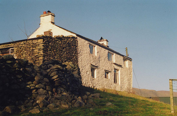 BIG11.jpg (taken 4.12.2003) |
||
|
|
||
| evidence:- | old map:- OS County Series (Wmd 27 7) placename:- Hill House |
|
| source data:- | Maps, County Series maps of Great Britain, scales 6 and 25
inches to 1 mile, published by the Ordnance Survey, Southampton,
Hampshire, from about 1863 to 1948.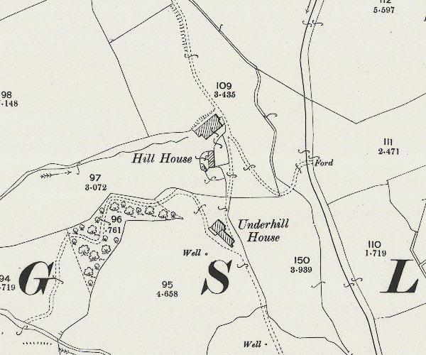 C5E007.jpg "Hill House" |
|
|
|
||
| evidence:- | census returns:- placename:- Hill placename:- Hill, The placename:- Hill House placename:- Hill Cottage |
|
|
|
||
 old parish register (formerly ) old parish register (formerly ) |
||
|
|
||
| evidence:- | old map:- Jefferys 1770 (Wmd) placename:- Hill |
|
| source data:- | Map, 4 sheets, The County of Westmoreland, scale 1 inch to 1
mile, surveyed 1768, and engraved and published by Thomas
Jefferys, London, 1770.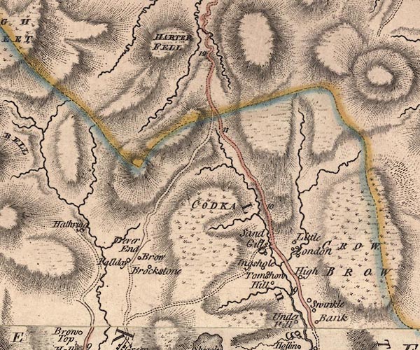 J5NY40NE.jpg "Hill" circle, labelled in italic lowercase text; settlement, farm, house, or hamlet? item:- National Library of Scotland : EME.s.47 Image © National Library of Scotland |
|
|
|
||
| evidence:- | old map:- Hodgson 1828 placename:- Hill |
|
| source data:- | Map, hand coloured engraving, 4 sheets mounted together on linen and rolled, Plan
of the County of Westmorland, scale about 1.25 inches to 1 mile, by Thomas Hodgson,
engraved by W R Gardner, Harpur Street, London, published by Thomas Hodgson, Lancaster,
and perhaps by C Smith, 172 Strand, London,1828.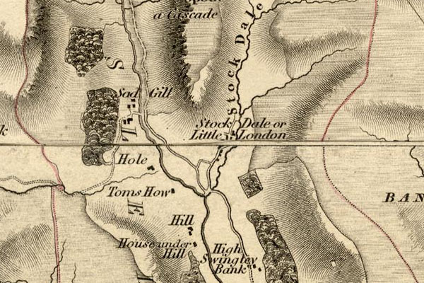 HDG6lsl3.jpg map courtesy of Mark Cropper "Hill" item:- private collection : 371 Image © see bottom of page |
|
|
|
||
| evidence:- | old map:- Kendal Corn Rent Act 1836 placename:- Hill |
|
| source data:- | Tithe map, Plan of part of the Township of Longsleddale, Westmorland, made regarding
the Kendal Corn Rent Act, ie a tithe award map, scale about 20 inches to 1 mile, Kendal,
Westmorland, 1836.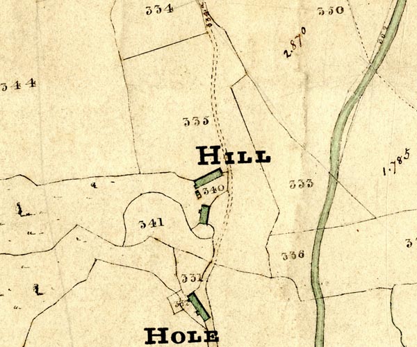 KCR206.jpg courtesy of Mark Cropper Plan of part of the Township of Longsleddale, Westmorland, made regarding the Kendal Corn Rent Act, ie a tithe award map, scale about 20 inches to 1 mile, Kendal, Westmorland, 1836. "HILL" item:- private collection : 370 Image © see bottom of page |
|
|
|
||
| Kendal Corn Rent Act 1836 |
||
|
|
||
| evidence:- | old map:- Fields 1875 placename:- Hill House |
|
| source data:- | 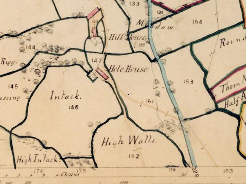 LFld0241.jpg courtesy of Ruth Fishwick |
|
|
|
||
| evidence:- | old map:- OS 1881-82 New Series (outline edition) placename:- Hill House |
|
| source data:- | Map, engraving, area north of Kendal, Westmorland, New Series
one inch map, outline edition, sheet 39, scale 1 inch to 1 mile,
published by the Ordnance Survey, Southampton, Hampshire,
1881-82.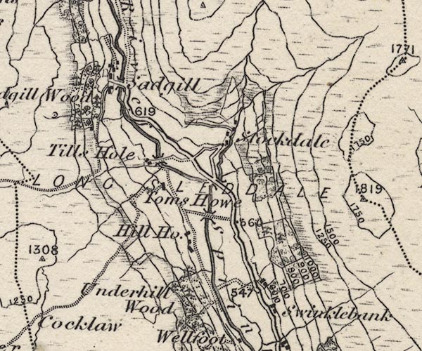 O21NY40X.jpg , "Hill Ho." item:- JandMN : 61 Image © see bottom of page |
|
|
|
||
| evidence:- | descriptive text, :- |
|
| source data:- | Royal Commission on Historical Monuments in England: 1936: Inventory of the Historical
Monuments in Westmorland: HMSO "[17th century, 2 storey, rubble walls, slate roofs] ..." |
|
|
|
||
| evidence:- | textbook:- EPNS Westmorland 1967 placename:- Hill House |
|
| source data:- | Book, The Place Names of Westmorland, two volumes, by A H Smith,
published for the English Place Name Society by Cambridge
University Press, Cambridgeshire, 1967 |
|
|
|
||
| census records |
||
|
|
||
| directory entries |
||
|
|
||
| evidence:- | map:- OS Six Inch (1956) placename:- Hill Cottage |
|
| source data:- | Map series, various editions with the national grid, scale about
6 inches to 1 mile, published by the Ordnance Survey,
Southampton, Hampshire, scale 1 to 10560 from 1950s to 1960s,
then 1 to 10000 from 1960s to 2000s, superseded by print on
demand from digital data.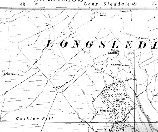 SINY4804.jpg "Hill Cottage" |
|
|
|
||
 BQX69.jpg (taken 28.6.2009) 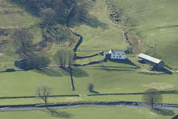 BSM34.jpg (taken 11.4.2010) |
||
|
|
||
 Lakes Guides menu.