 Old Cumbria Gazetteer
 |
 |
|
| Howtown, Martindale | ||
| Howtown | ||
| civil parish:- | Martindale (formerly Westmorland) | |
| county:- | Cumbria | |
| locality type:- | buildings | |
| coordinates:- | NY44331961 (etc) | |
| 1Km square:- | NY4419 | |
| 10Km square:- | NY41 | |
|
|
||
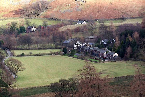 BLO87.jpg From the top of The Rake. (taken 25.1.2006) 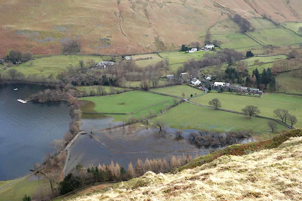 BZZ27.jpg ... encroaching waters. (taken 27.2.2014) |
||
|
|
||
| evidence:- | old map:- OS County Series (Wmd 13 1) placename:- Howtown |
|
| source data:- | Maps, County Series maps of Great Britain, scales 6 and 25
inches to 1 mile, published by the Ordnance Survey, Southampton,
Hampshire, from about 1863 to 1948. |
|
|
|
||
| evidence:- | old map:- Morden 1695 (Wmd) placename:- Haw Towne |
|
| source data:- | Map, hand coloured engraving, Westmorland, scale about 2.5 miles to 1 inch, by Robert
Morden, published by Abel Swale, the Unicorn, St Paul's Churchyard, Awnsham, and John
Churchill, the Black Swan, Paternoster Row, London, 1695.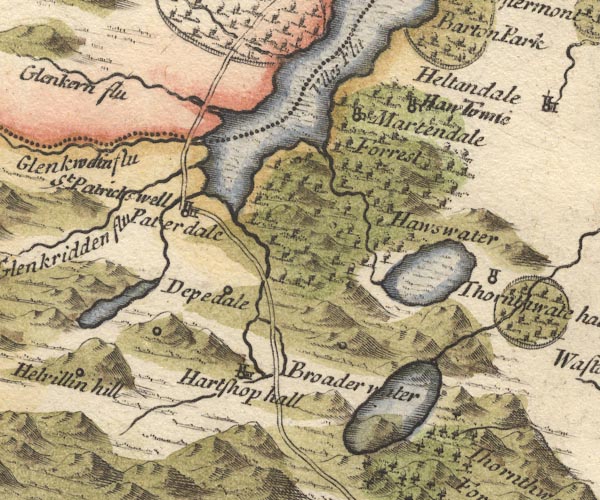 MD10NY41.jpg "Haw Towne" Circle, building and tower. item:- JandMN : 24 Image © see bottom of page |
|
|
|
||
| evidence:- | perhaps old map:- Simpson 1746 map (Wmd) placename:- Haw |
|
| source data:- | Map, uncoloured engraving, Westmorland, scale about 8 miles to 1
inch, printed by R Walker, Fleet Lane, London, 1746.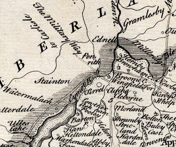 SMP2NYL.jpg "Haw" Circle. item:- Dove Cottage : 2007.38.59 Image © see bottom of page |
|
|
|
||
| evidence:- | old map:- Jefferys 1770 (Wmd) placename:- How Fow |
|
| source data:- | Map, 4 sheets, The County of Westmoreland, scale 1 inch to 1
mile, surveyed 1768, and engraved and published by Thomas
Jefferys, London, 1770.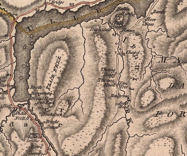 J5NY41NW.jpg "How Fow" circle, labelled in italic lowercase text; settlement, farm, house, or hamlet? item:- National Library of Scotland : EME.s.47 Image © National Library of Scotland |
|
|
|
||
| evidence:- | old map:- Crosthwaite 1783-94 (Ull) placename:- How Town |
|
| source data:- | Map, uncoloured engraving, Accurate Map of the Beautiful Lake of
Ullswater, scale about 3 inches to 1 mile, by Peter Crosthwaite,
Keswick, Cumberland, 1783, version published 1800.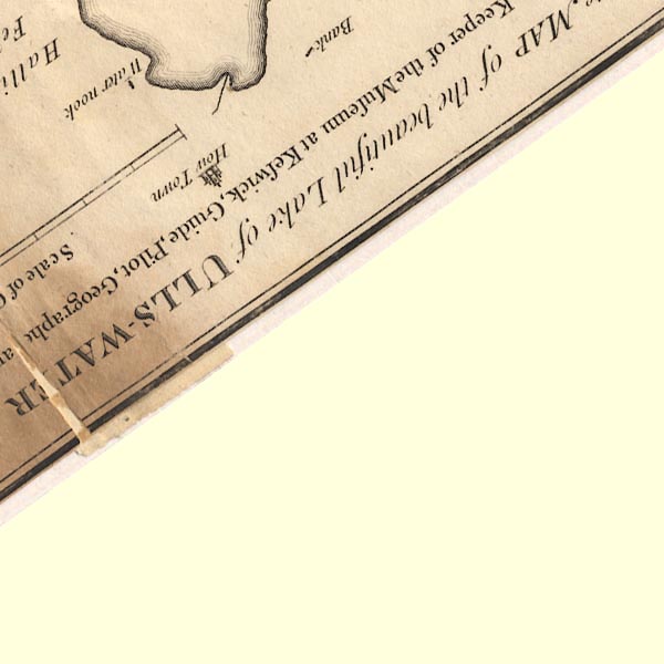 CT5NY41P.jpg "How Town" item:- Armitt Library : 1959.191.7 Image © see bottom of page |
|
|
|
||
| evidence:- | old text:- Clarke 1787 placename:- How Town item:- fishing; angling |
|
| source data:- | Guide book, A Survey of the Lakes of Cumberland, Westmorland,
and Lancashire, written and published by James Clarke, Penrith,
Cumberland, and in London etc, 1787; published 1787-93. goto source goto sourcePage 25:- "..." "... It will also much enhance the pleasure [visiting Ullswater], if they previously send notice to the fishermen at How-Town, or Water-Millock, to prepare their boats and nets; so that at their return, which will be about five hours, they may see the manner of taking the different kinds of fish. The price of these fishermen is three draughts for five shillings, and the fish they take is the property of their employers. Those who are fond of angling will do well to take their tackle with them, as perhaps they can no where meet with better sport. I one day caught, in this manner, between Powley and the small island, twenty-nine trouts." "..." |
|
|
|
||
| evidence:- | old text:- Clarke 1787 placename:- How Town item:- war; Civil War; Battle of Worcester |
|
| source data:- | Guide book, A Survey of the Lakes of Cumberland, Westmorland,
and Lancashire, written and published by James Clarke, Penrith,
Cumberland, and in London etc, 1787; published 1787-93. goto source Page 36:- "..." "At How-Town was born James Brown, who, being obliged to fly his country for deer stealing, entered the army under Cromwell, and was by him soon advanced to" goto sourcePage 37:- "the rank of captain: He made himself very acceptable to the Usurper, by taking prisoner Sir Timothy Featherstonhaugh at the battle of Worcester. The same Brown had a brother named Richard, whose son James likewise served under Cromwell. Richard, however, being loyal, that he might prevent any others of his sons from entering the service of the parliament, sold How-Town, ..." |
|
|
|
||
| evidence:- | old map:- Clarke 1787 map (Ullswater) placename:- How Town |
|
| source data:- | Map, A Map of the Lake Ullswater and its Environs, scale about
6.5 ins to 1 mile, by James Clarke, engraved by S J Neele, 352
Strand, published by James Clarke, Penrith, Cumberland and in
London etc, 1787.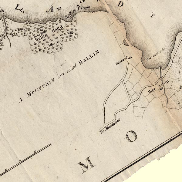 CL4NY41J.jpg "How town" item:- private collection : 10.4 Image © see bottom of page |
|
|
|
||
| evidence:- | old map:- Cary 1789 (edn 1805) placename:- How Fow |
|
| source data:- | Map, uncoloured engraving, Westmoreland, scale about 2.5 miles
to 1 inch, by John Cary, London, 1789; edition 1805. CY24NY41.jpg "How Fow" block/s, labelled in italic lowercase; house, or hamlet item:- JandMN : 129 Image © see bottom of page |
|
|
|
||
| evidence:- | perhaps old text:- Wordsworth 1810 |
|
| source data:- | Guide book, A Description of the Scenery of the Lakes, later A
Guide through the District of The Lakes, by William Wordsworth,
1810-35. goto source page xxiii "... Immediately under the eye is a deep-indented bay, with a plot of fertile land, traversed by a small brook, and rendered cheerful by two or three substantial houses of a more ornamented and showy appearance than is usual in those wild spots." |
|
|
|
||
| evidence:- | old map:- Otley 1818 placename:- How Town |
|
| source data:- | Map, uncoloured engraving, The District of the Lakes,
Cumberland, Westmorland, and Lancashire, scale about 4 miles to
1 inch, by Jonathan Otley, 1818, engraved by J and G Menzies,
Edinburgh, Scotland, published by Jonathan Otley, Keswick,
Cumberland, et al, 1833.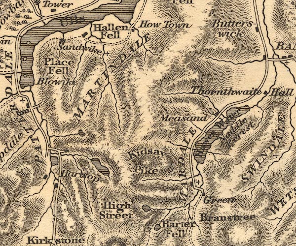 OT02NY41.jpg item:- JandMN : 48.1 Image © see bottom of page |
|
|
|
||
| evidence:- | old map:- Hall 1820 (Wmd) placename:- How Fow |
|
| source data:- | Map, hand coloured engraving, Westmoreland ie Westmorland, scale
about 14.5 miles to 1 inch, by Sidney Hall, London, 1820,
published by Samuel Leigh, 18 Strand, London, 1820-31. click to enlarge click to enlargeHA18.jpg "How Fow" circle, italic lowercase text; settlement item:- Armitt Library : 2008.14.58 Image © see bottom of page |
|
|
|
||
| evidence:- | old map:- Ford 1839 map placename:- How Town |
|
| source data:- | Map, uncoloured engraving, Map of the Lake District of
Cumberland, Westmoreland and Lancashire, scale about 3.5 miles
to 1 inch, published by Charles Thurnam, Carlisle, and by R
Groombridge, 5 Paternoster Row, London, 3rd edn 1843.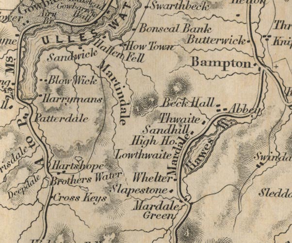 FD02NY41.jpg "How Town" item:- JandMN : 100.1 Image © see bottom of page |
|
|
|
||
| evidence:- | old map:- Garnett 1850s-60s H placename:- How Town |
|
| source data:- | Map of the English Lakes, in Cumberland, Westmorland and
Lancashire, scale about 3.5 miles to 1 inch, published by John
Garnett, Windermere, Westmorland, 1850s-60s.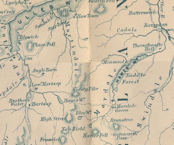 GAR2NY41.jpg "How Town" blocks, settlement item:- JandMN : 82.1 Image © see bottom of page |
|
|
|
||
Lakes Guides menu.