 Old Cumbria Gazetteer
 |
 |
|
| Kilnstones, Longsleddale | ||
| Kilnstones | ||
| locality:- | Longsleddale | |
| civil parish:- | Longsleddale (formerly Westmorland) | |
| county:- | Cumbria | |
| locality type:- | buildings | |
| coordinates:- | NY50200206 | |
| 1Km square:- | NY5002 | |
| 10Km square:- | NY50 | |
|
|
||
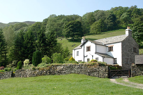 BQY14.jpg (taken 29.6.2009) 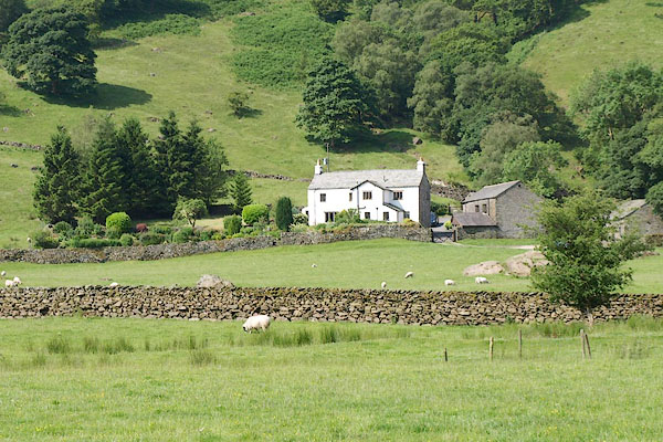 BQY20.jpg (taken 29.6.2009) |
||
|
|
||
| evidence:- | old map:- OS County Series (Wmd 27 15) placename:- Kilnstones |
|
| source data:- | Maps, County Series maps of Great Britain, scales 6 and 25
inches to 1 mile, published by the Ordnance Survey, Southampton,
Hampshire, from about 1863 to 1948.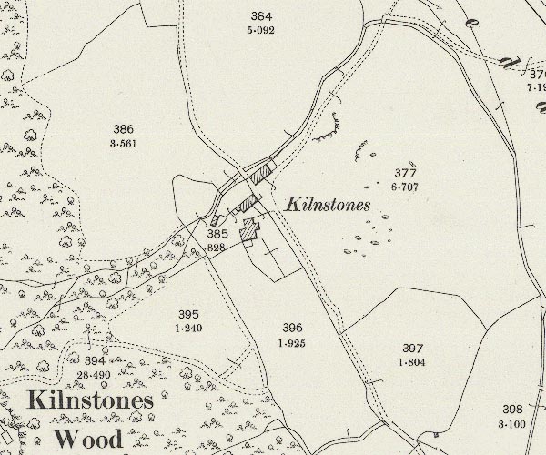 C5E017.jpg "Kilnstones" |
|
|
|
||
| evidence:- | census returns:- placename:- Kilingstone placename:- Kilnstone placename:- Kiln Stone |
|
|
|
||
 old parish registers (formerly ) old parish registers (formerly ) |
||
|
|
||
| evidence:- | old map:- Jefferys 1770 (Wmd) placename:- Gill Stone |
|
| source data:- | Map, 4 sheets, The County of Westmoreland, scale 1 inch to 1
mile, surveyed 1768, and engraved and published by Thomas
Jefferys, London, 1770.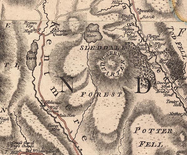 J5NY40SE.jpg "Gill Stone" circle, labelled in italic lowercase text; settlement, farm, house, or hamlet? item:- National Library of Scotland : EME.s.47 Image © National Library of Scotland |
|
|
|
||
| evidence:- | old map:- Cary 1789 (edn 1805) placename:- Gill Stone |
|
| source data:- | Map, uncoloured engraving, Westmoreland, scale about 2.5 miles
to 1 inch, by John Cary, London, 1789; edition 1805.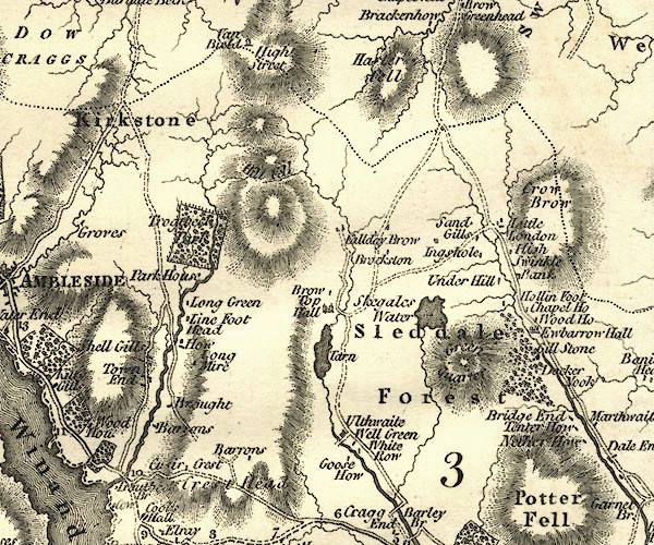 CY24NY40.jpg "Gill Stone" block/s, labelled in italic lowercase; house, or hamlet item:- JandMN : 129 Image © see bottom of page |
|
|
|
||
| evidence:- | old map:- Hodgson 1828 placename:- Kiln Stone |
|
| source data:- | Map, hand coloured engraving, 4 sheets mounted together on linen and rolled, Plan
of the County of Westmorland, scale about 1.25 inches to 1 mile, by Thomas Hodgson,
engraved by W R Gardner, Harpur Street, London, published by Thomas Hodgson, Lancaster,
and perhaps by C Smith, 172 Strand, London,1828.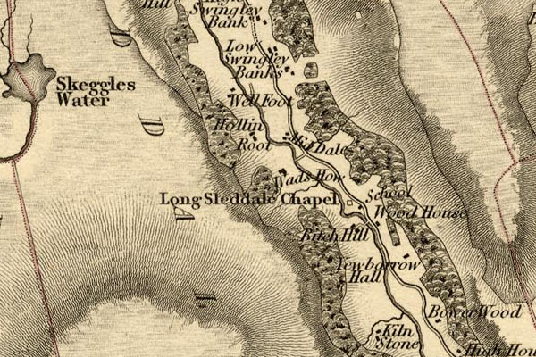 HDG6lsl2.jpg map courtesy of Mark Cropper "Kiln Stone" item:- private collection : 371 Image © see bottom of page |
|
|
|
||
| Kendal Corn Rent Act 1836 |
||
|
|
||
| evidence:- | old map:- OS 1881-82 New Series (outline edition) placename:- Kilnstones |
|
| source data:- | Map, engraving, area north of Kendal, Westmorland, New Series
one inch map, outline edition, sheet 39, scale 1 inch to 1 mile,
published by the Ordnance Survey, Southampton, Hampshire,
1881-82. O21NY50A.jpg "Kilnstones" item:- JandMN : 61 Image © see bottom of page |
|
|
|
||
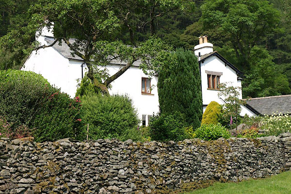
| evidence:- | descriptive text:- |
|
| source data:- | Royal Commission on Historical Monuments in England: 1936: Inventory of the Historical
Monuments in Westmorland: HMSO "[17th century, 2 storey, rubble walls, slate roofs] ... retains some original stone
windows and a W. doorway with the moulding of the jambs carried up to form an ornamental
sinking on the face of the lintel. Reset in a garden wall are two carved stone panels,
one with the figures 71, perhaps for 1671; there is also a fragmentary inscription
relating to the building of the house. Inside the building are some original panelling
and doors." |
|
|
|
||
| evidence:- | textbook:- EPNS Westmorland 1967 placename:- Kilne Stone placename:- Kiln Stone |
|
| source data:- | Book, The Place Names of Westmorland, two volumes, by A H Smith,
published for the English Place Name Society by Cambridge
University Press, Cambridgeshire, 1967 |
|
|
|
||
| evidence:- | descriptive text:- Ffinch 1983 |
|
| source data:- | Book, Kendal and the Kent Valley, by Michael Ffinch, published
by Robert Hale, London, 1983. "... there was a packhorse track along the western side [of the valley] which passed Kilnstone Farm, a sixteenth century building that was used in the days of the packhorse train as an inn." |
|
|
|
||
| census records |
||
|
|
||
| directory entries |
||
|
|
||
| evidence:- | database:- Listed Buildings 2010 placename:- Kilnstones |
|
| source data:- | courtesy of English Heritage "KILNSTONES FARMHOUSE / / / LONGSLEDDALE / SOUTH LAKELAND / CUMBRIA / II / 76406 / NY5020402054" |
|
|
|
||
| evidence:- | map:- OS Six Inch (1956) placename:- Kilnstones |
|
| source data:- | Map series, various editions with the national grid, scale about
6 inches to 1 mile, published by the Ordnance Survey,
Southampton, Hampshire, scale 1 to 10560 from 1950s to 1960s,
then 1 to 10000 from 1960s to 2000s, superseded by print on
demand from digital data. SINY5002.jpg "Kilnstones" |
|
|
|
||
| evidence:- | shepherds guide:- Wilson 1913 placename:- Kilnstone |
|
| source data:- | Book, New Shepherd's Guide for Cumberland, Westmorland, and
Lancashire, by Thomas Wilson, 1913.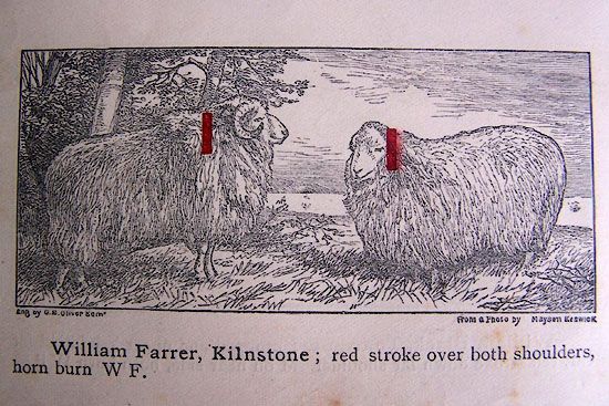 WL1p370c.jpg "William Farrer, Kilnstone; red stroke over both shoulders, horn burn W F." item:- private collection : 329 Image © see bottom of page |
|
|
|
||
| evidence:- | shepherds guide:- Gate 1879 placename:- Kilnstone |
|
| source data:- | Book, New Shepherd's Guide for Cumberland, Westmoreland, and
Lancashire, published by Daniel Gate, Keswick, Cumberland, 1879.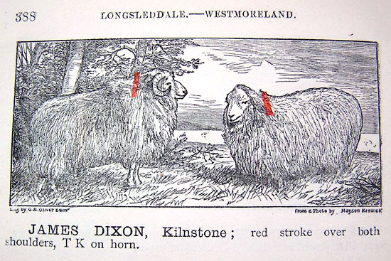 GT1p388a.jpg "JAMES DIXON, Kilnstone; red stroke over both shoulders, TK on horn." item:- Kendal Library : 38 Image © see bottom of page |
|
|
|
||
| evidence:- | shepherds guide:- Lamb 1937 placename:- Kilnstone |
|
| source data:- | Book, Lamb's Shepherds' Guide for Cumberland, Westmorland and
Lancashire, by R H Lamb, published by the Herald Printing Co,
Penrith, Cumberland, 1937.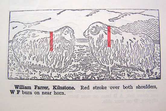 LM1p316c.jpg "William Farrer, Kilnstone. Red stroke over both shoulders, W F burn on near horn." item:- Kendal Library : 40 Image © see bottom of page |
|
|
|
||
| evidence:- | old newspaper:- Z8900705.txt placename:- Kilnstone item:- placename, Kilnstones |
|
| source data:- | Z8900705.txt Westmorland Gazette Transcription from the Westmorland Gazette 5 July 1890 page 6:- "... Kilnstone contains in its name a memorial of the custom of drying or baking oats on the stone, and preparing them for use. ..." |
|
|
|
||
 BQY15.jpg (taken 29.6.2009) 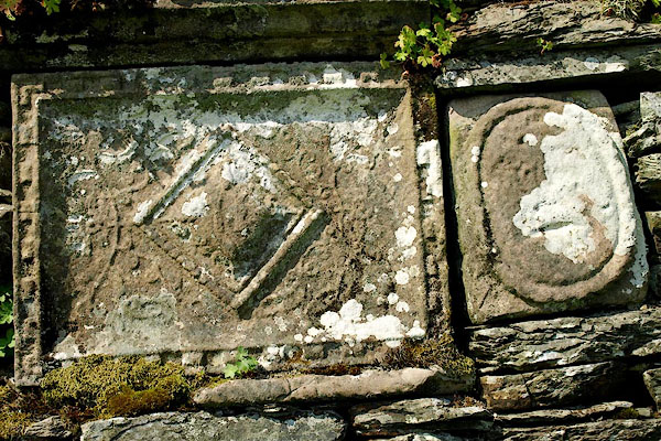 BQY16.jpg (taken 29.6.2009) 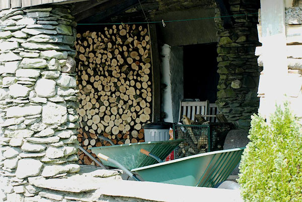 BQY17.jpg (taken 29.6.2009) 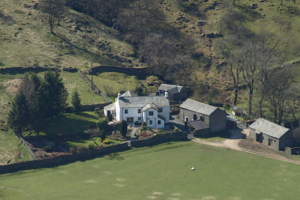 BSM23.jpg (taken 11.4.2010) 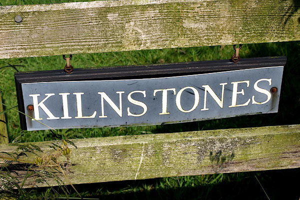 BQY21.jpg (taken 29.6.2009) |
||
|
|
||
| :- |
There is said to have been a potash kiln here. |
|
| : 2009: Archaeology Data Service |
||
|
|
||
| hearsay:- |
Built on the site of an earlier house inhabited by monks, 1263. |
|
| There was a forestair to a loft where packmen travelling could take a rest. |
||
| A small building was once a pigsty at ground floor, privy at first floor, and henhouse
at second floor level. |
||
|
|
||
| notes:- |
The Hawkshead Parish Account book, 1786, includes:- |
|
| "Journey horse hire and expenses to Backbarrow to Eliner Preston to take her child
to Mr. Kellets of Long Sleddale to be cured of a scabbed head 2/6." |
||
| Parish register entries have Kellets at Kilnstones and Murthwaite in the 1780s, but
perhaps elsewhere in the valley. |
||
| Cowper, H S: 1785=1896: Hawkshead Folklore: TransCWAAS: OS vol.14: pp.371-389 |
||
|
|
||
| hearsay:- |
There is said to be an inscribed stone in the garden:- |
|
| "[Thou who desirest to know who built this fabric, look and read his name below and
learn where he dwelt.]" |
||
| and ... no more |
||
| Palmer 1945 |
||
|
|
||
 Lakes Guides menu.