Old Cumbria Gazetteer
 |
 |
|
||
| Liddel Water | ||||
| runs into:- |  Esk, River Esk, River |
|||
|
|
||||
| Liddle Water | ||||
| civil parish:- | Arthuret (formerly Cumberland) | |||
| civil parish:- | Kirkandrews (formerly Cumberland) | |||
| civil parish:- | Nicholforest (formerly Cumberland) | |||
| county:- | Cumbria | |||
| locality type:- | river | |||
| locality type:- | boundary | |||
| locality type:- | national boundary | |||
| locality type:- | county boundary | |||
| 1Km square:- | NY4377 (etc) | |||
| 10Km square:- | NY47 | |||
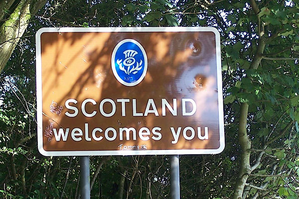
| country:- | Scotland | |||
| current boundary | ||||
| locality:- | Cumbria boundary | |||
|
|
||||
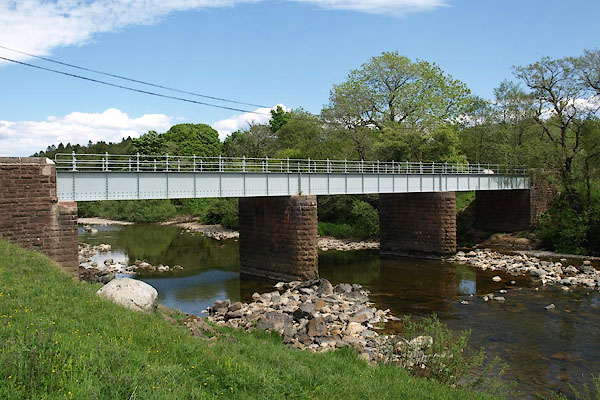
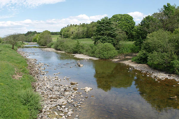
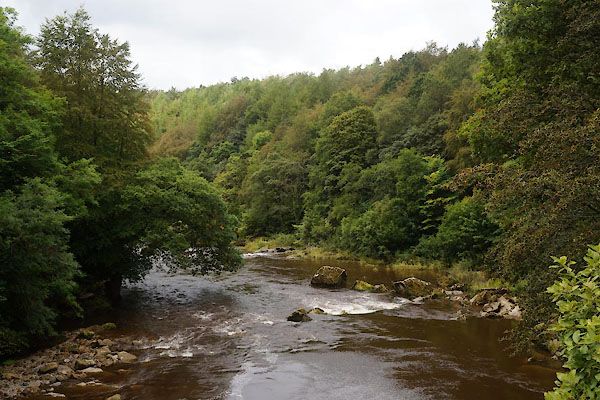 CBN50.jpg At Penton Bridge. (taken 29.8.2014) 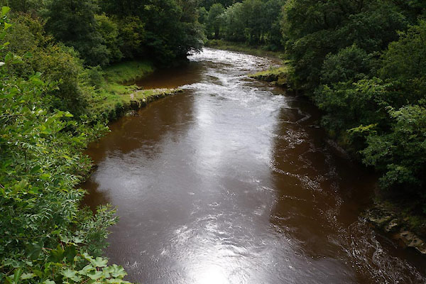 CBN51.jpg At Penton Bridge, Cowugly Pool. (taken 29.8.2014) |
||||
|
|
||||
| evidence:- | old map:- OS County Series (Cmd 3 9) placename:- Liddel Water |
|||
| source data:- | Maps, County Series maps of Great Britain, scales 6 and 25
inches to 1 mile, published by the Ordnance Survey, Southampton,
Hampshire, from about 1863 to 1948. |
|||
|
|
||||
| evidence:- | old map:- Saxton 1579 |
|||
| source data:- | Map, hand coloured engraving, Westmorlandiae et Cumberlandiae Comitatus ie Westmorland
and Cumberland, scale about 5 miles to 1 inch, by Christopher Saxton, London, engraved
by Augustinus Ryther, 1576, published 1579-1645.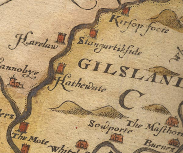 Sax9NY47.jpg County boundary. item:- private collection : 2 Image © see bottom of page |
|||
|
|
||||
| evidence:- | old map:- Burghley 1590 (facsimile) placename:- Liddall flu. |
|||
| source data:- | Facsimile map, A Platt of the Opposete Border of Scotland to ye West Marches of England,
parts of Cumberland and Scotland including the Debateable Land, from a manuscript
drawn for William Cecil, Lord Burghley, about 1590, published by R B Armstrong, 1897. courtesy of the National Library of Scotland 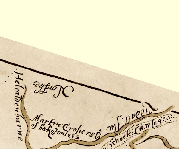 M048NT50.jpg "Liddall flu" river item:- National Library of Scotland : MS6113 f.267 Image © National Library of Scotland |
|||
|
|
||||
| evidence:- | old map:- Speed 1611 (Cmd) |
|||
| source data:- | Map, hand coloured engraving, Cumberland and the Ancient Citie
Carlile Described, scale about 4 miles to 1 inch, by John Speed,
1610, published by J Sudbury and George Humble, Popes Head
Alley, London, 1611-12.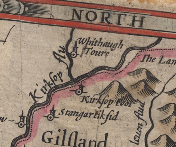 SP11NY48.jpg double line, joined by the Kershope  SP11NY37.jpg double line with stream lines, runs into the Esk; national boundary item:- private collection : 16 Image © see bottom of page |
|||
|
|
||||
| evidence:- | old map:- Jansson 1646 |
|||
| source data:- | Map, hand coloured engraving, Cumbria and Westmoria, ie
Cumberland and Westmorland, scale about 3.5 miles to 1 inch, by
John Jansson, Amsterdam, Netherlands, 1646.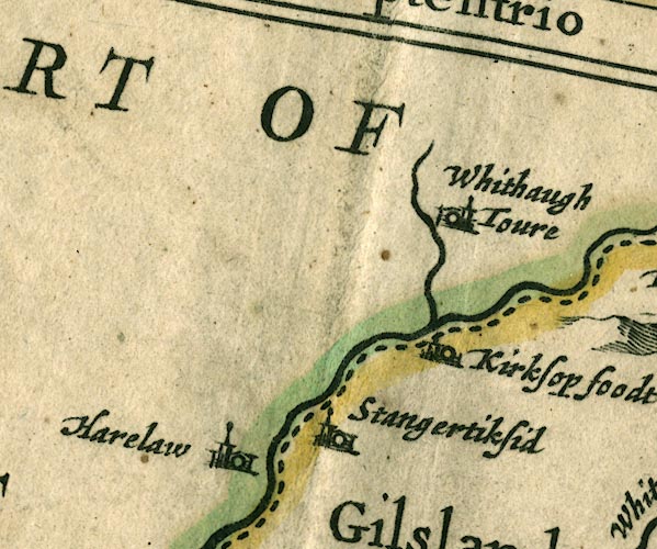 JAN3NY48.jpg  JAN3NY47.jpg Double wiggly line, tapering to single; country boundary. item:- JandMN : 88 Image © see bottom of page |
|||
|
|
||||
| evidence:- | old map:- Sanson 1679 |
|||
| source data:- | Map, hand coloured engraving, Ancien Royaume de Northumberland
aujourdhuy Provinces de Nort, ie the Ancient Kingdom of
Northumberland or the Northern Provinces, scale about 9.5 miles
to 1 inch, by Nicholas Sanson, Paris, France, 1679. click to enlarge click to enlargeSAN2Cm.jpg tapering wiggly line; river, county boundary with Scotland item:- Dove Cottage : 2007.38.15 Image © see bottom of page |
|||
|
|
||||
| evidence:- | old map:- Seller 1694 (Cmd) |
|||
| source data:- | Map, uncoloured engraving, Cumberland, scale about 12 miles to 1
inch, by John Seller, 1694. click to enlarge click to enlargeSEL9.jpg tapering wiggly line; river; county boundary item:- Dove Cottage : 2007.38.89 Image © see bottom of page |
|||
|
|
||||
| evidence:- | old map:- Morden 1695 (EW) |
|||
| source data:- | Map, hand coloured engraving, England, including Wales, scale
about 27 miles to 1 inch, by Robert Morden, published by Abel
Swale Awnsham and John Churchil, London, about 1695.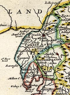 click to enlarge click to enlargeMRD3Cm.jpg tapering wiggly line item:- JandMN : 339 Image © see bottom of page |
|||
|
|
||||
| evidence:- | old map:- Morden 1695 (Cmd) placename:- Kirksop River |
|||
| source data:- | Map, uncoloured engraving, Cumberland, scale about 4 miles to 1
inch, by Robert Morden, 1695, published by Abel Swale, the
Unicorn, St Paul's Churchyard, Awnsham, and John Churchill, the
Black Swan, Paternoster Row, London, 1695-1715.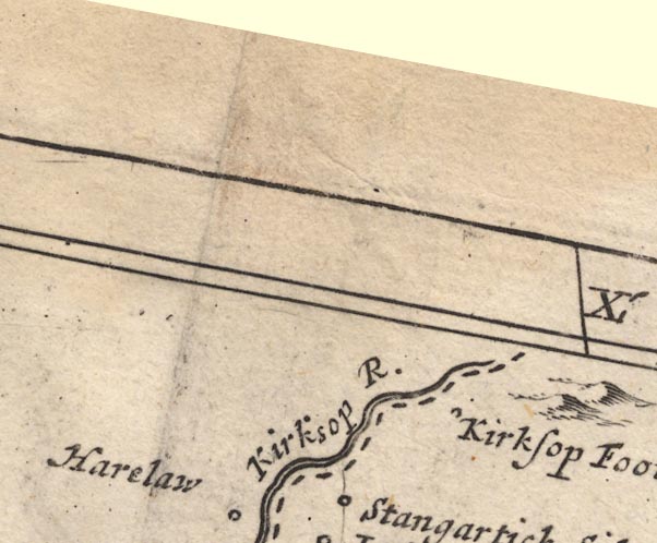 MD12NY48.jpg "Kirksop R." With the national boundary drawn alongside. item:- JandMN : 90 Image © see bottom of page |
|||
|
|
||||
| evidence:- | probably descriptive text:- Simpson 1746 placename:- Eske, River |
|||
| source data:- | Atlas, three volumes of maps and descriptive text published as
'The Agreeable Historian, or the Compleat English Traveller
...', by Samuel Simpson, 1746. goto source "Longtown, near where the Eske and Kirksop Rivers meet: ..." |
|||
|
|
||||
| evidence:- | old map:- Bowen and Kitchin 1760 |
|||
| source data:- | Map, hand coloured engraving, A New Map of the Counties of
Cumberland and Westmoreland Divided into their Respective Wards,
scale about 4 miles to 1 inch, by Emanuel Bowen and Thomas
Kitchin et al, published by T Bowles, Robert Sayer, and John
Bowles, London, 1760.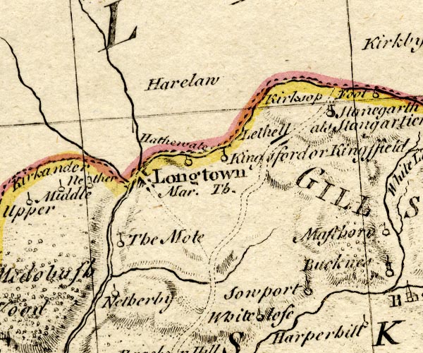 BO18NY47.jpg wiggly line, national boundary Cumberland Scotland, into the Esk item:- Armitt Library : 2008.14.10 Image © see bottom of page |
|||
|
|
||||
| evidence:- | old map:- Donald 1774 (Cmd) placename:- Liddel River |
|||
| source data:- | Map, hand coloured engraving, 3x2 sheets, The County of Cumberland, scale about 1
inch to 1 mile, by Thomas Donald, engraved and published by Joseph Hodskinson, 29
Arundel Street, Strand, London, 1774.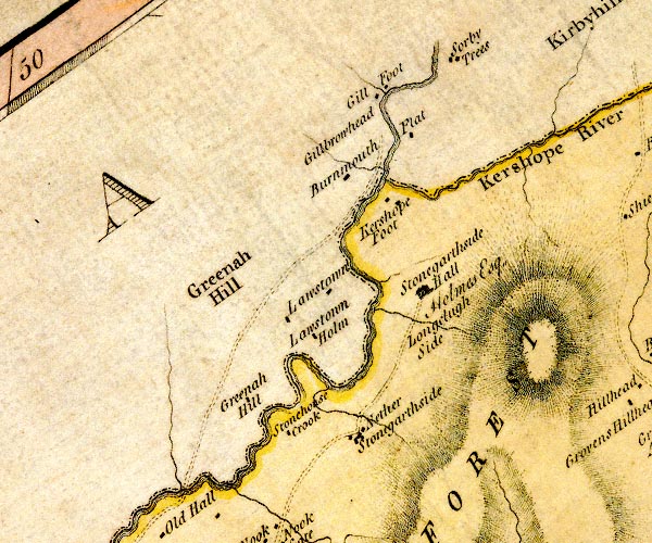 D4NY48SE.jpg 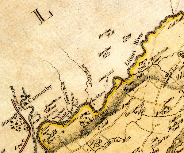 D4NY47NW.jpg "Liddel River" 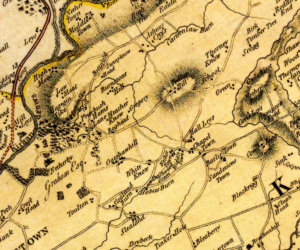 D4NY47SW.jpg single or double wiggly line; a river and national boundary item:- Carlisle Library : Map 2 Images © Carlisle Library |
|||
|
|
||||
| evidence:- | old text:- Camden 1789 placename:- Lidd |
|||
| source data:- | Book, Britannia, or A Chorographical Description of the Flourishing Kingdoms of England,
Scotland, and Ireland, by William Camden, 1586, translated from the 1607 Latin edition
by Richard Gough, published London, 1789. goto source Page 176:- "..." "Where the river Lidd falls into the Esk was formerly, as I have been told, Liddel, a castle ..." |
|||
|
|
||||
| evidence:- | old map:- Aikin 1790 (Cmd) placename:- Liddel River |
|||
| source data:- | Map, uncoloured engraving, Cumberland, by John Aikin, London,
1790.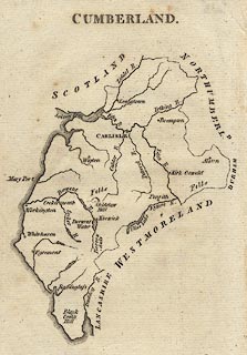 click to enlarge click to enlargeAIK3.jpg "Liddel R." river; on county boundary item:- JandMN : 145 Image © see bottom of page |
|||
|
|
||||
| evidence:- | old map:- Bailey 1797 placename:- Liddle River |
|||
| source data:- | Map, soil etc, uncoloured engraving, Cumberland, scale about 21
miles to 1 inch, by J Bailey, engraved by Neele, Strand,
published by Messrs Robinson, Paternoster Row and G Nicol, Pall
Mall, London, 1797.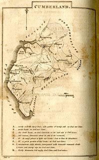 click to enlarge click to enlargeBY04.jpg "Liddle R." river; on county boundary item:- Armitt Library : A680.2 Image © see bottom of page |
|||
|
|
||||
| evidence:- | old map:- Cooper 1808 placename:- Liddel River |
|||
| source data:- | Map, uncoloured engraving, Cumberland, scale about 10.5 miles to
1 inch, drawn and engraved by Cooper, published by R Phillips,
Bridge Street, Blackfriars, London, 1808. click to enlarge click to enlargeCOP3.jpg "Liddel R." tapering wiggly line; river, county boundary with Scotland item:- JandMN : 86 Image © see bottom of page |
|||
|
|
||||
| evidence:- | old map:- Wallis 1810 (Cmd) placename:- Lidd River |
|||
| source data:- | Road map, hand coloured engraving, Cumberland, scale about 16
miles to 1 inch, by James Wallis, 77 Berwick Stree, Soho,
London, 1810. click to enlarge click to enlargeWL13.jpg "Lidd R." river; county boundary item:- Dove Cottage : 2009.81.10 Image © see bottom of page |
|||
|
|
||||
| evidence:- | old map:- Hall 1820 (Cmd) placename:- Liddle River |
|||
| source data:- | Map, hand coloured engraving, Cumberland, scale about 21 miles
to 1 inch, engraved by Sidney Hall, published by S Leigh, 18
Strand, London, 1820-31. click to enlarge click to enlargeHA14.jpg "Liddle R." tapering wiggly line; river; county boundary item:- JandMN : 91 Image © see bottom of page |
|||
|
|
||||
| evidence:- | old map:- Ford 1839 map placename:- Liddel River |
|||
| source data:- | Map, uncoloured engraving, Map of the Lake District of
Cumberland, Westmoreland and Lancashire, scale about 3.5 miles
to 1 inch, published by Charles Thurnam, Carlisle, and by R
Groombridge, 5 Paternoster Row, London, 3rd edn 1843.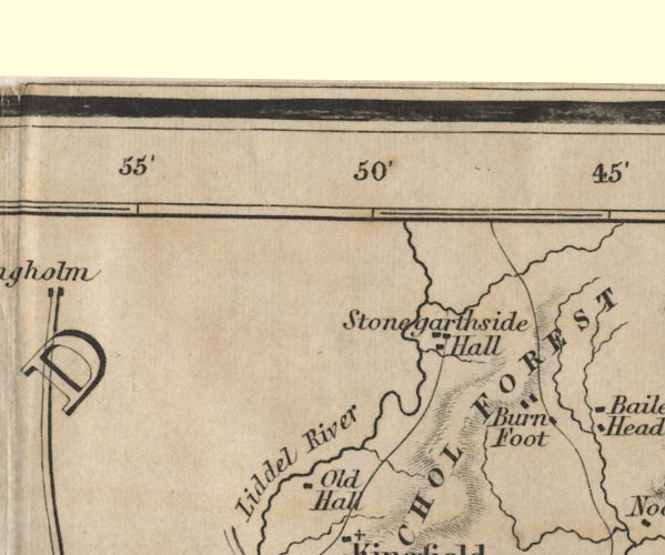 FD02NY48.jpg "Liddel River" item:- JandMN : 100.1 Image © see bottom of page |
|||
|
|
||||
| evidence:- | old print:- placename:- Liddle, River item:- otter; dog; otter hound; costume |
|||
| source data:- | Print, hand coloured, The Carlisle Otter Hunt, Liddel Water, Penton, Nicholforest,
Cumberland, after George Earl, published by H Koekkoek, 27 Piccadilly, London, 1876.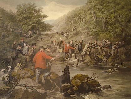 click to enlarge click to enlargePR0962.jpg A crowd of men, two of them wearing scarlet hunting jackets, and a pack of otterhounds, pursue an otter which has descended the rocky wooded hillside into the river at its foot. labelled at bottom centre on mount:- "The Carlisle Otter Hunt, River Liddle, Penton, 1876. George Earl" item:- Tullie House Museum : 1951.96 Image © Tullie House Museum |
|||
|
|
||||
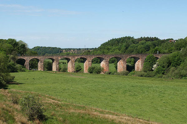
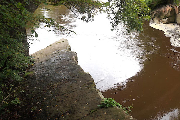 CBN52.jpg Under Penton Bridge. (taken 29.8.2014) 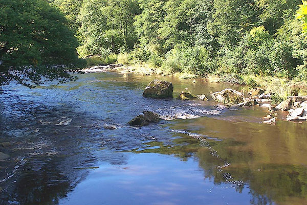 BMQ45.jpg At Penton Bridge. (taken 15.9.2006) |
||||
|
|
||||
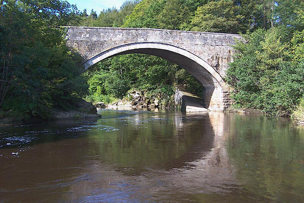
 BSV99.jpg At Kershopefoot Bridge; the Kershope Burn joins on the right. (taken 4.6.2010) |
||||
|
|
||||
| places:- |
|
|||
|
||||
|
||||
|
||||
|
||||
|
||||
|
||||
|
||||
|
||||
|
||||
|
||||
|
||||
|
||||
|
||||
|
||||
|
||||
|
||||
|
||||
|
||||
|
||||
|
||||
|
||||
|
||||
|
||||
|
||||
|
||||
|
||||
|
||||
|
||||
|
||||
|
||||
|
||||
|
||||
|
||||
|
||||
Lakes Guides menu.