 Old Cumbria Gazetteer
 |
 |
|
| Low Swinklebank, Longsleddale | ||
| Low Swinklebank | ||
| locality:- | Swinklebank | |
| civil parish:- | Longsleddale (formerly Westmorland) | |
| county:- | Cumbria | |
| locality type:- | buildings | |
| coordinates:- | NY49560386 | |
| 1Km square:- | NY4903 | |
| 10Km square:- | NY40 | |
|
|
||
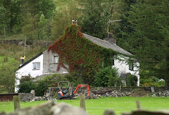 BRH99.jpg (taken 27.8.2009) 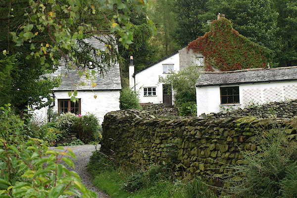 BRI02.jpg (taken 27.8.2009) |
||
|
|
||
| evidence:- | old map:- OS County Series (Wmd 27 11) placename:- Low Swinklebank |
|
| source data:- | Maps, County Series maps of Great Britain, scales 6 and 25
inches to 1 mile, published by the Ordnance Survey, Southampton,
Hampshire, from about 1863 to 1948.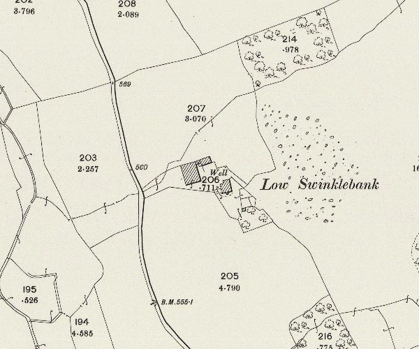 C5E010.jpg "Low Swinklebank" |
|
|
|
||
| evidence:- | census returns:- placename:- Low Swinklebank placename:- Low Swinkle Bank |
|
|
|
||
| evidence:- | old map:- Hodgson 1828 placename:- Low Swingley Banks |
|
| source data:- | Map, hand coloured engraving, 4 sheets mounted together on linen and rolled, Plan
of the County of Westmorland, scale about 1.25 inches to 1 mile, by Thomas Hodgson,
engraved by W R Gardner, Harpur Street, London, published by Thomas Hodgson, Lancaster,
and perhaps by C Smith, 172 Strand, London,1828.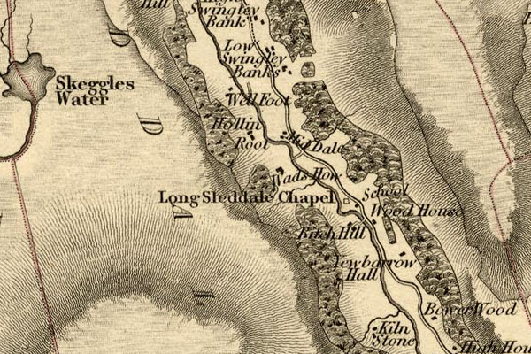 HDG6lsl2.jpg map courtesy of Mark Cropper "Low Swingley Banks" item:- private collection : 371 Image © see bottom of page |
|
|
|
||
| evidence:- | old map:- Kendal Corn Rent Act 1836 placename:- Low Swindle Bank |
|
| source data:- | Tithe map, Plan of part of the Township of Longsleddale, Westmorland, made regarding
the Kendal Corn Rent Act, ie a tithe award map, scale about 20 inches to 1 mile, Kendal,
Westmorland, 1836.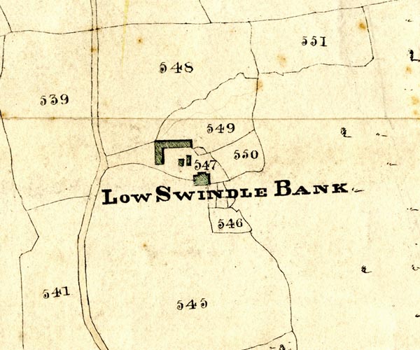 KCR210.jpg courtesy of Mark Cropper Plan of part of the Township of Longsleddale, Westmorland, made regarding the Kendal Corn Rent Act, ie a tithe award map, scale about 20 inches to 1 mile, Kendal, Westmorland, 1836. "LOW SWINDLE BANK" item:- private collection : 370 Image © see bottom of page |
|
|
|
||
 Kendal Corn Rent Act 1836 Kendal Corn Rent Act 1836 |
||
|
|
||
| evidence:- | old map:- OS 1881-82 New Series (outline edition) |
|
| source data:- | Map, engraving, area north of Kendal, Westmorland, New Series
one inch map, outline edition, sheet 39, scale 1 inch to 1 mile,
published by the Ordnance Survey, Southampton, Hampshire,
1881-82.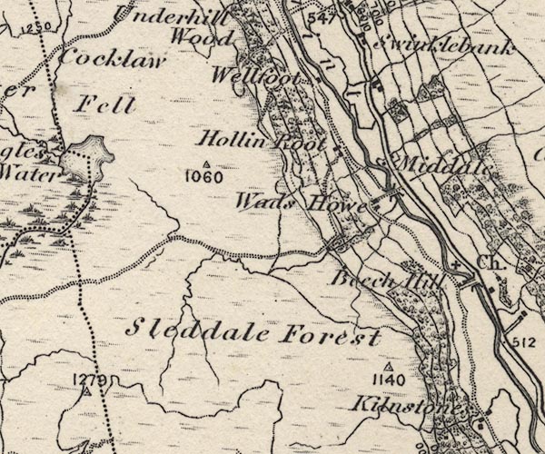 O21NY40W.jpg Not labelled. item:- JandMN : 61 Image © see bottom of page |
|
|
|
||
| census records |
||
|
|
||
| directory entries |
||
|
|
||
| evidence:- | map:- OS Six Inch (1956) placename:- Low Swinklebank |
|
| source data:- | Map series, various editions with the national grid, scale about
6 inches to 1 mile, published by the Ordnance Survey,
Southampton, Hampshire, scale 1 to 10560 from 1950s to 1960s,
then 1 to 10000 from 1960s to 2000s, superseded by print on
demand from digital data.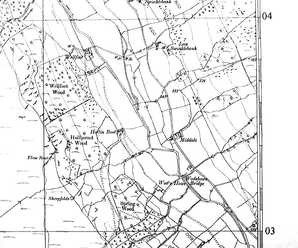 SINY4903.jpg "Low Swinklebank" |
|
|
|
||
| evidence:- | shepherds guide:- Wilson 1913 placename:- Low Swinkle Bank |
|
| source data:- | Book, New Shepherd's Guide for Cumberland, Westmorland, and
Lancashire, by Thomas Wilson, 1913.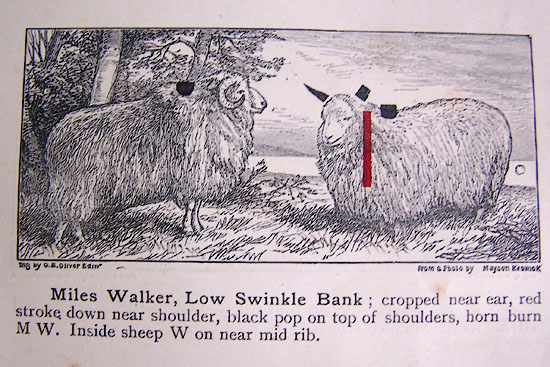 WL1p369b.jpg "Miles Walker, Low Swinkle Bank; cropped near ear, red stroke down near shoulder, black pop on top of shoulders, horn burn M W. Inside sheep W on near mid rib." item:- private collection : 329 Image © see bottom of page |
|
|
|
||
| evidence:- | shepherds guide:- Gate 1879 placename:- Low Swingle Bank |
|
| source data:- | Book, New Shepherd's Guide for Cumberland, Westmoreland, and
Lancashire, published by Daniel Gate, Keswick, Cumberland, 1879.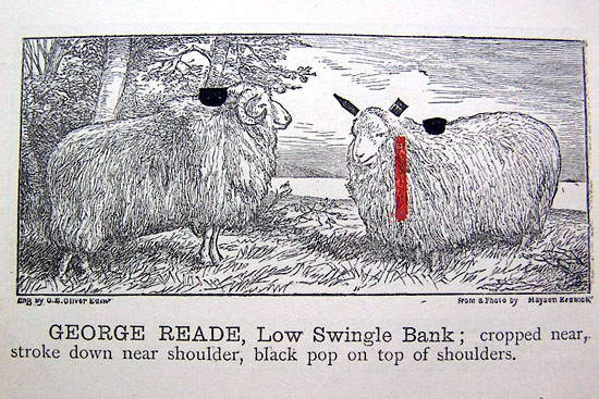 GT1p386b.jpg "GEORGE READE, Low Swingle Bank; cropped near, stroke down near shoulder, black pop on top of shoulders." item:- Kendal Library : 38 Image © see bottom of page |
|
|
|
||
| evidence:- | shepherds guide:- Hodgson 1849 placename:- Low Swingle Bank |
|
| source data:- | Book, Shepherd's Guide, or a Delineation of the Wool and Ear
Marks of the Different Stocks of Sheep, Lancashire, Cumberland,
and Westmorland, by William Hodgson, Normoss, Corney,
Cumberland, 1849. HG2p595b.jpg "JOHN TAYLOR, Low Swingle Bank." "Cropped near ear, a red stroke down the near shoulder, and a black pop on top of the shoulders, IT on the horn." item:- Kendal Library : 39 Image © see bottom of page |
|
|
|
||
| evidence:- | shepherds guide:- Lamb 1937 placename:- Low Swinklebank |
|
| source data:- | Book, Lamb's Shepherds' Guide for Cumberland, Westmorland and
Lancashire, by R H Lamb, published by the Herald Printing Co,
Penrith, Cumberland, 1937.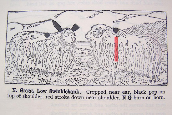 LM1p318b.jpg "N. Gregg, Low Swinklebank. Cropped near ear, black pop on top of shoulder, red stroke down near shoulder, N G burn on horn." item:- Kendal Library : 40 Image © see bottom of page |
|
|
|
||
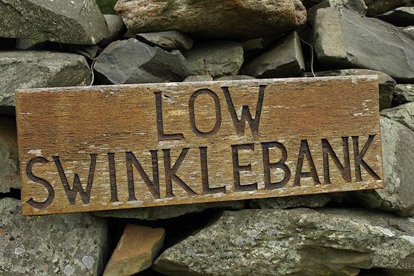 BRI03.jpg Sign:- "LOW / SWINKLEBANK" (taken 27.8.2009) 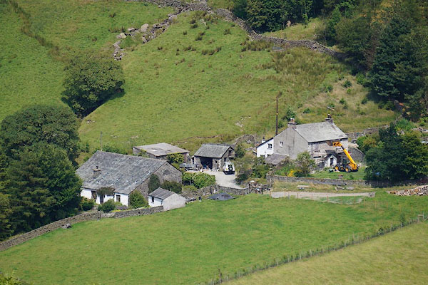 CBC42.jpg (taken 11.7.2014) |
||
|
|
||
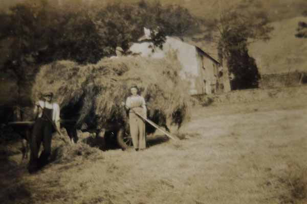 BYZ07.jpg Haymaking. |
||
|
|
||
 Lakes Guides menu.