 Old Cumbria Gazetteer
 |
 |
|
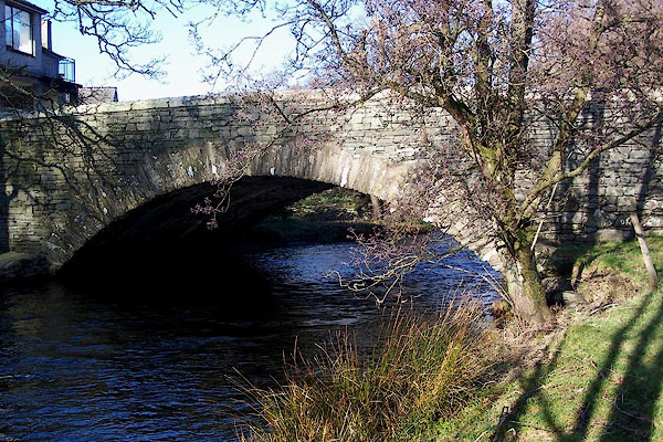
| Lowick Bridge bridge, Lowick | ||
| Lowick Bridge | ||
| locality:- | Lowick Bridge | |
| locality:- | Lowick | |
| civil parish:- | Lowick (formerly Lancashire) | |
| civil parish:- | Colton (formerly Lancashire) | |
| county:- | Cumbria | |
| locality type:- | bridge | |
| coordinates:- | SD29358653 | |
| 1Km square:- | SD2986 | |
| 10Km square:- | SD28 | |
|
|
||
 BND31.jpg (taken 2.2.2007) 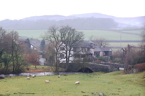 BOK25.jpg On a dull day! (taken 11.1.2008) |
||
|
|
||
| evidence:- | possibly old map:- Sanson 1679 |
|
| source data:- | Map, hand coloured engraving, Ancien Royaume de Northumberland
aujourdhuy Provinces de Nort, ie the Ancient Kingdom of
Northumberland or the Northern Provinces, scale about 9.5 miles
to 1 inch, by Nicholas Sanson, Paris, France, 1679. click to enlarge click to enlargeSAN2Cm.jpg double line over a stream; bridge item:- Dove Cottage : 2007.38.15 Image © see bottom of page |
|
|
|
||
| evidence:- | old map:- Ford 1839 map placename:- Lowick Bridge |
|
| source data:- | Map, uncoloured engraving, Map of the Lake District of
Cumberland, Westmoreland and Lancashire, scale about 3.5 miles
to 1 inch, published by Charles Thurnam, Carlisle, and by R
Groombridge, 5 Paternoster Row, London, 3rd edn 1843.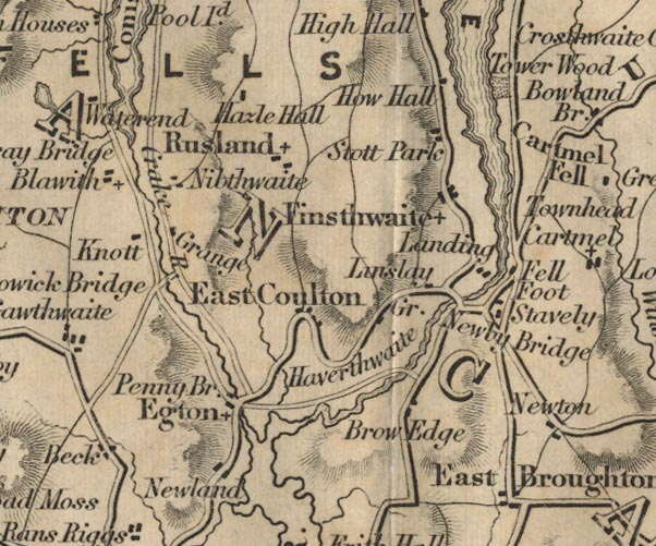 FD02SD38.jpg "Lowick Bridge" Road across stream. item:- JandMN : 100.1 Image © see bottom of page |
|
|
|
||
 Lakes Guides menu.