 Old Cumbria Gazetteer
 |
 |
|
| Lowick Hall, Lowick | ||
| Lowick Hall | ||
| locality:- | Lowick | |
| civil parish:- | Lowick (formerly Lancashire) | |
| county:- | Cumbria | |
| locality type:- | buildings | |
| coordinates:- | SD28588598 | |
| 1Km square:- | SD2885 | |
| 10Km square:- | SD28 | |
|
|
||
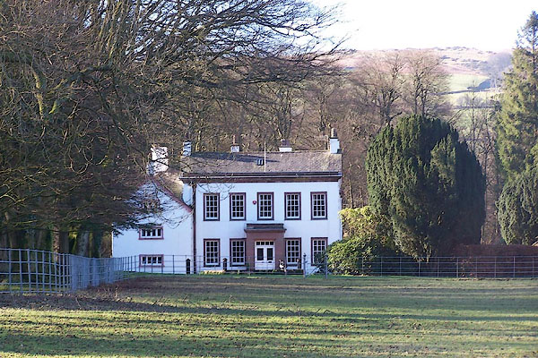 BND37.jpg (taken 2.2.2007) |
||
|
|
||
| evidence:- | old map:- OS County Series (Lan 7 15) placename:- Lowick Hall |
|
| source data:- | Maps, County Series maps of Great Britain, scales 6 and 25
inches to 1 mile, published by the Ordnance Survey, Southampton,
Hampshire, from about 1863 to 1948. |
|
|
|
||
| evidence:- | old map:- West 1784 map placename:- Lowick Hall |
|
| source data:- | Map, hand coloured engraving, A Map of the Lakes in Cumberland,
Westmorland and Lancashire, scale about 3.5 miles to 1 inch,
engraved by Paas, 53 Holborn, London, about 1784.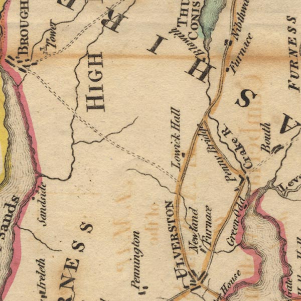 Ws02SD28.jpg item:- Armitt Library : A1221.1 Image © see bottom of page |
|
|
|
||
| evidence:- | database:- Listed Buildings 2010 placename:- Lowick Hall |
|
| source data:- | courtesy of English Heritage "LOWICK HALL / / / LOWICK / SOUTH LAKELAND / CUMBRIA / II[star] / 75874 / SD2858685956" |
|
|
|
||
| hearsay:- |
Arthur Ransome lived here 1948-50, and made improvements to the norman manorial hall
as Lord of the Manor. |
|
|
|
||
| notes:- |
site of a hall |
|
| Perriam, D R &Robinson, J: 1998: Medieval Fortified Buildings of Cumbria: CWAAS::
ISBN 1 873124 23 6 |
||
|
|
||
| personal | ||
| person:- | author : Ransome, Arthur |
|
| place:- | home | |
| date:- | 1948 to 1950 |
|
|
|
||
 Lakes Guides menu.