 Old Cumbria Gazetteer
 |
 |
|
| Moorhouses, Brougham | ||
| Moorhouses | ||
| Street:- | Moor Lane | |
| civil parish:- | Brougham (formerly Westmorland) | |
| county:- | Cumbria | |
| locality type:- | buildings | |
| coordinates:- | NY546280 | |
| 1Km square:- | NY5428 | |
| 10Km square:- | NY52 | |
|
|
||
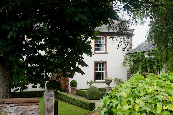 CDP72.jpg (taken 24.7.2015) 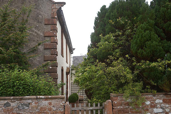 CDP71.jpg (taken 24.7.2015) |
||
|
|
||
| evidence:- | old map:- OS County Series (Wmd 4 13) placename:- Moor Houses |
|
| source data:- | Maps, County Series maps of Great Britain, scales 6 and 25
inches to 1 mile, published by the Ordnance Survey, Southampton,
Hampshire, from about 1863 to 1948. |
|
|
|
||
| evidence:- | probably hearth tax returns:- Hearth Tax 1675 placename:- Moore house |
|
| source data:- | Records, hearth tax survey returns, Westmorland, 1674/75. "Moore house" in "Clifton" |
|
|
|
||
| evidence:- | database:- Listed Buildings 2010 placename:- Moorhouse Farm |
|
| source data:- | courtesy of English Heritage "MOORHOUSE FARMHOUSE / / / BROUGHAM / EDEN / CUMBRIA / II / 74215 / NY5462828045" |
|
|
|
||
 Lakes Guides menu.