 Old Cumbria Gazetteer
 |
 |
|
| Naddle Forest, Shap Rural | ||
| Naddle Forest | ||
| Low Forest | ||
| High Forest | ||
| civil parish:- | Shap Rural (formerly Westmorland) | |
| county:- | Cumbria | |
| locality type:- | forest | |
| locality type:- | hill | |
| coordinates:- | NY495145 (etc) | |
| 1Km square:- | NY4914 | |
| 10Km square:- | NY41 | |
| 10Km square:- | NY51 | |
| SummaryText:- | Remember that High and Low refer to position, respectivey upstream and downstream. | |
|
|
||
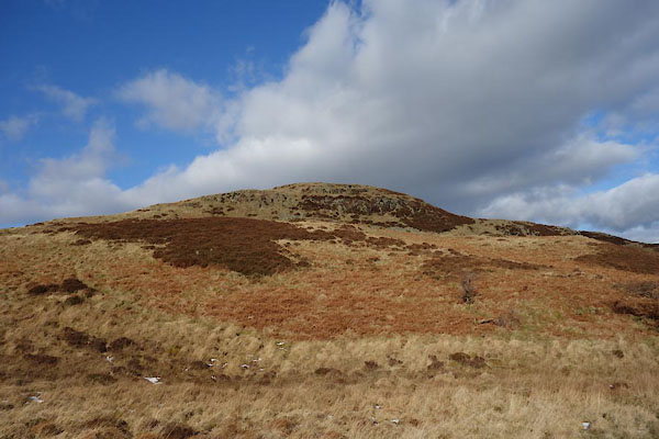 BZW88.jpg High Forest, (taken 16.2.2014) 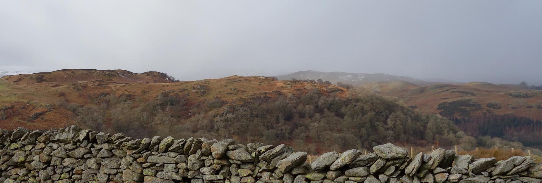 Click to enlarge BZW81.jpg Low Forest, (taken 16.2.2014) |
||
|
|
||
| evidence:- | possibly old map:- Morden 1695 (Wmd) placename:- Thornthwate Forrest |
|
| source data:- | Map, hand coloured engraving, Westmorland, scale about 2.5 miles to 1 inch, by Robert
Morden, published by Abel Swale, the Unicorn, St Paul's Churchyard, Awnsham, and John
Churchill, the Black Swan, Paternoster Row, London, 1695.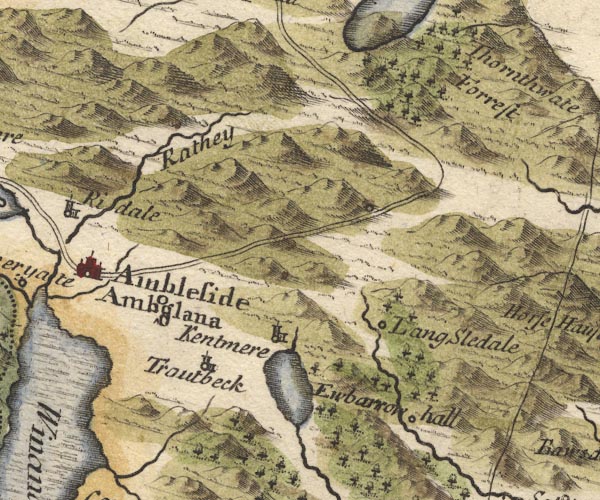 MD10NY40.jpg "Thornthwate Forrest" Trees. item:- JandMN : 24 Image © see bottom of page |
|
|
|
||
| evidence:- | probably descriptive text:- Simpson 1746 placename:- Thornthwaite Forest placename:- Thornthwait Forest |
|
| source data:- | Atlas, three volumes of maps and descriptive text published as
'The Agreeable Historian, or the Compleat English Traveller
...', by Samuel Simpson, 1746. goto source goto sourcePage 1020:- "..." "... The Loder, or Lowther River is a very clear Stream without Mud, which rises in the Broad water Lake near Thornthwaite Forest; ..." goto sourcePage 1021:- "..." "... there are divers Forests in the Barony of Westmoreland, as ... Thornthwait Forest, ..." |
|
|
|
||
| evidence:- | old map:- Simpson 1746 map (Wmd) placename:- Thorntwate Forrest |
|
| source data:- | Map, uncoloured engraving, Westmorland, scale about 8 miles to 1
inch, printed by R Walker, Fleet Lane, London, 1746.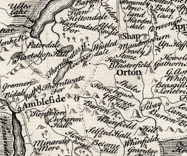 SMP2NYK.jpg "Thorntwate For" Tree symbols? item:- Dove Cottage : 2007.38.59 Image © see bottom of page |
|
|
|
||
| evidence:- | old map:- Bowen and Kitchin 1760 placename:- Thornthwate Forrest |
|
| source data:- | Map, hand coloured engraving, A New Map of the Counties of
Cumberland and Westmoreland Divided into their Respective Wards,
scale about 4 miles to 1 inch, by Emanuel Bowen and Thomas
Kitchin et al, published by T Bowles, Robert Sayer, and John
Bowles, London, 1760.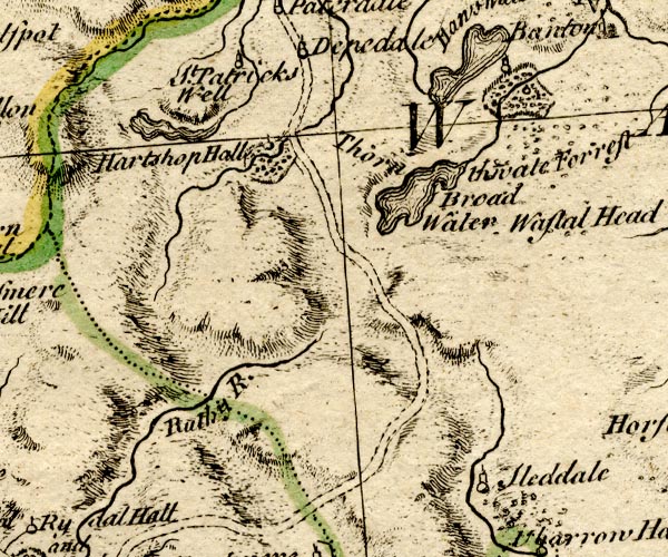 BO18NY30.jpg "Thornthwate Forrest" trees or bushes item:- Armitt Library : 2008.14.10 Image © see bottom of page |
|
|
|
||
| evidence:- | old map:- Jefferys 1770 (Wmd) |
|
| source data:- | Map, 4 sheets, The County of Westmoreland, scale 1 inch to 1
mile, surveyed 1768, and engraved and published by Thomas
Jefferys, London, 1770.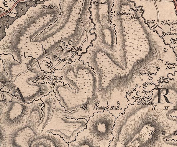 J5NY51SW.jpg hill hachuring; hill or mountain item:- National Library of Scotland : EME.s.47 Image © National Library of Scotland |
|
|
|
||
| evidence:- | old map:- Housman 1800 map 4 placename:- Naddle Forest |
|
| source data:- | Maps, hand coloured engraving, Lakes in Lancashire and Westmorland, 7 lakes on one
sheet, engraved by McIntyre, Edinburgh, published by F Jollie, Carlisle, Cumberland,
and C Law, Ave Maria Lane, London, 1800.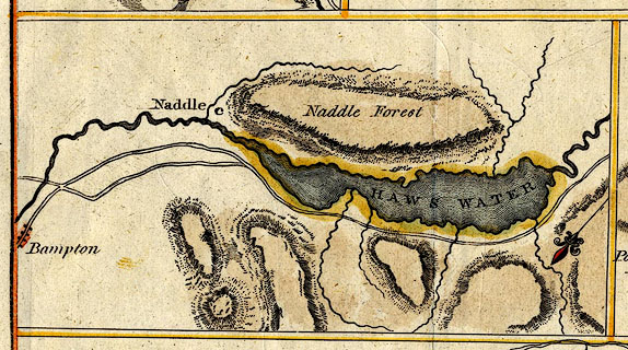 click to enlarge click to enlargeHM02Haw.jpg "Naddle Forest" item:- Dove Cottage : 2007.38.97 Image © see bottom of page |
|
|
|
||
| evidence:- | old map:- Otley 1818 placename:- Naddle Forest |
|
| source data:- | Map, uncoloured engraving, The District of the Lakes,
Cumberland, Westmorland, and Lancashire, scale about 4 miles to
1 inch, by Jonathan Otley, 1818, engraved by J and G Menzies,
Edinburgh, Scotland, published by Jonathan Otley, Keswick,
Cumberland, et al, 1833.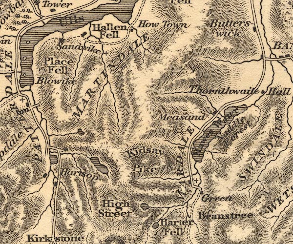 OT02NY41.jpg Label; no trees. item:- JandMN : 48.1 Image © see bottom of page |
|
|
|
||
| evidence:- | outline view:- Otley 1823 (8th edn 1849) placename:- Naddle Forest placename:- Gurnes |
|
| source data:- | Engraving, outline view of mountains, Hawes Water from Measand Beck, drawn by T Binns,
engraved by O Jewitt, opposite p.16 of A Descriptive Guide of the English Lakes, by
Jonathan Otley, 8th edition, 1849.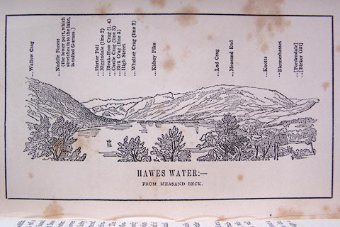 click to enlarge click to enlargeO80E09.jpg "... (The lower part, which stretches into the lake, is called Gurnes.)" item:- Armitt Library : A1180.10 Image © see bottom of page |
|
|
|
||
| evidence:- | descriptive text:- Otley 1823 (5th edn 1834) |
|
| source data:- | Guide book, A Concise Description of the English Lakes, the
mountains in their vicinity, and the roads by which they may be
visited, with remarks on the mineralogy and geology of the
district, by Jonathan Otley, published by the author, Keswick,
Cumberland now Cumbria, by J Richardson, London, and by Arthur
Foster, Kirkby Lonsdale, Cumbria, 1823; published 1823-49,
latterly as the Descriptive Guide to the English Lakes. goto source Page 28:- "... Its [Hawes Water's] eastern side is bounded by Naddle Forest, the lower part completely wooded, and surmounted by the lofty Wallow Crag; beyond which the hill side is scattered with aged thorns." |
|
|
|
||
| evidence:- | old map:- Garnett 1850s-60s H placename:- Naddle Forest |
|
| source data:- | Map of the English Lakes, in Cumberland, Westmorland and
Lancashire, scale about 3.5 miles to 1 inch, published by John
Garnett, Windermere, Westmorland, 1850s-60s.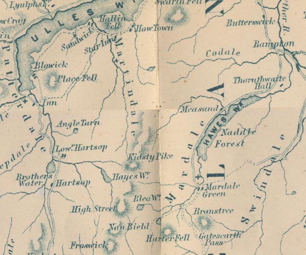 GAR2NY41.jpg "Naddle Forest" area item:- JandMN : 82.1 Image © see bottom of page |
|
|
|
||
| evidence:- | possibly fiction:- Trollope 1864 placename:- Naddale |
|
| source data:- | goto source chapter 31 Among the Fells "... at the back of the house [Vavasor, perhaps Thornthwaite Hall] there was a thick wood of firs running up to the top of what was there called the Beacon Hill. Through this there was a wild steep walk which came out upon the moorland, and from thence there was a track across the mountain to Hawes Water and Naddale, ..." "..." "... But the girls had arranged that immediately after church they would start for a walk up the Beacon Hill, across the fells, towards Hawes Water. ..." "... The two girls [Kate and Alice] took a slice of cake each in her hand, and started on their walk. 'We shan't be able to get to the lake,' said Kate. 'No,' said Alice; 'but we can go as far as the big stone on Swindale Fell, where we can sit down and see it.' ..." "..." "... They walked on, exchanging now and then a word or two, till the distant Cumberland mountains began to form themselves in groups of beauty before their eyes. 'There's Helvellyn at last,' said Kate. 'I'm always happy when I see that.' 'And isn't that Kidsty Pike?' asked Alice. 'No; you don't see Kidsty yet. But you will when you get up to the bank there. That's Scaw Fell on the left; - the round distant top. I can distinguish it, though I doubt whether you can.' Then they went on again, and were soon at the bank from whence the sharp top of the mountain which Alice had named was visible.'And now we are on Swindale, and in five minutes we shall get to the stone.'" |
|
|
|
||
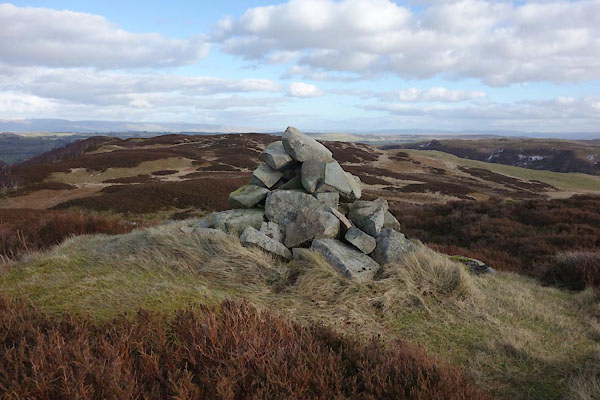 BZW89.jpg cairn, High Forest, (taken 16.2.2014) |
||
|
|
||
Lakes Guides menu.