 Old Cumbria Gazetteer
 |
 |
|
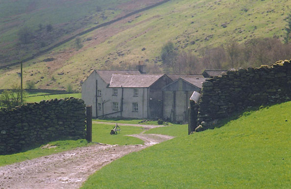
| Nether House, Longsleddale | ||
| Nether House Farm | ||
| Nether House Farm | ||
| locality:- | Longsleddale | |
| civil parish:- | Longsleddale (formerly Westmorland) | |
| county:- | Cumbria | |
| locality type:- | buildings | |
| coordinates:- | NY51460030 | |
| 1Km square:- | NY5100 | |
| 10Km square:- | NY50 | |
|
|
||
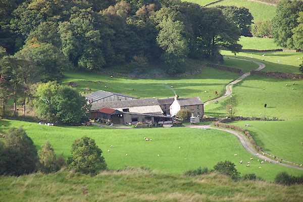 BJX05.jpg (taken 1.10.2005) 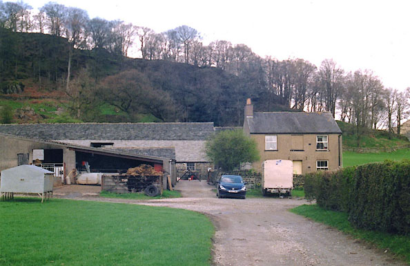 BIQ05.jpg (taken 22.4.2004) |
||
|
|
||
| evidence:- | old map:- OS County Series (Wmd 33 4) placename:- Nether House |
|
| source data:- | Maps, County Series maps of Great Britain, scales 6 and 25
inches to 1 mile, published by the Ordnance Survey, Southampton,
Hampshire, from about 1863 to 1948.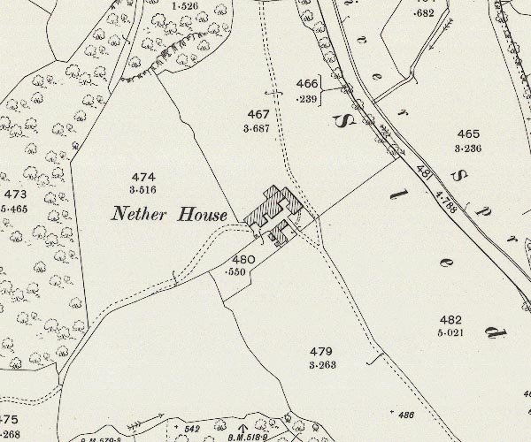 C5E024.jpg "Nether House" |
|
|
|
||
| evidence:- | old map:- OS County Series (Wmd 33 4) placename:- Nether House |
|
| source data:- | County Series map, Westmorland sheet 33 4, part of Longsleddale, Westmorland, scale
25 inches to 1 mile, published by the Ordnance Survey, Southampton, Hampshire, about
1890s?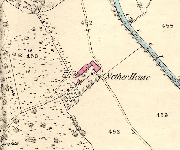 BNJ83.jpg item:- private collection : 55 Image © see bottom of page |
|
|
|
||
| evidence:- | census returns:- placename:- Netherhouse placename:- Nether House |
|
|
|
||
 old parish registers (formerly ) old parish registers (formerly ) |
||
|
|
||
| evidence:- | old map:- Jefferys 1770 (Wmd) placename:- Nether House |
|
| source data:- | Map, 4 sheets, The County of Westmoreland, scale 1 inch to 1
mile, surveyed 1768, and engraved and published by Thomas
Jefferys, London, 1770.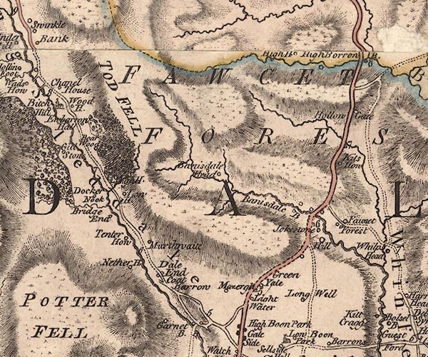 J5NY50SW.jpg "Nether H." circle, labelled in italic lowercase text; settlement, farm, house, or hamlet? item:- National Library of Scotland : EME.s.47 Image © National Library of Scotland |
|
|
|
||
| evidence:- | old map:- Cary 1789 (edn 1805) placename:- Nether How |
|
| source data:- | Map, uncoloured engraving, Westmoreland, scale about 2.5 miles
to 1 inch, by John Cary, London, 1789; edition 1805.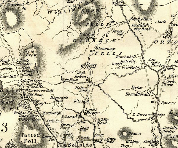 CY24NY50.jpg "Nether How" block/s, labelled in italic lowercase; house, or hamlet item:- JandMN : 129 Image © see bottom of page |
|
|
|
||
| evidence:- | old map:- Hodgson 1828 placename:- Nether House |
|
| source data:- | Map, hand coloured engraving, 4 sheets mounted together on linen and rolled, Plan
of the County of Westmorland, scale about 1.25 inches to 1 mile, by Thomas Hodgson,
engraved by W R Gardner, Harpur Street, London, published by Thomas Hodgson, Lancaster,
and perhaps by C Smith, 172 Strand, London,1828.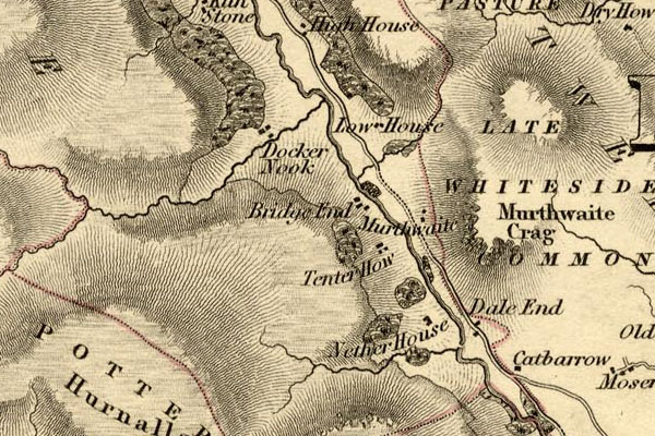 HDG6lsl1.jpg map courtesy of Mark Cropper "Nether House" item:- private collection : 371 Image © see bottom of page |
|
|
|
||
| Kendal Corn Rent Act 1836 |
||
|
|
||
| evidence:- | old map:- OS 1881-82 New Series (outline edition) placename:- Nether House |
|
| source data:- | Map, engraving, area north of Kendal, Westmorland, New Series
one inch map, outline edition, sheet 39, scale 1 inch to 1 mile,
published by the Ordnance Survey, Southampton, Hampshire,
1881-82.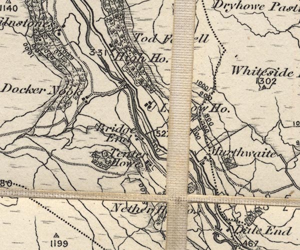 O21NY50A.jpg , "Nether Ho." item:- JandMN : 61 Image © see bottom of page |
|
|
|
||
| evidence:- | old postcard:- |
|
| source data:- | Postcard, black and white photograph of Nether House Farm, Longsleddale by Ewan, Kendal,
1900s?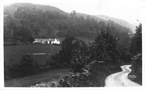 click to enlarge click to enlargePH0045.jpg "Longsleddale" "EWAN KENDAL" courtesy of Michael Wooldridge item:- private collection : 148 Image © see bottom of page |
|
|
|
||
| evidence:- | descriptive text:- |
|
| source data:- | Royal Commission on Historical Monuments in England: 1936: Inventory of the Historical
Monuments in Westmorland: HMSO "[17th century, 2 storey, rubble walls, slate roofs] ... has a modern front block." |
|
|
|
||
| census records |
||
|
|
||
| directory entries |
||
|
|
||
| evidence:- | map:- OS Six Inch (1956) placename:- Nether House |
|
| source data:- | Map series, various editions with the national grid, scale about
6 inches to 1 mile, published by the Ordnance Survey,
Southampton, Hampshire, scale 1 to 10560 from 1950s to 1960s,
then 1 to 10000 from 1960s to 2000s, superseded by print on
demand from digital data.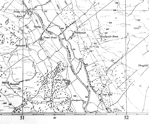 SINY5100.jpg "Nether House" |
|
|
|
||
| evidence:- | shepherds guide:- Wilson 1913 placename:- Nether House |
|
| source data:- | Book, New Shepherd's Guide for Cumberland, Westmorland, and
Lancashire, by Thomas Wilson, 1913.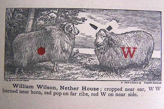 WL1p372c.jpg "William Wilson, Nether House; cropped near ear, W W burned near horn, red pop on far ribs, red W on near side." item:- private collection : 329 Image © see bottom of page |
|
|
|
||
| evidence:- | shepherds guide:- Gate 1879 placename:- Nether House |
|
| source data:- | Book, New Shepherd's Guide for Cumberland, Westmoreland, and
Lancashire, published by Daniel Gate, Keswick, Cumberland, 1879.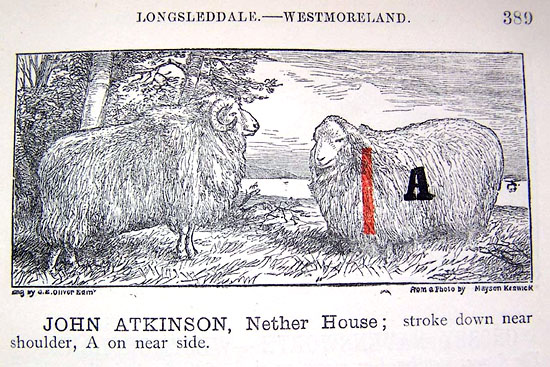 GT1p389a.jpg "JOHN ATKINSON, Nether House; stroke down near shoulder, A on near side." item:- Kendal Library : 38 Image © see bottom of page |
|
|
|
||
| evidence:- | shepherds guide:- Lamb 1937 placename:- Nether House |
|
| source data:- | Book, Lamb's Shepherds' Guide for Cumberland, Westmorland and
Lancashire, by R H Lamb, published by the Herald Printing Co,
Penrith, Cumberland, 1937.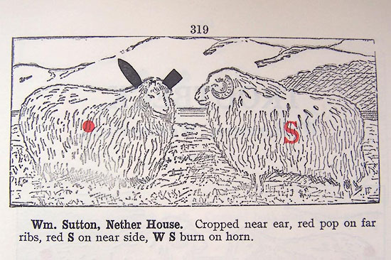 LM1p319a.jpg "Wm. Sutton, Nether House. Cropped near ear, red pop on far ribs, red S on near side, W S burn on horn." item:- Kendal Library : 40 Image © see bottom of page |
|
|
|
||
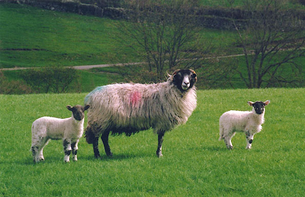 BIQ03.jpg Swaledale ewe and lambs with Nether House mark. Red pop on farside mid rib. (taken 22.4.2004) |
||
|
|
||
 BIQ07.jpg (taken 22.4.2004) |
||
|
|
||
 Lakes Guides menu.