Old Cumbria Gazetteer
 |
 |
|
||
| Orton | ||||
| civil parish:- | Orton S (formerly Westmorland) | |||
| county:- | Cumbria | |||
| locality type:- | locality | |||
| locality type:- | buildings | |||
| locality type:- | market town | |||
| locality type:- | selected place | |||
| coordinates:- | NY62200823 (etc) | |||
| 1Km square:- | NY6208 | |||
| 10Km square:- | NY60 | |||
| latitude; longitude:- | 2d 34.9m W; 54d 28.1m N | |||
|
|
||||
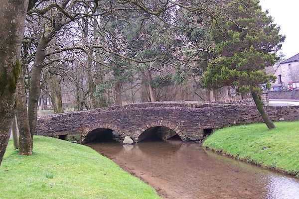
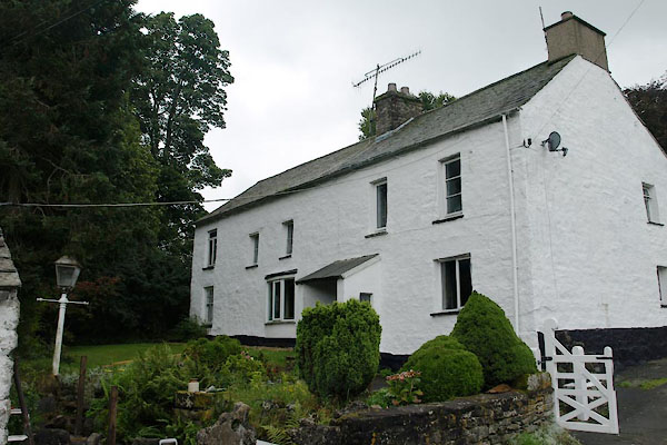
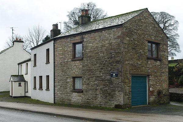
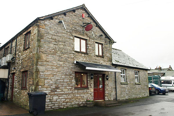
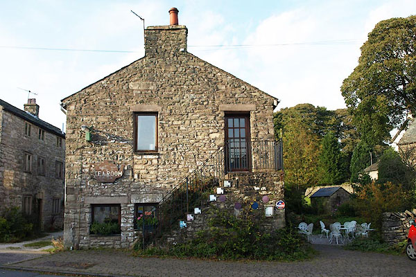
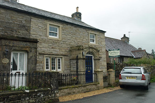
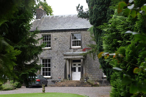
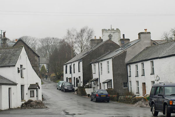
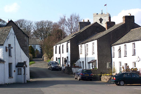 BLX77.jpg (taken 21.4.2006) 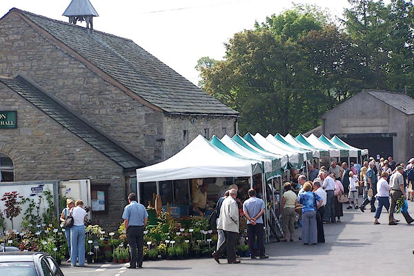 BNU75.jpg Orton Farmers' Market (taken 9.6.2007) |
||||
|
|
||||
| evidence:- | old map:- OS County Series (Wmd 21 16) placename:- Orton |
|||
| source data:- | Maps, County Series maps of Great Britain, scales 6 and 25
inches to 1 mile, published by the Ordnance Survey, Southampton,
Hampshire, from about 1863 to 1948. |
|||
|
|
||||
| evidence:- | old map:- Saxton 1579 placename:- Orton |
|||
| source data:- | Map, hand coloured engraving, Westmorlandiae et Cumberlandiae Comitatus ie Westmorland
and Cumberland, scale about 5 miles to 1 inch, by Christopher Saxton, London, engraved
by Augustinus Ryther, 1576, published 1579-1645.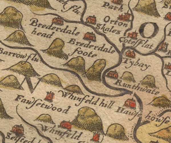 Sax9NY50.jpg Church, symbol for a parish or village, with a parish church. "Orton" item:- private collection : 2 Image © see bottom of page |
|||
|
|
||||
| evidence:- | old map:- Mercator 1595 (edn?) placename:- Oerton |
|||
| source data:- | Map, hand coloured engraving, Westmorlandia, Lancastria, Cestria
etc, ie Westmorland, Lancashire, Cheshire etc, scale about 10.5
miles to 1 inch, by Gerard Mercator, Duisberg, Germany, 1595,
edition 1613-16. MER5WmdA.jpg "Oerton" circle item:- Armitt Library : 2008.14.3 Image © see bottom of page |
|||
|
|
||||
| evidence:- | old map:- Speed 1611 (Wmd) placename:- Orton |
|||
| source data:- | Map, hand coloured engraving, The Countie Westmorland and
Kendale the Cheif Towne, scale about 2.5 miles to 1 inch, by
John Speed, 1610, published by George Humble, Popes Head Alley,
London, 1611-12.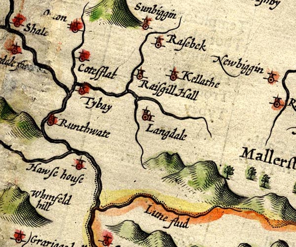 SP14NY60.jpg "Orton" circle, building and tower item:- Armitt Library : 2008.14.5 Image © see bottom of page |
|||
|
|
||||
| evidence:- | table of distances:- Simons 1635 placename:- Orton |
|||
| source data:- | Table of distances, uncoloured engraving, Westmerland ie
Westmorland, with a thumbnail map, scale about 42 miles to 1
inch, by Mathew Simons, published in A Direction for the English
Traviller, 1635.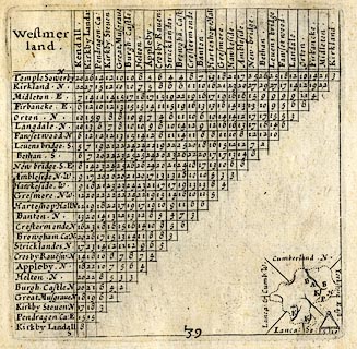 click to enlarge click to enlargeSIM3.jpg "Orton N" and tabulated distances item:- private collection : 50.39 Image © see bottom of page |
|||
|
|
||||
| evidence:- | old map:- Jansson 1646 placename:- Orton |
|||
| source data:- | Map, hand coloured engraving, Cumbria and Westmoria, ie
Cumberland and Westmorland, scale about 3.5 miles to 1 inch, by
John Jansson, Amsterdam, Netherlands, 1646.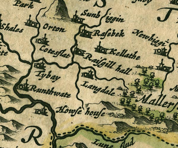 JAN3NY60.jpg "Orton" Buildings and tower. item:- JandMN : 88 Image © see bottom of page |
|||
|
|
||||
| evidence:- | hearth tax returns:- Hearth Tax 1670 placename:- Orton Towne |
|||
| source data:- | Records, hearth tax returns, exchequer duplicates, Westmorland,
1670. "Orton Towne" |
|||
|
|
||||
| evidence:- | old map:- Morden 1695 (EW) placename:- Orton |
|||
| source data:- | Map, hand coloured engraving, England, including Wales, scale
about 27 miles to 1 inch, by Robert Morden, published by Abel
Swale Awnsham and John Churchil, London, about 1695.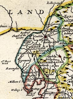 click to enlarge click to enlargeMRD3Cm.jpg "Orton" circle; village or town item:- JandMN : 339 Image © see bottom of page |
|||
|
|
||||
| evidence:- | old map:- Morden 1695 (Wmd) placename:- Orton |
|||
| source data:- | Map, hand coloured engraving, Westmorland, scale about 2.5 miles to 1 inch, by Robert
Morden, published by Abel Swale, the Unicorn, St Paul's Churchyard, Awnsham, and John
Churchill, the Black Swan, Paternoster Row, London, 1695.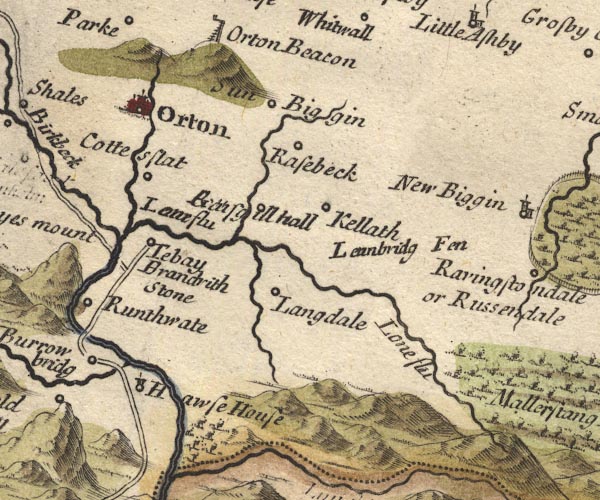 MD10NY60.jpg "Orton" Circle, buildings, towers. item:- JandMN : 24 Image © see bottom of page |
|||
|
|
||||
| evidence:- | old map:- Badeslade 1742 placename:- Orton |
|||
| source data:- | Maps, Westmorland North from London, scale about 10 miles to 1
inch, and Cumberland North from London, scale about 11 miles to
1 inch, with descriptive text, by Thomas Badeslade, London,
engraved and published by William Henry Toms, Union Court,
Holborn, London, 1742; published 1742-49. "Orton Market Wednesday." |
|||
|
|
||||
| evidence:- | old map:- Badeslade 1742 placename:- Orton |
|||
| source data:- | Map, uncoloured engraving, A Map of Westmorland North from
London, scale about 10 miles to 1 inch, with descriptive text,
by Thomas Badeslade, London, engraved and published by William
Henry Toms, Union Court, Holborn, London, 1742. click to enlarge click to enlargeBD12.jpg "Orton" circle, tower/s, upright lowercase text; town item:- Dove Cottage : 2007.38.62 Image © see bottom of page |
|||
|
|
||||
| evidence:- | old text:- Gents Mag item:- rebellion, 1745; 1745 Rebellion |
|||
| source data:- | Magazine, The Gentleman's Magazine or Monthly Intelligencer or
Historical Chronicle, published by Edward Cave under the
pseudonym Sylvanus Urban, and by other publishers, London,
monthly from 1731 to 1922. goto source goto sourceGentleman's Magazine 1745 p.624 "From the London Gazette extraordinary. Whitehall, Dec. 18 [1745]." "... The person call'd duke of Perth, with about 150 horse, left the rebel army upon the 11th at Lancaster, and took the road towards Carlisle, giving out, that he was going to fetch a reinforcement. Notice thereof has been sent to all the towns through which he was to pass, and it was hoped the country people would intercept him. ..." "... and were hunted all day by the people, who took one of them, and were driven into Orton, at 6 in the evening; here they only staid to feed their horses in the street, and then set forward (having pressed a guide) to join their main body at Kendal, being pursued by the people from Appleby and Brough, who ('tis said) took the D. of Perth's mistress and another gentlewoman, and two horses, their chaise being broke down. ..." |
|||
|
|
||||
| evidence:- | old text:- Gents Mag 1746 item:- rebellion, 1745; 1745 Rebellion |
|||
| source data:- | goto source Gentleman's Magazine 1746 p.62 "... The D. of Perth with about 110 men, the vanguard of the rebels, ... they set out early in the morning [15.12.1745], ... About 7 o'clock [pm] they came to Orton, where the D. of Perth had lodged all night when the rebels marched southward, but he did not know the town, nor dursts enter it, till having first sent in to take some prisoners, by whom he learnt that there were no soldiers or armed men in it. During this pursuit one of the rebels was taken and they took a country boy who had discharged his pistol 2 or 3 times at them, and seem'd determin'd to shoot him; but Perth dissuaded them, saying he was a pretty boy, and 'twould be a pity to kill him. The Eastern part of Westmorland, hearing the transactions of the day, and yt the rebels were lodged at Orton, resolved to serve their king and country, by taking or destroying these enemies of our peace. Accordingly Appleby, Kirkby Stephen, and indeed the country in general rose that night, and went to surround Orton as soon as they could, many of them being near before day, and determined to attack the town, but the rebels after a short repose having proceeded forward to Kendal, the country were disappointed of their design." "..." |
|||
|
|
||||
| evidence:- | old map:- Simpson 1746 map (Wmd) placename:- Orton |
|||
| source data:- | Map, uncoloured engraving, Westmorland, scale about 8 miles to 1
inch, printed by R Walker, Fleet Lane, London, 1746.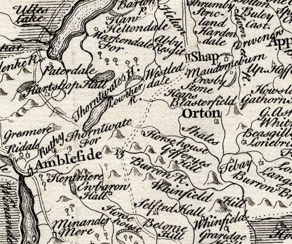 SMP2NYK.jpg "Orton" Building; labelled as a town. item:- Dove Cottage : 2007.38.59 Image © see bottom of page |
|||
|
|
||||
| evidence:- | old map:- Bickham 1753-54 (Wmd) placename:- Orton |
|||
| source data:- | Map, uncoloured engraving, perspective view, A Map of
Westmorland, North from London, by George Bickham, James Street,
Bunhill Fields, London, 1753.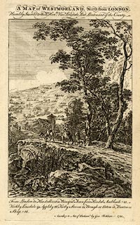 click to enlarge click to enlargeBCK3.jpg "Orton" view (sort of) item:- Armitt Library : 2008.14.71 Image © see bottom of page |
|||
|
|
||||
| evidence:- | old map:- Bowen and Kitchin 1760 placename:- Orton |
|||
| source data:- | Map, hand coloured engraving, A New Map of the Counties of
Cumberland and Westmoreland Divided into their Respective Wards,
scale about 4 miles to 1 inch, by Emanuel Bowen and Thomas
Kitchin et al, published by T Bowles, Robert Sayer, and John
Bowles, London, 1760.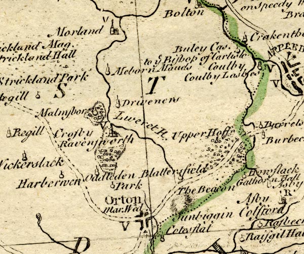 BO18NY51.jpg "Orton Mar. Wed. / V" blocks at cross roads, town, market, vicarage item:- Armitt Library : 2008.14.10 Image © see bottom of page |
|||
|
|
||||
| evidence:- | old map:- Jefferys 1770 (Wmd) placename:- Orton |
|||
| source data:- | Map, 4 sheets, The County of Westmoreland, scale 1 inch to 1
mile, surveyed 1768, and engraved and published by Thomas
Jefferys, London, 1770.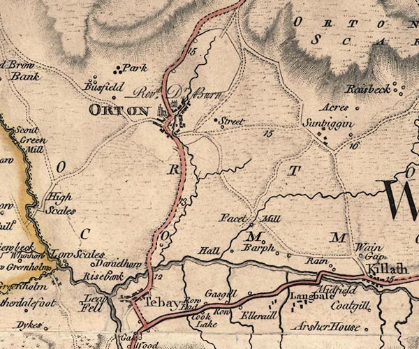 J5NY60NW.jpg "ORTON" blocks on a street plan, labelled in block caps; settlement, market town? item:- National Library of Scotland : EME.s.47 Image © National Library of Scotland |
|||
|
|
||||
| evidence:- | old map:- Jefferys 1770 placename:- Orton |
|||
| source data:- | Map, 4 sheets, The County of Westmoreland, scale 1 inch to 1
mile, surveyed 1768, and engraved and published by Thomas
Jefferys, London, 1770.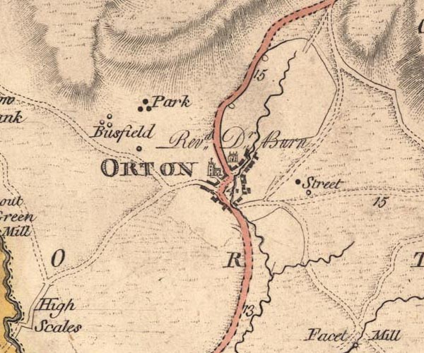 JEF5Ortn.jpg "ORTON" blocks on a street plan, a church and large house item:- National Library of Scotland : EME.s.47 Image © National Library of Scotland |
|||
|
|
||||
| evidence:- | old text:- Pennant 1773 placename:- Orton placename:- Overton item:- History and Antiquities of Cumberland and Westmoreland; inclosure |
|||
| source data:- | Book, A Tour from Downing to Alston Moor, 1773, by Thomas
Pennant, published by Edward Harding, 98 Pall Mall, London, 1801. goto source Pennant's Tour 1773, page 122 "... to Orton, or Overton; principally induced from the wish to see the Reverend Doctor Burn, author of the Justice of the Peace, and joint publisher with Joseph Nicholson, esq. of the History and Antiquities of Cumberland and Westmoreland. To these Gentlemen this Journal is much indebted: to the former, every country gentleman, who assumes the useful character of the magistrate, owes the greatest obligation for the clearest and safest guide in his intricate and laborious office." "I had the satisfaction of dining with the worthy author, and may add, that to other public services he encourages the inclosures of the open lands, which will give to future times cheerful and plenteous harvests, in places where poverty and negligence seem now to reign." |
|||
|
|
||||
| evidence:- | old map:- Pennant 1777 placename:- Orton |
|||
| source data:- | Map, hand coloured engraving, A Map of Scotland, Hebrides and
Part of England, drawn for Thomas Pennant, engraved by J Bayly,
published by Benjamin White, London, 1777. click to enlarge click to enlargePEN1Cm.jpg "Orton" circle; buildings, village, etc item:- private collection : 66 Image © see bottom of page |
|||
|
|
||||
| evidence:- | descriptive text:- West 1778 (11th edn 1821) |
|||
| source data:- | Guide book, A Guide to the Lakes, by Thomas West, published by
William Pennington, Kendal, Cumbria once Westmorland, and in
London, 1778 to 1821. goto source Tour to the Caves in the West Riding of Yorkshire, late 18th century Page 243:- "..." "... The Roman road is easily traced from Ribchester ... to Overborough; afterwards the Roman road goes through Casterton and Middleton, and, as some think, by Borrow-bridge and Orton, to Apulby. ..." |
|||
|
|
||||
| evidence:- | old text:- Camden 1789 (Gough Additions) placename:- Orton placename:- Overton item:- market |
|||
| source data:- | Book, Britannia, or A Chorographical Description of the Flourishing Kingdoms of England,
Scotland, and Ireland, by William Camden, 1586, translated from the 1607 Latin edition
by Richard Gough, published London, 1789. goto source Page 155:- "..." "Orton, or Overton, is a vicarage belonging formerly to Conishead priory, Lancashire, after the dissolution to the crown, and by purchase from the latter settled in feoffees, who present, and the bishop of Carlisle institutes. The late Dr. Richard Burn, chancellor of the diocese of Carlisle, author of the Justice of Peace, and a system of ecclesiastical law, and joint editor of the History and Antiquities of this county and Cumberland in 2 vols. 4to. 1777, held it" goto sourcePage 156:- "near 50 years to his death Nov. 20, 1785. Here is a market granted by Edward I. and confirmed by Oliver Cromwell 1655, who, 1678, granted two fairs. ..." |
|||
|
|
||||
| evidence:- | old map:- Cary 1789 (edn 1805) placename:- Orton |
|||
| source data:- | Map, uncoloured engraving, Westmoreland, scale about 2.5 miles
to 1 inch, by John Cary, London, 1789; edition 1805. CY24NY60.jpg "Orton" blocks, church symbol, labelled in upright lowercase; village item:- JandMN : 129 Image © see bottom of page |
|||
|
|
||||
| evidence:- | old map:- Aikin 1790 (Wmd) placename:- Orton |
|||
| source data:- | Map, uncoloured engraving, Westmoreland ie Westmorland, scale
about 8.5 miles to 1 inch, by John Aikin, London, 1790. click to enlarge click to enlargeAIK2.jpg "Orton" circle; town item:- JandMN : 51 Image © see bottom of page |
|||
|
|
||||
| evidence:- | old map:- Bailey 1797 placename:- Orten |
|||
| source data:- | Map, soil etc, uncoloured engraving, Westmoreland, scale about
12 miles to 1 inch, by J Bailey, engraved by Neele, Strand,
published by Messrs Robinson, Paternoster Row and G Nicol, Pall
Mall, London, 1797. click to enlarge click to enlargeBY05.jpg "Orten" group of blocks; town item:- Armitt Library : A680.3 Image © see bottom of page |
|||
|
|
||||
| evidence:- | road book:- Cary 1798 (2nd edn 1802) placename:- Orton |
|||
| source data:- | Road book, itineraries, Cary's New Itinerary, by John Cary, 181
Strand, London, 2nd edn 1802. goto source click to enlarge click to enlargeC38315.jpg page 315-316 "Orton" market town "At Orton, John Burn, Esq." item:- JandMN : 228.1 Image © see bottom of page |
|||
|
|
||||
| evidence:- | old map:- Cooke 1802 placename:- Orton |
|||
| source data:- | Map, Westmoreland ie Westmorland, scale about 12 miles to 1
inch, by George Cooke, 1802, published by Sherwood, Jones and
Co, Paternoster Road, London, 1824. click to enlarge click to enlargeGRA1Wd.jpg "Orton / 279" blocks, upright lowercase text; town, distance from London item:- Hampshire Museums : FA2000.62.4 Image © see bottom of page |
|||
|
|
||||
| evidence:- | old map:- Luffman 1803 placename:- Orton |
|||
| source data:- | Map, hand coloured engraving, Westmoreland ie Westmorland, scale
about 37 miles to 1 inch, by John Luffman, 28 Little Bell Alley,
Coleman Street, London, 1803-06. click to enlarge click to enlargeLUF4.jpg "Orton" circle; town item:- Dove Cottage : 2007.38.46 Image © see bottom of page |
|||
|
|
||||
| evidence:- | old map:- Laurie and Whittle 1806 placename:- Orton |
|||
| source data:- | Road map, Continuation of the Roads to Glasgow and Edinburgh,
scale about 10 miles to 1 inch, by Nathaniel Coltman? 1806,
published by Robert H Laurie, 53 Fleet Street, London, 1834. click to enlarge click to enlargeLw21.jpg "Orton 275¾" market town; distance from London item:- private collection : 18.21 Image © see bottom of page |
|||
|
|
||||
| evidence:- | old text:- Capper 1808 placename:- Orton item:- population; market; fair; Justice of the Peace; History and Antiquities of Westmoreland and Cumberland |
|||
| source data:- | Gazetteer, A Topographical Dictionary of the United Kingdom,
compiled by Benjamin Pitts Capper, published by Richard
Phillips, Bridge Street, Blackfriars, London, 1808; published
1808-29. goto source "..." "ORTON, a market-town and parish in East ward, Westmoreland, 8 miles from Appleby, and 274 from London; containing 291 houses and 1230 inhabitants. The church is an extensive old building, with a tower steeple. There are two free-schools in this town. Dr. Burn, the author of The Justice of the Peace, and joint editor of the History and Antiquities of Westmoreland and Cumberland, was vicar of this parish for 30 years. The market is on Wednesday. Fairs, 2d May, and the Friday before Whit Sunday. It is a vicarage, value 16l. 17s. 3d." "..." |
|||
|
|
||||
| evidence:- | old map:- Cooper 1808 placename:- Orton |
|||
| source data:- | Map, hand coloured engraving, Westmoreland ie Westmorland, scale
about 9 miles to 1 inch, by H Cooper, 1808, published by R
Phillips, Bridge Street, Blackfriars, London, 1808. click to enlarge click to enlargeCOP4.jpg "Orton" circle with two side bars; town item:- Dove Cottage : 2007.38.53 Image © see bottom of page |
|||
|
|
||||
| evidence:- | old map:- Wallis 1810 (Wmd) placename:- Orton |
|||
| source data:- | Road map, Westmoreland, scale about 19 miles to 1 inch, by James
Wallis, 77 Berwick Street, Soho, 1810, published by W Lewis,
Finch Lane, London, 1835? click to enlarge click to enlargeWAL5.jpg "Orton / 279" town; distance from London item:- JandMN : 63 Image © see bottom of page |
|||
|
|
||||
| evidence:- | descriptive text:- Wallis 1810 placename:- Orton |
|||
| source data:- | Map, Westmoreland, scale about 19 miles to 1 inch, and
Cumberland, scale about 16 miles to 1 inch, by James Wallis, 77
Berwick Street, Soho, London, 1810; published 1810-36. "PRINCIPAL FAIRS." "Orton: May 2, black cattle; Friday before Whitsunday, sheep and black cattle." |
|||
|
|
||||
| evidence:- | old text:- Gents Mag |
|||
| source data:- | Magazine, The Gentleman's Magazine or Monthly Intelligencer or
Historical Chronicle, published by Edward Cave under the
pseudonym Sylvanus Urban, and by other publishers, London,
monthly from 1731 to 1922. goto source Gentleman's Magazine 1816 part 2 p.601 Biographical note from the Compendium of County History:- "Nicolson, William, Abp. of Cashel, antiquary, Orton, 1655." |
|||
|
|
||||
| evidence:- | old text:- Gents Mag 1825 |
|||
| source data:- | goto source Gentleman's Magazine 1825 part 1 p.513 From the Compendium of County History:- "Barlow, Dr. Thomas, Bishop of Lincoln, Orton, 1607." |
|||
|
|
||||
| evidence:- | old map:- Hall 1820 (Wmd) placename:- Orton |
|||
| source data:- | Map, hand coloured engraving, Westmoreland ie Westmorland, scale
about 14.5 miles to 1 inch, by Sidney Hall, London, 1820,
published by Samuel Leigh, 18 Strand, London, 1820-31. click to enlarge click to enlargeHA18.jpg "Orton / 276" circle, upright lowercase text; town; distance from London item:- Armitt Library : 2008.14.58 Image © see bottom of page |
|||
|
|
||||
| evidence:- | old map:- Greenwood 1824 (Wmd) placename:- Orton |
|||
| source data:- | Map, hand coloured engraving, Map of the County of Westmorland,
scale about 1 inch to 1 mile, by C and J Greenwood, published by
George Pringle jnr, 70 Queen Street, Cheapside, London, 1824.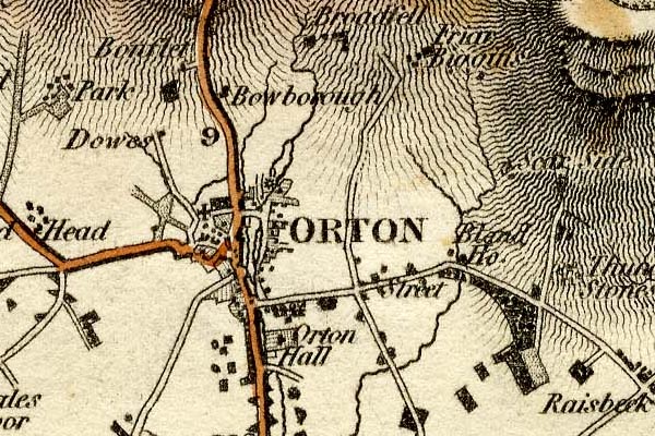 grw5ortn.jpg "ORTON" street map; labelled in block caps for a market town. item:- Armitt Library : A1827 Image © see bottom of page |
|||
|
|
||||
| evidence:- | old map:- Ford 1839 map placename:- Orton |
|||
| source data:- | Map, uncoloured engraving, Map of the Lake District of
Cumberland, Westmoreland and Lancashire, scale about 3.5 miles
to 1 inch, published by Charles Thurnam, Carlisle, and by R
Groombridge, 5 Paternoster Row, London, 3rd edn 1843. FD02NY60.jpg "ORTON" item:- JandMN : 100.1 Image © see bottom of page |
|||
|
|
||||
| evidence:- | old map:- Garnett 1850s-60s H placename:- Orton |
|||
| source data:- | Map of the English Lakes, in Cumberland, Westmorland and
Lancashire, scale about 3.5 miles to 1 inch, published by John
Garnett, Windermere, Westmorland, 1850s-60s.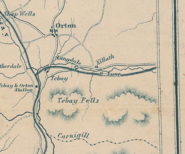 GAR2NY60.jpg "Orton" blocks, settlement item:- JandMN : 82.1 Image © see bottom of page |
|||
|
|
||||
| evidence:- | market notes:- placename:- Overton item:- market |
|||
| source data:- | www.history.ac.uk/cmh/gaz/gazweb2.htmPalmer's Index No.93:: Public Record OfficeOwen: 1792: New Book of FairsBowen, Emanuel &Kitchin, Thomas: 1760: New Map of the Counties of Cumberland and Westmoreland | |||
|
|
||||
 Post Office maps Post Office maps |
||||
|
|
||||
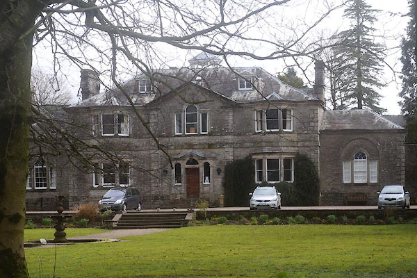
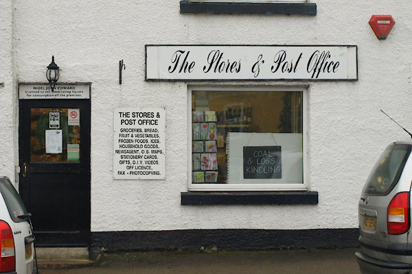
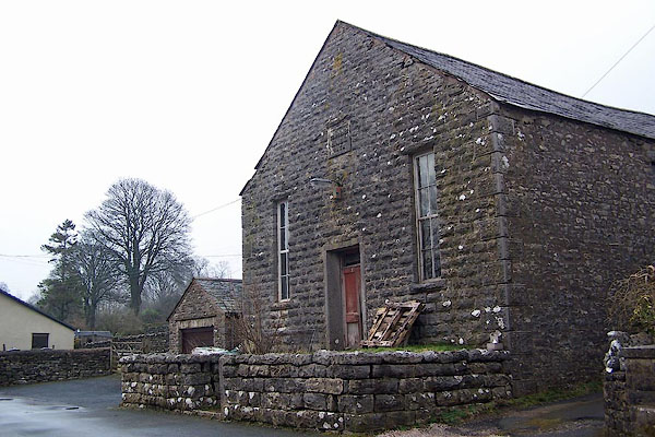
 BTW18.jpg On a less cheerful day. (taken 31.12.2010) |
||||
|
|
||||
| notes:- |
Market charter granted by Edward I; after a lapse it was re-established 1863. |
|||
| At the request of Lady Anne Pembroke, a licnce to hold fairs was granted by Oliver
Cromwell. Fairs: 3 May for horses, cattle, and sheep, with side shows, and gypsy caravans,
etc; October, a tup fair. |
||||
|
|
||||
| places:- |
|
|||
|
||||
|
||||
|
||||
|
||||
|
||||
|
||||
|
||||
|
||||
|
||||
|
||||
|
||||
|
||||
|
||||
|
||||
|
||||
|
||||
|
||||
|
||||
|
||||
|
||||
|
||||
|
||||
|
||||
|
||||
|
||||
|
||||
|
||||
|
||||
|
||||
|
||||
|
||||
|
||||
|
||||
|
||||
|
||||
|
||||
Lakes Guides menu.