Old Cumbria Gazetteer
 |
 |
|
|||||||||||||||||||||
| included in:- |
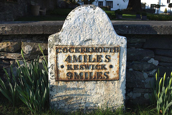
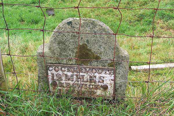
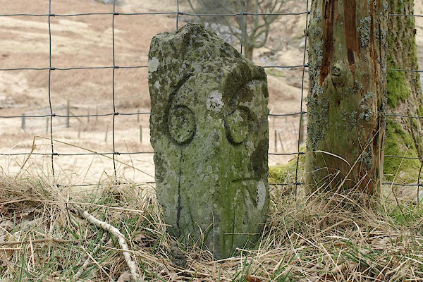
 road, Penrith to Workington road, Kendal to Cockermouth road, Keswick to Carlisle road, Penrith to Workington road, Kendal to Cockermouth road, Keswick to Carlisle |
||||||||||||||||||||||
| road, Keswick to Cockermouth | |||||||||||||||||||||||
| Keswick to Cockermouth | |||||||||||||||||||||||
| Cockermouth to Keswick | |||||||||||||||||||||||
| A66(T) | |||||||||||||||||||||||
| civil parish:- | Keswick (formerly Cumberland) | ||||||||||||||||||||||
| civil parish:- | Underskiddaw (formerly Cumberland) | ||||||||||||||||||||||
| civil parish:- | Above Derwent (formerly Cumberland) | ||||||||||||||||||||||
| civil parish:- | Wythop (formerly Cumberland) | ||||||||||||||||||||||
| civil parish:- | Setmurthy (formerly Cumberland) | ||||||||||||||||||||||
| civil parish:- | Embleton (formerly Cumberland) | ||||||||||||||||||||||
| civil parish:- | Cockermouth (formerly Cumberland) | ||||||||||||||||||||||
| civil parish:- | Lorton (formerly Cumberland) | ||||||||||||||||||||||
| county:- | Cumbria | ||||||||||||||||||||||
| locality type:- | road route | ||||||||||||||||||||||
| 10Km square:- | NY22 | ||||||||||||||||||||||
| 10Km square:- | NY23 | ||||||||||||||||||||||
| 10Km square:- | NY13 | ||||||||||||||||||||||
|
|
|||||||||||||||||||||||
| evidence:- | old map:- Ogilby 1675 (plate 96) |
||||||||||||||||||||||
| source data:- | Road strip map, hand coloured engraving, the Road from Kendal to
Cockermouth, and the Road from Egremond to Carlisle, scale about
1 inch to 1 mile, by John Ogilby, London, 1675.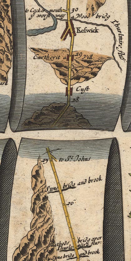 OG96m025.jpg In mile 29, Cumberland. Turning left:- "to Cockermouth ye worst way" item:- JandMN : 22 Image © see bottom of page |
||||||||||||||||||||||
|
|
|||||||||||||||||||||||
| evidence:- | old map:- Ogilby 1675 |
||||||||||||||||||||||
| source data:- | Road strip map, hand coloured engraving, the Road from Kendal to
Cockermouth, and the Road from Egremond to Carlisle, scale about
1 inch to 1 mile, by John Ogilby, London, 1675.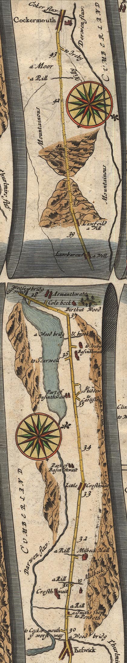 OG96KtoC.jpg item:- JandMN : 22 Image © see bottom of page |
||||||||||||||||||||||
|
|
|||||||||||||||||||||||
| evidence:- | old map:- Morden 1695 (Cmd) |
||||||||||||||||||||||
| source data:- | Map, uncoloured engraving, Cumberland, scale about 4 miles to 1
inch, by Robert Morden, 1695, published by Abel Swale, the
Unicorn, St Paul's Churchyard, Awnsham, and John Churchill, the
Black Swan, Paternoster Row, London, 1695-1715.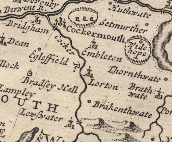 MD12NY12.jpg Single line (incomplete). 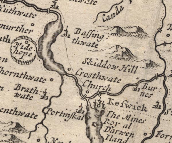 MD12NY22.jpg item:- JandMN : 90 Image © see bottom of page |
||||||||||||||||||||||
| source data:- | Map, uncoloured engraving, Cumberland, scale about 4 miles to 1
inch, by Robert Morden, 1695, published by Abel Swale, the
Unicorn, St Paul's Churchyard, Awnsham, and John Churchill, the
Black Swan, Paternoster Row, London, 1695-1715. item:- JandMN : 90 Image © see bottom of page |
||||||||||||||||||||||
|
|
|||||||||||||||||||||||
| evidence:- | old map:- Bowen 1720 (plate 260 and 261) |
||||||||||||||||||||||
| source data:- | Road strip map, uncoloured engraving, pl.260, The Road from
Kendal to Cockermouth, scale about 2 miles to 1 inch, with
sections in Westmorland and Cumberland, published by Emanuel
Bowen, St Katherines, London, 1720.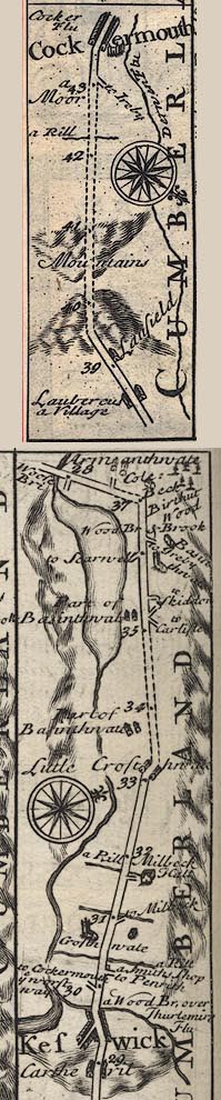 B260KtoC.jpg The Road from Kendal to Cockermouth - from Kendal on past Keswick, Cumberland. Places labelled are:- ... Keswick, a Wood Br. over Thurlemire Flu / 30, a turning to Cockermout ye worst way, a Smiths shop, Crosthwate on left / 31 / Milbeck Hall on right / 32 ... 33 / Little Crosthwate / part of Basinthwate / 34 ... 35 / part of Basinthwate / 36, Basinthwate on right / Birthut Wood on right / 37 / Cole: Beck / 38, Armanthwate Laubercus a Village / 39, Laufield / 40 / Mountains / 41 ... 42 / 43, a Moor / Cockermouth, Cocker Flu, Derwen Flu item:- private collection : 1.260 Image © see bottom of page |
||||||||||||||||||||||
|
|
|||||||||||||||||||||||
| evidence:- | old map:- Bowen 1720 (plate 259) |
||||||||||||||||||||||
| source data:- | Map, uncoloured engraving, pl.259, Cumberland, scale about 16.5
miles to 1 inch, published by Emanuel Bowen, St Katherines,
London, 1720.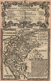 click to enlarge click to enlargeB259.jpg Plate 259 has the title cartouche for:- "The Roads from KENDAL to COCKERMOUTH, &c. Containing 32 Comp. and 43'7 measd. Miles &c." and a table of distances, computed and measured miles in miles'furlongs, which includes, from Kendal:- "..." "Keswick 22 / 29'5" "Cockermout 32 / 43'7" item:- Dove Cottage : Lowther.35 Image © see bottom of page |
||||||||||||||||||||||
|
|
|||||||||||||||||||||||
| evidence:- | old map:- Bowen and Kitchin 1760 |
||||||||||||||||||||||
| source data:- | Map, hand coloured engraving, A New Map of the Counties of
Cumberland and Westmoreland Divided into their Respective Wards,
scale about 4 miles to 1 inch, by Emanuel Bowen and Thomas
Kitchin et al, published by T Bowles, Robert Sayer, and John
Bowles, London, 1760.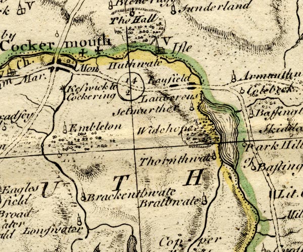 BO18NY12.jpg "Keswick to Cockering 14 2" double line, dotted, road distance 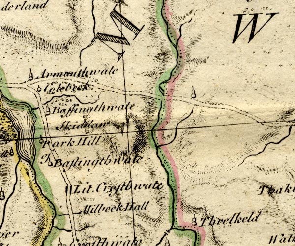 BO18NY22.jpg double line, dotted item:- Armitt Library : 2008.14.10 Image © see bottom of page |
||||||||||||||||||||||
|
|
|||||||||||||||||||||||
| evidence:- | old map:- Kitchin 1767 |
||||||||||||||||||||||
| source data:- | Road strip map, uncoloured engraving, The Road from Kendal to
Cockermouth, and The Road from Egremont to Carlisle, in
Kitchin's Post Chaise Companion, by Thomas Kitchin, published by
Robert Sayer, 53 Fleet Street, John Bowles, Cornhill, and
Carington Bowles, St Paul's Church Yard, London, 1767.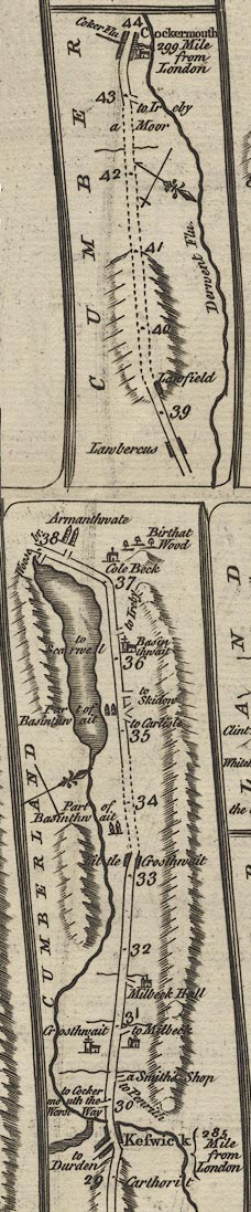 K084KtoC.jpg item:- Hampshire Museums : FA1999.138.84 Image © see bottom of page |
||||||||||||||||||||||
|
|
|||||||||||||||||||||||
| evidence:- | old map:- Donald 1774 (Cmd) |
||||||||||||||||||||||
| source data:- | Map, hand coloured engraving, 3x2 sheets, The County of Cumberland, scale about 1
inch to 1 mile, by Thomas Donald, engraved and published by Joseph Hodskinson, 29
Arundel Street, Strand, London, 1774. double line, solid or dotted, with a dot or milestone and number at 1 mile intervals, tinted red; turnpike road  D4NY13SW.jpg  D4NY12NW.jpg 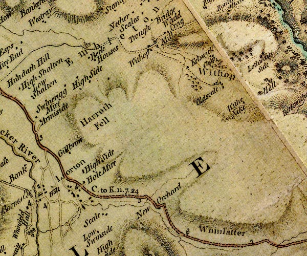 D4NY12NE.jpg "C. to K. 11.7.24"  D4NY22SW.jpg  D4NY22SE.jpg item:- Carlisle Library : Map 2 Images © Carlisle Library |
||||||||||||||||||||||
|
|
|||||||||||||||||||||||
| evidence:- | old map:- Donald 1774 (Cmd) |
||||||||||||||||||||||
| source data:- | Map, hand coloured engraving, 3x2 sheets, The County of Cumberland, scale about 1
inch to 1 mile, by Thomas Donald, engraved and published by Joseph Hodskinson, 29
Arundel Street, Strand, London, 1774. double line, solid or dotted, with a dot or milestone and number at 1 mile intervals, tinted red; turnpike road D4NY13SW.jpg 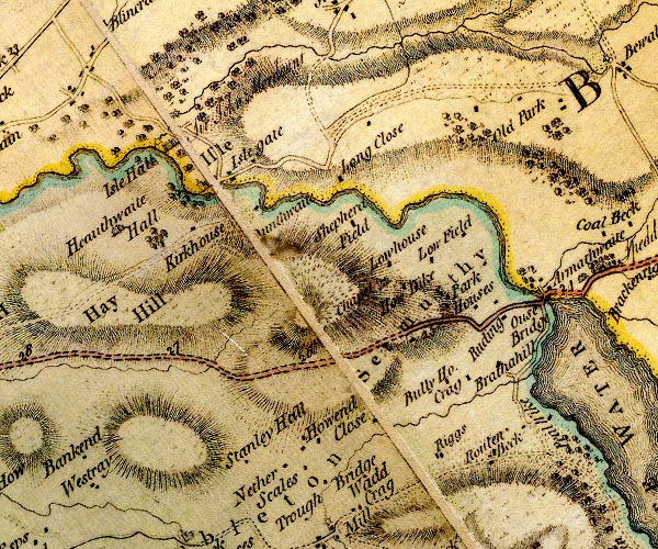 D4NY13SE.jpg 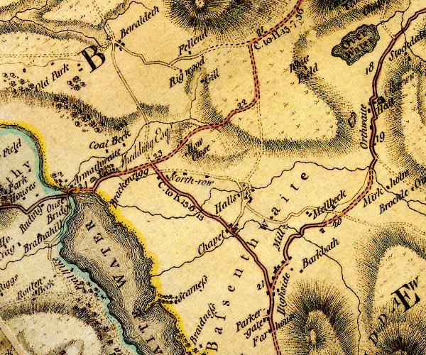 D4NY23SW.jpg "C. to K. 15:0:13" miles.furlongs.poles; Cockermouth to Keswick 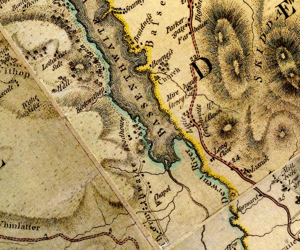 D4NY22NW.jpg D4NY22SE.jpg item:- Carlisle Library : Map 2 Images © Carlisle Library |
||||||||||||||||||||||
|
|
|||||||||||||||||||||||
| evidence:- | old map:- Donald 1774 (Cmd) |
||||||||||||||||||||||
| source data:- | Map, hand coloured engraving, 3x2 sheets, The County of Cumberland, scale about 1
inch to 1 mile, by Thomas Donald, engraved and published by Joseph Hodskinson, 29
Arundel Street, Strand, London, 1774.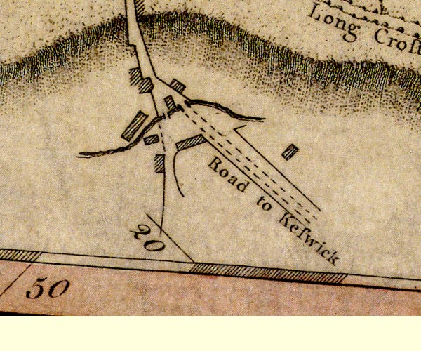 D41230L.jpg "Road to Keswick" road out of town, street item:- Carlisle Library : Map 2 Image © Carlisle Library |
||||||||||||||||||||||
|
|
|||||||||||||||||||||||
| evidence:- | old map:- Donald 1774 (Cmd) |
||||||||||||||||||||||
| source data:- | Map, hand coloured engraving, 3x2 sheets, The County of Cumberland, scale about 1
inch to 1 mile, by Thomas Donald, engraved and published by Joseph Hodskinson, 29
Arundel Street, Strand, London, 1774.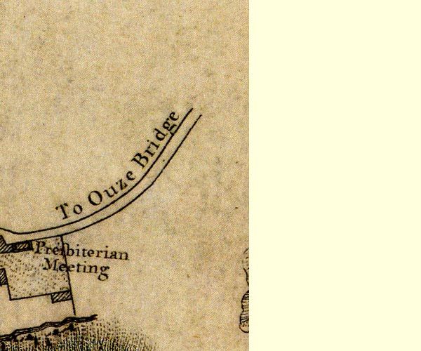 D41230Y.jpg "To Ouze Bridge" road out of town item:- Carlisle Library : Map 2 Image © Carlisle Library |
||||||||||||||||||||||
|
|
|||||||||||||||||||||||
| evidence:- | old map:- Crosthwaite 1783-94 (Der) |
||||||||||||||||||||||
| source data:- | Map, uncoloured engraving, An Accurate Map of the Matchless Lake
of Derwent, ie Derwent Water, scale about 3 inches to 1 mile, by
Peter Crosthwaite, Keswick, Cumberland, 1783, version published
1800.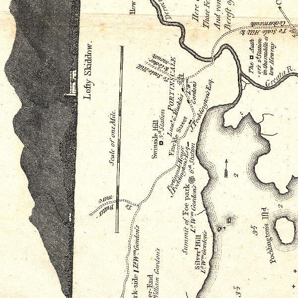 CT2NY22K.jpg "to Scale Hill &Cockermouth" item:- Armitt Library : 1959.191.3 Image © see bottom of page |
||||||||||||||||||||||
|
|
|||||||||||||||||||||||
| evidence:- | old map:- Clarke 1787 map (Der) |
||||||||||||||||||||||
| source data:- | Map, uncoloured engraving, Map of Derwentwater and its Environs,
scale about 13 ins to 1 mile, by James Clarke, engraved by S J
Neele, published by James Clarke, Penrith, Cumberland and in
London etc, 1787.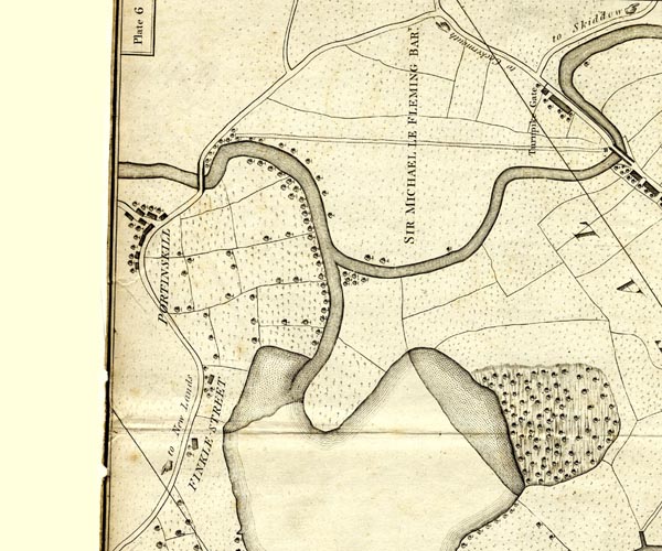 CL152523.jpg "to Cockermouth" road, and a pointing hand 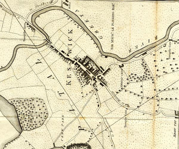 CL152623.jpg road item:- private collection : 169 Image © see bottom of page |
||||||||||||||||||||||
|
|
|||||||||||||||||||||||
| evidence:- | old map:- Clarke 1787 map (Bassenthwaite Lake) |
||||||||||||||||||||||
| source data:- | Map, A Map of Broadwater and its Environs, ie Bassenthwaite
Lake, scale about 6.5 ins to 1 mile, by James Clarke, engraved
by Neele, 352 Strand, published by James Clarke, Penrith,
Cumberland and in London etc, 1787. CL8NY13W.jpg "To Cockermouth" With a hand pointing the way. 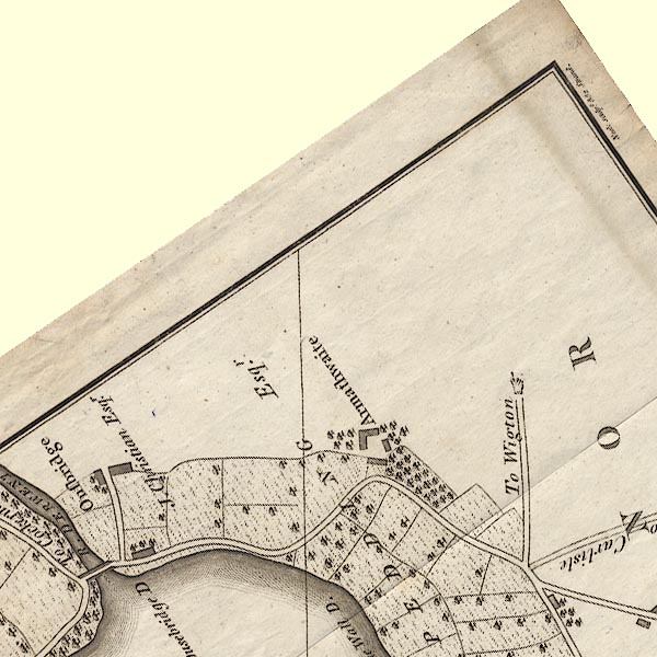 CL8NY23B.jpg 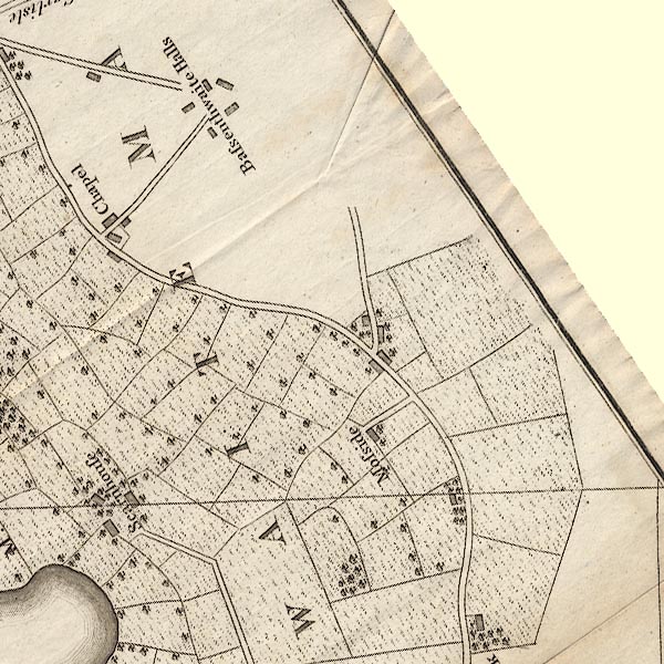 CL8NY23F.jpg  CL8NY22J.jpg  CL8NY22I.jpg item:- private collection : 10.8 Image © see bottom of page |
||||||||||||||||||||||
|
|
|||||||||||||||||||||||
| evidence:- | road map:- Cary 1790 (Cmd/edn 1789) |
||||||||||||||||||||||
| source data:- | Road map, hand coloured engraving, Cumberland, scale about 15
miles to 1 inch, by John Cary, 181 Strand, London, 1790, edn
1789.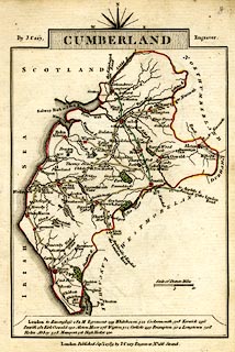 click to enlarge click to enlargeCY47.jpg double line, with road distances from Cockermouth item:- JandMN : 419 Image © see bottom of page |
||||||||||||||||||||||
|
|
|||||||||||||||||||||||
| evidence:- | road book:- Cary 1798 (2nd edn 1802) |
||||||||||||||||||||||
| source data:- | Road book, itineraries, Cary's New Itinerary, by John Cary, 181
Strand, London, 2nd edn 1802. goto source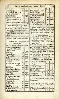 click to enlarge click to enlargeC38317.jpg page 317-318 "LONDON to Cockermouth and Workington" part of item:- JandMN : 228.1 Image © see bottom of page |
||||||||||||||||||||||
|
|
|||||||||||||||||||||||
| evidence:- | road book:- Cary 1798 (2nd edn 1802) |
||||||||||||||||||||||
| source data:- | Road book, itineraries, Cary's New Itinerary, by John Cary, 181
Strand, London, 2nd edn 1802. goto source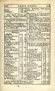 click to enlarge click to enlargeC38557.jpg page 557-558 "At Cockermouth, on l. a T.R. to Keswick." item:- JandMN : 228.2 Image © see bottom of page |
||||||||||||||||||||||
|
|
|||||||||||||||||||||||
| evidence:- | old map:- Cooke 1802 |
||||||||||||||||||||||
| source data:- | Map, Cumberland, scale about 15.5 miles to 1 inch, by George
Cooke, 1802, bound in Gray's New Book of Roads, 1824, published
by Sherwood, Jones and Co, Paternoster Road, London, 1824. click to enlarge click to enlargeGRA1Cd.jpg double line, light dark solid; road AND double line, light dark dotted; unfenced road; two routes item:- Hampshire Museums : FA2000.62.2 Image © see bottom of page |
||||||||||||||||||||||
|
|
|||||||||||||||||||||||
| evidence:- | old map:- Laurie and Whittle 1806 |
||||||||||||||||||||||
| source data:- | Road map, Completion of the Roads to the Lakes, scale about 10
miles to 1 inch, by Nathaniel Coltman? 1806, published by Robert
H Laurie, 53 Fleet Street, London, 1834. click to enlarge click to enlargeLw18.jpg bold line; 'Principal Travelling Roads' item:- private collection : 18.18 Image © see bottom of page |
||||||||||||||||||||||
|
|
|||||||||||||||||||||||
| evidence:- | old map:- Cooper 1808 |
||||||||||||||||||||||
| source data:- | Map, uncoloured engraving, Cumberland, scale about 10.5 miles to
1 inch, drawn and engraved by Cooper, published by R Phillips,
Bridge Street, Blackfriars, London, 1808. click to enlarge click to enlargeCOP3.jpg double line; road item:- JandMN : 86 Image © see bottom of page |
||||||||||||||||||||||
|
|
|||||||||||||||||||||||
| evidence:- | old map:- Wallis 1810 (Cmd) |
||||||||||||||||||||||
| source data:- | Road map, hand coloured engraving, Cumberland, scale about 16
miles to 1 inch, by James Wallis, 77 Berwick Stree, Soho,
London, 1810. click to enlarge click to enlargeWL13.jpg double line, light bold; 'Turnpike Road' item:- Dove Cottage : 2009.81.10 Image © see bottom of page |
||||||||||||||||||||||
|
|
|||||||||||||||||||||||
| evidence:- | old map:- Hall 1820 (Cmd) |
||||||||||||||||||||||
| source data:- | Map, hand coloured engraving, Cumberland, scale about 21 miles
to 1 inch, engraved by Sidney Hall, published by S Leigh, 18
Strand, London, 1820-31. click to enlarge click to enlargeHA14.jpg single line, solid; minor road; Keswick, Highside, Armathwaite, Cockermouth OR Keswick, Orchard, [Whinlatter Pass], Armside, Cockermouth item:- JandMN : 91 Image © see bottom of page |
||||||||||||||||||||||
|
|
|||||||||||||||||||||||
| evidence:- | descriptive text:- Otley 1823 (5th edn 1834) item:- road distances |
||||||||||||||||||||||
| source data:- | Guide book, A Concise Description of the English Lakes, the
mountains in their vicinity, and the roads by which they may be
visited, with remarks on the mineralogy and geology of the
district, by Jonathan Otley, published by the author, Keswick,
Cumberland now Cumbria, by J Richardson, London, and by Arthur
Foster, Kirkby Lonsdale, Cumbria, 1823; published 1823-49,
latterly as the Descriptive Guide to the English Lakes. goto source Page 128:- "DRIVE TO SCALE HILL, AND BUTTERMERE." "... the old road towards Cockermouth over the steep mountain Whinlatter, which in the length of two miles rises to the height of 800 feet above the valley."
|
||||||||||||||||||||||
|
|
|||||||||||||||||||||||
| evidence:- | descriptive text:- Ford 1839 (3rd edn 1843) |
||||||||||||||||||||||
| source data:- | Guide book, A Description of Scenery in the Lake District, by
Rev William Ford, published by Charles Thurnam, Carlisle, by W
Edwards, 12 Ave Maria Lane, Charles Tilt, Fleet Street, William
Smith, 113 Fleet Street, London, by Currie and Bowman,
Newcastle, by Bancks and Co, Manchester, by Oliver and Boyd,
Edinburgh, and by Sinclair, Dumfries, 1839. goto source Page 172:- "..." "XV. WHITEHAVEN TO KESWICK. - 27 M."
|
||||||||||||||||||||||
|
|
|||||||||||||||||||||||
| evidence:- | old map:- Ford 1839 map |
||||||||||||||||||||||
| source data:- | Map, uncoloured engraving, Map of the Lake District of
Cumberland, Westmoreland and Lancashire, scale about 3.5 miles
to 1 inch, published by Charles Thurnam, Carlisle, and by R
Groombridge, 5 Paternoster Row, London, 3rd edn 1843.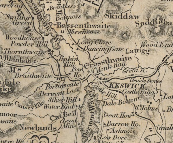 FD02NY22.jpg 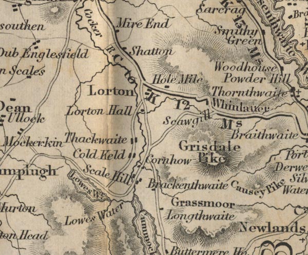 FD02NY12.jpg "C to K 12 Ms." 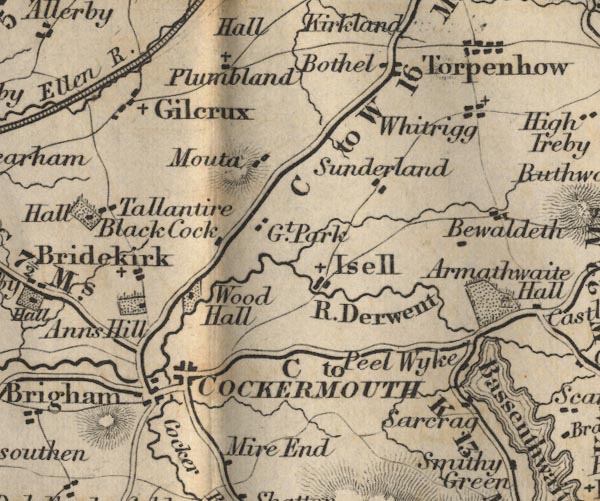 FD02NY13.jpg "C to K 13 Ms." Two routes shown, by Bassenthwaite and over Whinlatter Pass. item:- JandMN : 100.1 Image © see bottom of page |
||||||||||||||||||||||
|
|
|||||||||||||||||||||||
| evidence:- | old map:- Garnett 1850s-60s H |
||||||||||||||||||||||
| source data:- | Map of the English Lakes, in Cumberland, Westmorland and
Lancashire, scale about 3.5 miles to 1 inch, published by John
Garnett, Windermere, Westmorland, 1850s-60s.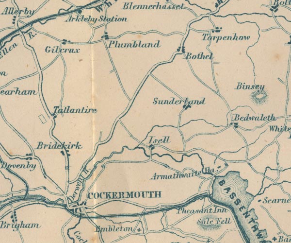 GAR2NY13.jpg double line, bold light, major road 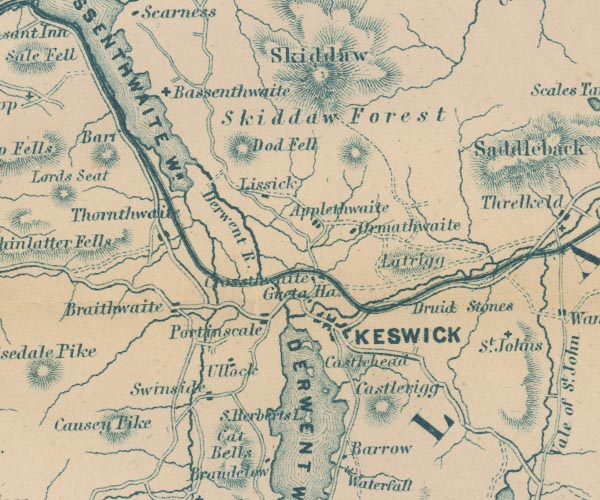 GAR2NY22.jpg item:- JandMN : 82.1 Image © see bottom of page |
||||||||||||||||||||||
|
|
|||||||||||||||||||||||
| evidence:- | gradient diagram:- Gall and Inglis 1890s-1900s (Roads) |
||||||||||||||||||||||
| source data:- | Contour Road Book of England, Northern Division, by Harry R G Inglis, published by
Gall and Inglis, 25 Paternoster Square, London and Edinburgh, 1898.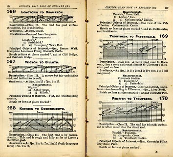 click to enlarge click to enlargeIG5166.jpg Itinerary, with gradient diagram, routes 166, Longtown to Brampton, 167, Wigton to Silloth, 168, Keswick to Cockermouth, 169, Troutbeck to Patterdale, and 170, Penrith to Troutbeck, Cumberland, 1898. item:- JandMN : 763.11 Image © see bottom of page |
||||||||||||||||||||||
|
|
|||||||||||||||||||||||
| evidence:- | gradient diagram:- Gall and Inglis 1890s-1900s (Roads) |
||||||||||||||||||||||
| source data:- | Contour Road Book of England, Northern Division, by Harry R G Inglis, published by
Gall and Inglis, 25 Paternoster Square, London and Edinburgh, 1898.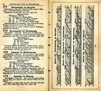 click to enlarge click to enlargeIG5171.jpg Itinerary, with gradient diagram, routes 171, Whitehaven to Silloth, 172, Whitehaven to Ravenglass, 173, Keswick to Workington, and 174, Keswick to Wigton, Cumberland, 1898. item:- JandMN : 763.12 Image © see bottom of page |
||||||||||||||||||||||
|
|
|||||||||||||||||||||||
| evidence:- | gradient diagram:- Watson 1912 |
||||||||||||||||||||||
| source data:- | Gradient diagram, black and white halftone, roads from Keswick, Cumberland, in a guide
book, Keswick on Derwentwater, published by George Watson, after 1913.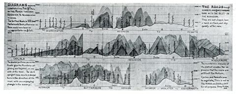 click to enlarge click to enlargeWT4Gd.jpg item:- Keswick Museum : 2145.5 Image © see bottom of page |
||||||||||||||||||||||
|
|
|||||||||||||||||||||||
 Act of Parliament Act of Parliament |
|||||||||||||||||||||||
|
|
|||||||||||||||||||||||
| evidence:- | old strip map:- Rumney 1899 |
||||||||||||||||||||||
| source data:- | Road map, strip map, gradient diagram, and itinerary for Route XV, Keswick to Ennerdale
via Scale Hill, Cumberland, scale about 2 miles to 1 inch, by A W Rumney, published
by George Philip and Son, 32 Fleet Street, London, and Liverpool, 1899.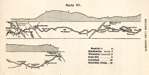 click to enlarge click to enlargeRUM121.jpg On p.62 of the Cyclist's Guide to the English Lake District, by A W Rumney. printed at top:- "Route XV." item:- JandMN : 147.22 Image © see bottom of page |
||||||||||||||||||||||
|
|
|||||||||||||||||||||||
| places:- | old route Keswick Bassenthwaite Ouse Bridge, Ouse Bridge Embleton Cockermouth |
||||||||||||||||||||||
|
|
|||||||||||||||||||||||
| places:- | by Whinlater Pass Keswick Whinlatter Pass, Lorton High Lorton, Lorton Cockermouth |
||||||||||||||||||||||
|
|
|||||||||||||||||||||||
| places:- | A66, modern road Keswick Braithwaite, Above Derwent Dubwath, Setmurthy near Cockermouth |
||||||||||||||||||||||
|
|
|||||||||||||||||||||||
| places:- |
|
||||||||||||||||||||||
|
|||||||||||||||||||||||
|
|||||||||||||||||||||||
|
|||||||||||||||||||||||
|
|||||||||||||||||||||||
|
|||||||||||||||||||||||
|
|||||||||||||||||||||||
|
|||||||||||||||||||||||
|
|||||||||||||||||||||||
|
|||||||||||||||||||||||
|
|||||||||||||||||||||||
|
|||||||||||||||||||||||
|
|||||||||||||||||||||||
|
|||||||||||||||||||||||
|
|||||||||||||||||||||||
|
|||||||||||||||||||||||
|
|||||||||||||||||||||||
|
|||||||||||||||||||||||
|
|||||||||||||||||||||||
|
|||||||||||||||||||||||
|
|||||||||||||||||||||||
|
|||||||||||||||||||||||
|
|||||||||||||||||||||||
|
|||||||||||||||||||||||
|
|||||||||||||||||||||||
|
|||||||||||||||||||||||
|
|||||||||||||||||||||||
|
|||||||||||||||||||||||
|
|||||||||||||||||||||||
|
|||||||||||||||||||||||
|
|||||||||||||||||||||||
|
|||||||||||||||||||||||
Lakes Guides menu.