 Old Cumbria Gazetteer
 |
 |
|
|||||||||||||||||||||||||||||||||||||||||||||
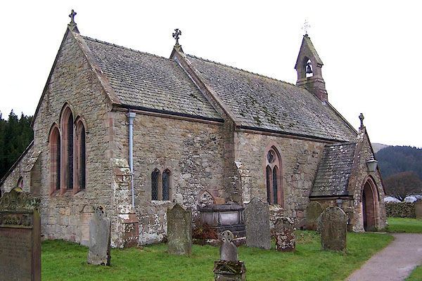
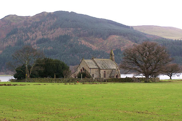
| St Bega, Bassenthwaite | |||||||||||||||||||||||||||||||||||||||||||||||
| St Bega's Church | |||||||||||||||||||||||||||||||||||||||||||||||
| Bassenthwaite Church | |||||||||||||||||||||||||||||||||||||||||||||||
| civil parish:- | Bassenthwaite (formerly Cumberland) | ||||||||||||||||||||||||||||||||||||||||||||||
| county:- | Cumbria | ||||||||||||||||||||||||||||||||||||||||||||||
| locality type:- | church | ||||||||||||||||||||||||||||||||||||||||||||||
| coordinates:- | NY22652875 | ||||||||||||||||||||||||||||||||||||||||||||||
| 1Km square:- | NY2228 | ||||||||||||||||||||||||||||||||||||||||||||||
| 10Km square:- | NY22 | ||||||||||||||||||||||||||||||||||||||||||||||
| SummaryText:- | The church is sited by an old road along the shore of Bassenthwaite Lake, on the segment between Little Crosthwaite and Bowness Farm. | ||||||||||||||||||||||||||||||||||||||||||||||
| references:- | : 2005: Diocese of Carlisle, Directory 2004/5 |
||||||||||||||||||||||||||||||||||||||||||||||
|
|
|||||||||||||||||||||||||||||||||||||||||||||||
 BLO35.jpg (taken 20.1.2006) 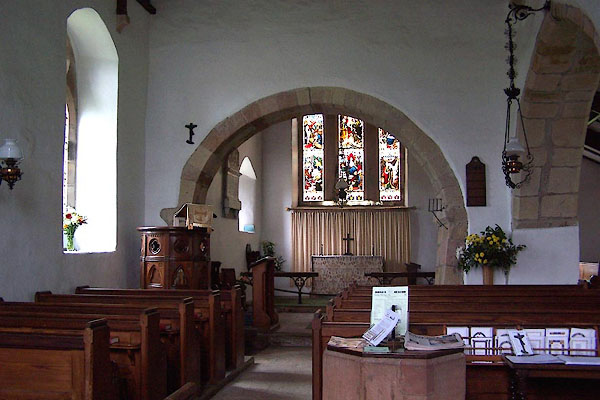 BLO36.jpg (taken 20.1.2006) |
|||||||||||||||||||||||||||||||||||||||||||||||
|
|
|||||||||||||||||||||||||||||||||||||||||||||||
| evidence:- | old map:- Donald 1774 (Cmd) |
||||||||||||||||||||||||||||||||||||||||||||||
| source data:- | Map, hand coloured engraving, 3x2 sheets, The County of Cumberland, scale about 1
inch to 1 mile, by Thomas Donald, engraved and published by Joseph Hodskinson, 29
Arundel Street, Strand, London, 1774.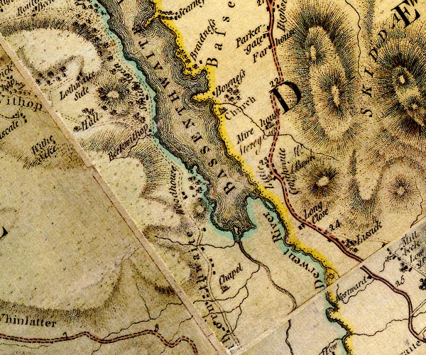 D4NY22NW.jpg "Church" church on the lake shore item:- Carlisle Library : Map 2 Image © Carlisle Library |
||||||||||||||||||||||||||||||||||||||||||||||
|
|
|||||||||||||||||||||||||||||||||||||||||||||||
| evidence:- | old map:- Crosthwaite 1783-94 (Bas) placename:- Bassenthwaite Church |
||||||||||||||||||||||||||||||||||||||||||||||
| source data:- | Map, uncoloured engraving, An Accurate Map of Broadwater or
Bassenthwaite Lake, scale about 3 inches to 1 mile, by Peter
Crosthwaite, Keswick, Cumberland, 1783, version published 1800.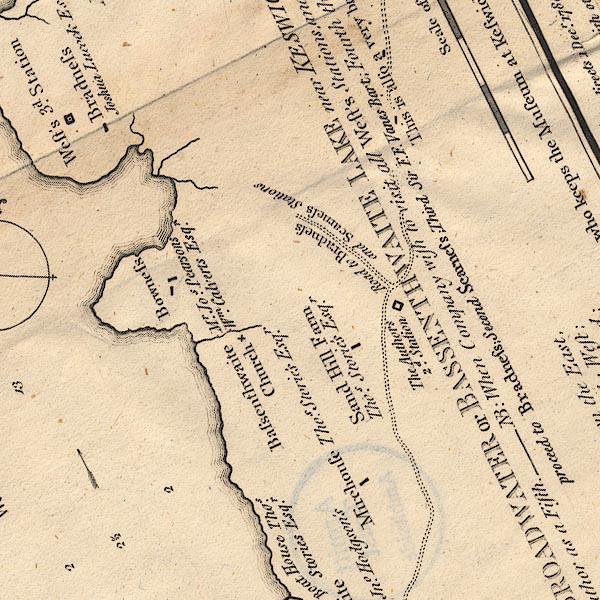 CT6NY22J.jpg "Bassenthwaite Church" Marked by a cross (x), by the lake. item:- Armitt Library : 1959.191.4 Image © see bottom of page |
||||||||||||||||||||||||||||||||||||||||||||||
|
|
|||||||||||||||||||||||||||||||||||||||||||||||
| evidence:- | old text:- Clarke 1787 placename:- St Bridget's Church |
||||||||||||||||||||||||||||||||||||||||||||||
| source data:- | Guide book, A Survey of the Lakes of Cumberland, Westmorland,
and Lancashire, written and published by James Clarke, Penrith,
Cumberland, and in London etc, 1787; published 1787-93. goto source goto sourcePage 98:- "..." "In a hollow, and out of sight of the road, yet near Bonas, stands, obscurely sequestred, the parish church of Bassenthwaite. In troublesome times, (particularly in the" goto sourcePage 99:- "time of popery,) the churches in these parts (or most of them) were built in the remotest and most obscure part of the parishes: this was done, to the end that their enemies might not so easily find them, as they were often most sought for, being generally the richest prizes, containing the reliques and plate; and at this day, when we have a war with a Popish kingdom, our sailors make no objection to landing upon their coasts, and piously visiting a few of their churches. The church is dedicated to St Bridget, and the Dean and Chapter of Carlisle are appropriators and patrons." |
||||||||||||||||||||||||||||||||||||||||||||||
|
|
|||||||||||||||||||||||||||||||||||||||||||||||
| evidence:- | old map:- Clarke 1787 map (Bassenthwaite Lake) |
||||||||||||||||||||||||||||||||||||||||||||||
| source data:- | Map, A Map of Broadwater and its Environs, ie Bassenthwaite
Lake, scale about 6.5 ins to 1 mile, by James Clarke, engraved
by Neele, 352 Strand, published by James Clarke, Penrith,
Cumberland and in London etc, 1787.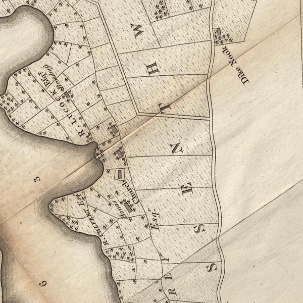 CL8NY22J.jpg "Church" item:- private collection : 10.8 Image © see bottom of page |
||||||||||||||||||||||||||||||||||||||||||||||
|
|
|||||||||||||||||||||||||||||||||||||||||||||||
| evidence:- | descriptive text:- Ford 1839 (3rd edn 1843) |
||||||||||||||||||||||||||||||||||||||||||||||
| source data:- | Guide book, A Description of Scenery in the Lake District, by
Rev William Ford, published by Charles Thurnam, Carlisle, by W
Edwards, 12 Ave Maria Lane, Charles Tilt, Fleet Street, William
Smith, 113 Fleet Street, London, by Currie and Bowman,
Newcastle, by Bancks and Co, Manchester, by Oliver and Boyd,
Edinburgh, and by Sinclair, Dumfries, 1839. goto source Page 87:- "... the church, which is old and was built about 1471, on the margin of the lake, not far from the promontories of Bradness and Scarness. ..." |
||||||||||||||||||||||||||||||||||||||||||||||
|
|
|||||||||||||||||||||||||||||||||||||||||||||||
| evidence:- | old map:- Ford 1839 map placename:- Bassenthwaite |
||||||||||||||||||||||||||||||||||||||||||||||
| source data:- | Map, uncoloured engraving, Map of the Lake District of
Cumberland, Westmoreland and Lancashire, scale about 3.5 miles
to 1 inch, published by Charles Thurnam, Carlisle, and by R
Groombridge, 5 Paternoster Row, London, 3rd edn 1843.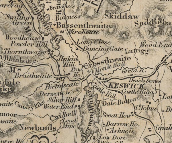 FD02NY22.jpg "Bassenthwaite" Labelling the church by the lake. item:- JandMN : 100.1 Image © see bottom of page |
||||||||||||||||||||||||||||||||||||||||||||||
|
|
|||||||||||||||||||||||||||||||||||||||||||||||
| evidence:- | old map:- Garnett 1850s-60s H |
||||||||||||||||||||||||||||||||||||||||||||||
| source data:- | Map of the English Lakes, in Cumberland, Westmorland and
Lancashire, scale about 3.5 miles to 1 inch, published by John
Garnett, Windermere, Westmorland, 1850s-60s.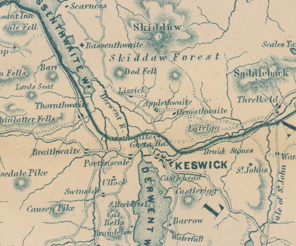 GAR2NY22.jpg cross, a church item:- JandMN : 82.1 Image © see bottom of page |
||||||||||||||||||||||||||||||||||||||||||||||
|
|
|||||||||||||||||||||||||||||||||||||||||||||||
| evidence:- | perhaps old map:- Nurse 1918 placename:- St Bridget's Church |
||||||||||||||||||||||||||||||||||||||||||||||
| source data:- | Map, The Diocese of Carlisle, Cumberland, Westmorland, and
Lancashire North of the Sands, scale about 4 miles to 1 inch, by
Rev Euston J Nurse, published by Charles Thurnam and Sons, 11
English Street, Carlisle, Cumberland, 2nd edn 1939.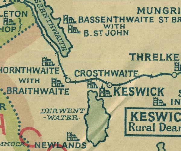 NUR1NY22.jpg "BASSENTHWAITE ST. BRIDGET WITH B. ST. JOHN" item:- JandMN : 27 Image © see bottom of page |
||||||||||||||||||||||||||||||||||||||||||||||
|
|
|||||||||||||||||||||||||||||||||||||||||||||||
 BVE28.jpg (taken 9.8.2011) |
|||||||||||||||||||||||||||||||||||||||||||||||
|
|
|||||||||||||||||||||||||||||||||||||||||||||||
 stained glass stained glass |
|||||||||||||||||||||||||||||||||||||||||||||||
|
|
|||||||||||||||||||||||||||||||||||||||||||||||
| evidence:- | database:- Listed Buildings 2010 placename:- Church of St Bega |
||||||||||||||||||||||||||||||||||||||||||||||
| source data:- | courtesy of English Heritage "CHURCH OF ST BEGA / / / BASSENTHWAITE / ALLERDALE / CUMBRIA / II[star] / 72100 / NY2266228748" |
||||||||||||||||||||||||||||||||||||||||||||||
| source data:- | courtesy of English Heritage "Parish church. C12 and C13, with restoration of 1874 by Messrs S. Watson of Penrith. Dressed calciferous sandstone, the larger blocks medieval, with angle buttresses and flush quoins of pink sandstone. Graduated greenslate roof with coped gables and cross finials. 2-bay nave with south aisle and vestry, west open bellcote; single-bay chancel with south chapel continuous with aisles and vestry. Nave has C19 north round-headed doorway within stone porch. C19 2-light north window and double-lancet west window under round plate-tracery window. South aisle has paired lancet windows; vestry shouldered windows. Chancel has blocked north doorway and window with 2 cusped lights. C19 3-light east window and chapel with C19 lancets. Interior of nave has C19 open timber roof and single pointed aisle archway. Unmoulded chancel arch on simple imposts. South door now leads to vestry, near which is a medieval graveslab to Robert Highmore and wall plaque to Mary Wane of Scarness 1741. Royal arms of George II and recut octagonal font. Wrought-iron hourglass stand beside chancel arch. Chancel has side chapel archway similar to aisle. Floor paving includes medieval graveslab to a Highmore. Wall plaque to Walter Vane, 1814 by Paul Nixson of Carlisle. Stained glass east window and aisle windows of 1874 by Powell Bros of Leeds. See Transactions Cumberland & Westmorland Antiquarian &Archaeological Society, new series, 1xvi, pp 276-292." |
||||||||||||||||||||||||||||||||||||||||||||||
|
|
|||||||||||||||||||||||||||||||||||||||||||||||
| cross slab |
|||||||||||||||||||||||||||||||||||||||||||||||
|
|
|||||||||||||||||||||||||||||||||||||||||||||||
| incumbents:- |
|
||||||||||||||||||||||||||||||||||||||||||||||
|
|
|||||||||||||||||||||||||||||||||||||||||||||||
| notes:- |
Described in:- |
||||||||||||||||||||||||||||||||||||||||||||||
| Butler, Lawrence (ed): 2011: Church Notes of Sir Stephen Glynne for Cumbria, 1833-1872:
CWAAS:: ISBN 978 1 873124 52 9 |
|||||||||||||||||||||||||||||||||||||||||||||||
| Extracted from the original notes made by Sir Stephen, now in Deiniol's Library, Hawarden,
Flintshire, contact through Flintshire Record Office |
|||||||||||||||||||||||||||||||||||||||||||||||
|
|
|||||||||||||||||||||||||||||||||||||||||||||||
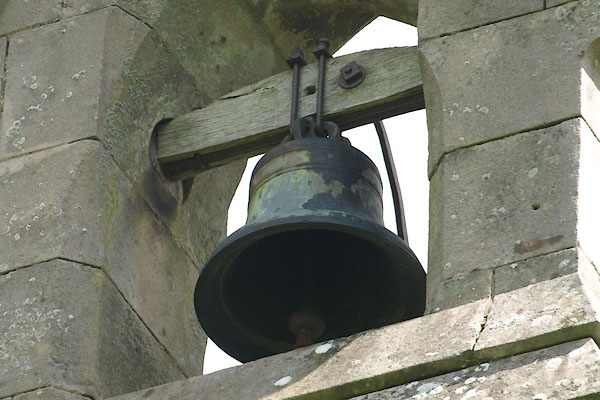
 BLO34.jpg (taken 20.1.2006) 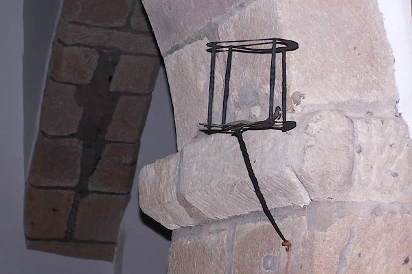 BLO40.jpg Holder for an hour glass. (taken 20.1.2006) 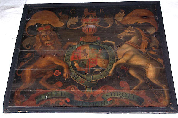 BLO38.jpg Royal coat of arms. (taken 20.1.2006) 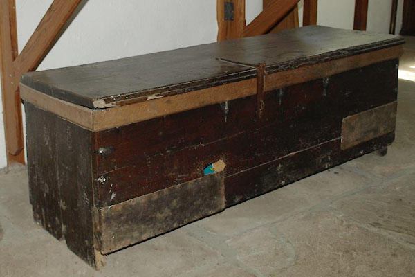 BVE27.jpg Parish chest? (taken 9.8.2011) 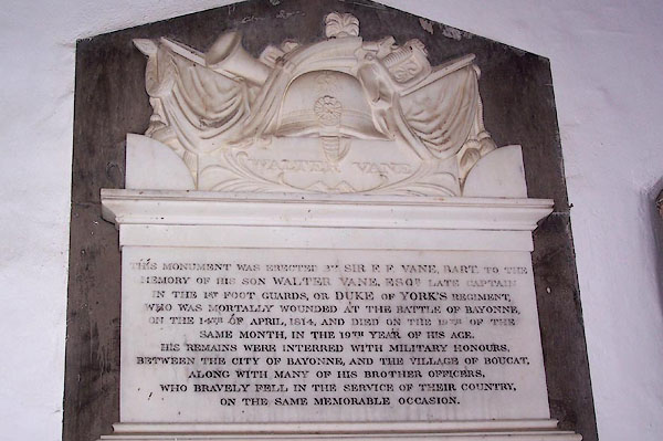 BLO39.jpg Memorial to Captain Walter Vane, 1st Regiment of Foot, killed at the Battle of Bayonne, during the Napoleonic Wars, and buried there, 1814. Erected by his father Sir Frederick Fletcher Vane. (taken 20.1.2006) 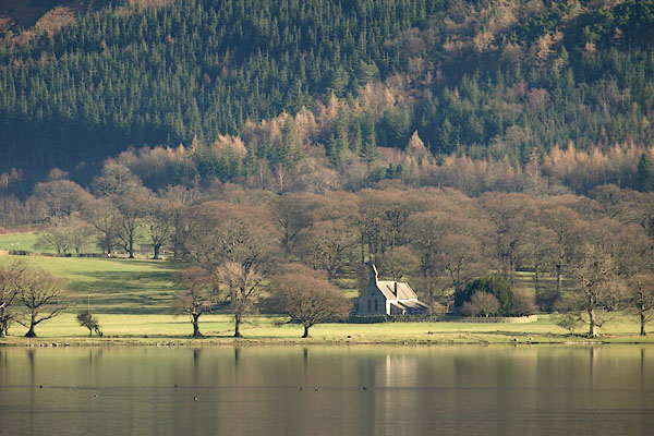 BOQ45.jpg (taken 13.2.2008) 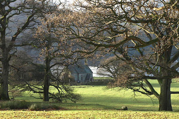 BPV74.jpg (taken 17.12.2008) 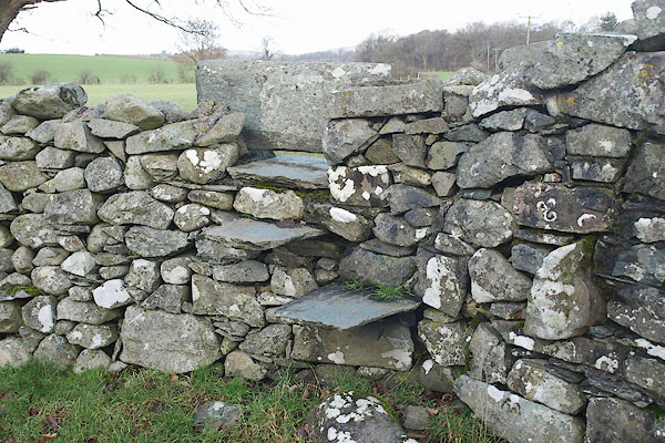 BPV86.jpg Stile over the churchyard wall, next the gate. (taken 17.12.2008) |
|||||||||||||||||||||||||||||||||||||||||||||||
|
|
|||||||||||||||||||||||||||||||||||||||||||||||
| notes:- |
The church has been here since about 950, though there might have been an earlier
church; recorded history of the church begins in the mid 12th century. There was extensive
restoration in 1874. |
||||||||||||||||||||||||||||||||||||||||||||||
| : : church leaflet |
|||||||||||||||||||||||||||||||||||||||||||||||
|
|
|||||||||||||||||||||||||||||||||||||||||||||||
| hearsay:- |
A lead crucifix, about 12 inches high, was found when the priest's door on the north
wall of the church was filled in, 1874. This is in the treasury at Carlisle Cathedral.
It probably dates from the 14th century. |
||||||||||||||||||||||||||||||||||||||||||||||
|
|
|||||||||||||||||||||||||||||||||||||||||||||||
| personal | |||||||||||||||||||||||||||||||||||||||||||||||
| person:- | : Vane, Frederick Fletcher, Sir |
||||||||||||||||||||||||||||||||||||||||||||||
| person:- | : Highmoor, Robert de |
||||||||||||||||||||||||||||||||||||||||||||||
| place:- | burial place | ||||||||||||||||||||||||||||||||||||||||||||||
|
|
|||||||||||||||||||||||||||||||||||||||||||||||
| dedication | |||||||||||||||||||||||||||||||||||||||||||||||
| person:- | : St Bega |
||||||||||||||||||||||||||||||||||||||||||||||
| place:- | Bassenthwaite / Carlisle Diocese | ||||||||||||||||||||||||||||||||||||||||||||||
| St Bega was the daughter of an irish chieftan, 7th century, who fled Ireland to avoid
marriage to a norse prince. She landed at St Bees Head. |
|||||||||||||||||||||||||||||||||||||||||||||||
|
|
|||||||||||||||||||||||||||||||||||||||||||||||
| person:- | : Vane, Frederick Fletcher, Sir |
||||||||||||||||||||||||||||||||||||||||||||||
| date:- | 1832 |
||||||||||||||||||||||||||||||||||||||||||||||
| item:- | grave |
||||||||||||||||||||||||||||||||||||||||||||||
| In the churchyard is the grave of Sir Frederick Fletcher Vane, died age 72, 1832. |
|||||||||||||||||||||||||||||||||||||||||||||||
|
|
|||||||||||||||||||||||||||||||||||||||||||||||
Lakes Guides menu.