 Old Cumbria Gazetteer
 |
 |
|
| included in:- |
 Karl Lofts, Shap possibly Karl Lofts, Shap possibly
|
|
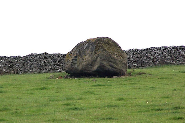
| Thunder Stone, Shap | ||
| Thunder Stone | ||
| locality:- | Karl Lofts | |
| locality:- | High Buildings | |
| civil parish:- | Shap (formerly Westmorland) | |
| county:- | Cumbria | |
| locality type:- | standing stone | |
| locality type:- | stone | |
| locality type:- | stone alignment | |
| coordinates:- | NY55141575 | |
| 1Km square:- | NY5515 | |
| 10Km square:- | NY51 | |
|
|
||
 BJQ51.jpg (taken 22.7.2005) |
||
|
|
||
| evidence:- | old map:- OS County Series (Wmd 14 9) placename:- Thunder Stone |
|
| source data:- | Maps, County Series maps of Great Britain, scales 6 and 25
inches to 1 mile, published by the Ordnance Survey, Southampton,
Hampshire, from about 1863 to 1948. "Thunder Stone" |
|
|
|
||
| hearsay:- |
A standing stone that used to be part of an alignment of pairs of stones, an avenue
called Karl Lofts. The alignment was dispersed by railway building. |
|
|
|
||
Lakes Guides menu.