Old Cumbria Gazetteer
 |
 |
|
||
| Torver | ||||
| civil parish:- | Torver (formerly Lancashire) | |||
| county:- | Cumbria | |||
| locality type:- | locality | |||
| locality type:- | buildings | |||
| coordinates:- | SD28359413 (etc) | |||
| 1Km square:- | SD2894 | |||
| 10Km square:- | SD29 | |||
|
|
||||
| evidence:- | old map:- OS County Series (Lan 4 11) placename:- Torver |
|||
| source data:- | Maps, County Series maps of Great Britain, scales 6 and 25
inches to 1 mile, published by the Ordnance Survey, Southampton,
Hampshire, from about 1863 to 1948. |
|||
|
|
||||
| evidence:- | old map:- Crosthwaite 1783-94 (Con) placename:- Torver |
|||
| source data:- | Map, uncoloured engraving, An Accurate Map of Coniston Lake,
scale about 3 inches to 1 mile, by Peter Crosthwaite, Keswick,
Cumberland, 1788, version published 1809.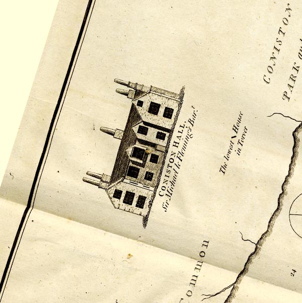 CTESD29X.jpg marked by a block for building/s:- "The lowest House in Torver" item:- JandMN : 182.5 Image © see bottom of page |
|||
|
|
||||
| evidence:- | old map:- West 1784 map placename:- Torver |
|||
| source data:- | Map, hand coloured engraving, A Map of the Lakes in Cumberland,
Westmorland and Lancashire, scale about 3.5 miles to 1 inch,
engraved by Paas, 53 Holborn, London, about 1784.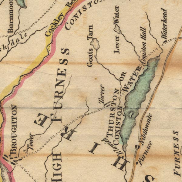 Ws02SD29.jpg item:- Armitt Library : A1221.1 Image © see bottom of page |
|||
|
|
||||
| evidence:- | old map:- Cooke 1802 placename:- Torver |
|||
| source data:- | Map, Lancashire, scale about 18 miles to 1 inch, by George
Cooke, 1802, bound in Gray's New Book of Roads, 1824, published
by Sherwood, Jones and Co, Paternoster Road, London, 1824.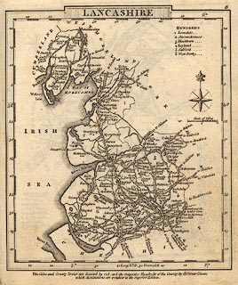 click to enlarge click to enlargeGRA1La.jpg "Torver" blocks, italic lowercase text, village, hamlet, locality item:- Hampshire Museums : FA2000.62.6 Image © see bottom of page |
|||
|
|
||||
| evidence:- | old map:- Otley 1818 placename:- Torver |
|||
| source data:- | Map, uncoloured engraving, The District of the Lakes,
Cumberland, Westmorland, and Lancashire, scale about 4 miles to
1 inch, by Jonathan Otley, 1818, engraved by J and G Menzies,
Edinburgh, Scotland, published by Jonathan Otley, Keswick,
Cumberland, et al, 1833.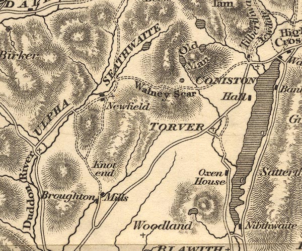 OT02SD29.jpg "TORVER" item:- JandMN : 48.1 Image © see bottom of page |
|||
|
|
||||
| evidence:- | descriptive text:- Otley 1823 (5th edn 1834) item:- geology |
|||
| source data:- | Guide book, A Concise Description of the English Lakes, the
mountains in their vicinity, and the roads by which they may be
visited, with remarks on the mineralogy and geology of the
district, by Jonathan Otley, published by the author, Keswick,
Cumberland now Cumbria, by J Richardson, London, and by Arthur
Foster, Kirkby Lonsdale, Cumbria, 1823; published 1823-49,
latterly as the Descriptive Guide to the English Lakes. goto source goto sourcePage 158:- "The THIRD division - forming only inferior elevations - commences with a bed of dark-blue or blackish transition limestone, containing here and there a few shells and madrepores, and alternating with a slaty rock of the same colour; the different layers of each being in some places several feet, in others only a few inches in thickness. This limestone crosses the river Duddon near Broughton; passing Broughton Mills it runs in a north-east direction through Torver, by the foot of the Old Man mountain, and appears near Low Yewdale and Yew Tree. Here it makes a considerable slip to the eastward, after which it ranges past the Tarns upon the hills above Borwick Ground; and stretching through Skelwith, it crosses the head of Windermere near Low Wood Inn. Then passing above Dovenest and Skelgill, it traverses the vales of Troutbeck, Kentmere, and Long Sleddale;" |
|||
|
|
||||
| evidence:- | old map:- Ford 1839 map placename:- Torver |
|||
| source data:- | Map, uncoloured engraving, Map of the Lake District of
Cumberland, Westmoreland and Lancashire, scale about 3.5 miles
to 1 inch, published by Charles Thurnam, Carlisle, and by R
Groombridge, 5 Paternoster Row, London, 3rd edn 1843.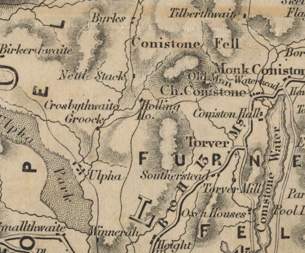 FD02SD29.jpg "Torver" item:- JandMN : 100.1 Image © see bottom of page |
|||
|
|
||||
| evidence:- | old map:- Garnett 1850s-60s H placename:- Torver |
|||
| source data:- | Map of the English Lakes, in Cumberland, Westmorland and
Lancashire, scale about 3.5 miles to 1 inch, published by John
Garnett, Windermere, Westmorland, 1850s-60s.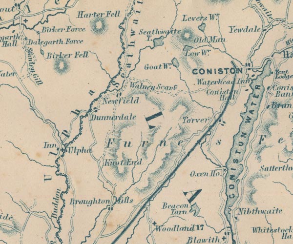 GAR2SD29.jpg "Torver" blocks, settlement item:- JandMN : 82.1 Image © see bottom of page |
|||
|
|
||||
| evidence:- | old map:- Post Office 1850s-1900s placename:- Torver |
|||
| source data:- | Post road maps, General Post Office Circulation Map for England
and Wales, for the General Post Office, London, 1850s-1900s. click to enlarge click to enlargePOF7Cm.jpg "Torver" map date 1909 |
|||
|
|
||||
| :- |
images courtesy of the British Postal Museum and Hampshire CC Museums |
|||
|
|
||||
| places:- |
|
|||
|
||||
|
||||
|
||||
|
||||
|
||||
|
||||
|
||||
|
||||
|
||||
|
||||
|
||||
|
||||
|
||||
Lakes Guides menu.