 Old Cumbria Gazetteer
 |
 |
|
| Troutbeck Park, Lakes | ||
| Troutbeck Park | ||
| civil parish:- | Lakes (formerly Westmorland) | |
| county:- | Cumbria | |
| locality type:- | park | |
| coordinates:- | NY42190685 (etc) | |
| 1Km square:- | NY4206 | |
| 10Km square:- | NY40 | |
|
|
||
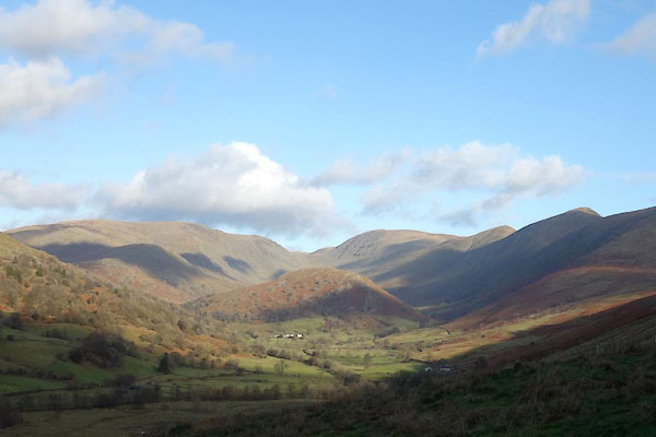 BZS61.jpg (taken 4.12.2013) 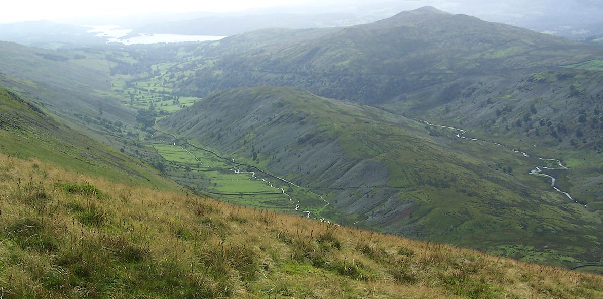 Click to enlarge BRK24.jpg The valley from above; Hagg Gill, The Tongue, Trout Beck. (taken 9.9.2009) |
||
|
|
||
| evidence:- | old map:- OS County Series (Wmd 26 4) placename:- Troutbeck Park |
|
| source data:- | Maps, County Series maps of Great Britain, scales 6 and 25
inches to 1 mile, published by the Ordnance Survey, Southampton,
Hampshire, from about 1863 to 1948. |
|
|
|
||
| evidence:- | old map:- Jefferys 1770 (Wmd) placename:- Troutbeck Park |
|
| source data:- | Map, 4 sheets, The County of Westmoreland, scale 1 inch to 1
mile, surveyed 1768, and engraved and published by Thomas
Jefferys, London, 1770.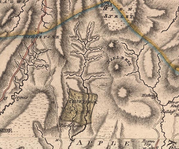 J5NY40NW.jpg "TROUTBECK PARK" outline with fence palings; park, with trees and undergrowth item:- National Library of Scotland : EME.s.47 Image © National Library of Scotland |
|
|
|
||
| evidence:- | old map:- West 1784 map |
|
| source data:- | Map, hand coloured engraving, A Map of the Lakes in Cumberland,
Westmorland and Lancashire, scale about 3.5 miles to 1 inch,
engraved by Paas, 53 Holborn, London, about 1784. Ws02NY40.jpg "Park" A rectangular area, bounded by the Trout Beck and a paling fence. item:- Armitt Library : A1221.1 Image © see bottom of page |
|
|
|
||
| evidence:- | old map:- Cary 1789 (edn 1805) placename:- Trogtbeck Park |
|
| source data:- | Map, uncoloured engraving, Westmoreland, scale about 2.5 miles
to 1 inch, by John Cary, London, 1789; edition 1805.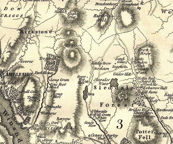 CY24NY40.jpg "Trogtbeck Park" outline with fence palings; park item:- JandMN : 129 Image © see bottom of page |
|
|
|
||
| evidence:- | old map:- Cooke 1802 placename:- Trogtbeck Park |
|
| source data:- | Map, Westmoreland ie Westmorland, scale about 12 miles to 1
inch, by George Cooke, 1802, published by Sherwood, Jones and
Co, Paternoster Road, London, 1824. click to enlarge click to enlargeGRA1Wd.jpg "Trogtbeck Park" outline of fence palings; park item:- Hampshire Museums : FA2000.62.4 Image © see bottom of page |
|
|
|
||
| evidence:- | old map:- Wallis 1810 (Wmd) placename:- Trogtbeck Park |
|
| source data:- | Road map, Westmoreland, scale about 19 miles to 1 inch, by James
Wallis, 77 Berwick Street, Soho, 1810, published by W Lewis,
Finch Lane, London, 1835? click to enlarge click to enlargeWAL5.jpg "Trogtbeck Pa." outline with fence palings; park item:- JandMN : 63 Image © see bottom of page |
|
|
|
||
| evidence:- | old map:- Hall 1820 (Wmd) placename:- Troutbeck Park |
|
| source data:- | Map, hand coloured engraving, Westmoreland ie Westmorland, scale
about 14.5 miles to 1 inch, by Sidney Hall, London, 1820,
published by Samuel Leigh, 18 Strand, London, 1820-31. click to enlarge click to enlargeHA18.jpg "Troutbeck Pk." outline of fence palings; park item:- Armitt Library : 2008.14.58 Image © see bottom of page |
|
|
|
||
| evidence:- | old map:- Ford 1839 map placename:- Troutbeck Park |
|
| source data:- | Map, uncoloured engraving, Map of the Lake District of
Cumberland, Westmoreland and Lancashire, scale about 3.5 miles
to 1 inch, published by Charles Thurnam, Carlisle, and by R
Groombridge, 5 Paternoster Row, London, 3rd edn 1843.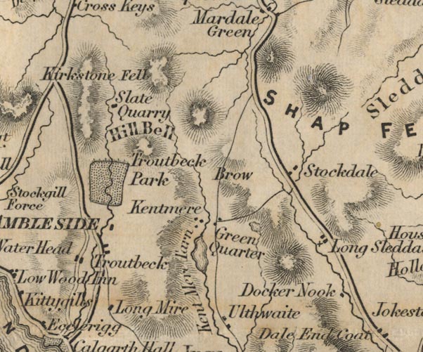 FD02NY40.jpg "Troutbeck Park" Park. item:- JandMN : 100.1 Image © see bottom of page |
|
|
|
||
| evidence:- | perhaps old drawing:- Aspland 1840s-60s |
|
| source data:- | Drawing, pencil, Troutbeck, Westmorland, by Theophilus Lindsey Aspland, 1847.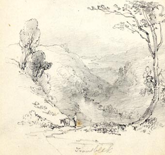 click to enlarge click to enlargeAS0287.jpg "Troutbeck" page number "75" item:- Armitt Library : 1958.488.87 Image © see bottom of page |
|
|
|
||
| evidence:- | old text:- Martineau 1855 |
|
| source data:- | Guide book, A Complete Guide to the English Lakes, by Harriet
Martineau, published by John Garnett, Windermere, Westmorland,
and by Whittaker and Co, London, 1855; published 1855-76. goto source goto sourcePage 34:- "Troutbeck hills, ... After Romans and Saxons were gone, the valley was a great park, and the inhabitants were virtually serfs, in danger of the gallows, (which had a hill to itself, named after it to this day) at the will and pleasure of the one great man. In course of time,- that is, a good many centuries ago,- the valley was disparked, and divided among the inhabitants,- only one very large estate being left,- the new park, containing 2,000 acres. This was the estate given by Charles I, to Huddlestone Phillipson, for his services in the civil wars. ..." |
|
|
|
||
Lakes Guides menu.