 Old Cumbria Gazetteer
 |
 |
|
||||||||||||||||||||||||
| Wansfell, Lakes | ||||||||||||||||||||||||||
| Wansfell | ||||||||||||||||||||||||||
| civil parish:- | Lakes (formerly Westmorland) | |||||||||||||||||||||||||
| county:- | Cumbria | |||||||||||||||||||||||||
| locality type:- | hill | |||||||||||||||||||||||||
| locality type:- | fell | |||||||||||||||||||||||||
| coordinates:- | NY39400430 (etc) | |||||||||||||||||||||||||
| 1Km square:- | NY3904 | |||||||||||||||||||||||||
| 10Km square:- | NY30 | |||||||||||||||||||||||||
| SummaryText:- | Wansfell is the whole fell, Wansfell Pike is the pike, but is hardly worth distinguishing them. All notes are gathered here. | |||||||||||||||||||||||||
|
|
||||||||||||||||||||||||||
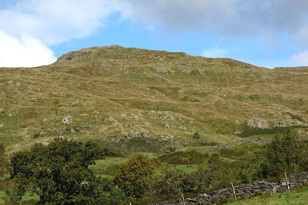 CDZ56.jpg (taken 22.9.2015) 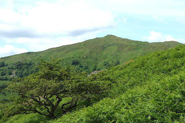 CDO41.jpg (taken 9.7.2015) |
||||||||||||||||||||||||||
|
|
||||||||||||||||||||||||||
| evidence:- | old map:- OS County Series (Wmd 26 11) placename:- Wansfell |
|||||||||||||||||||||||||
| source data:- | Maps, County Series maps of Great Britain, scales 6 and 25
inches to 1 mile, published by the Ordnance Survey, Southampton,
Hampshire, from about 1863 to 1948. |
|||||||||||||||||||||||||
|
|
||||||||||||||||||||||||||
| evidence:- | old map:- OS County Series (Wmd 26 11) placename:- Wansfell Pike |
|||||||||||||||||||||||||
| source data:- | Maps, County Series maps of Great Britain, scales 6 and 25
inches to 1 mile, published by the Ordnance Survey, Southampton,
Hampshire, from about 1863 to 1948. |
|||||||||||||||||||||||||
|
|
||||||||||||||||||||||||||
| evidence:- | old map:- Jefferys 1770 (Wmd) |
|||||||||||||||||||||||||
| source data:- | Map, 4 sheets, The County of Westmoreland, scale 1 inch to 1
mile, surveyed 1768, and engraved and published by Thomas
Jefferys, London, 1770.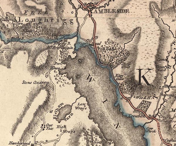 J5NY30SE.jpg hill hachuring; hill or mountain, area item:- National Library of Scotland : EME.s.47 Image © National Library of Scotland |
|||||||||||||||||||||||||
|
|
||||||||||||||||||||||||||
| evidence:- | old map:- Otley 1818 placename:- Wansfell |
|||||||||||||||||||||||||
| source data:- | Map, uncoloured engraving, The District of the Lakes,
Cumberland, Westmorland, and Lancashire, scale about 4 miles to
1 inch, by Jonathan Otley, 1818, engraved by J and G Menzies,
Edinburgh, Scotland, published by Jonathan Otley, Keswick,
Cumberland, et al, 1833.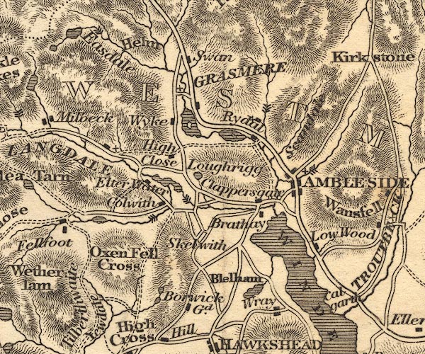 OT02NY30.jpg item:- JandMN : 48.1 Image © see bottom of page |
|||||||||||||||||||||||||
|
|
||||||||||||||||||||||||||
| evidence:- | outline view:- Otley 1823 (8th edn 1849) placename:- Wansfell Pike |
|||||||||||||||||||||||||
| source data:- | Engraving, outline view of mountains, Windermere looking towards the North East from
Bowness, drawn by T Binns, engraved by O Jewitt, opposite p.2 of A Descriptive Guide
of the English Lakes, by Jonathan Otley, 8th edition, 1849.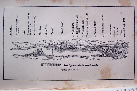 click to enlarge click to enlargeO80E02.jpg With a list of mountains. item:- Armitt Library : A1180.3 Image © see bottom of page |
|||||||||||||||||||||||||
|
|
||||||||||||||||||||||||||
| evidence:- | outline view:- Otley 1823 (5th edn 1834) placename:- Wansfell Pike |
|||||||||||||||||||||||||
| source data:- | Print, woodcut outline view, Mountains North East of Windermere, by Jonathan Otley,
Keswick, Cumberland, 1830.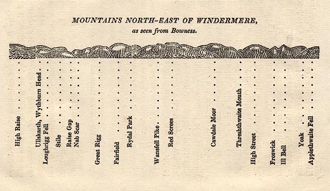 click to enlarge click to enlargeOT2E11.jpg Printed on p.99 of A Concise Description of the English Lakes, by Jonathan Otley, 5th edition, 1834. "MOUNTAINS NORTH-EAST OF WINDERMERE, as seen from Bowness." Mountains are listed:- "High Raise / Ullskarth, Wythburn Head / Loughrigg Fell / Stile / Raise Gap / Nab Scar / Great Rigg / Fairfield / Rydal Park / Wansfell Pike / Red Screes / Cawdale Moor / Threshthwaite Mouth / High Street / Froswick / Ill Bell / Yoak / Applethwaite Fell" item:- JandMN : 48.12 Image © see bottom of page |
|||||||||||||||||||||||||
|
|
||||||||||||||||||||||||||
| evidence:- | descriptive text:- Otley 1823 (5th edn 1834) |
|||||||||||||||||||||||||
| source data:- | Guide book, A Concise Description of the English Lakes, the
mountains in their vicinity, and the roads by which they may be
visited, with remarks on the mineralogy and geology of the
district, by Jonathan Otley, published by the author, Keswick,
Cumberland now Cumbria, by J Richardson, London, and by Arthur
Foster, Kirkby Lonsdale, Cumbria, 1823; published 1823-49,
latterly as the Descriptive Guide to the English Lakes. goto source goto sourcePage 75:- "WANSFELL PIKE" "Rises nearly 1500 feet above Windermere Lake. This is a moderate elevation compared with many of its neighbours; yet it is not deficient in prospects. It affords excellent views of Windermere, Grasmere, and Rydal lakes; the towns of Ambleside and Hawkshead, with the beautifully diversified scenery in the neighbourhood. Further distant are seen the sands of Milnthorp, Lancaster, and" goto sourcePage 76:- "Ulverston, with the majestic mountains of Coniston and Langdale. In a walk from the pike, towards Kirkstone, it is curious to observe Great Gable start out, as it were, from behind Langdale Pikes, and appearing to separate itself from them still further as the spectator makes his progress along this ridge. Wansfell may be conveniently visited either from Ambleside or Low Wood Inn; and a formation of slaty limestone may be observed crossing its southern end." |
|||||||||||||||||||||||||
|
|
||||||||||||||||||||||||||
| evidence:- | descriptive text:- Ford 1839 (3rd edn 1843) placename:- Wansfell Pike placename:- Wans Fell item:- altitude, Wansfell Pike |
|||||||||||||||||||||||||
| source data:- | Guide book, A Description of Scenery in the Lake District, by
Rev William Ford, published by Charles Thurnam, Carlisle, by W
Edwards, 12 Ave Maria Lane, Charles Tilt, Fleet Street, William
Smith, 113 Fleet Street, London, by Currie and Bowman,
Newcastle, by Bancks and Co, Manchester, by Oliver and Boyd,
Edinburgh, and by Sinclair, Dumfries, 1839. goto source Page 34:- "..." "WANSFELL AND SKELGILL." "Mountain excursions of moderate elevation, and almost without fatigue, may be made to Skelgill and Wansfell Pike, whence the localities of Ambleside are displayed as on a map, and thus the stranger is enabled to form a better idea of his position with regard to the mighty masses around him. Windermere, also, is seen in a new point of view." goto sourcePage 178:- "ELEVATION OF THE MOUNTAINS," "ACCORDING TO DIFFERENT AUTHORITIES."
|
|||||||||||||||||||||||||
|
|
||||||||||||||||||||||||||
| evidence:- | old text:- Martineau 1855 placename:- Wansfell |
|||||||||||||||||||||||||
| source data:- | Guide book, A Complete Guide to the English Lakes, by Harriet
Martineau, published by John Garnett, Windermere, Westmorland,
and by Whittaker and Co, London, 1855; published 1855-76. goto source Page 58:- "... Wansfell is nearest, and also easy and safe. It may be reached by a charming walk from Low Wood Inn, and descended by the Stockghyll lane, above Ambleside. The immediate neighbourhood is mapped out below; and there is a long and wide opening to the south: but to the north-east, and everywhere round the head of the lake, the view is stopped, first by Nab Scar, and then by other heights. ..." |
|||||||||||||||||||||||||
|
|
||||||||||||||||||||||||||
| evidence:- | outline view:- Black 1856 (23rd edn 1900) placename:- Wansfell Pike |
|||||||||||||||||||||||||
| source data:- | Print, lithograph, Outline Views, Windermere - Mountains as seen from the North End
of Belle Isle, Windermere, and Mountains as seen from Biscay How, Bowness, by J Flintoft,
Keswick, Cumberland, engraved by R Mason, Edinburgh, Lothian, about 1900.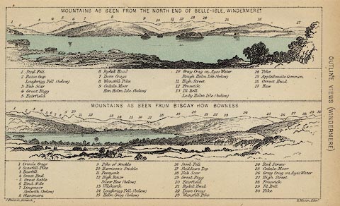 click to enlarge click to enlargeBC08E1.jpg "... 8 Wansfell Pike ... 23 Wansfell Pike ..." item:- JandMN : 37.4 Image © see bottom of page |
|||||||||||||||||||||||||
|
|
||||||||||||||||||||||||||
| evidence:- | outline view:- Black 1841 (3rd edn 1846) placename:- Wansfell Pike |
|||||||||||||||||||||||||
| source data:- | Print, engraving, outline view, Mountains as seen from the North End of Belle Isle,
Windermere, and Mountains as seen from Bisket How, Bowness, by J Flintoft, Keswick,
Cumberland, engraved by R Mason, Edinburgh, about 1844.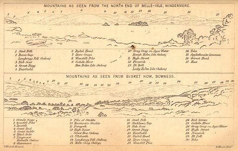 click to enlarge click to enlargeBC02E1.jpg "... 8 Wansfell Pike ... 23 Wansfell Pike ..." item:- JandMN : 32.3 Image © see bottom of page |
|||||||||||||||||||||||||
|
|
||||||||||||||||||||||||||
| evidence:- | outline view:- Tattersall 1836 placename:- Wansfell item:- boat; rowing boat |
|||||||||||||||||||||||||
| source data:- | Print, engraving, Upper Reach, Windermere, Westmorland, drawn by George Tattersall,
engraved by W F Topham, published by Sherwood and Co, Paternoster Row, London, about
1836.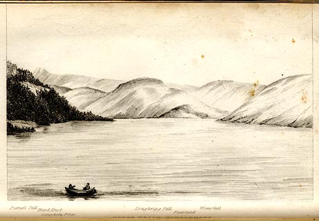 click to enlarge click to enlargeTAT102.jpg The print is captioned with mountain names and acts as an outline view. Tipped in opposite p.25 of The Lakes of England, by George Tattersall. printed at bottom:- "UPPER REACH, WINDERMERE." printed at bottom left to right:- "Furness Fell. / Hard Knot. / Langdale Pikes. / Loughrigg Fell. / Fairfield. / Wansfell." item:- Armitt Library : A1204.3 Image © see bottom of page |
|||||||||||||||||||||||||
|
|
||||||||||||||||||||||||||
| evidence:- | outline view:- Black 1856 (23rd edn 1900) placename:- Wansfell Pike |
|||||||||||||||||||||||||
| source data:- | Print, lithograph, Outline Views, Windermere - Mountains as seen from the North End
of Belle Isle, Windermere, and Mountains as seen from Biscay How, Bowness, by J Flintoft,
Keswick, Cumberland, engraved by R Mason, Edinburgh, Lothian, about 1900. click to enlarge BC08E1.jpg "... 8 Wansfell Pike ... 23 Wansfell Pike ..." item:- JandMN : 37.4 Image © see bottom of page |
|||||||||||||||||||||||||
|
|
||||||||||||||||||||||||||
| evidence:- | outline view:- Black 1841 (3rd edn 1846) placename:- Wansfell Pike |
|||||||||||||||||||||||||
| source data:- | Print, engraving, outline view, Mountains as seen from the North End of Belle Isle,
Windermere, and Mountains as seen from Bisket How, Bowness, by J Flintoft, Keswick,
Cumberland, engraved by R Mason, Edinburgh, about 1844. click to enlarge BC02E1.jpg "... 8 Wansfell Pike ... 23 Wansfell Pike ..." item:- JandMN : 32.3 Image © see bottom of page |
|||||||||||||||||||||||||
|
|
||||||||||||||||||||||||||
| evidence:- | outline view:- Tattersall 1836 placename:- Wansfell item:- boat; rowing boat |
|||||||||||||||||||||||||
| source data:- | Print, engraving, Upper Reach, Windermere, Westmorland, drawn by George Tattersall,
engraved by W F Topham, published by Sherwood and Co, Paternoster Row, London, about
1836. click to enlarge TAT102.jpg The print is captioned with mountain names and acts as an outline view. Tipped in opposite p.25 of The Lakes of England, by George Tattersall. printed at bottom:- "UPPER REACH, WINDERMERE." printed at bottom left to right:- "Furness Fell. / Hard Knot. / Langdale Pikes. / Loughrigg Fell. / Fairfield. / Wansfell." item:- Armitt Library : A1204.3 Image © see bottom of page |
|||||||||||||||||||||||||
|
|
||||||||||||||||||||||||||
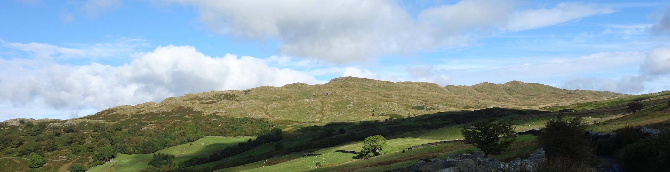 Click to enlarge CDZ53.jpg from Hundreds Road. (taken 22.9.2015) 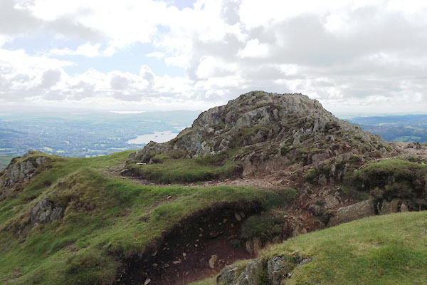 CDZ67.jpg Wansfell Pike? E side, (taken 22.9.2015) 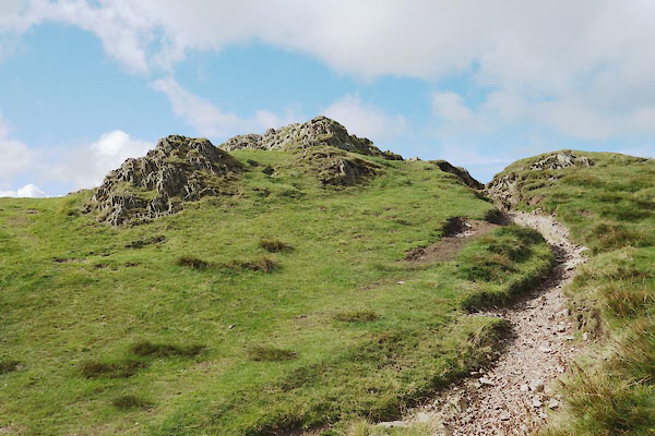 CDZ68.jpg Wansfell Pike? (taken 22.9.2015) |
||||||||||||||||||||||||||
| Footpath erosion is very obvious. |
||||||||||||||||||||||||||
|
|
||||||||||||||||||||||||||
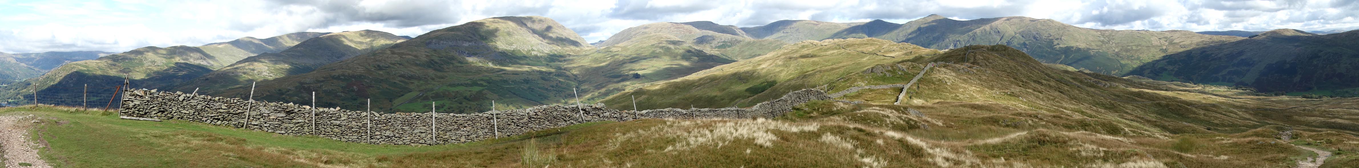 Click to enlarge CDZ71.jpg Panorama NW to SE. (taken 22.9.2015) 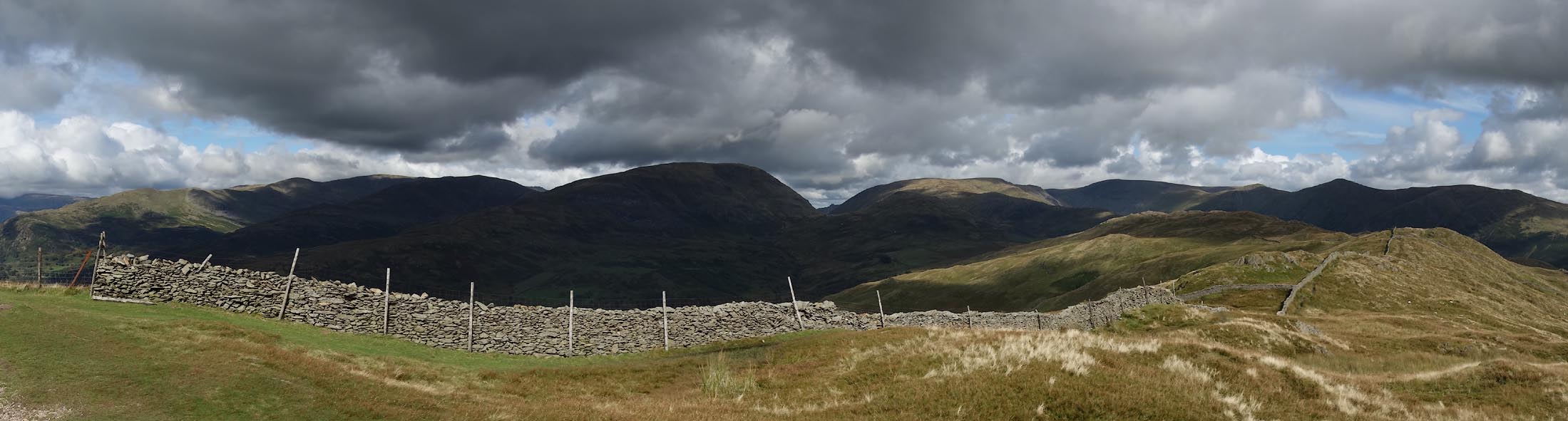 Click to enlarge CDZ72.jpg Panorama NW to NE. (taken 22.9.2015) |
||||||||||||||||||||||||||
| Footpath erosion is very obvious. |
||||||||||||||||||||||||||
|
|
||||||||||||||||||||||||||
Lakes Guides menu.