 Old Cumbria Gazetteer
 |
 |
|
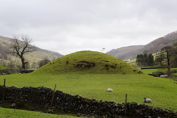
| Whirl Howe, Longsleddale | ||
| Whirl Howe | ||
| civil parish:- | Longsleddale (formerly Westmorland) | |
| county:- | Cumbria | |
| locality type:- | tumulus | |
| coordinates:- | NY48600534 | |
| 1Km square:- | NY4805 | |
| 10Km square:- | NY40 | |
|
|
||
 BZV67.jpg (taken 11.2.2014) 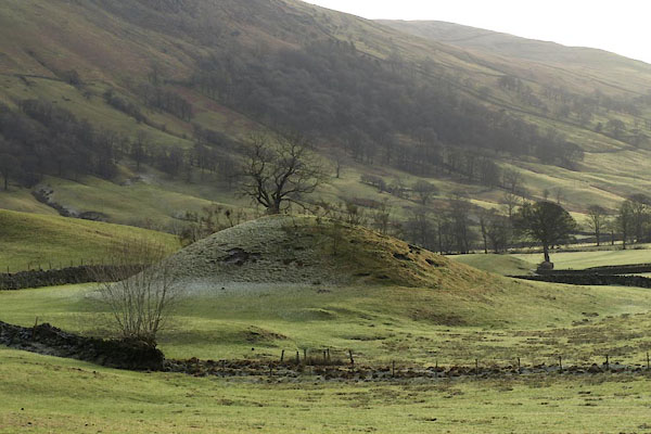 BTX69.jpg (taken 22.1.2011) |
||
|
|
||
| evidence:- | old map:- OS County Series (Wmd 27 7) placename:- Whirl Howe |
|
| source data:- | Maps, County Series maps of Great Britain, scales 6 and 25
inches to 1 mile, published by the Ordnance Survey, Southampton,
Hampshire, from about 1863 to 1948.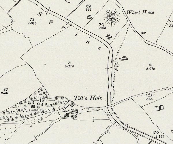 C5E003.jpg "Whirl Howe" |
|
|
|
||
| evidence:- | old map:- Fields 1875 |
|
| source data:- | 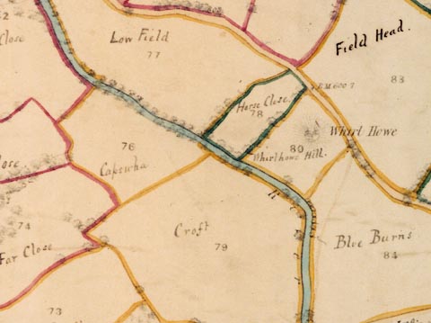 LFld0225.jpg courtesy of Ruth Fishwick piece no = 80 |
|
|
|
||
| evidence:- | textbook:- EPNS Westmorland 1967 placename:- Wharlehowemyer |
|
| source data:- | Book, The Place Names of Westmorland, two volumes, by A H Smith,
published for the English Place Name Society by Cambridge
University Press, Cambridgeshire, 1967 |
|
|
|
||
| evidence:- | map:- OS Six Inch (1956) placename:- Whirl Howe |
|
| source data:- | Map series, various editions with the national grid, scale about
6 inches to 1 mile, published by the Ordnance Survey,
Southampton, Hampshire, scale 1 to 10560 from 1950s to 1960s,
then 1 to 10000 from 1960s to 2000s, superseded by print on
demand from digital data.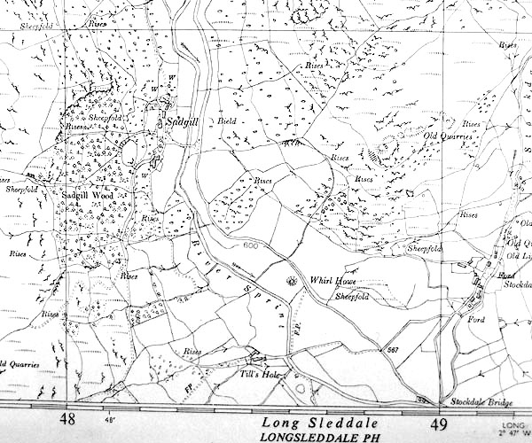 SINY4805.jpg "Whirl Howe" marked as a tumulus |
|
|
|
||
 Lakes Guides menu.