 Old Cumbria Gazetteer
 |
 |
|
| Aikbank Junction, Waverton | ||
| Aikbank Junction | ||
| site name:- | Maryport and Carlisle Railway | |
| locality:- | Aikbank | |
| civil parish:- | Waverton (formerly Cumberland) | |
| county:- | Cumbria | |
| locality type:- | railway junction | |
| coordinates:- | NY21834649 (about) | |
| 1Km square:- | NY2146 | |
| 10Km square:- | NY24 | |
|
|
||
| evidence:- | old map:- OS County Series (Cmd 28 12) item:- railway milepost |
|
| source data:- | Maps, County Series maps of Great Britain, scales 6 and 25
inches to 1 mile, published by the Ordnance Survey, Southampton,
Hampshire, from about 1863 to 1948.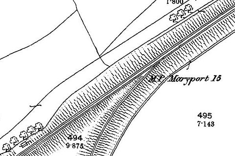 click to enlarge click to enlargeCSRY0047.jpg "M.P. Maryport 15" |
|
|
|
||
| evidence:- | old map:- Postlethwaite 1877 (3rd edn 1913) |
|
| source data:- | Map, uncoloured engraving, Map of the Lake District Mining Field, Westmorland, Cumberland,
Lancashire, scale about 5 miles to 1 inch, by John Postlethwaite, published by W H
Moss and Sons, 13 Lowther Street, Whitehaven, Cumberland, 1877 edn 1913.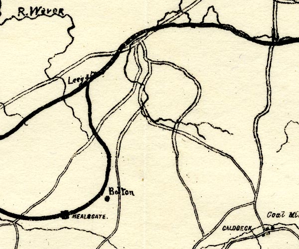 PST2NY24.jpg "Leeg[ ]" labelled at junction on railway; Leegate Station is further SW item:- JandMN : 162.2 Image © see bottom of page |
|
|
|
||
 Lakes Guides menu.