 West 1784 map

|

|
|
|
item:- JandMN (127) image:- © see bottom of page |
click to enlarge |
|
|
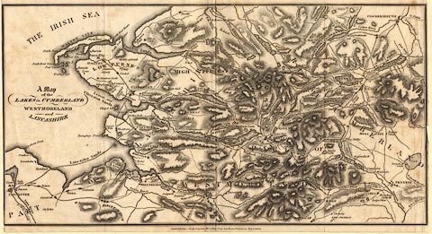
Map, uncoloured engraving, A Map of the Lakes in
Cumberland, Westmoreland and Lancashire, scale about 3.5
miles to 1 inch, derived from Thomas West's map, 1784,
published by Longman, Hurst, Rees, Orme and Brown,
Paternoster Row, London, 1811.
A significant addition is relief shown by hill hachuring. |
||

|
West 1784 map | |
| map feature:- | north point & up is W & sea plain & coast form lines & rivers & lakes & relief & hill hachuring & parks & county & settlements & roads & sands roads | |
| inscription:- |
printed left middle
A / Map / of the / LAKES in CUMBERLAND / WESTMORELAND / and / LANCASHIRE |
|
| inscription:- |
printed bottom centre
Published June 1, 1811, by Longman, Hurst, Rees, Orme and Brown, Paternosterrow, London. |
|
| wxh, sheet:- | 34.5x19.5cm | |
| wxh, map:- | 345x181mm | |
|
|
notes | |