 Otley 1818

|

|
|
|
map type:- Otley 1818 |
|
|
|
A New Map of the District of the Lakes, by Jonathan
Otley, 1817, engraved by J and G Menzies, Edinburgh,
Lothian, Scotland, published by Jonathan Otley, Keswick,
Cumberland, 1818; published 1818-50.
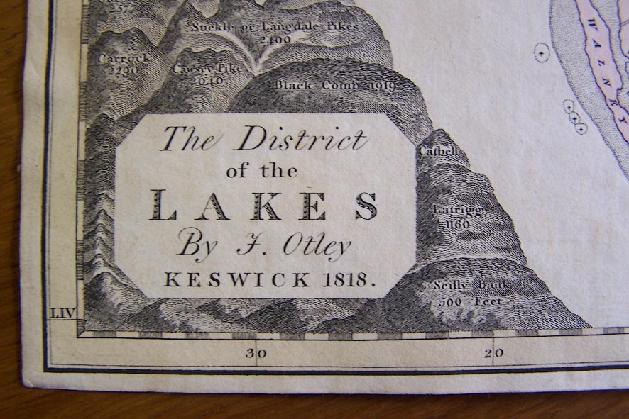
Published as 'A NEW MAP OF THE LAKES IN Cumberland, Westmorland and Lancashire, WITH THE HEIGHTS OF THE PRINCIPAL HILLS, EXHIBITED AT ONE VIEW. Constructed by J. OTLEY: Engraved by J. MENZIES. 1818.' the title cartouche having 'The District of the LAKES By J. Otley KESWICK 1818.' Jonathan Otley in a letter to Thomas Sanderson, London, 1840, wrote 'In 1817 I constructed a map of the district which I had engraved and published in 1818. It was chiefly sold folded for the pocket.' The map was mounted and folded in a slip case, or in card covers with useful tables of information, and perhaps in other forms? Published as the frontispiece to A Concise Description of the English Lakes, by Jonathan Otley, 1st edn 1823. The title cartouche is 'The District of the LAKES By J. Otley KESWICK 1818.' and the imprint '2d. Edit. 1823 / Engraved by J. & G. Menzies, Edinr.'. From 1823 a version of the map is included in Jonathan Otley's guide book; though the map is still '... sold separately, as usual, neatly coloured and folded into a case for the pocket; with Tables showing the height and position of remarkable mountains, distances of places, &c. ...' Published as the frontispiece to the guide book 2nd edn 1825; same title, imprint '2d. Edit. 1825. / Engraved by J. & G. Menzies, Edinr.'. Published in the guide book 3rd edn 1827; title 'The District of the LAKES; By J. Otley.' and imprint 'KESWICK Published by Jona. Otley 21st. June 1827 / Engraved by J. & G. Menzies Edinr.' The guide book back cover has - 'MAP OF THE LAKES. / The Map which accompanied the former Editions of this work, was honoured by the approbation of a liberal public; and to render it still more worthy of the patronage it has received, it has been re-engraved with considerable additions, and is now with confidence offered as the most correct delineation of the district, yet published. It is sold separately, as usual, neatly coloured and folded into a case for the pocket; with Tables shewing the height and position of remarkable mountains, distances of places, &c. - price 3/6. Keswick, May, 1827.'. Published again in the guide book 4th edn 1833; title 'The District of the LAKES; By J. Otley.' and imprint 'KESWICK Published by Jona. Otley 21st. June 1827. And, with additions 20th. July 1833. / Engraved by J. & G. Menzies Edinr.' Published in the guide book 5th edn 1834. Published in the guide book 6th edn 1837; title 'The District of the LAKES; By J. Otley.' and imprint 'KESWICK Published by Jona. Otley 21st. June 1827. And, with additions 20th. July 1833: and 1837. / Engraved by J. & G. Menzies Edinr.' Published in the 7th edn of the guidebook, 1843-45; title '' and imprint 'KESWICK Published by Jona. Otley 2d. Augt. 1841. / Engd. by J. Menzies & Son. EDINR.' The map is re-engraved. Published in guide book 8th edn 1849; title 'THE DISTRICT OF THE LAKES By J. OTLEY.' and imprint 'KESWICK Published by Jona. Otley 2d. May 1849. / Engd. by J. Menzies & Son. EDINR.' Railways are now added, and the guide book includes a table of symbols. Published again 1850? Published again 1892. A version of the map is used in the Red Guide to the Lake District, Ward Lock and Co, 1892. |
||
|
Keswick Museum has a portrait of Jonathan Otley, oil on
canvas, and his tripod and some surveying instruments, etc.
|
||

|
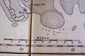
Red Guide 1892 map | |
| see:- | Otley 1823 | |
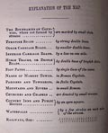
| map feature:- | plain cartouche & north point & magnetic deviation & scale line & lat and long scales & sea plain & coast shaded & rivers & lakes & relief & hill hachuring & table of heights & settlements & roads & canals | |
| inscription:- |
printed title cartouche, lower left
The District / of the / LAKES; / By J. Otley |
|
| inscription:- |
printed bottom
KESWICK Published by Jona. Otley 21st June 1827. And, with additions, 20th. July 1833. |
|
| wxh, sheet:- | 28x37.5cm | |
| wxh, map:- | 262x338mm | |
| scale line:- | 10 miles = 63.4 mm | |
| scale:- | 1 to 250000 ? (1 to 253840 from scale line) | |
|
||
|
||
| sources:- |
Bicknell 1990 Armitt Library Kendal Library Maps JandMN Collection Keswick Museum Carlisle Library Maps Kendal Record Office private collection |
|
| items seen (illustrated items in bold, * have map squares etc):- | ||
|
|
Armitt Library : A1141.1 -- map -- District of the Lakes -- Guide to the Lakes | |
|
|
Armitt Library : A1170.1 -- map -- District of the Lakes | |
|
|
Armitt Library : A1171.1 -- map -- District of the Lakes | |
|
|
Armitt Library : A1173.1 -- map -- District of the Lakes | |
|
|
Armitt Library : A1174.1 -- map -- District of the Lakes | |
|
|
Armitt Library : A1175.1 -- map -- District of the Lakes | |
|
|
Armitt Library : A1176.1 -- map -- District of the Lakes | |
|
|
Armitt Library : A1177.1 -- map -- District of the Lakes | |
|
|
Armitt Library : A1178.1 -- map -- District of the Lakes | |
|
|
Armitt Library : A1179.1 -- map -- District of the Lakes | |
|
|
Armitt Library : A1180.1 -- map -- District of the Lakes | |
|
|
Armitt Library : A1828 -- map -- District of the Lakes -- New Map of the Lakes | |
|
|
Carlisle Library : Map 47 -- map -- District of the Lakes | |
|
|
JandMN (48_1) -- map -- District of the Lakes * | |
|
|
JandMN (452) -- map -- District of the Lakes -- Guide to the Lakes | |
|
|
Kendal Library : Map 150 -- map -- District of the Lakes | |
|
|
Kendal Library : Map 151 -- map -- District of the Lakes | |
|
|
Kendal Library : Map 159 -- map -- District of the Lakes | |
|
|
Kendal Library (6_1) -- map -- District of the Lakes | |
|
|
KendalRO : WDX 1113/1 -- map -- District of the Lakes | |
|
|
Keswick Museum : 1973 no id -- map -- District of the Lakes | |
|
|
private collection (32) -- map -- District of the Lakes -- Correct Map of the Lake District | |