 Otley 1818 NY23


|

|
|
|
gazetteer links places may or may not be labelled on the map |
||

|
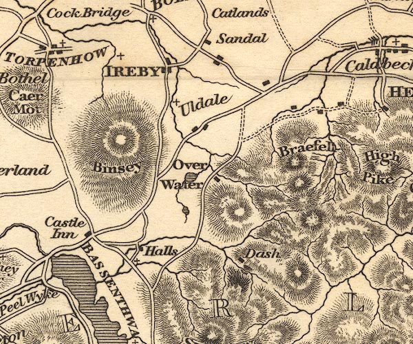
-- Bassenthwaite Lake -- "BASSENTHWAITE" |
|
|
|
-- Bassenthwaite |
|
|
|
-- Binsey |
|
|
|
-- Brae Fell |
|
|
|
-- Castle Inn |
|
|
|
-- Dash |
|
|
|
-- Ireby -- "IREBY" |
|
|
|
-- Little Tarn |
|
|
|
-- Over Water |
|
|
|
-- Sandale |
|
|
|
-- Uldale |
|
|
civil parishes The area roughly includes parts of parishes:- Setmurthy Blindcrake Blennerhasset and Torpenhow Boltons Bewaldeth and Snittlegarth Underskiddaw Bassenthwaite Ireby Mungrisdale Caldbeck Wythop |
||
|
|
||
|
|
Lakes Guides menu. | |