 Otley 1818 SD58


|

|
|
|
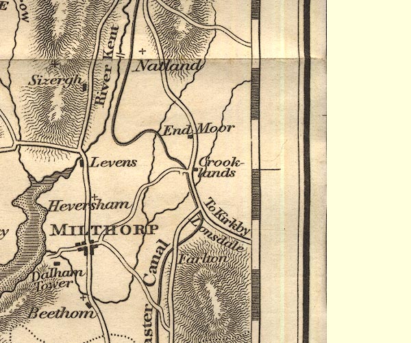
gazetteer links places may or may not be labelled on the map |
||

|
-- Crooklands |
|
|
|
-- Endmoor |
|
|
|
-- Farleton Fell |
|
|
|
-- Farleton Knott |
|
|
|
-- Force Bridge |
|
|
|
-- Kent, River -- "River Kent" |
|
|
|
-- Lancaster Canal -- "The Lancaster Canal" |
|
|
|
-- Natland |
|
|
civil parishes The area roughly includes parts of parishes:- Heversham Hutton Roof Levens New Hutton Old Hutton and Holmescales Milnthorpe Killington Lupton Beetham Kirkby Lonsdale Mansergh Helsington Kendal Natland Hincaster Sedgwick Preston Richard Holme Preston Patrick Stainton |
||
|
|
||
|
|
Lakes Guides menu. | |