Old Cumbria Gazetteer
 |
 |
|
||
| Kent, River | ||||
| runs into:- |  Kentmere Tarn Kentmere Tarn |
|||
|
|
||||
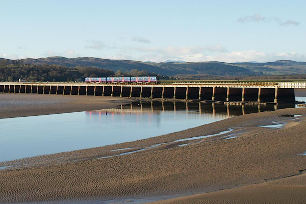
| runs into:- | Kent Estuary |
|||
|
|
||||
| civil parish:- | Kentmere (formerly Westmorland) | |||
| civil parish:- | Over Staveley (formerly Westmorland) | |||
| civil parish:- | Hugill (formerly Westmorland) | |||
| civil parish:- | Strickland Roger (formerly Westmorland) | |||
| civil parish:- | Strickland Ketel (formerly Westmorland) | |||
| civil parish:- | Kendal (formerly Westmorland) | |||
| civil parish:- | Natland (formerly Westmorland) | |||
| civil parish:- | Helsington (formerly Westmorland) | |||
| civil parish:- | Witherslack (formerly Westmorland) | |||
| civil parish:- | Beetham (formerly Westmorland) | |||
| civil parish:- | Heversham (formerly Westmorland) | |||
| civil parish:- | Levens (formerly Westmorland) | |||
| county:- | Cumbria | |||
| locality type:- | river | |||
| 1Km square:- | NY4506 (etc) | |||
| 10Km square:- | NY40 | |||
| 10Km square:- | SD59 | |||
| 10Km square:- | SD48 | |||
|
|
||||
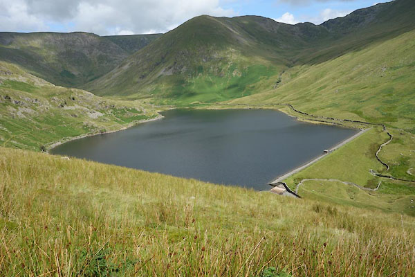
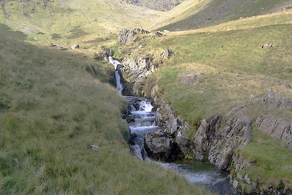
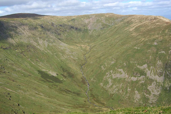 BRK30.jpg Head of the river in Hall Cove, (taken 9.9.2009) 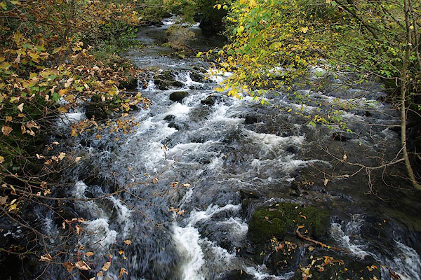 BPS59.jpg Water, in Kentmere valley. (taken 17.10.2008) |
||||
|
|
||||
| evidence:- | old map:- OS County Series (Wmd 27 1) placename:- Kent, River |
|||
| source data:- | Maps, County Series maps of Great Britain, scales 6 and 25
inches to 1 mile, published by the Ordnance Survey, Southampton,
Hampshire, from about 1863 to 1948. OS County Series (Wmd 27 6) OS County Series (Wmd 27 9) OS County Series (Wmd 27 13) OS County Series (Wmd 33 2) OS County Series (Wmd 33 6) OS County Series (Wmd 33 11) OS County Series (Wmd 33 16) OS County Series (Wmd 38 4) OS County Series (Wmd 38 12) OS County Series (Wmd 42 4) OS County Series (Wmd 42 7) |
|||
|
|
||||
| evidence:- | old map:- OS County Series (Wmd 42) item:- tides |
|||
| source data:- | Maps, County Series maps of Great Britain, scales 6 and 25
inches to 1 mile, published by the Ordnance Survey, Southampton,
Hampshire, from about 1863 to 1948. "Ordinary Spring Tides flow to this point" labelled at SD48808470 |
|||
|
|
||||
| evidence:- | old map:- OS County Series (Wmd 42 11) |
|||
| source data:- | Maps, County Series maps of Great Britain, scales 6 and 25
inches to 1 mile, published by the Ordnance Survey, Southampton,
Hampshire, from about 1863 to 1948. "Ordinary Spring Tides flow to this point" |
|||
|
|
||||
| evidence:- | old map:- Gough 1350s-60s placename:- Kent |
|||
| source data:- | Map, colour photozincograph copy, reduced size facsimile, Gough
Map of Britain, scale about 28.5 miles to 1 inch, published by
the Ordnance Survey, Southampton, Hampshire, 1875. click to enlarge click to enlargeGgh1Cm.jpg "Kent" Flowing from east of Kendal to the sea. item:- JandMN : 33 Image © see bottom of page |
|||
|
|
||||
| evidence:- | old map:- Gough 1350s-60s placename:- Kent |
|||
| source data:- | Map, lithograph facsimile, Gough Map of Britain, 20 miles to 1
inch? published by the Ordnance Survey, Southampton, Hampshire,
1935. click to enlarge click to enlargeGgh2Cm.jpg "Kent" Flowing from east of Kendal to the sea. item:- JandMN : 34 Image © see bottom of page |
|||
|
|
||||
| evidence:- | old map:- Ptolemy 1540 |
|||
| source data:- | Map, copy, uncoloured lithograph? Anglia II Nova Tabula, New Map
of England, scale about 50 miles to 1 inch, data in the
Geographia by Claudius Ptolemy, engraved by Sebastian Munster,
Basle, Switzerland, 1540.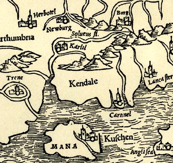 click to enlarge click to enlargePTY4Cm.jpg tapering wiggly double line; river item:- private collection : 131 Image © see bottom of page |
|||
|
|
||||
| evidence:- | old map:- Lloyd 1573 placename:- Cand Flu. |
|||
| source data:- | Map, hand coloured copper plate engraving, Angliae Regni,
Kingdom of England, with Wales, scale about 24 miles to 1 inch, authored by Humphrey
Lloyd, Denbigh, Clwyd, drawn and engraved
by Abraham Ortelius, Netherlands, 1573.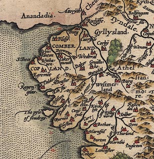 click to enlarge click to enlargeLld1Cm.jpg "Cand flu." item:- Hampshire Museums : FA1998.69 Image © see bottom of page |
|||
|
|
||||
| evidence:- | old map:- Saxton 1579 |
|||
| source data:- | Map, hand coloured engraving, Westmorlandiae et Cumberlandiae Comitatus ie Westmorland
and Cumberland, scale about 5 miles to 1 inch, by Christopher Saxton, London, engraved
by Augustinus Ryther, 1576, published 1579-1645. Sax9NY40.jpg  Sax9SD49.jpg  Sax9SD48.jpg item:- private collection : 2 Image © see bottom of page |
|||
|
|
||||
| evidence:- | old map:- Mercator 1595 (edn?) placename:- |
|||
| source data:- | Map, hand coloured engraving, Westmorlandia, Lancastria, Cestria
etc, ie Westmorland, Lancashire, Cheshire etc, scale about 10.5
miles to 1 inch, by Gerard Mercator, Duisberg, Germany, 1595,
edition 1613-16. MER5WmdA.jpg "" double line with stream lines; river, running into the sea, the upper reaches wrong item:- Armitt Library : 2008.14.3 Image © see bottom of page |
|||
|
|
||||
| evidence:- | old map:- Keer 1605 |
|||
| source data:- | Map, hand coloured engraving, Westmorland and Cumberland, scale
about 16 miles to 1 inch, probably by Pieter van den Keere, or
Peter Keer, about 1605 edition perhaps 1676. click to enlarge click to enlargeKER8.jpg "" double wiggly line, tapering to single; river item:- Dove Cottage : 2007.38.110 Image © see bottom of page |
|||
|
|
||||
| evidence:- | old map:- Speed 1611 (Cum/EW) |
|||
| source data:- | Map, hand coloured engraving, Kingdome of Great Britaine and
Ireland, scale about 36 miles to 1 inch, by John Speed, about
1610-11, published by Thomas Bassett, Fleet Street and Richard
Chiswell, St Paul's Churchyard, London, 1676?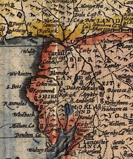 click to enlarge click to enlargeSPD6Cm.jpg tapering wiggly line item:- private collection : 85 Image © see bottom of page |
|||
|
|
||||
| evidence:- | old map:- Speed 1611 (Wmd) placename:- Can flu |
|||
| source data:- | Map, hand coloured engraving, The Countie Westmorland and
Kendale the Cheif Towne, scale about 2.5 miles to 1 inch, by
John Speed, 1610, published by George Humble, Popes Head Alley,
London, 1611-12. SP14SD58.jpg  SP14SD48.jpg "Can flu" double line, and estuary item:- Armitt Library : 2008.14.5 Image © see bottom of page |
|||
|
|
||||
| evidence:- | poem:- Drayton 1612/1622 text placename:- Ken |
|||
| source data:- | Poem, Poly Olbion, by Michael Drayton, published by published by
John Marriott, John Grismand and Thomas Dewe, and others?
London, part 1 1612, part 2 1622. goto source page 137:- "... Upon the East from these [Duddon and Leven], cleere Ken her beautie showes, From Kendale comming in, which she doth please to grace, First with her famous Type, then lastly in her race, Her name upin those Sands doth liberally bequeath, Whereas the Muse awhile may sit her downe to breath, And after walke along tow'rds Yorkshire on her way, On which shee strongly hopes to get a noble day." "... ..." goto sourcepage 161:- "... Where Can first creeping forth, her feet hath scarcely found, But gives that Dale her name, where Kendale towne doth stand, ... Then keeping on her course, though having in her traine, But Sput, a little Brooke, then Winster doth retaine, Tow'rds the Verginian Sea, by her two mighty Falls, (Which the brave Roman tongue, her Catadupa calls) This eager River seemes outragiousy to rore, And counterfetting Nyle, to deafe the neighboring shore, ..." goto sourcepage 162:- "... To the Hibernick Gulfe, when soone the River hasts, And to those queachy Sands, from whence her selfe she casts, She likewise leaves her name as every place where she, In her cleare course doth come, by her should honored be." |
|||
|
|
||||
| evidence:- | old map:- Drayton 1612/1622 placename:- Ken Flu. |
|||
| source data:- | Map, hand coloured engraving, Cumberlande and Westmorlande, by
Michael Drayton, probably engraved by William Hole, scale about
4 or 5 miles to 1 inch, published by John Mariott, John
Grismand, and Thomas Dewe, London, 1622.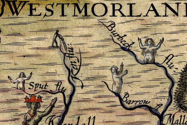 DRY517.jpg "Ken flu:" River, naiad pouring out water; his rivers are muddled.. item:- JandMN : 168 Image © see bottom of page |
|||
|
|
||||
| evidence:- | table of distances:- Simons 1635 |
|||
| source data:- | Table of distances, uncoloured engraving, Westmerland ie
Westmorland, with a thumbnail map, scale about 42 miles to 1
inch, by Mathew Simons, published in A Direction for the English
Traviller, 1635.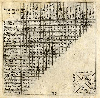 click to enlarge click to enlargeSIM3.jpg on thumbnail map item:- private collection : 50.39 Image © see bottom of page |
|||
|
|
||||
| evidence:- | old map:- Jenner 1643 |
|||
| source data:- | Table of distances, with map, hand coloured engraving,
Westmerland ie Westmorland, scale about 16 miles to 1 inch,
engraved by Jacob van Langeren, published by Thomas Jenner,
Cornhill, London, 1643.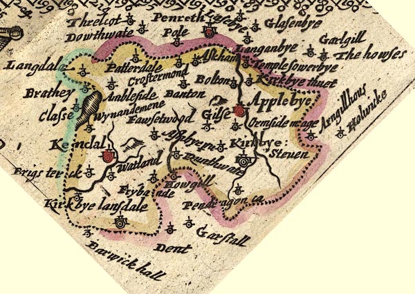 JEN3Sq.jpg wiggly line item:- private collection : 52.Wmd Image © see bottom of page |
|||
|
|
||||
| evidence:- | old map:- Jansson 1646 |
|||
| source data:- | Map, hand coloured engraving, Cumbria and Westmoria, ie
Cumberland and Westmorland, scale about 3.5 miles to 1 inch, by
John Jansson, Amsterdam, Netherlands, 1646. JAN3SD48.jpg  JAN3SD58.jpg 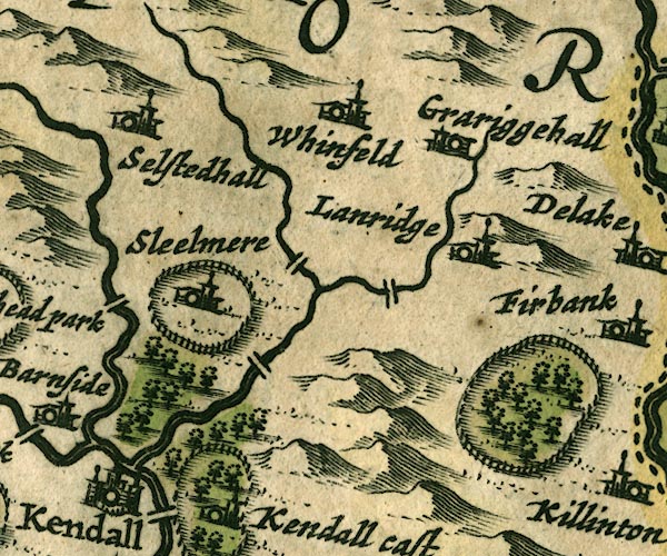 JAN3SD59.jpg Double wiggly line tapering to single. item:- JandMN : 88 Image © see bottom of page |
|||
|
|
||||
| evidence:- | old map:- Ogilby 1675 (plate 96) |
|||
| source data:- | Road strip map, hand coloured engraving, the Road from Kendal to
Cockermouth, and the Road from Egremond to Carlisle, scale about
1 inch to 1 mile, by John Ogilby, London, 1675.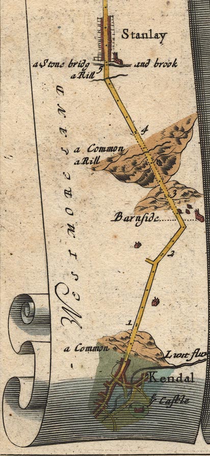 OG96m000.jpg In mile 0, Westmoreland. River through the town. item:- JandMN : 22 Image © see bottom of page |
|||
|
|
||||
| evidence:- | old map:- Ogilby 1675 (plate 38) placename:- Kent Flu. |
|||
| source data:- | Road strip map, hand coloured engraving, continuation of the
Road from London to Carlisle, scale about 1 inch to 1 mile, by
John Ogilby, London, 1675.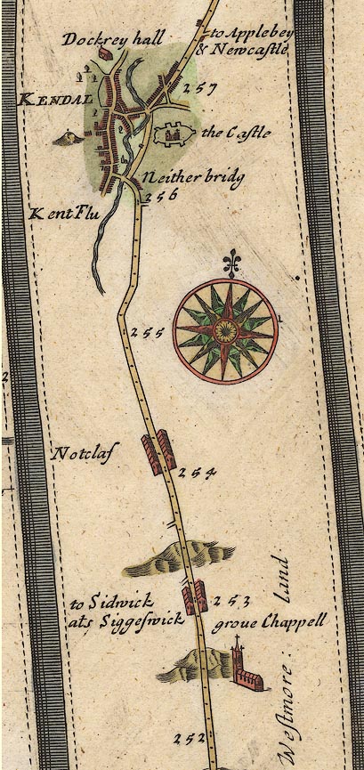 OG38m252.jpg In mile 255, Westmoreland. River alongside the road:- "Kent Flu" and running through Kendal to the north. In mile 256, Westmoreland. River crossed by a turning into Kendal at:- "Neither bridg" item:- JandMN : 21 Image © see bottom of page |
|||
|
|
||||
| evidence:- | old map:- Sanson 1679 placename:- Kene fl. |
|||
| source data:- | Map, hand coloured engraving, Ancien Royaume de Northumberland
aujourdhuy Provinces de Nort, ie the Ancient Kingdom of
Northumberland or the Northern Provinces, scale about 9.5 miles
to 1 inch, by Nicholas Sanson, Paris, France, 1679. click to enlarge click to enlargeSAN2Cm.jpg "Kene fl." tapering wiggly line; river item:- Dove Cottage : 2007.38.15 Image © see bottom of page |
|||
|
|
||||
| evidence:- | old map:- Seller 1694 (Wmd) |
|||
| source data:- | Map, hand coloured engraving, Westmorland, scale about 8 miles
to 1 inch, by John Seller, 1694. click to enlarge click to enlargeSEL7.jpg tapering wiggly line; river item:- Dove Cottage : 2007.38.87 Image © see bottom of page |
|||
|
|
||||
| evidence:- | old map:- Morden 1695 (EW) |
|||
| source data:- | Map, hand coloured engraving, England, including Wales, scale
about 27 miles to 1 inch, by Robert Morden, published by Abel
Swale Awnsham and John Churchil, London, about 1695. click to enlarge click to enlargeMRD3Cm.jpg tapering wiggly line item:- JandMN : 339 Image © see bottom of page |
|||
|
|
||||
| evidence:- | old map:- Morden 1695 (Wmd) placename:- Can Flu. |
|||
| source data:- | Map, hand coloured engraving, Westmorland, scale about 2.5 miles to 1 inch, by Robert
Morden, published by Abel Swale, the Unicorn, St Paul's Churchyard, Awnsham, and John
Churchill, the Black Swan, Paternoster Row, London, 1695.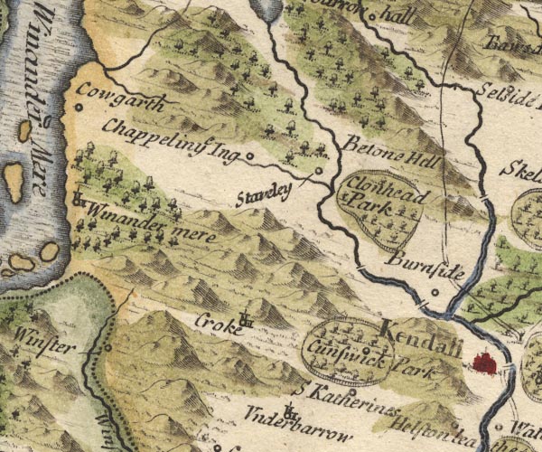 MD10SD49.jpg 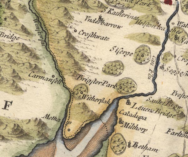 MD10SD48.jpg "Can Flu." item:- JandMN : 24 Image © see bottom of page |
|||
|
|
||||
| evidence:- | descriptive text:- Fiennes 1698 placename:- Can, River item:- salmon; salmon wier; salmon spear |
|||
| source data:- | Travel book, manuscript record of Journeys through England
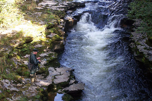
including parts of the Lake District, by Celia Fiennes, 1698. "The River Can which gives name to the town [Kendal] is pretty large but full of rocks and stones that makes shelves and falls in the water, its stor'd with plenty of good fish and there are great falls of water partly naturall and added to by putting more stones in manner of wyers at which they catch salmon when they leape with speares; the roareing of the water at these places sometymes does foretell wet weather, they do observe when the water roares most in the fall on the northside it will be faire, if on the southside of the town it will be wet; some of them are falls as high as a house ..." |
|||
|
|
||||
| evidence:- | old map, descriptive text:- Bowen 1720 (plate 93) placename:- Kent Flu. placename:- Kan Flu. placename:- Kant Flu. |
|||
| source data:- | Strip maps, uncoloured engravings, road maps, The Road from
London to Carlisle, scale about 2 miles to 1 inch, with sections
in Lancashire and Westmorland, published by Emanuel Bowen, St
Katherines, London, 1720.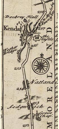 B093m252.jpg "Kendal ... So called from its scituation on Kan or Kant Flu. ..." item:- Dove Cottage : 2007.38.100 Image © see bottom of page |
|||
|
|
||||
| evidence:- | old map:- Badeslade 1742 placename:- Can, River placename:- Ken, River |
|||
| source data:- | Maps, Westmorland North from London, scale about 10 miles to 1
inch, and Cumberland North from London, scale about 11 miles to
1 inch, with descriptive text, by Thomas Badeslade, London,
engraved and published by William Henry Toms, Union Court,
Holborn, London, 1742; published 1742-49. "... The S. part of the County [Westmorland] is divided into 2 by the Can or Ken, which gives name to Kendale ..." |
|||
|
|
||||
| evidence:- | old map:- Badeslade 1742 placename:- Can River |
|||
| source data:- | Map, uncoloured engraving, A Map of Westmorland North from
London, scale about 10 miles to 1 inch, with descriptive text,
by Thomas Badeslade, London, engraved and published by William
Henry Toms, Union Court, Holborn, London, 1742. click to enlarge click to enlargeBD12.jpg "Can R." tapering wiggly line item:- Dove Cottage : 2007.38.62 Image © see bottom of page |
|||
|
|
||||
| evidence:- | descriptive text:- Simpson 1746 placename:- Can, River placename:- Ken, River placename:- Kent, River |
|||
| source data:- | Atlas, three volumes of maps and descriptive text published as
'The Agreeable Historian, or the Compleat English Traveller
...', by Samuel Simpson, 1746. goto source Page 1020:- "..." "The River Can, Ken, or Kent, rises at Kentmere, and being joined by two large Rivers before it comes to Kendale, they render it a large Stream, with which is passeth thro' a Stony Channel abounding with Fish, into Solway Frith." |
|||
|
|
||||
| evidence:- | old map:- Simpson 1746 map (Wmd) |
|||
| source data:- | Map, uncoloured engraving, Westmorland, scale about 8 miles to 1
inch, printed by R Walker, Fleet Lane, London, 1746. SMP2NYK.jpg Wiggly line; from Kentmere Tarn. 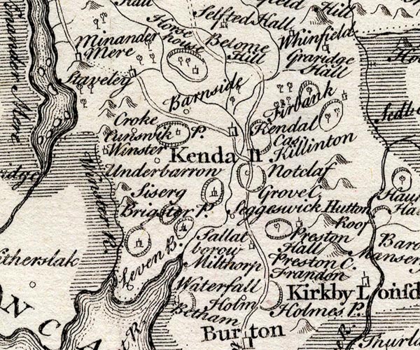 SMP2SDP.jpg Wiggly line. item:- Dove Cottage : 2007.38.59 Image © see bottom of page |
|||
|
|
||||
| evidence:- | old map:- Bowen and Kitchin 1760 placename:- Can River |
|||
| source data:- | Map, hand coloured engraving, A New Map of the Counties of
Cumberland and Westmoreland Divided into their Respective Wards,
scale about 4 miles to 1 inch, by Emanuel Bowen and Thomas
Kitchin et al, published by T Bowles, Robert Sayer, and John
Bowles, London, 1760.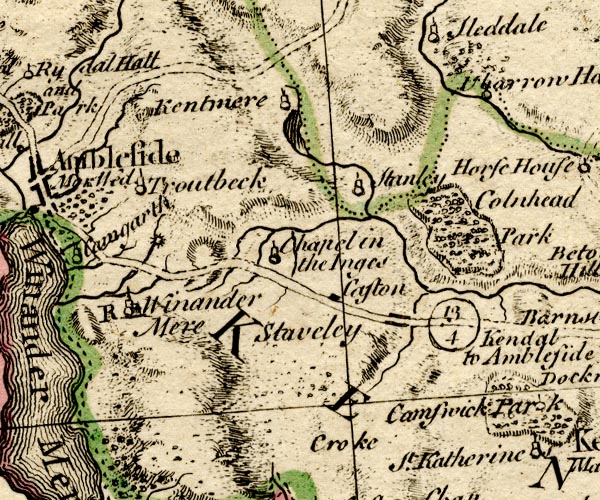 BO18SD39.jpg wiggly line, from Kentmere Tarn 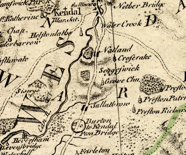 BO18SD48.jpg "Can R." double line with stream lines 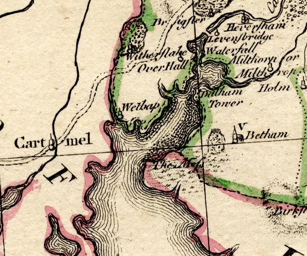 BO18SD37.jpg double line with stream lines and river mouth, into an estuary item:- Armitt Library : 2008.14.10 Image © see bottom of page |
|||
|
|
||||
| evidence:- | old map:- Jefferys 1770 |
|||
| source data:- | Map, 4 sheets, The County of Westmoreland, scale 1 inch to 1
mile, surveyed 1768, and engraved and published by Thomas
Jefferys, London, 1770. J55193M.jpg  J55193L.jpg  J55193R.jpg  J55193Q.jpg 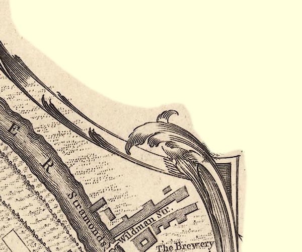 J55193V.jpg 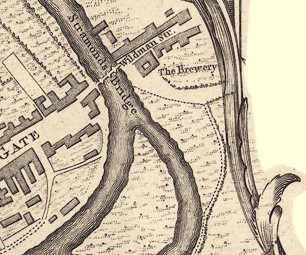 J55192Z.jpg 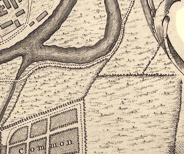 J55192Y.jpg 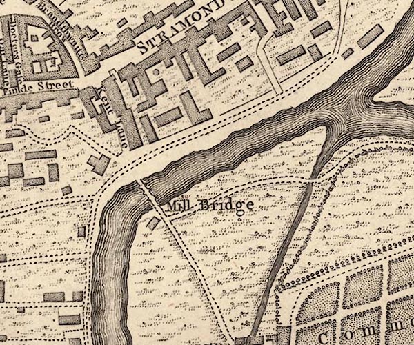 J55192T.jpg 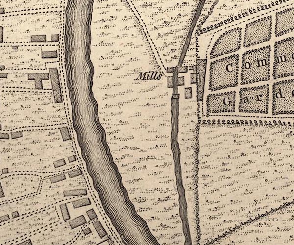 J55192S.jpg  J55192R.jpg  J55192Q.jpg  J55191U.jpg "KENT RIVER" river; and a mill lade and race for Castle Mills item:- National Library of Scotland : EME.s.47 Images © National Library of Scotland |
|||
|
|
||||
| evidence:- | old map:- Jefferys 1770 (Wmd) placename:- Kent River |
|||
| source data:- | Map, 4 sheets, The County of Westmoreland, scale 1 inch to 1
mile, surveyed 1768, and engraved and published by Thomas
Jefferys, London, 1770. J5NY40NE.jpg  J5NY40SE.jpg  J5SD49NE.jpg "Kent R."  J5SD59NW.jpg 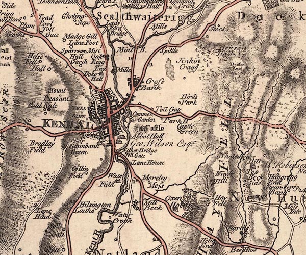 J5SD59SW.jpg 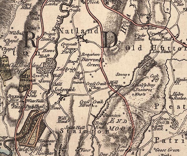 J5SD58NW.jpg "Kent R." single or double wiggly line; river 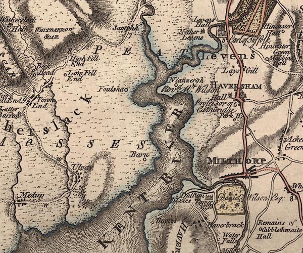 J5SD48SE.jpg "KENT RIVER" river mouth item:- National Library of Scotland : EME.s.47 Images © National Library of Scotland |
|||
|
|
||||
| evidence:- | descriptive text:- West 1778 (11th edn 1821) |
|||
| source data:- | Guide book, A Guide to the Lakes, by Thomas West, published by
William Pennington, Kendal, Cumbria once Westmorland, and in
London, 1778 to 1821. goto source Page 177:- "... A noble river, the Kent, is discovered flowing briskly through fertile fields, and visiting the town [Kendal] in its whole length. It is crossed by a handsome bridge, where three great roads coincide, from Sedbergh, Kirkby-Stephen, and Penrith. ..." "..." goto sourcePage 185:- "... from the crown of it [Force Bridge] have a very singular romantic view of the river both ways, working its passage in a narrow deep channel of rocks, hanging over it in a variety of forms, and streaming a thousand rills into the flood. The rocks in the bottom are strangely excavated into deep holes of various shapes, which, when the river is low, remain full of water, and from their depth are black as ink. ..." "..." goto sourcePage 186:- "... The side of the Kent is famous for petrifying springs, that incrust vegetable bodies, such as moss, leaves of trees, &c. There is one on the park [Levens Park], called the Dropping-well." goto sourceAddendum; Mr Gray's Journal, 1769 Page 213:- "..." "Oct. 9. ... I went up the castle-hill: ... by their [houses] side runs a fine brisk stream, over which there are three stone bridges: ..." goto sourcePage 214:- "... The remains of the castle are seated on a fine hill on the side of the river opposite the town; ..." goto sourcePage 215:- "[from the castle] ... There is a good view of the town and river, with a fertile open valley, though which it winds." "After dinner I went along the Millthorp turnpike, four miles to see the falls, or force of the river Kent; ... came to Sizergh ... I soon came to the river; it works its way in a narrow and deep rocky channel, overhung with trees. The calmness and brightness of the evening, the roar of the waters, and the thumping of huge hammers at an iron forge not far distant, made it a singular walk; ..." |
|||
|
|
||||
| evidence:- | old map:- West 1784 map placename:- Kent River |
|||
| source data:- | Map, hand coloured engraving, A Map of the Lakes in Cumberland,
Westmorland and Lancashire, scale about 3.5 miles to 1 inch,
engraved by Paas, 53 Holborn, London, about 1784.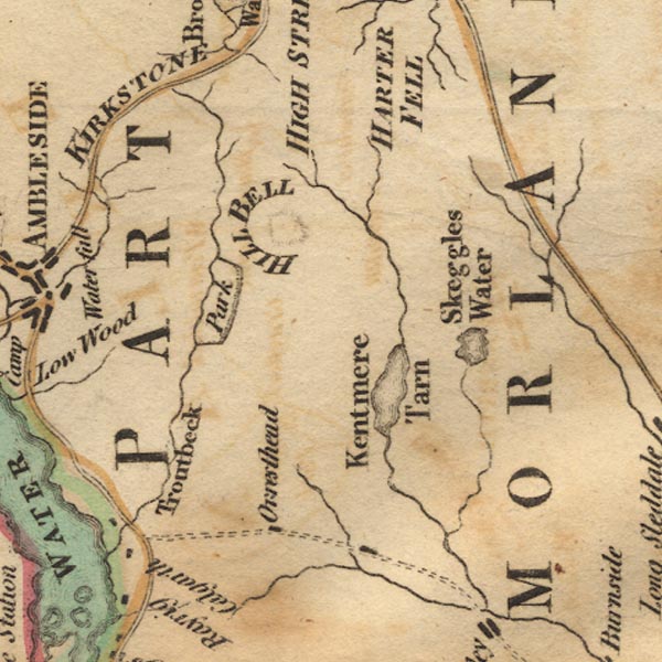 Ws02NY40.jpg 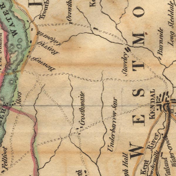 Ws02SD49.jpg 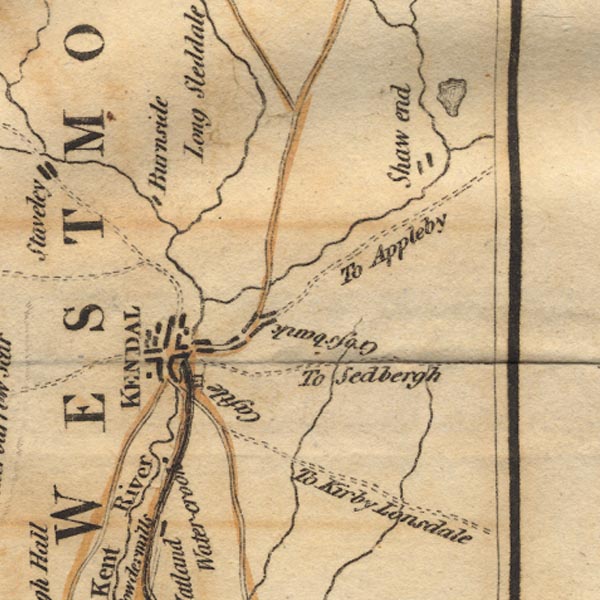 Ws02SD59.jpg 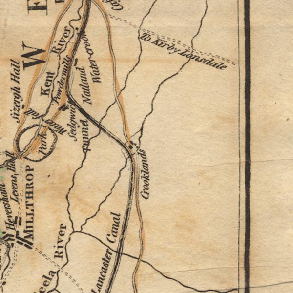 Ws02SD58.jpg 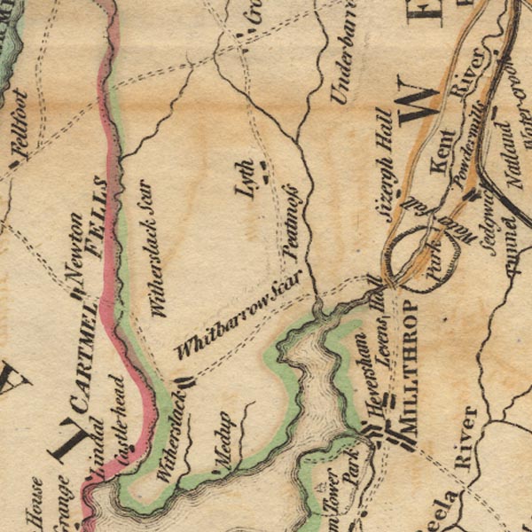 Ws02SD48.jpg "Kent River" item:- Armitt Library : A1221.1 Image © see bottom of page |
|||
|
|
||||
| evidence:- | old text:- Camden 1789 placename:- Can, River |
|||
| source data:- | Book, Britannia, or A Chorographical Description of the Flourishing Kingdoms of England,
Scotland, and Ireland, by William Camden, 1586, translated from the 1607 Latin edition
by Richard Gough, published London, 1789. goto source Page 147:- "..." "... Kendale, or Candale, q.d. the Valley on the Can, a river which runs over rocks through this valley, and gives name to it, on whose western banks is the populous town of Candale or Kirkeby Candale, ..." |
|||
|
|
||||
| evidence:- | old text:- Camden 1789 (Gough Additions) placename:- Kent, River item:- salmon leap |
|||
| source data:- | Book, Britannia, or A Chorographical Description of the Flourishing Kingdoms of England,
Scotland, and Ireland, by William Camden, 1586, translated from the 1607 Latin edition
by Richard Gough, published London, 1789. goto source Page 150:- "..." "The rivers of this county [Westmorland] are but small, and only three that can properly be called rivers carry their name to the sea: ... The 3d is Kent which rises in Kentmere and washes the vale which from thence receives the name of Kendale, and empties itself into the sea below Levens." ""Kent river is of a good depth not well to be occupyed with botes for rowlling stones and other moles. Yt risith of very many heddes be likelihood springing within the same shire. A 2 mile about Kendale they come to one good botom and Kentdale town that standeth on the west side of it. Seven or 8 miles from Kendale is a mere commonly called Kenmore." In it is a salmon leap." |
|||
|
|
||||
| evidence:- | old map:- Cary 1789 (edn 1805) |
|||
| source data:- | Map, uncoloured engraving, Westmoreland, scale about 2.5 miles
to 1 inch, by John Cary, London, 1789; edition 1805.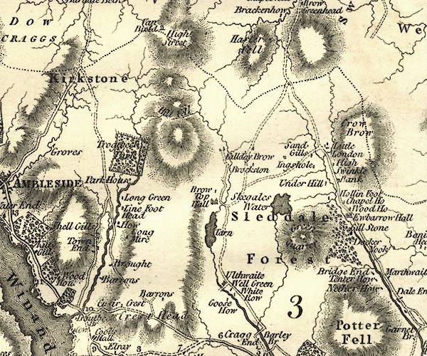 CY24NY40.jpg 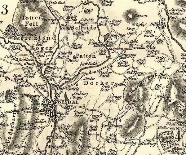 CY24SD59.jpg 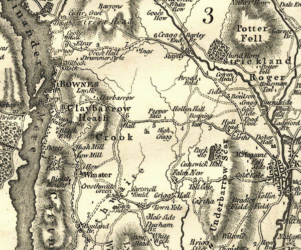 CY24SD49.jpg 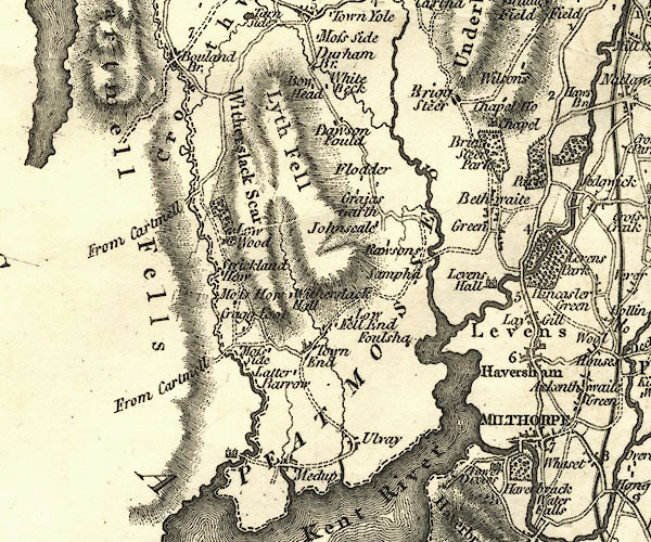 CY24SD48.jpg 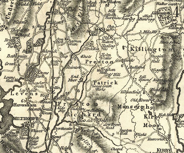 CY24SD58.jpg "Kent River" river from Kentmere Tarn, running into its estuary item:- JandMN : 129 Image © see bottom of page |
|||
|
|
||||
| evidence:- | old map:- Aikin 1790 (Wmd) placename:- Ken River |
|||
| source data:- | Map, uncoloured engraving, Westmoreland ie Westmorland, scale
about 8.5 miles to 1 inch, by John Aikin, London, 1790.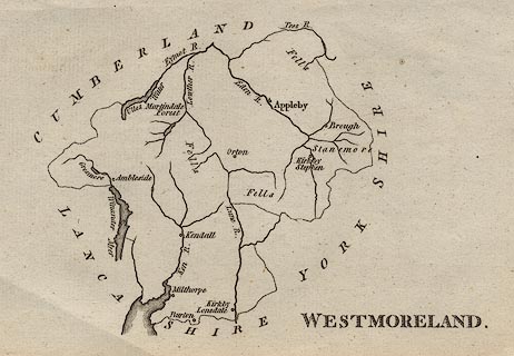 click to enlarge click to enlargeAIK2.jpg "Ken R." river item:- JandMN : 51 Image © see bottom of page |
|||
|
|
||||
| evidence:- | old text:- Gents Mag item:- zoology; fish; otter |
|||
| source data:- | Magazine, The Gentleman's Magazine or Monthly Intelligencer or
Historical Chronicle, published by Edward Cave under the
pseudonym Sylvanus Urban, and by other publishers, London,
monthly from 1731 to 1922. goto source Gentleman's Magazine 1794 p.113 "..." "Before quitting the park [Levens Park], we came to high-water mark; for, the tides reach thus far into the country at the time of spring-floods, the distance from the sea being not less than twenty miles; consequently this part of the river is not more than eighteen or twenty yards above low-water mark, which is a very gentle ascent when compared with that we had been examining; for, the Kent falls nearly fifty yards, by means of streams and cascades, in the space of less than five miles between Kendal and Levens. The watery inhabitants of this limpid current may be thus enumerated: the fresh-water muscle, Mytilus Cygneus; the cray-fish, Cancer Astacus; the samlet, Salmo; the trout, S. Fario; the salmon, S. Salar; the eel, Muraena Anguilla; the bull-head, Costus Gobio; the pink, Cyprinus Phoxinus; the loach, Cobitis Toenia. About high-water-mark are found the flounder, Pleuronectes Flessius; and the smelt, Salmo Eperlanus. The otter may be added, without much impropriety, to the catalogue, the common enemy of the finny tribe." "(To be concluded in a future number.)" |
|||
|
|
||||
| evidence:- | old map:- Bailey 1797 placename:- Kent River |
|||
| source data:- | Map, soil etc, uncoloured engraving, Westmoreland, scale about
12 miles to 1 inch, by J Bailey, engraved by Neele, Strand,
published by Messrs Robinson, Paternoster Row and G Nicol, Pall
Mall, London, 1797.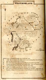 click to enlarge click to enlargeBY05.jpg "Kent R." river item:- Armitt Library : A680.3 Image © see bottom of page |
|||
|
|
||||
| evidence:- | road book:- Cary 1798 (2nd edn 1802) placename:- Ken, River |
|||
| source data:- | Road book, itineraries, Cary's New Itinerary, by John Cary, 181
Strand, London, 2nd edn 1802. goto source click to enlarge click to enlargeC38267.jpg page 267-268 "Cross the Ken River." goto source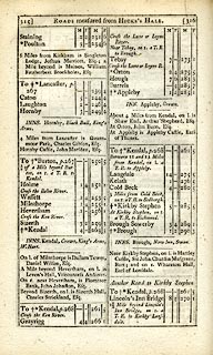 click to enlarge click to enlargeC38315.jpg page 315-316 "Cross the Ken River." twice goto source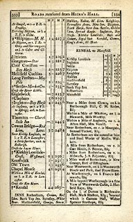 click to enlarge click to enlargeC38333.jpg page 333-334 "Cross the Ken River" item:- JandMN : 228.1 Image © see bottom of page |
|||
|
|
||||
| evidence:- | old map:- Skrine 1801 placename:- Ken River |
|||
| source data:- | Map, uncoloured engraving, rivers in Cumberland, Westmorland,
Lancashire and Cheshire, scale about 23 miles to 1 inch, by
Henry Skrine, published by P Elmsly, London, 1801. click to enlarge click to enlargeM076.jpg "Ken R." river item:- JandMN : 421 Image © see bottom of page |
|||
|
|
||||
| evidence:- | descriptive text:- Baker 1802 placename:- Kenken, River placename:- Ken, River |
|||
| source data:- | Perspective road map with sections in Lancashire, Westmorland,
and Cumberland, by J Baker, London 1802. pp.25-26:- "... Cartmel ... between two bays of the sea, the one formed by the river Kenken, ..." "..." "The road from Kendal to Shap, after passing the fertile vale of the river Ken, ..." |
|||
|
|
||||
| evidence:- | old map:- Cooke 1802 placename:- Kent River |
|||
| source data:- | Map, Westmoreland ie Westmorland, scale about 12 miles to 1
inch, by George Cooke, 1802, published by Sherwood, Jones and
Co, Paternoster Road, London, 1824. click to enlarge click to enlargeGRA1Wd.jpg "Kent R." tapering wiggly line; river item:- Hampshire Museums : FA2000.62.4 Image © see bottom of page |
|||
|
|
||||
| evidence:- | old map:- Cooke 1802 |
|||
| source data:- | Map, Lancashire, scale about 18 miles to 1 inch, by George
Cooke, 1802, bound in Gray's New Book of Roads, 1824, published
by Sherwood, Jones and Co, Paternoster Road, London, 1824. click to enlarge click to enlargeGRA1La.jpg tapering wiggly line; river; county boundary item:- Hampshire Museums : FA2000.62.6 Image © see bottom of page |
|||
|
|
||||
| evidence:- | old map:- Cooke 1802 placename:- Ken River |
|||
| source data:- | Map, The Lakes, Westmorland and Cumberland, scale about 8.5
miles to 1 inch, engravedby Neele and Son, published by
Sherwood, Jones and Co, Paternoster Road, London, 1824. click to enlarge click to enlargeGRA1Lk.jpg "Ken R." tapering wiggly line; river item:- Hampshire Museums : FA2000.62.5 Image © see bottom of page |
|||
|
|
||||
| evidence:- | old map:- Laurie and Whittle 1806 placename:- Ken River |
|||
| source data:- | Road map, Completion of the Roads to the Lakes, scale about 10
miles to 1 inch, by Nathaniel Coltman? 1806, published by Robert
H Laurie, 53 Fleet Street, London, 1834. click to enlarge click to enlargeLw18.jpg "Ken R." river item:- private collection : 18.18 Image © see bottom of page |
|||
|
|
||||
| evidence:- | old map:- Cooper 1808 placename:- Ken River |
|||
| source data:- | Map, hand coloured engraving, Westmoreland ie Westmorland, scale
about 9 miles to 1 inch, by H Cooper, 1808, published by R
Phillips, Bridge Street, Blackfriars, London, 1808. click to enlarge click to enlargeCOP4.jpg "Ken R." tapering wiggly line; river item:- Dove Cottage : 2007.38.53 Image © see bottom of page |
|||
|
|
||||
| evidence:- | old map:- Wallis 1810 (Wmd) placename:- Kent River |
|||
| source data:- | Road map, Westmoreland, scale about 19 miles to 1 inch, by James
Wallis, 77 Berwick Street, Soho, 1810, published by W Lewis,
Finch Lane, London, 1835? click to enlarge click to enlargeWAL5.jpg "Kent R. / Kent River" item:- JandMN : 63 Image © see bottom of page |
|||
|
|
||||
| evidence:- | descriptive text:- Wallis 1810 placename:- Ken |
|||
| source data:- | Map, Westmoreland, scale about 19 miles to 1 inch, and
Cumberland, scale about 16 miles to 1 inch, by James Wallis, 77
Berwick Street, Soho, London, 1810; published 1810-36. "PRINCIPAL RIVERS." "This county is well watered by the rivers, Eden, Loder, Ken, and Lune, or Lon. ..." "... The Ken rises from a lake called Kent Mere, near Ambleside, and running S.E. passes by Kendal, when it forms an angle, and turning S. falls into the Irish sea a few miles below Burton" |
|||
|
|
||||
| evidence:- | old map:- Otley 1818 placename:- Kent, River |
|||
| source data:- | Map, uncoloured engraving, The District of the Lakes,
Cumberland, Westmorland, and Lancashire, scale about 4 miles to
1 inch, by Jonathan Otley, 1818, engraved by J and G Menzies,
Edinburgh, Scotland, published by Jonathan Otley, Keswick,
Cumberland, et al, 1833.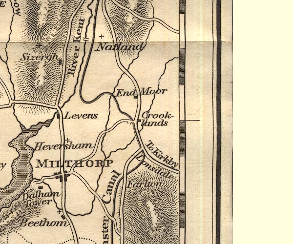 OT02SD58.jpg "River Kent" item:- JandMN : 48.1 Image © see bottom of page |
|||
|
|
||||
| evidence:- | old map:- Hall 1820 (Wmd) |
|||
| source data:- | Map, hand coloured engraving, Westmoreland ie Westmorland, scale
about 14.5 miles to 1 inch, by Sidney Hall, London, 1820,
published by Samuel Leigh, 18 Strand, London, 1820-31. click to enlarge click to enlargeHA18.jpg tapering wiggly line; river item:- Armitt Library : 2008.14.58 Image © see bottom of page |
|||
|
|
||||
| evidence:- | descriptive text:- Otley 1823 (5th edn 1834) item:- geology |
|||
| source data:- | Guide book, A Concise Description of the English Lakes, the
mountains in their vicinity, and the roads by which they may be
visited, with remarks on the mineralogy and geology of the
district, by Jonathan Otley, published by the author, Keswick,
Cumberland now Cumbria, by J Richardson, London, and by Arthur
Foster, Kirkby Lonsdale, Cumbria, 1823; published 1823-49,
latterly as the Descriptive Guide to the English Lakes. goto source Page 41:- "The Kent rising in Kentmere, receives the Sprint from Longsleddale, and the Mint from Bannisdale. It washes the skirts of Kendal, and enters the sea near Milnthorp, where it is joined by the Belo." "..." goto sourcePage 158:- "... Towards the south-east succeeds [from the 3rd division of rocks] a series of rocks of the same dark-blue colour, and principally of a slaty structure: but accompanied in places with a rock, which breaks alike in all directions. This last has supplied a great portion of the rounded" goto sourcePage 159:- "stones found in the beds of the rivers Kent and Lune; thus furnishing materials for paving the streets, and repairing the roads in the vicinity." |
|||
|
|
||||
| evidence:- | old map:- Perrot 1823 |
|||
| source data:- | Map, hand coloured engraving, Cumberland and Westmoreland ie
Westmorland, scale about 38 miles to 1 inch, by Aristide Michel
Perrot, engraved by Migneret, 1823, published by Etienne Ledoux,
9 Rue Guenegaud, Paris, France, 1824-48. click to enlarge click to enlargePER2.jpg tapering wiggly line item:- Dove Cottage : 2007.38.45 Image © see bottom of page |
|||
|
|
||||
| evidence:- | :- Hullmandel 1826 |
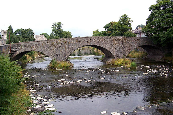
|||
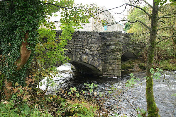
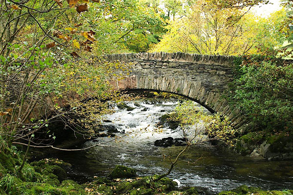
| source data:- | 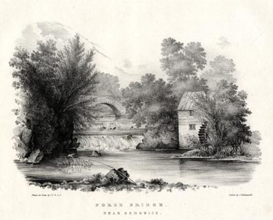 click to enlarge click to enlargeHUL102.jpg Print, uncoloured lithograph, Force Bridge, near Sedgwick, Westmorland, drawn by Miss I Cropper and Miss S Atkins, published by Charles Hullmandel, London, 1826. "Drawn on Stone by I.C & S.A. / Printed by C. Hullmandel. / FORCE BRIDGE. / NEAR SEDGWICK" item:- Armitt Library : ALMA370.2 Image © see bottom of page |
|||
|
|
||||
| evidence:- | descriptive text:- Ford 1839 (3rd edn 1843) |
|||
| source data:- | Guide book, A Description of Scenery in the Lake District, by
Rev William Ford, published by Charles Thurnam, Carlisle, by W
Edwards, 12 Ave Maria Lane, Charles Tilt, Fleet Street, William
Smith, 113 Fleet Street, London, by Currie and Bowman,
Newcastle, by Bancks and Co, Manchester, by Oliver and Boyd,
Edinburgh, and by Sinclair, Dumfries, 1839. goto source Page 18:- "... The river enters the grounds [of Levens Hall] by a cascade of foaming whiteness, and pursues its way amid lawns, sweetly diversified with trees, whilst herds of deer" "'-- across their green-sward bound, Through shade and sunny gleam; And the swan glides past them, with the sound Of Kent's rejoicing stream.'" |
|||
|
|
||||
| evidence:- | old map:- Ford 1839 map placename:- Kent River |
|||
| source data:- | Map, uncoloured engraving, Map of the Lake District of
Cumberland, Westmoreland and Lancashire, scale about 3.5 miles
to 1 inch, published by Charles Thurnam, Carlisle, and by R
Groombridge, 5 Paternoster Row, London, 3rd edn 1843. FD02SD47.jpg "Kent River" item:- JandMN : 100.1 Image © see bottom of page |
|||
|
|
||||
| evidence:- | old map:- Garnett 1850s-60s H placename:- Kent, River |
|||
| source data:- | Map of the English Lakes, in Cumberland, Westmorland and
Lancashire, scale about 3.5 miles to 1 inch, published by John
Garnett, Windermere, Westmorland, 1850s-60s.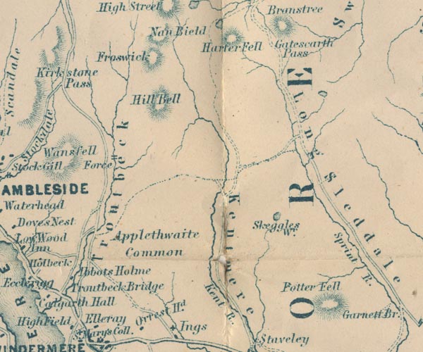 GAR2NY40.jpg "Kent R." wiggly line, river 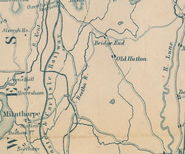 GAR2SD58.jpg "R. Kent" item:- JandMN : 82.1 Image © see bottom of page |
|||
|
|
||||
| evidence:- | old map:- Postlethwaite 1877 (3rd edn 1913) placename:- Kent, River |
|||
| source data:- | Map, uncoloured engraving, Map of the Lake District Mining Field, Westmorland, Cumberland,
Lancashire, scale about 5 miles to 1 inch, by John Postlethwaite, published by W H
Moss and Sons, 13 Lowther Street, Whitehaven, Cumberland, 1877 edn 1913. PST2SD58.jpg "R. Kent" wiggly line, running into Kent Estuary item:- JandMN : 162.2 Image © see bottom of page |
|||
|
|
||||
| evidence:- | old print:- Rose 1832-35 (vol.1 no.22) |
|||
| source data:- | Print, uncoloured engraving, Kendal, from the Castle, Westmorland, drawn by Thomas
Allom, engraved by W le Petit, published by Fisher, Son and Co, London, 1832-35.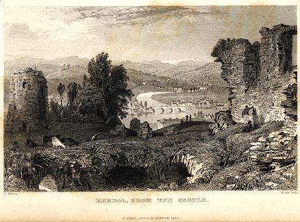 click to enlarge click to enlargePR0008.jpg vol.1 pl.22 in the set of prints, Westmorland, Cumberland, Durham and Northumberland Illustrated. printed at bottom left, right, centre:- "T. Allom. / W. Le Petit. / KENDAL, FROM THE CASTLE. / FISHER, SON &CO. LONDON, 1832." item:- Dove Cottage : 2008.107.8 Image © see bottom of page |
|||
|
|
||||
| evidence:- | old painting:- |
|||
| source data:- | Painting, watercolour, water mill on the River Kent, by Paul Sandby, forge, Levens,
Westmorland, England, 1760s-70s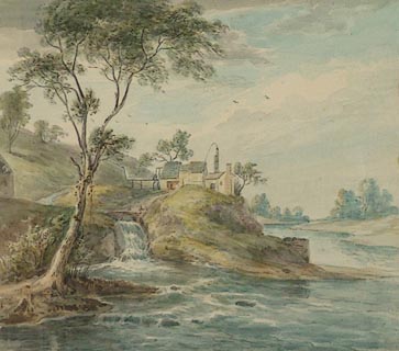 click to enlarge click to enlargePR0826.jpg summertime; view of a small forge standing in centre of composition on a grassy islet formed by the convergence of a shallow hillside stream and the River Kent. Composition is framed to left by a tall tree. item:- Tullie House Museum : 1905.10A.4 Image © Tullie House Museum |
|||
|
|
||||
| evidence:- | old painting:- |
|||
| source data:- | Painting, watercolour, View on the River Kent, Force Bridge, Sedgwick, Westmorland,
by Paul Sandby, 1760s-70s.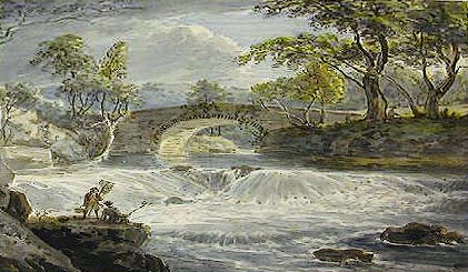 click to enlarge click to enlargePR0811.jpg Foreshortened view of the small natural weir of a river spanned in centre of composition by a stone bridge. Trees line either bank. item:- Tullie House Museum : 1905.10A.2 Image © Tullie House Museum |
|||
|
|
||||
| evidence:- | old painting:- placename:- Kent, River |
|||
| source data:- | Painting, watercolour, View of Force Bridge and a Fall of the River Kent Five Miles
South of Kendal, Sedgwick, Westmorland, by Paul Sandby, 1760s-70s.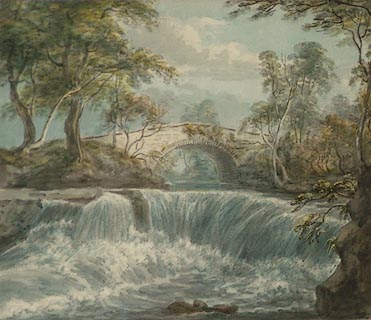 click to enlarge click to enlargePR0810.jpg Foreshortened view of the small natural weir of a river spanned in centre of composition by a stone bridge. Trees line either bank. inscribed at lower edge:- "View of Force Bridge and a Fall of the River Kent 5 miles South of Kendal" item:- Tullie House Museum : 1905.10A.1 Image © Tullie House Museum |
|||
|
|
||||
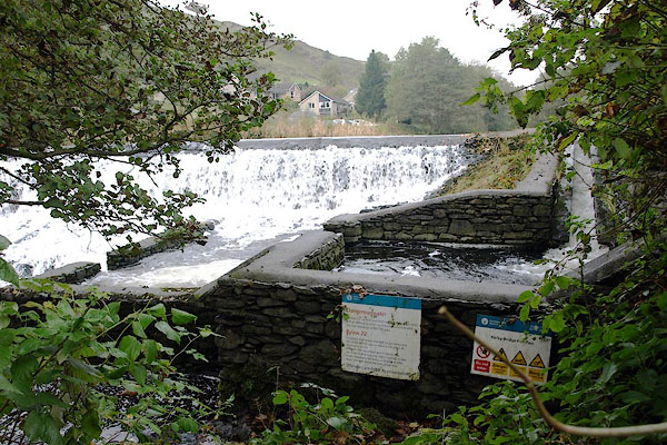
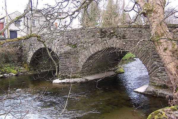
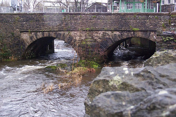
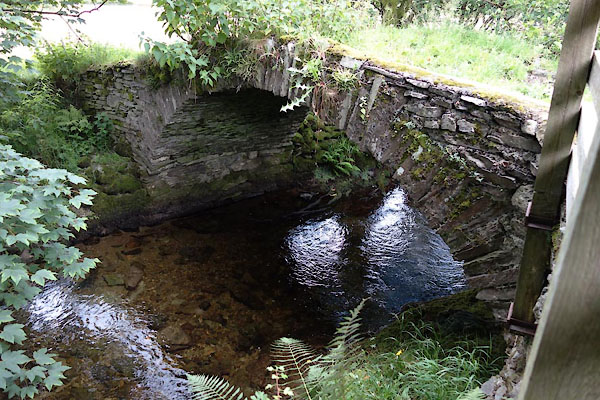
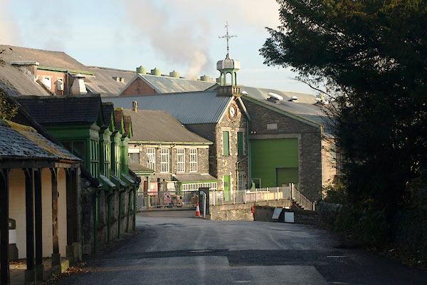
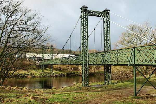
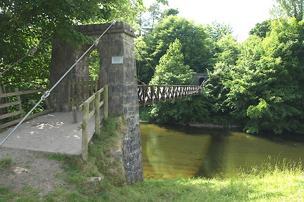
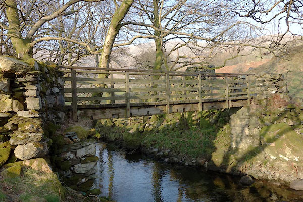
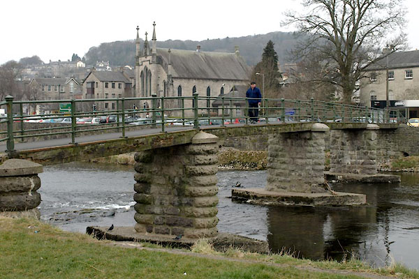
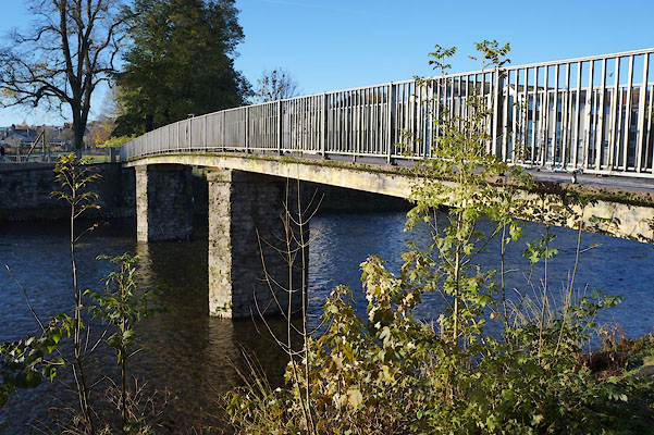
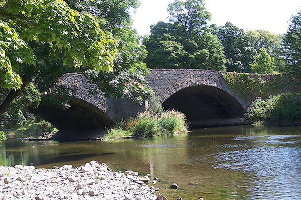
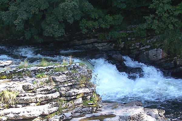
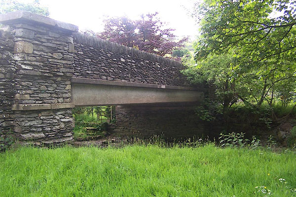
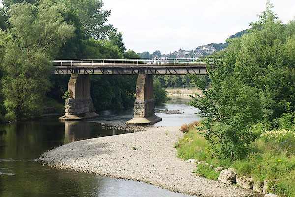
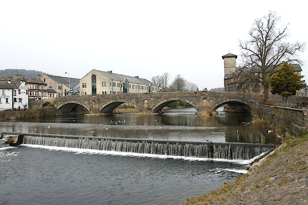
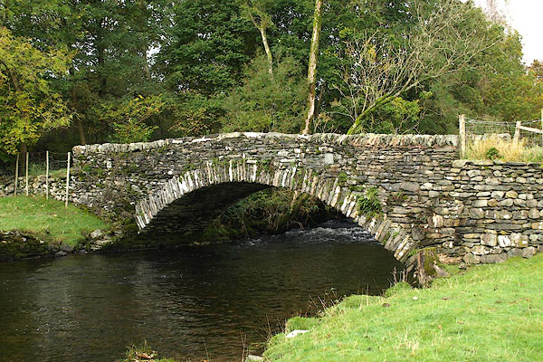
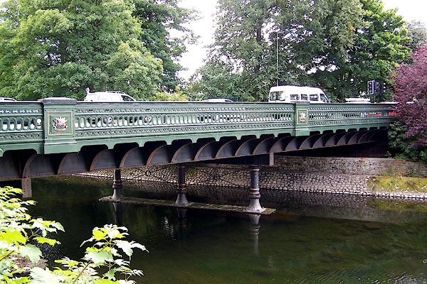
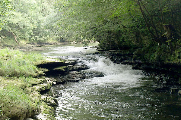
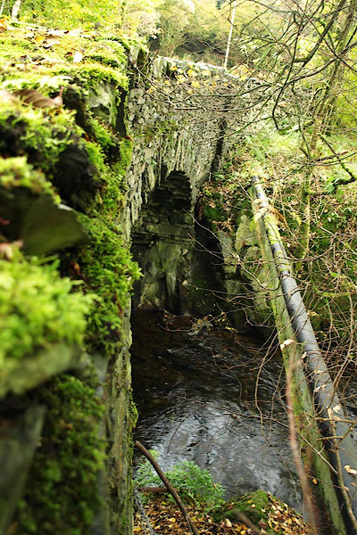
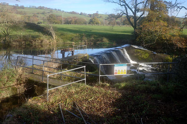
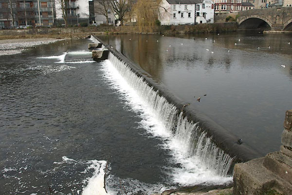
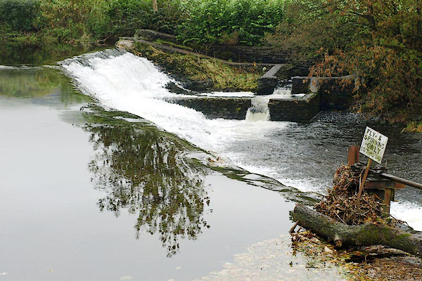
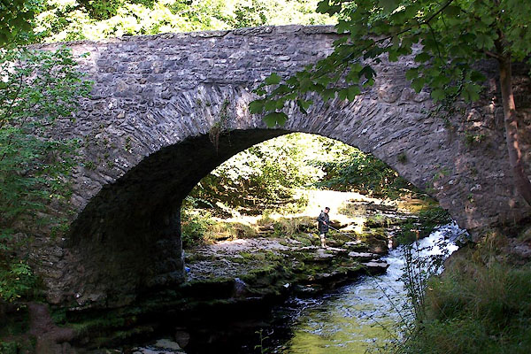
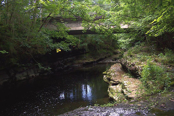
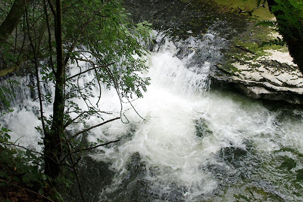
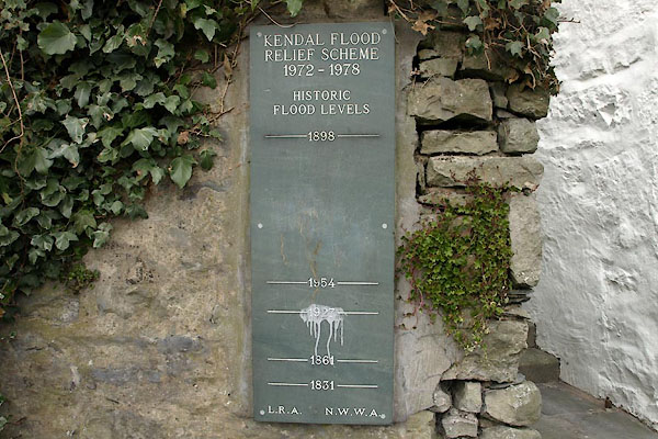
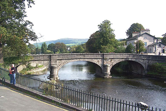
 CBE12.jpg Into the reservoir, (taken 15.7.2014) 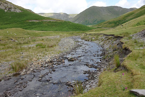 CBD79.jpg (taken 15.7.2014) 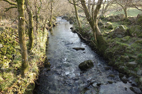 CAC36.jpg At a footbridge, (taken 12.3.2014) 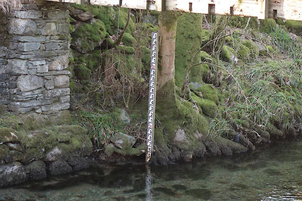 CAC37.jpg Depth gauge at footbridge, (taken 12.3.2014) 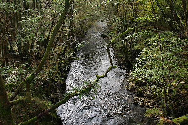 BPT03.jpg At Waterfoot Bridge. (taken 17.10.2008) 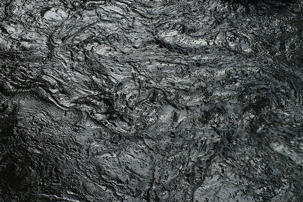 BPS62.jpg Water. (taken 9.10.2008) 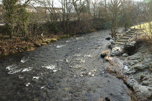 BTX74.jpg At Ford Bridge, Burneside, (taken 22.1.2011) 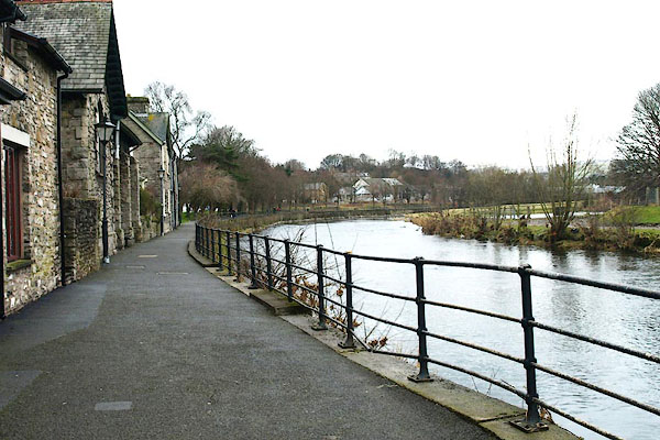 BQE04.jpg Kendal Riverside Improvement Scheme, Kendal. (taken 4.3.2009) 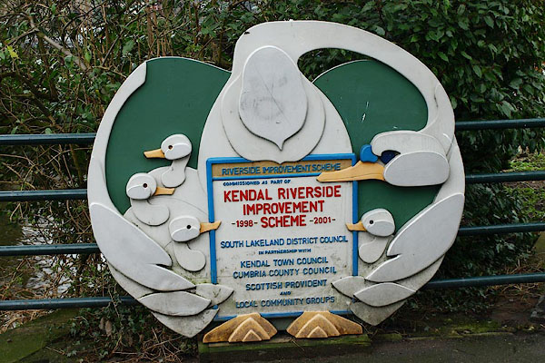 BQE05.jpg Kendal Riverside Improvement Scheme, Kendal. (taken 4.3.2009) 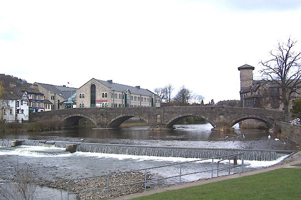 BLU73.jpg Weir below Stramongate Bridge, Kendal. (taken 9.4.2006) 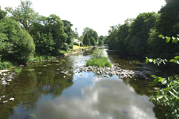 BPI71.jpg (taken 16.6.2008) 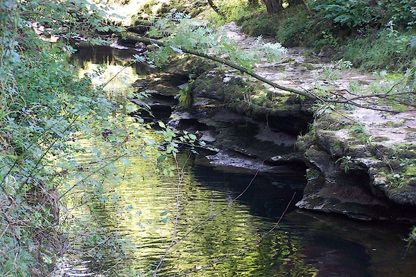 BJU78.jpg River gorge south of Hawes Bridge, Natland. (taken 12.9.2005) 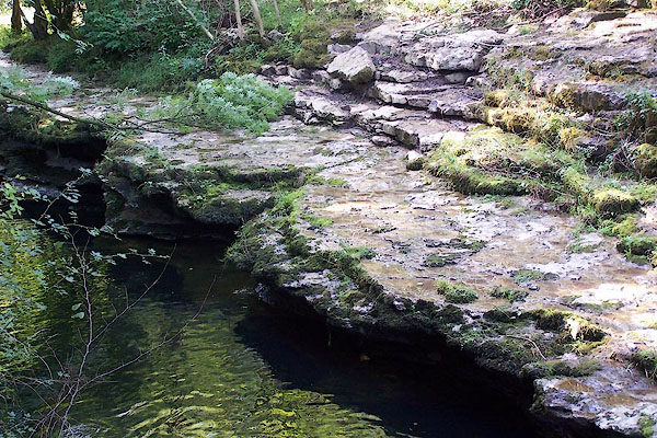 BJU79.jpg River gorge south of Hawes Bridge, Natland. (taken 12.9.2005) 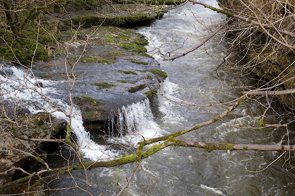 CCP69.jpg At Force Bridge, (taken 13.3.2015) 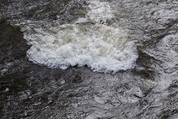 CCP67.jpg At Force Bridge, (taken 13.3.2015) 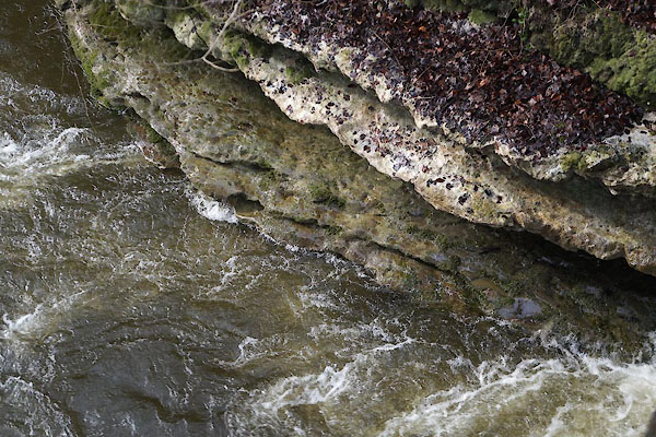 CCP68.jpg At Force Bridge, (taken 13.3.2015) |
||||
|
|
||||
| mapping:- | [Force Jump, Kentmere] |
|||
|
|
||||
| places:- |
|
|||
|
||||
|
||||
|
||||
|
||||
|
||||
|
||||
|
||||
|
||||
|
||||
|
||||
|
||||
|
||||
|
||||
|
||||
|
||||
|
||||
|
||||
|
||||
|
||||
|
||||
|
||||
|
||||
|
||||
|
||||
|
||||
|
||||
|
||||
|
||||
|
||||
|
||||
|
||||
|
||||
|
||||
|
||||
|
||||
|
||||
|
||||
|
||||
|
||||
|
||||
|
||||
|
||||
|
||||
|
||||
|
||||
|
||||
|
||||
|
||||
|
||||
|
||||
|
||||
|
||||
|
||||
|
||||
|
||||
|
||||
|
||||
|
||||
|
||||
|
||||
|
||||
|
||||
|
||||
|
||||
|
||||
Lakes Guides menu.